
The Last Frontier: Gates of the Arctic National Park - Part 1 of 3
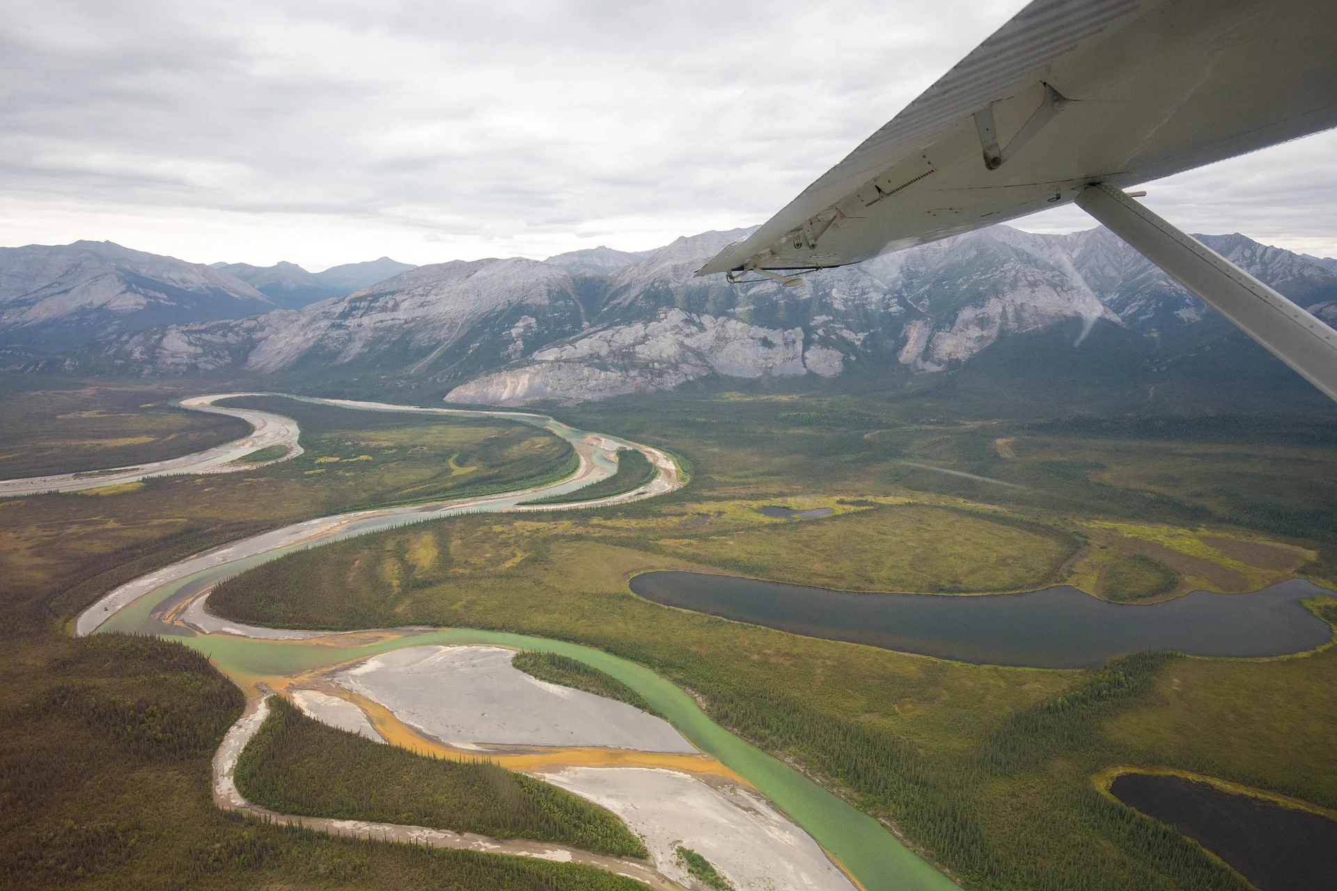
The tiny float plane suddenly lurched from side to side, I grabbed the armrests and sucked in air. The plane steadied itself again, just a bit of turbulence. It was my first time in a small aircraft and I was still getting used to the exaggerated bumps. I looked out the window at my surroundings: a braided green river carved through the valley floor below and sun rays pierced the clouds and illuminated the mountain slopes. Our plane probably looked like a fly in the endless Alaskan landscape, soaring over Gates of the Arctic National Park. Finally the reality of my situation was sinking in: I was on a float plane bound for Circle Lake, where I was to deplane with the four other occupants who were still strangers to me. Our group would spend the next ten days backpacking and packrafting through Gates of the Arctic National Park. I grinned at the thought of the adventurous days that lay ahead of me and also questioned my sanity.
Gates of the Arctic National Park is located in the Brooks Range in Alaska and is entirely north of the Arctic Circle. Covering a staggering 8.4 million acres it is the second largest national park, only Wrangell-St. Elias is larger. It is also the second least visited national park, in 2013 Gates saw 11,000 visitors. This remoteness and unparalleled beauty are the main reasons I was drawn to a trip in Gates of the Arctic. The idea of being flown into an untouched wilderness and forging my own path (there are also no signs or maintained trails in the park) allows for a person to feel as if they are discovering a place for the first time, which is quite a novel experience in this day and age where untouched pieces of land are nearly impossible to come by. So I researched guiding companies that toured through Gates and found Expeditions Alaska. The company had great reviews so I decided to book my trip!

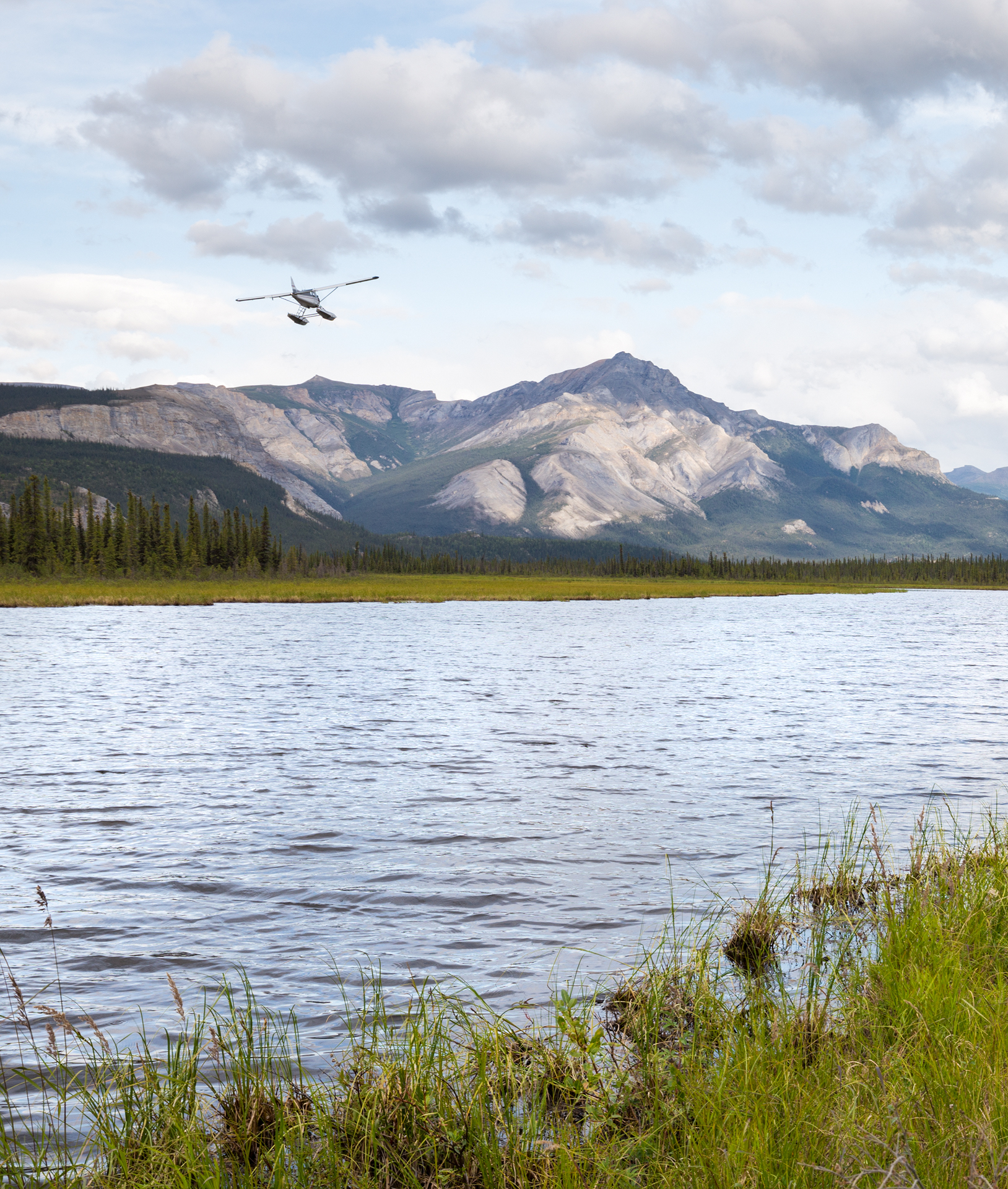
The famed wilderness advocate Robert Marshall named the park. He was exploring the Brooks Range and found himself at the headwaters of the North Fork of the Koyukuk River where two towering mountains appeared to usher him into the arctic and thus he called them the Gates of the Arctic. As you can probably guess judging by its name that includes the word "arctic", the park is not easy to reach. First, I had to get myself to Fairbanks, AK where I met my group. Together we took an hour and a half flight on Wrights Air to Bettles where we then boarded a float plane and flew another 45 minutes to Circle Lake. The landing was smooth and before we knew it we were standing on the shores of Circle Lake, surrounded by our gear, waving to our pilot as he disappeared into the sky. As soon as the faint hum of the plane propeller faded I was struck by a silence that held in the air. Everything was perfectly still.
After a brief safety talk we shouldered our packs and walked along the shore until we found a nice camping spot. We had a weather delay that caused us to leave about four hours late from Bettles so we weren’t going to make much ground the first night, which is something I was okay with since my pack weighed a hefty 47 pounds. I wanted to start eating some of the food and lighten the load!
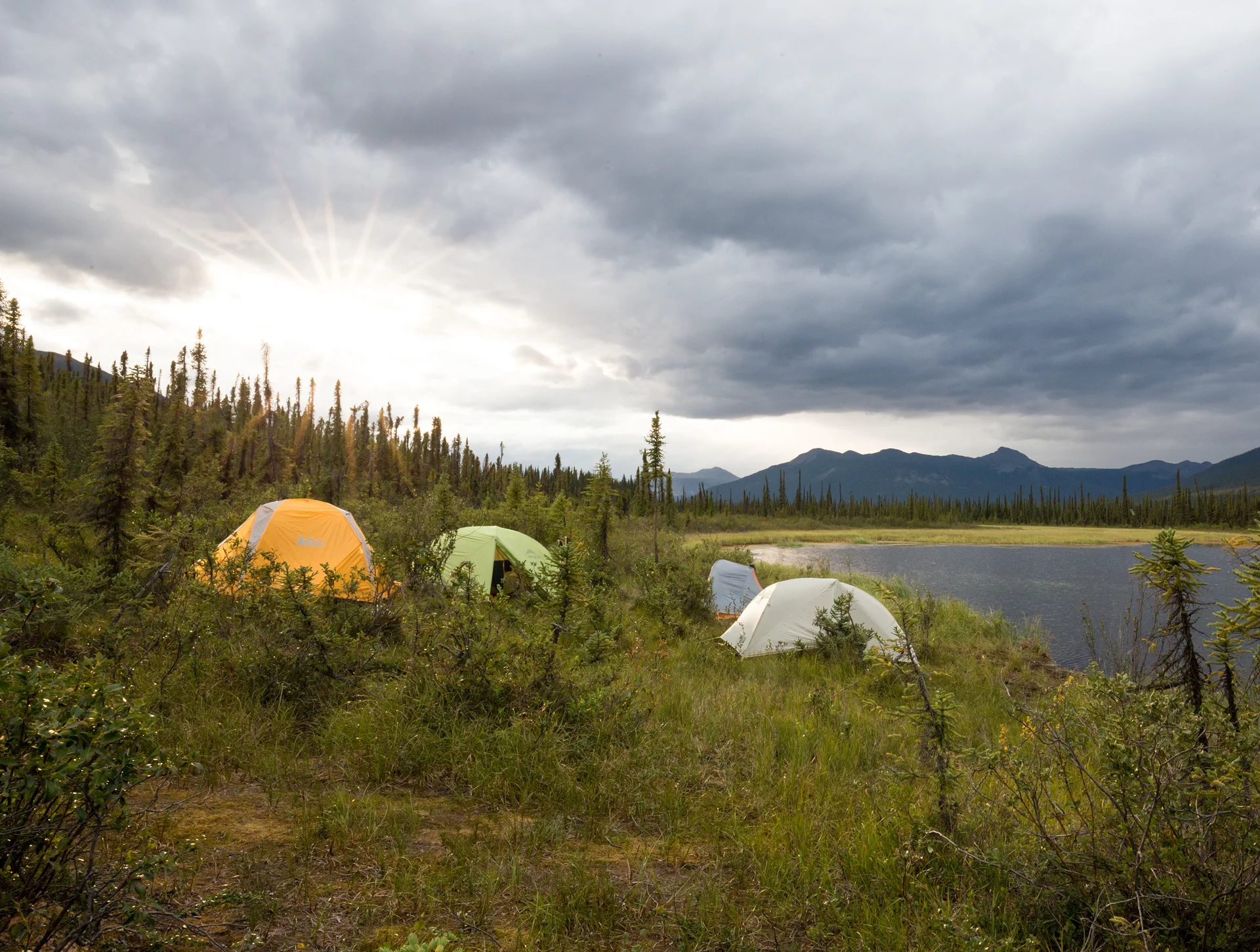
It rained off and on for most of the first night. We awoke to a wet ground and a sky full of heavy clouds that looked as if they could burst at any moment. We ate a leisurely breakfast and kept an eye on the sky. The clouds were moving through and it appeared we might luck out and begin our hike dry. We packed up and set out. I was disappointed to discover that despite eating two full meals my pack did not feel any lighter.
We made our way to the end of Circle Lake and began bushwhacking our way through tussocks. I knew this trip would consist of a great deal of bushwhacking and I had read up on what bushwhacking entailed but nothing prepared me for how difficult the task was. Our first hurdle was the tussocks, which are giant knee-high balls of soil with gaps between them and grass on their top. Some of the grass folds over and creates the illusion of solid ground between the tussocks, but then you put your foot down only to find that solid ground is nearly 12 inches below and you slowly tumble into the grass. You get up only to repeat the process again within a few steps. After about an hour we took a break and our guide informed us we had gone a third of a mile. A third of a mile! In my research on bushwhacking I read that a mile an hour is considered a decent pace in the bush so I was prepared for some slow-going, but not this slow!
After an extended break we muscled on through the tussocks and then willow and alder forests. When we reached the edge of a dense alder patch I thought our guide was definitely going to try to find a way around it, it looked completely impassable! But just as soon as we arrived she threw herself, headfirst, into it and just like that was gone! I surveyed the gnarly, intertwined branches and tried to discern the least dense section of foliage and then I stuck my hands out, closed my eyes, and forced my way through the branches. The foliage was so thick that if you weren’t within five feet of the person in front of you, you would lose them. I fought my way through the alder and the alder fought back. Finally, we emerged on the other side, a few scrapes, and tousled hair, but standing, and that was the important part.

By afternoon we had finally reached a social trail that follows Arrigetch Creek from the Arrigetch Peaks to the Alatna River. Walking along a trail, albeit an almost imperceivable one, was easy going compared to the morning’s trek. We were finally making some headway! By late afternoon we made it to our camping spot for the evening: The Terraces. Our guide had talked about this camping spot all the day, informing us that it was what she called “an REI site”, meaning it was picturesque and #tentview worthy and she was not kidding. The Terraces are two large outcrops from the trail, about 100 yards apart, that sit high above the Arrigetch Creek rushing by below, and offer the first glimpses of the Arrigetch Peaks in the distance. One makes a perfect tent site and the other makes a perfect kitchen. We set up camp and headed to the other terrace for dinner. I quickly picked the heaviest looking meal from my bear canister and began heating up some water. As I sat on The Terrace and ate my dehydrated dinner out of a bag I admired the mountains on the horizon. They were sharp, angular, rock faces jutting up into the sky, they resembled glass shards. Our first day was tough, much tougher than I anticipated. On more than one occasion I cursed myself for choosing such an arduous trip over a lazy beach vacation, but when I looked at the peaks I was instantly reminded of why I made my choice: solitude, adventure, and awesome mountains!


Our second day was another strenuous day of bushwhacking, although we had more game and social trails to follow, which was a relief. Throughout the day we were graced with views of the Arrigetch Peaks ever so slowly growing larger. While this day consisted mostly of bushwhacking the most challenging task proved to be crossing the Arrigetch Creek. While the term "creek" doesn't bring to mind images of rushing water this "creek" was strong. We exchanged our hiking boots for water shoes, unbuckled our packs, and one by one forged on across the rushing water. Not only was the current fast, but the water was cold. So cold that it was painful. I grimaced with each step I took, trying to ignore the pain and focus all my energy on staying upright. It took less than a minute to cross the stream but it felt longer.

After another long day of hiking we arrived to basecamp at 7pm. We set up our tents in the shadows of the Maidens. We were spent. Luckily, this spot was going to act as our base camp for the next four days. There were three valleys that lay under the peaks and we had three days scheduled at basecamp, so we planned to spend a full day exploring each valley. The fun was just beginning!
