
Trekking the Alta Via 1 in the Dolomites

Lago di Braies
Finally we were there: Lago di Braies. It was the starting point of our 120km trek through the Dolomites in northern Italy. Six months of anticipation, four months of Italian lessons on Duo Lingo, two lengthy plane rides, and three bus rides led up to this point and everything suddenly felt surreal.
Every summer Alex and I like to take one long backpacking trip. When we were in the planning process for this summer’s trip I stumbled across some photos of the Dolomites. Alex and I had talked about this picturesque region before and we both mentioned our desire to visit it. It felt exactly like what we were looking for so I began researching hikes in the Dolomites. I noticed the Alta Via 1 showed up on nearly every website I found. There are eight Alta Via routes in the Dolomites but number 1 is the most popular. After reading about the trail and talking it over with Alex we decided it was the one! We would spend 8 days hiking the Alta Via 1.

Rifugio Città di Fiume under the Pelmo
Wild or dispersed camping is not allowed along the route, instead hikers are required to stay in mountain rifugios. These rifugios are often set in the most idyllic locations: impossibly perched upon a mountaintop, nestled in the shadow of mountains, or set against the backdrop of undulating hills that stretch to the horizon. At first I was a bit hesitant to stray from my tried-and-true backpacking routine of pitching a tent, powering up the JetBoil, and eating my dinner out of a bag, but it turns out the rifugios are a comparatively luxurious alternative. They offered a warm shelter from the afternoon and evening storms, three course meals that consisted of too much food to finish, a warm, albeit very brief, shower, and an actual bed. There are quite a few rifugios along the trail but I tried to plan our itinerary so we could stay at the most scenic ones. In order to do this and still hike the trail in only eight days (most guidebooks and online resources recommended completing it in 9-11) we would be starting and ending the AV1 with long, strenuous hikes.

Lago di Braies sunrise
The hike begins at the world-famous Lago di Braies, a destination in and of itself. I reserved Alex and myself a room at the lakeshore lodge and we spent a day exploring the lake before we began our hike. Like most easily-accessible, beautiful places the lake was teeming with tourists during the day, but by early evening most of the day-hikers had returned to where they came from and we were able to enjoy the views in relative solitude.
Evening transitioned into night and Alex and I headed to bed, with early alarms set, eager to finally set off on the Alta Via 1.
Prior to our trip I bought the Cicerone guide, “Trekking in the Dolomites” that includes full details for the Alta Via 1 and 2 and briefly outlines Alta Via routes 3-6. Each evening Alex and I read up on the portions that we would be completing the following day. Our first day was planned to be one of the toughest: we were going to hike from Lago di Braies to Rifugio Lavarella, a 12.4 mile hike that required 4,900’ of elevation gain and 3,000’ of elevation loss.
Taking a break on the hike to Rifugio Lavarella
We started the hike bright and early and we were immediately introduced to what our trek would be like over the coming days. The hike gained nearly 3,000’ in the first four miles. There were no steps to aid our ascent and my calves started burning. The grade was brutal and I quickly found myself wondering if we made the right decision. The first day was rough but it was an accurate representation of the Alta Via 1 as a whole: we climbed 3000’ just to descend 1,800’ on a knee-jarring grade. By the time we reached Rifugio Lavarella, eight hours after we left Lago di Braies, I was exhausted. We checked into the rifugio and headed to our tiny dorm that we shared with three other hikers. I changed into my camp clothes and promptly passed out. I was so tired I almost didn’t have the energy to make it to dinner on time. At the tables all around us were boisterous groups of German cyclists. I envied their energy levels.
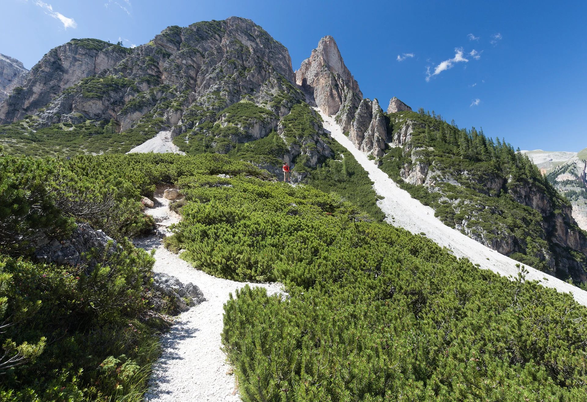
On the morning of the second day I woke up feeling revitalized and ready to tackle the route. This day consisted of more of the same up and down. We climbed up to the pass Forcella del Lago and descended a trail that the guidebook describes as zigzagging “madly downhill” only to climb back up to our destination of Rifugio Lagazuoi. This rifugio was well worth the effort. It is situated on a mountaintop with 360 degrees of breathtaking views. To the south were countless jagged mountains and from our vantage point we could see the route we would follow over the next few days. It was shocking to see how far we would hike in such a short amount of time but I was excited to see some of the most anticipated landmarks up close.

Alex hiking towards that V in the mountains: Forcella del Lago

Descending towards Lago di Lagazuoi before heading back up the mountain in the distance where Rifugio Lagazuoi is located
Rifugio Lagazuoi also happened to be the spot that Alex proposed to me! We arrived to the rifugio early so we had the afternoon to explore before we were due for dinner. We washed up and changed clothes. In our dorm I put on a green rain jacket and then threw my yellow puffy vest over it and began to head towards the door. Alex looked at my ensemble and informed me that I looked ridiculous and needed to change. I thought that was a little strange, he’s never critiqued my outfits before but I agreed that the rain jacket looked silly under a puffy so I swapped it out for an orange fleece and we headed out. Alex began scoping out locations for us to take a “couple photo” for our parents. It seemed that he was really invested in finding the perfect spot which I found interesting since this photo was likely only going to be sent to our parents, it didn’t need to be perfect!

The proposal!
Finally, he said he found the best spot and began to set up his tripod for a time-lapse so we didn’t have to worry about running back and forth from the camera using its 10-second timer. Once he was set up and the time-lapse was running I noticed how often the shutter was opening and closing. “Wow, you’re taking a lot of photos,” I told Alex, he responded “Don’t worry about it”. He came over and I asked what we should do, that was when he reached into his pocket and got down on one knee. The following moments were a complete blur for me as I blacked out. It’s funny because I imagined this moment in my head so many times and every time I excitedly would say something along the lines of “I can’t believe this! Are you serious?! Yes!! I’m so happy” but what came out of my mouth in reality was a mumbled mess that didn’t contain a single coherent word. So, if the Alta Via 1 wasn’t already spectacular enough it was also life-changing.

Sunrise from Rifugio Lagazuoi
I didn’t think it was possible to come down off the high of getting engaged on top of a mountain but day three on the Alta Via 1 challenged Alex and I so thoroughly it nearly drove us to abandoning our hike. As we were navigating our way down from Rifugio Lagazuoi and making turns at intersections that we were sure were correct we found ourselves descending at quite a bit more than the “gradual” grade our book informed us we would take. We also noticed that besides one other hiker, who seemed a little lost, we hadn’t seen anybody else. A sinking feeling began to set in as we pulled out a map, assessed our surroundings, and realized we had just hiked an hour and descended 1,500’ in the wrong direction. Feeling absolutely defeated we turned around and began hiking back up the way we came. Then we finally made it back to the 3-way intersection where we made the initial wrong turn and made another wrong turn. Time was now ticking and we were worried we weren’t going to make it to the rifugio on time. The hiking guide mentioned that an alternate route exists for hikers who don’t want to do a via ferrata, so we cut out a huge portion of the trail and chose this option.
As we were hiking we seriously considered quitting the trail. “We could go to Switzerland,” I tentatively suggested. “Oo that'd be pretty cool! We could go see the Matterhorn!” Alex answered. “Or we could hop a flight to Norway!” We decided that we would stay at Rifugio Nuvolau as planned and make the decision to continue or not after we rested.

Rifugio Nuvolau, named after the Italian word for cloud: "la nuvola"
After a warm meal and another nap we decided we would stick to the Alta Via 1 but I think that just talking about other options and imaging ourselves in those spots kept our morale up throughout the day.

Our friend Evan makes his way down the via ferrata route
Just as the trail had its literal ups and downs it had its figurative ones as well. As discouraged as we felt on day three, we felt reinvigorated on day four. In fact, this was both of our favorite days in terms of the scenery. The day immediately started out on a fun note as we attempted our first via ferrata! When we arrived at Rifugio Nuvolau it seemed to be the end of the trail, as behind it appeared to be a cliff. However, it turns out the trail actually continues over this cliff following a via ferrata route. The via ferrata routes were one of the aspects of the trail I was looking forward to most. “Via ferrata” is Italian for “iron road” and the segments consist of iron cables and ladders that were initially bolted in place during WWI to help soldiers navigate the exposed terrain. Today hikers along the AV1 use the cables for the same reason with a much different mindset. While the scenery was stunning, I found my mind somberly reflecting on the significance of following the same routes and using the same foot- and hand-holds that soldiers did a century ago.
The next few days were spent traversing through some of the most captivating landscapes as we made our way from the high, rocky alpine into the lush valleys. Near the easier-to-access huts the trail grew crowded with day-hikers but it always thinned out again after we passed the towns and we found ourselves hiking alone quite often. Free-range cows and horses kept us company and kept us on our toes as we navigated through their piles of poo.

Horses right off the side of the trail
When I was originally planning this trip I thought that we could easily finish the hike in eight days and I divided the 120km up into fairly even amounts across the days. However, in order to stay at the rifugios I wanted to stay in and make the trip only eight days we would have to have a long starting day and a very, very long ending day. The last day was planned to be 12 miles with 6,700’ elevation loss. We needed to make it to the La Pissa bus stop by midday in order to catch a bus and make it to Venice for our early flight the next morning. When I planned the trip I just figured we could start the hike out at 4am in order to make that happen but when we were on the trail I discovered how difficult it was to follow the right route even in the middle of the day and we got nervous about hiking out in the dark. We also realized that we would have to pack up in the middle of the night, most likely disturbing all of our roommates. The more we thought about it the less we wanted to subject ourselves to that on the last day. So we made a decision; we would end the Alta Via 1 after our stay in Rifugio Carestiato, 20km short. By doing this we allowed ourselves plenty of time to make it to Venice and gave ourselves some time to explore the city.

Heading from Rifugio Coldai to Rifugio Carestiato
As we turned our backs to Rifugio Carestiato and the Alta Via 1, we couldn't help but feel a bit disappointed that we weren't going to officially finish the route. We felt like quitters who had failed their goal. However, by the time we were in Venice Alex and I both felt we made the right decision. We spent a day being tourists, we visited Murano Island and watched a master glass-blower at work, we wandered the city streets, and we relaxed in our hotel spa. It’s tough to feel disappointed when you’re soaking in a hot tub!
Although we didn’t complete the Alta Via 1 I would still consider our time on the trail a success. We made new friends, tried a whole lot of new foods, admired some of the most spectacular mountains I’ve ever seen, watched the sunrise nearly every morning, and got engaged! Now the only question is: which Alta Via route to tackle next?!
IF YOU ARE INTERESTED IN ALL THE DETAILS, LOGISTICS, AND FAQ FOR HIKING THE ALTA VIA 1, PLEASE CHECK OUT MY ADVENTURE GUIDE HERE!

Cinque Torri seen from Rifugio Nuvolau at sunrise