
A North Cascades Beauty: Backpacking the Copper Ridge Loop

8/31/19 - 9/4/19
We pulled into the North Cascades ranger station in Marblemount at 5:00am, a full two hours before the office opened, but as our headlights swept through the dark lot we saw that we weren’t the first to arrive. There were already two people waiting at the front door, their headlamps illuminating a map as they talked over their options. I parked the car, turned off the engine, and walked over to join them. We were all here hoping to secure a walk up permit for North Cascades National Park over Labor Day weekend. The competition for the weekend would be fierce and we all decided that showing up at the ranger station extra early would help us be first in line. Thankfully, Alex and I had our sights set on a different hike than our early bird companions. We hoped to hike the Copper Ridge/Chilliwack River Loop with an extension to Whatcom Pass and Tapto Lakes. The route is 46.1 miles and covers 13,200’ of elevation gain and loss but also offers sprawling mountain views, pristine lakes, and the opportunity to see black bears foraging for berries.
We whiled the minutes away in line by chatting with other permit-hopefuls who showed up as 7am approached. By the time the doors opened there were at least 20 groups in line. I was thankful for our 3am Seattle departure.
The ranger asked me for our itinerary and I listed off the camps we wanted to book. “We’d like to head to Whatcom Camp on the first day,” I started. The ranger paused mid-typing and looked up at me, “You know the mileage for that?” I nodded, “Yes, about 17 miles. It’ll be a long day but we want to get out of the forest.” She remained quiet as she gave me a brief, considering look and then continued typing. We were able to secure our ideal itinerary:
Hannegan Pass TH > Whatcom Camp > Tapto Lakes > Indian Creek > Silesia Camp > Hannegan Pass TH
Below is the park’s map of the loop. You can use this link to explore the map: https://www.nps.gov/noca/planyourvisit/upload/Wilderness-Trip-Planner-2017_compliant.pdf

And with our itinerary secured, Alex and I headed back to Seattle to work and pack.
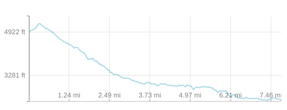
DAY 1: Hannegan Trailhead to Whatcom Camp, 17 miles, 4,900’ gain, 3,500’ loss

We knew our first day would be our toughest day—17 miles, with just under 5k of elevation gain with fully loaded packs—so we hit the trail at 9am with a plan to keep moving for a majority of the day. The sky was overcast and dreary, but the trail was dry and the views of Ruth Mountain on our way to Hannegan Pass were impressive. We tried to maintain our pace, but the views were making it difficult as we stopped often to take photos of the surrounding valley. We knew we would be seeing this valley again in four days, but conditions in the mountains are never guaranteed to be the same, so we took advantage of the soft, filtered light.

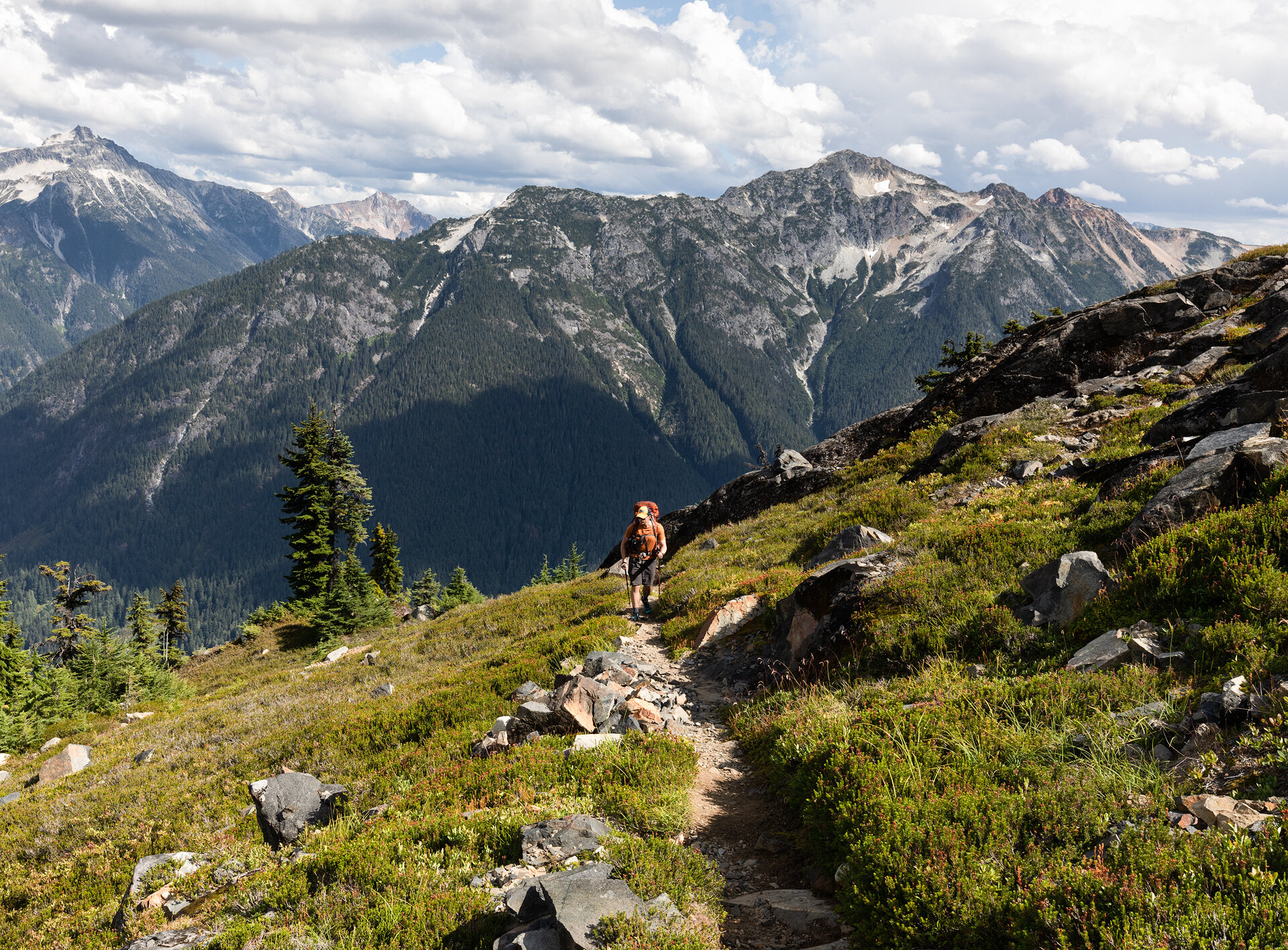
Alex hiking up from Hannegan Trailhead
After we gained Hannegan Pass we began to descend into the dreaded forested section of the trail. This is the portion of the trail that other hikers have told us is dull and monotonous—miles of trail, with few views. This is the reason we elected to hike 17 miles the first day. We wanted to put a majority of the forested trail behind us and spend more time in the high alpine, but we actually found the forested hike to be peaceful. It was quiet, cool, and the forest smelled of fallen leaves and those first hints of autumn. It was lovely, but it was also long.
We spent six miles in the forest before we made it to the cable car. This was a part of the trail I was highly anticipating, but a sign affixed to a tree at the junction for the car made my spirits fall. “Cable Car is closed for reconstruction. Please use ford. Thank you.” So we turned back toward the trail and made our way to the ford, feeling disappointed by the closed car and overwhelmed by the miles and elevation gain we had left. It was 2pm and we still had another 5.5 miles with another 3,000’ of gain in front of us. At that moment those numbers were daunting.

The views were a welcome distraction as we made our way to Whatcom Camp
The final 5.5 miles took us 3.5 hours, a markedly slower pace than the miles we completed earlier in the day. Our energy was drained and every step forward seemed to take a monumental amount of effort. We knew 17 miles with full packs would be difficult, but imagining a hike’s difficulty is much different than experiencing that difficulty. We stopped often, drank water, ate, and kept encouraging each other. “You got this!” I’d chirp to Alex, meanwhile my own glutes were screaming under the strain of each step. Slowly, ever so slowly, we made our way uphill.
After nine hours of hiking the signpost designating “Whatcom Camp” came into view. We felt overjoyed by the fact that we finally made it, but were too tired to celebrate. Instead, we smiled at each other before lumbering the last few steps to our site and collapsing onto the tent pad.
We set up camp with what little energy we had left, ate a couple slices of pizza each, and promptly passed out. It wasn’t even 8pm yet but we were too exhausted to even think of exploring the area around camp. We slept deeply for the next 12 hours.
DAY 2: Whatcom Camp to Tapto Lakes, 1.5 miles, 1,000’ gain, 400’ loss

Although Alex and I were feeling insurmountably exhausted when we went to sleep, we awoke feeling energized. The 12 hours of sleep reinvigorated us and we felt ready to tackle our second day on the trail!
The forecast for day two called for overcast skies and rain in the evening, but the day dawned relatively clear. There were a few wispy clouds, but they seemed to be dissipating and left us hopeful that the forecast would be wrong. Our second day’s hike was planned to be brief—only 1.5 miles—so we lazed around camp, enjoyed some fresh blueberries, and took our time packing up camp.
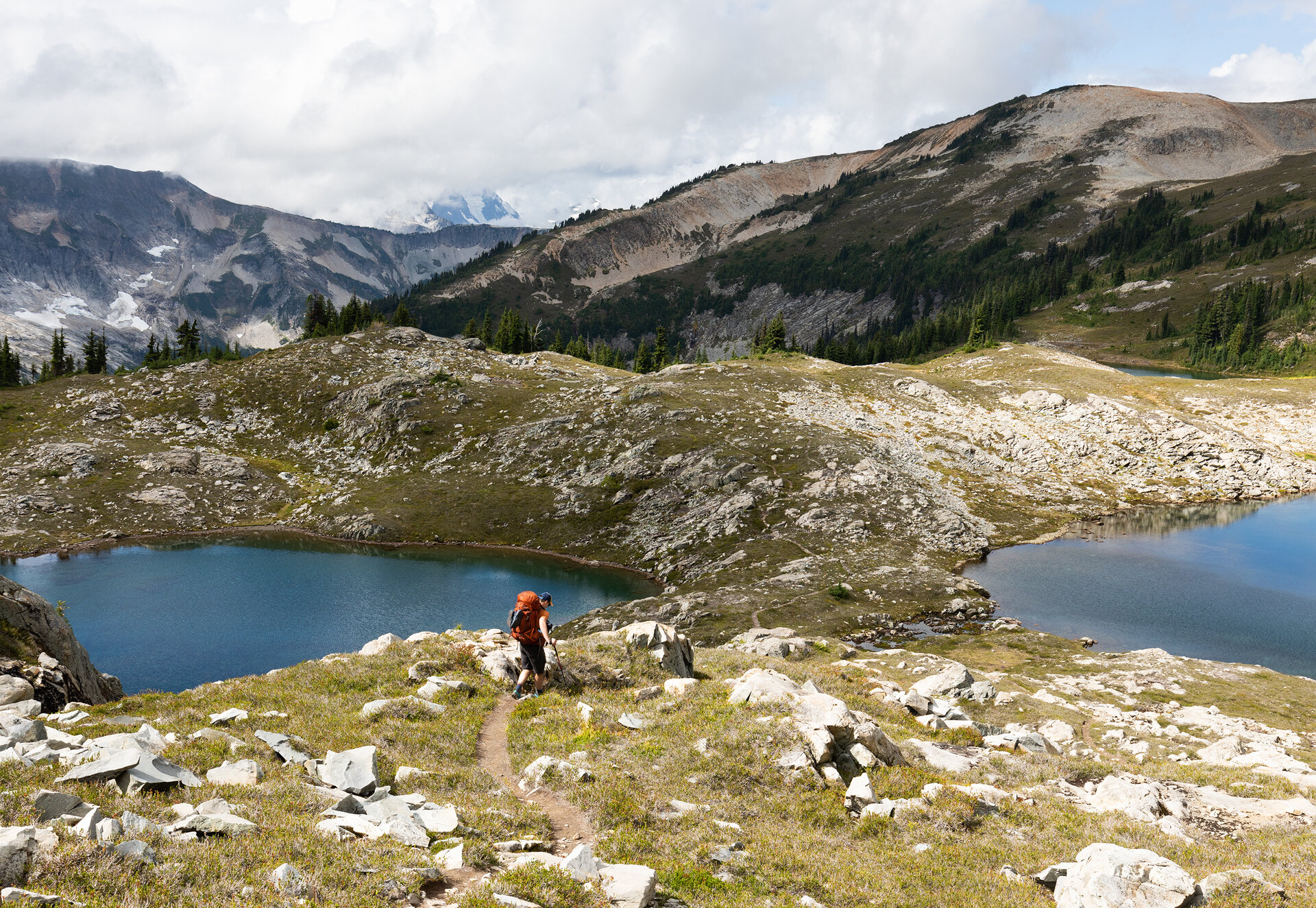
We finally hit the trail at 10am, and it wasn’t long until we ran into a couple groups coming down from Tapto Lakes. They told us the area was wildly beautiful and warned us that there was a bear in the meadow about a mile ahead of us. Filing the information about the bear in the back of our minds, we continued our hike.
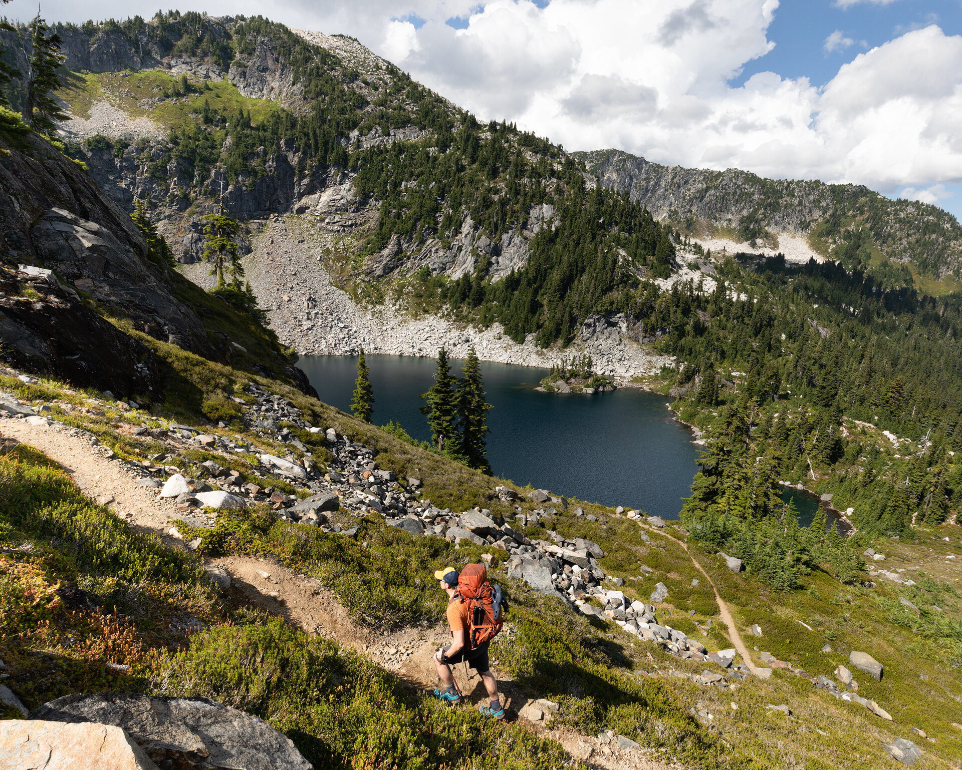
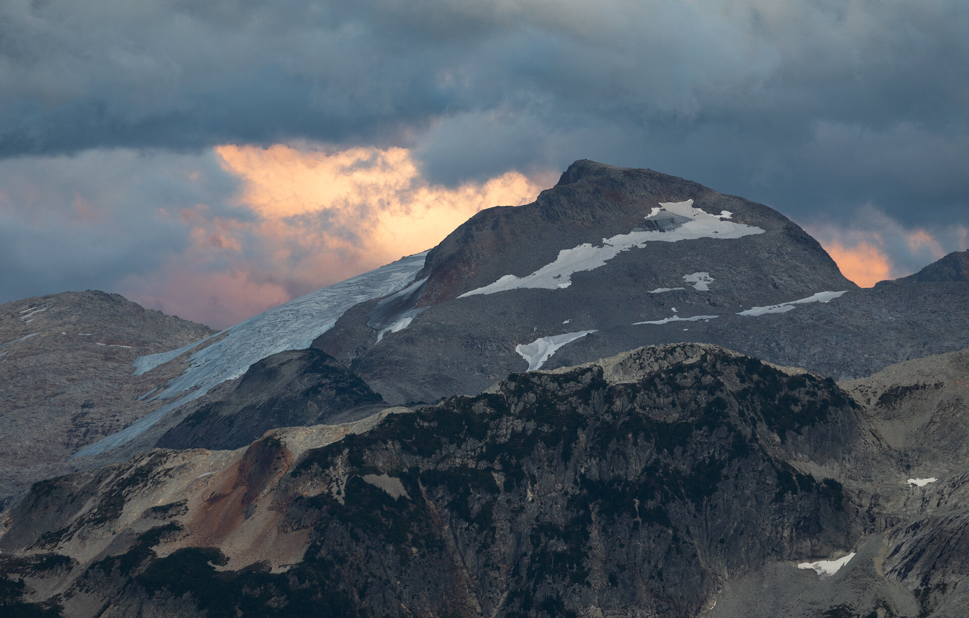
The Tapto lakes are in a cross-country zone of the national park, which means there are no designated trails, campsites, or signage. There is a social trail that leads from Whatcom Pass to the lakes but it is rugged; it’s steep, full of rocks, roots and overhanging branches, and requires the use of all four limbs to clamber up some of its steepest sections. We carefully made our way upwards. As we broke out of the trees we were treated to stunning views of Whatcom Peak and the Challenger Glacier (the peak of Mount Challenger was, unfortunately, obscured by clouds).

Whatcom Peak and an obscured Challenger Glacier seen from the trail
As we headed into the meadow we began looking for the bear the other groups had mentioned. We talked loudly to warn it of our presence and looked behind us often as we hiked, just to make sure it wasn’t tucked away in a stand of trees. A few minutes after we entered the meadow we saw it. It was about 100 yards in front of us, its head in the bushes, filling up on berries. We made some noise and it looked up at us for a moment before it plunged its head back into the bushes, seemingly unfazed by us. I quickly took off my pack and swapped out my wide angle lens for my telephoto lens. The park recommends hikers stay at least 100 yards from bears so we kept our distance as we photographed it. After snapping a few photos we continued on, checking on the bear every few steps to make sure it was still a safe distance away and not moving closer to us.

The bear moving from berry bush to berry bush
Tapto Lakes came into view after just over an hour of hiking and their beauty far surpassed my highest expectations. They sat like gems twinkling in a basin below Red Face Mountain. We descended to the lakeshore and enjoyed a quick lunch before looking for a campsite. Since there are no designated sites in this area we were on the lookout for an established site on a durable surface (snow, rock, or bare dirt). We quickly found one with a commanding view of Mount Challenger and Whatcom Peak. We set up camp and settled in for a well-deserved “lazy” day. After the previous day’s efforts we were content to sit on the rocks, read, and gaze at the clouds dance over the surrounding peaks.
There was only one other group camped in the area and they were out on a day hike to explore another lake in the area, so we enjoyed having the basin entirely to ourselves. The park only allows three groups to stay in the Tapto Lakes zone each night—this preserves the fragile landscape and ensures solitude for the groups that are permitted to camp there.

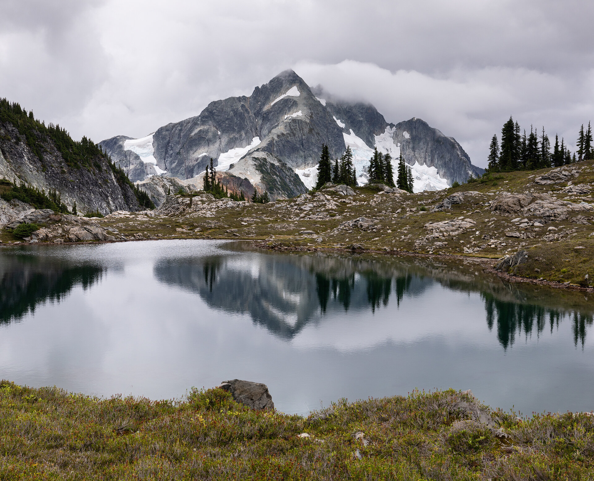
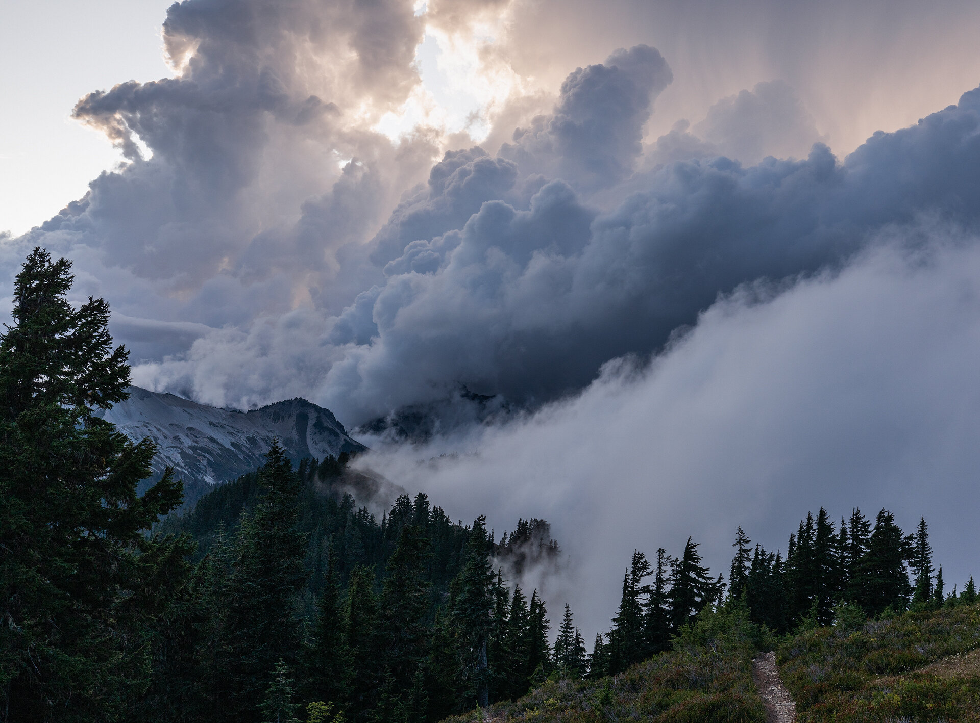
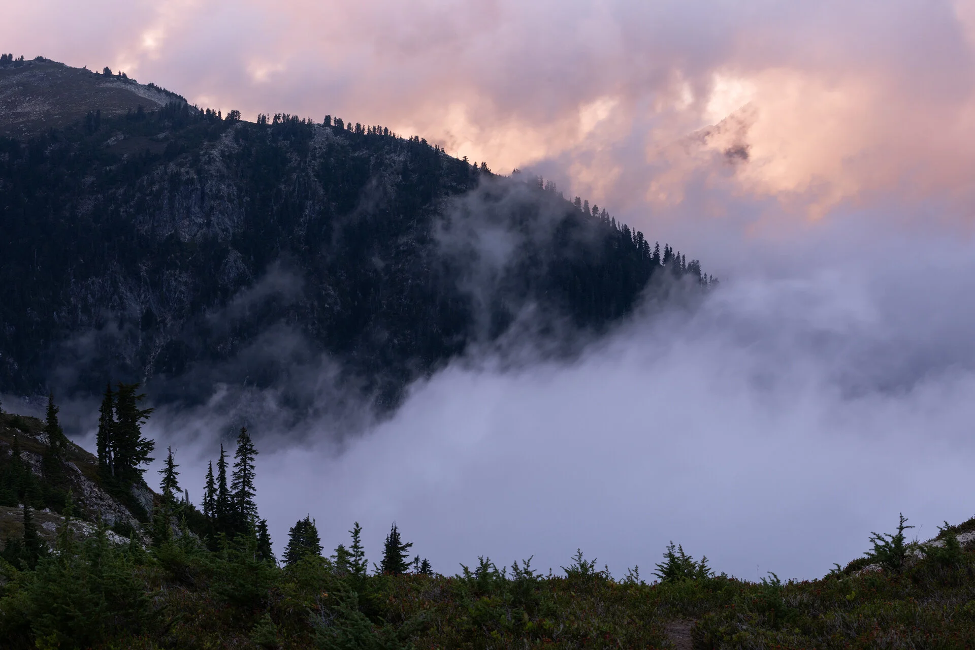
While the morning was relatively clear, clouds began to sink lower and lower in the sky as the day wore on, but thankfully any rain remained at bay. As afternoon transitioned into early evening the clouds became more animated. The sun dipped toward the horizon and golden, wispy clouds began to dance up from the valley below. Mount Challenger glowed and Whatcom Peak flirted with the clouds.

Mount Challenger and the Challenger Glacier at sunset
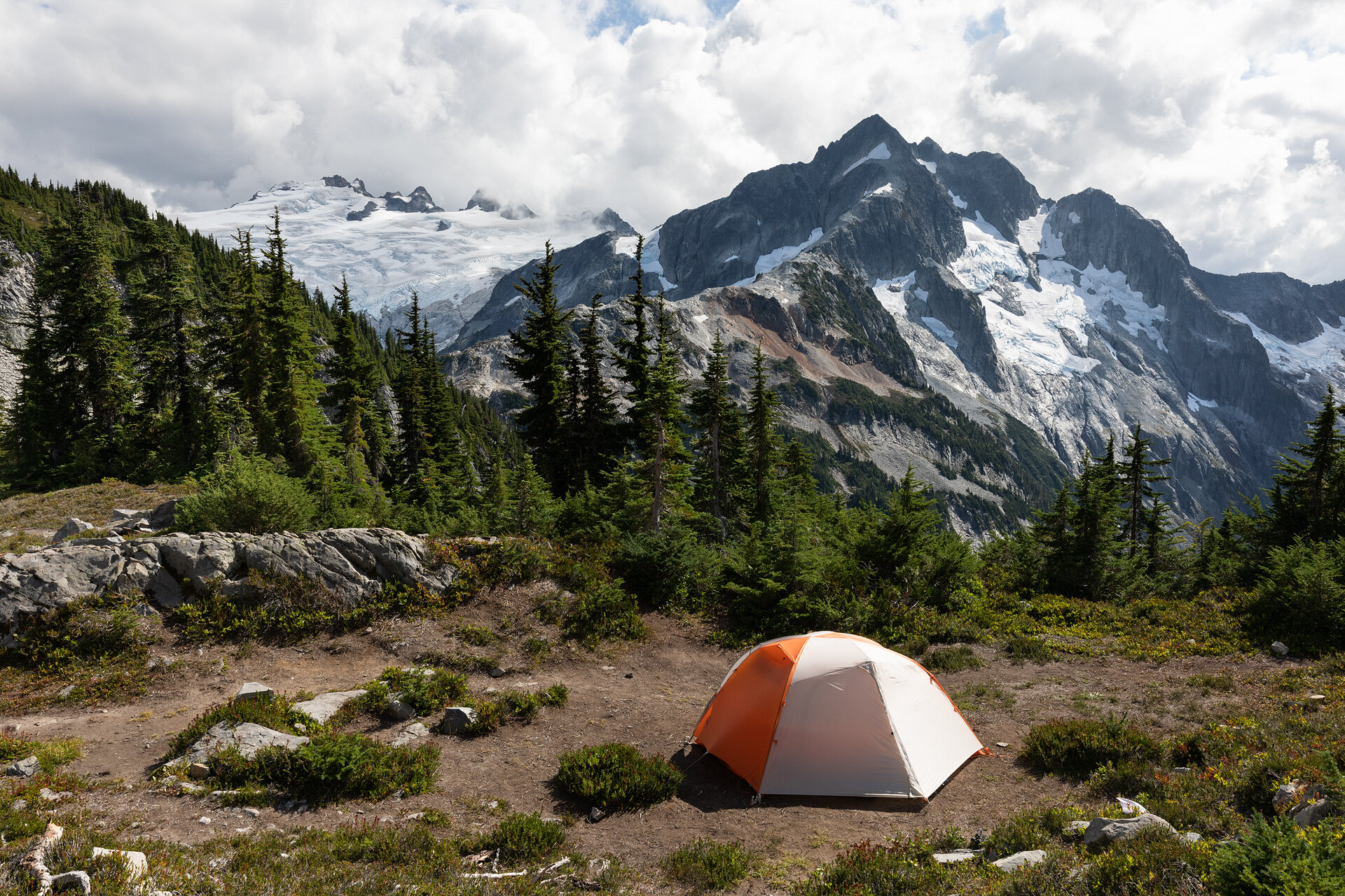
After the light faded, we headed for the tent. We hoped that the clouds would clear overnight and allow for night photos, both Alex and I set multiple alarms. When the first one went off I looked out the tent and saw nothing but darkness. We were in a cloud, so I went back to sleep. An hour later my second alarm sounded and once again I saw we were engulfed by clouds. Finally, at midnight I could see stars. I quickly grabbed my camera gear and took a few night photos before the clouds reclaimed the stars once again.

Our camp at night, with Mount Challenger and Whatcom Peak in the background
Day 3: Tapto Lakes to Indian Creek Camp, 8.5 miles, 1,000’ gain, 4,000’ loss
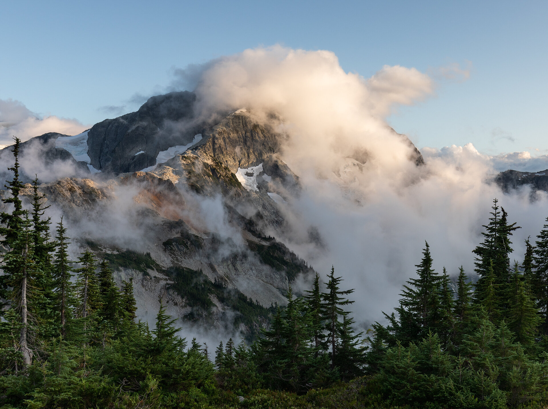
The third day of our trip dawned crisp and clear. The clouds that roiled in the valleys and over the peaks the previous day all but completely dissipated, revealing Mount Challenger and Whatcom Peak in their full glory in the soft morning light. I hiked down to the lake to capture some photos of Whatcom Peak reflecting in the mirror-like Tapto Lake before the wind picked up and swept the reflection away.
After the sun fully rose, we cooked breakfast and made coffee. The day was going to be 8.5 miles, and it would be all downhill so we didn’t feel the need to rush the morning.

Whatcom Peak reflected in the lake at sunrise
Nearly our entire third day was spent hiking through the forest. We were graced with beautiful views of Mount Challenger on our descent from Tapto Lakes, but once we passed Whatcom Pass we were in the trees for a vast majority of the descent. This made for a long hike. While the day wasn’t strenuous or difficult, it seemed to drag on and on as we plodded along the trail.

Alex descending toward Whatcom Pass with Mount Challenger in the background
I was grateful when we finally made it to Indian Creek Camp in the mid-afternoon. We picked the first campsite we saw and immediately threw down our packs to rest. There were no vantage points from which to take sunset photos at this campsite, so after we set up camp and made dinner we headed to the tent for the remainder of the evening. We knew the following day was going to be another big uphill day and we wanted to get a good night’s sleep before tackling it.
Day 4: Indian Creek Camp to Silesia Camp, 11.5 miles, 5,200’ gain, 1,800’ loss
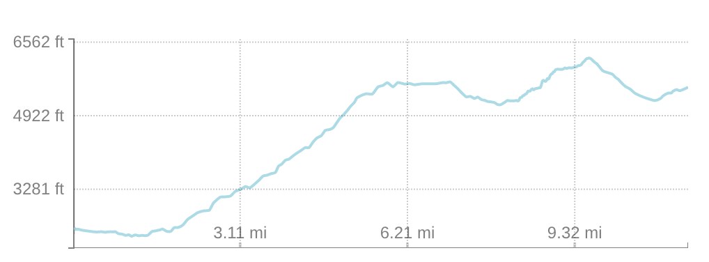
Our alarms rang early on our fourth day on the trail. We had over 11 miles and 5,000’ of gain ahead of us along the famed Copper Ridge section of the Copper Ridge/Chilliwack River Loop. The mileage and elevation gain alone would have warranted an early start, but this section of the trail is also known as the most scenic, so it was likely photo stops would further slow our pace.

Wild salmon in the Chilliwack River
What we didn’t know was that our first photo stop would come shortly after leaving camp, when we encountered wild salmon in the Chilliwack River. The water was so clear they appeared to be floating in air. We lingered at the river shore, watching them flit back and forth, their pink bodies catching flashes of the morning sun.
Once back on the trail we fell into a rhythm. This carried us through the first few miles and couple thousand feet of elevation gain. As we climbed ever higher through the forest the rush of the river became more distant until we were hiking in near perfect silence—only our footfalls and labored breaths sounded through the quiet forest.
We stopped every half an hour for water and to catch our breath, but then the hike continued, up, up, and up through the forest. After a few hours of hiking we broke out of the woods once again and were treated to our first glimpses of the views we would have from the ridge. From where we were standing we could see the valley we had spent the past couple days in, it already seemed so far away.
We hiked all morning and saw only two other hikers, a father and son duo who were cruising through the loop in an ambitious overnight hike. Besides the staggering beauty, my favorite part of this hike was the solitude. The loop is very difficult to dayhike and the park allows only a few groups to stay at each campsite every night, so there are relatively few people hiking the trail at the same time. We regularly hiked hours without seeing another soul and we relished those moments.

Taking a break at Copper Lake
We reached Copper Lake a little after lunch and took an extended break to filter water and soak in the views of the lake’s jewel-colored waters. While we were at the lake and had a clear view of our surrounding area, we noticed the skies were darkening and cumulonimbus clouds were beginning to form both south and north of us. We still had the highest and most exposed point of the trail ahead of us—the Copper Mountain Lookout—and were nervous about the prospect of being caught in a storm at the top. It didn’t look like it would rain quite yet but we still gathered our packs and continued our ascent.
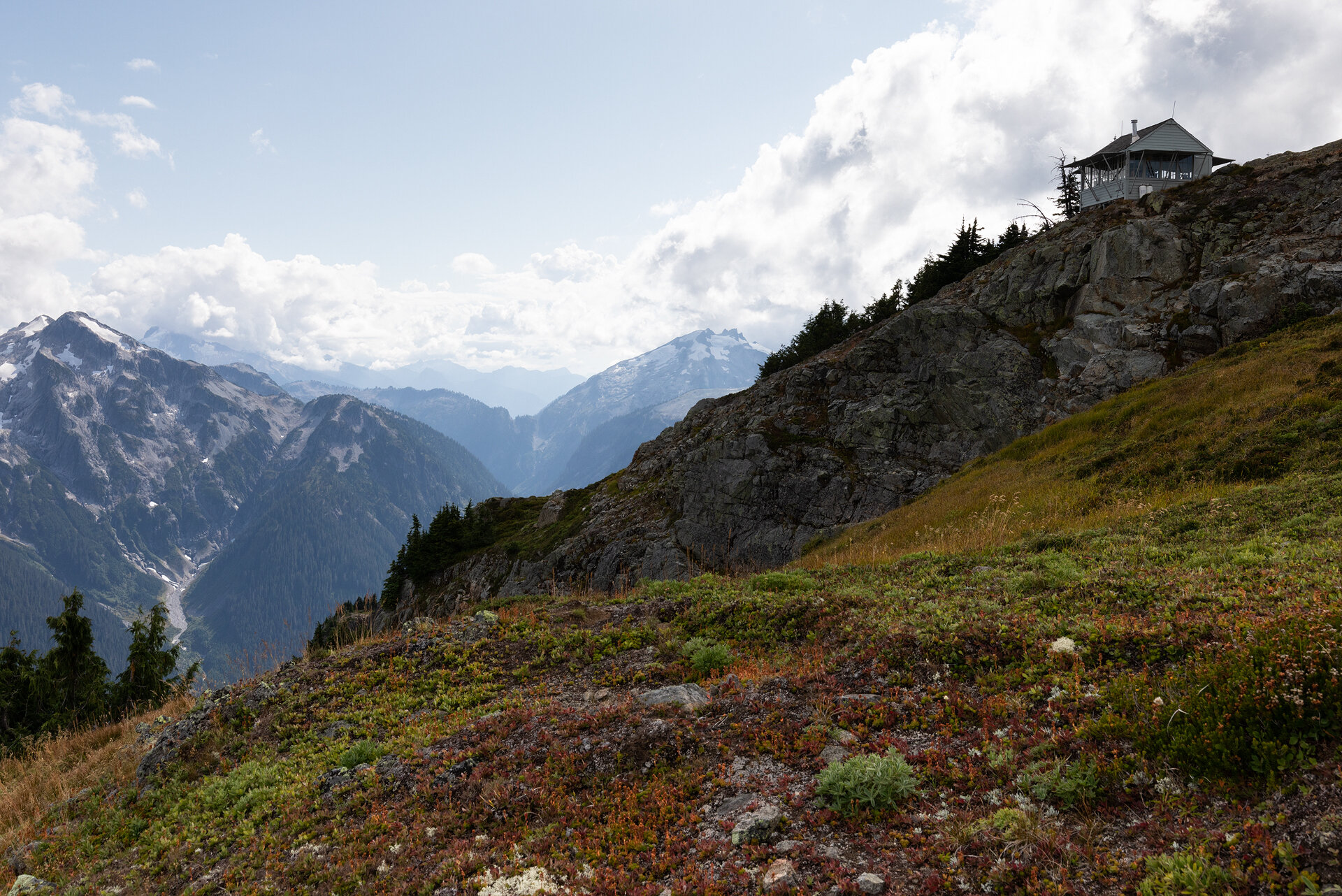
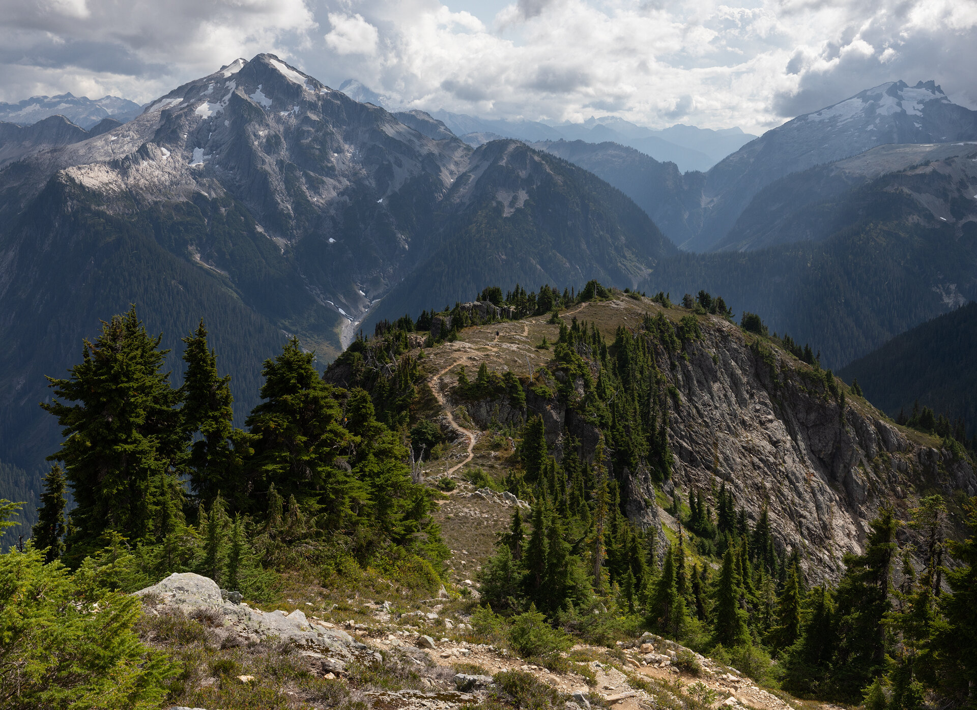

Photos from the ascent to the Copper Mountain Lookout
By the time we reached the lookout the sky had grown more tumultuous and we could see it was raining to the north. We wished we had more time to spend at the lookout, to be able to truly appreciate the 360-degree views it offered, but we didn’t want to risk being caught in a storm on a ridge. We reluctantly hiked down from the lookout and continued toward Silesia Camp.

Mineral Mountain seen from Silesia Camp
An hour later we were at camp. Silesia is known as one of the prettiest, if not prettiest, camps along the loop. There are only two sites, one is available for advance reservation and the other is saved for a walk-up permit. By a hiking miracle we were able to secure the site on a walk-up permit. However, there was one downside to the Silesia Camp—it was dry. There were no creeks or streams at which we could fill up our water bottles, so instead I had to hike to Egg Lake. This added another mile and 500’ of gain and loss to my already strenuous day. (This mileage is not included in the header for Day 4.)
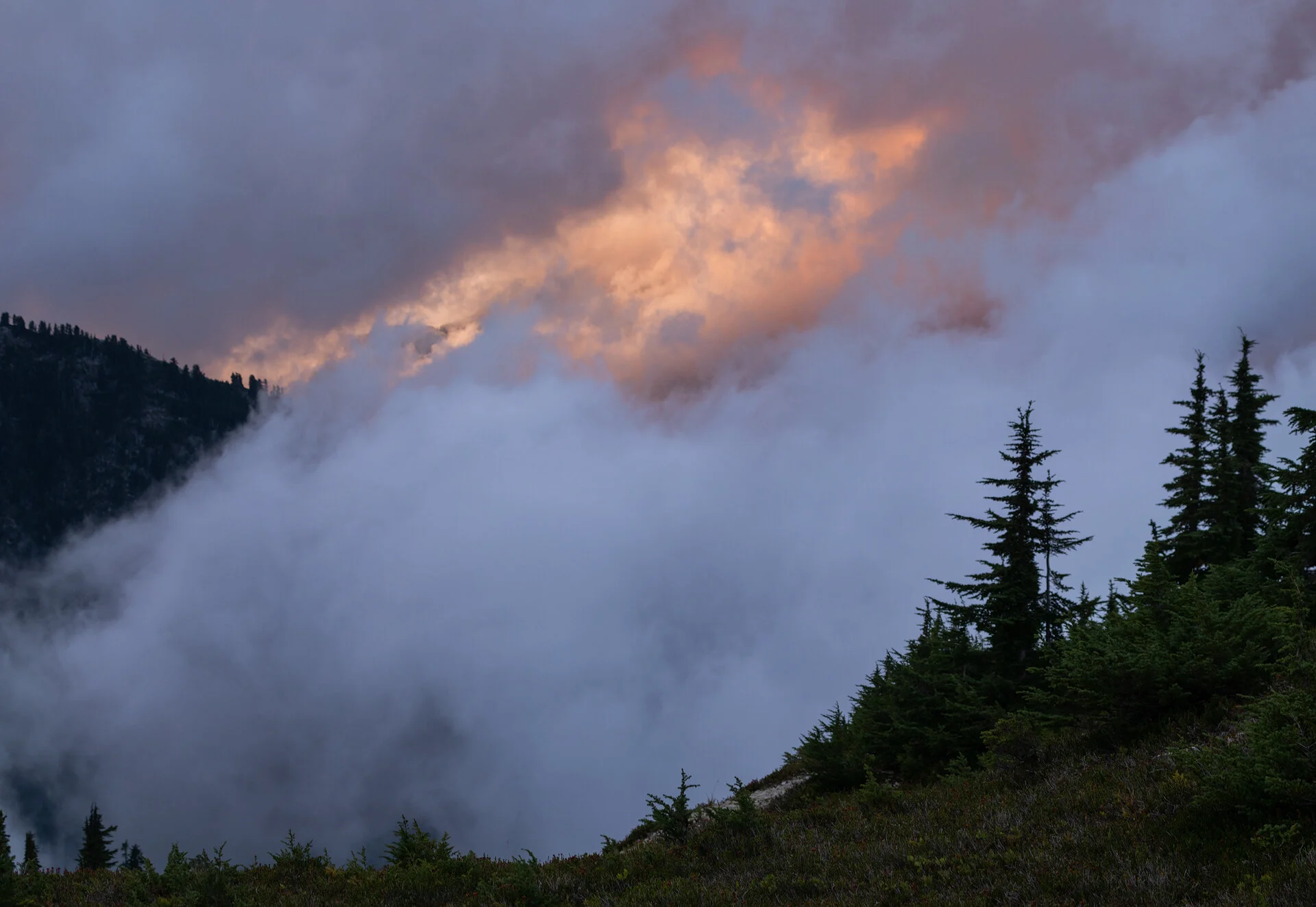
After dinner the clouds began to put on a show. Similar to the clouds at Tapto Lakes they danced up from the valleys and swept across hilltops and ridges. The setting sun painted streaks of orange and pink on the clouds. It wasn’t a typical mountain sunset, but it may have been one of the most unique scenes I have ever witnessed. I went to bed with tired legs but a full heart. As I drifted to sleep, the rain that had held off all afternoon began to fall on the tent, softly at first, and then with more force. I let the sound lull me to sleep and remained hopeful that the storm would clear by morning.
Day 5: Silesia Camp to Hannegan Pass Trailhead, 7.6 miles, 1,100’ gain, 3,500’ loss

To my pleasant surprise, when I peered out of the tent the next morning I saw that it was clear. That sunrise was the cherry on top of an incredible trip. We enjoyed the morning scene as it unfolded with a cup of coffee and a bowl of oatmeal, complete with fresh berries Alex picked from near our camp.

Sunrise at Silesia Camp

Hiking down from Hannegan Pass with Ruth Mountain in the background
Our final day was quick and easy compared to the previous day. We broke down camp and hit the trail. We maintained a brisk pace and made it to Hannegan Pass in an hour and a half. From Hannegan Pass it was just four miles downhill to the car. Along this stretch we finally began to run into dayhikers again, it wasn’t many, but after seeing only a handful of hikers in the preceding days, it was a reminder that our trip was coming to an end.
We cruised down the rest of the trail and made it to the car at noon. We cleaned up, changed into fresh clothes, pulled out our snacks for the car ride, and then hit the road for another hike!
I am still filled with a deep sense of gratitude for the experiences we had on this trip. The landscapes were rugged and beautiful, the solitude was serene, and the weather cooperated nearly every step of the way. I am well aware that a five day trip in the North Cascades could have easily consisted of nothing more than rain, so our billowy clouds and clear sunrises feel even more sweet with that knowledge.
This is a range that I could easily spend a lifetime exploring and I’m certainly excited to plan more backpacking routes there in the future!

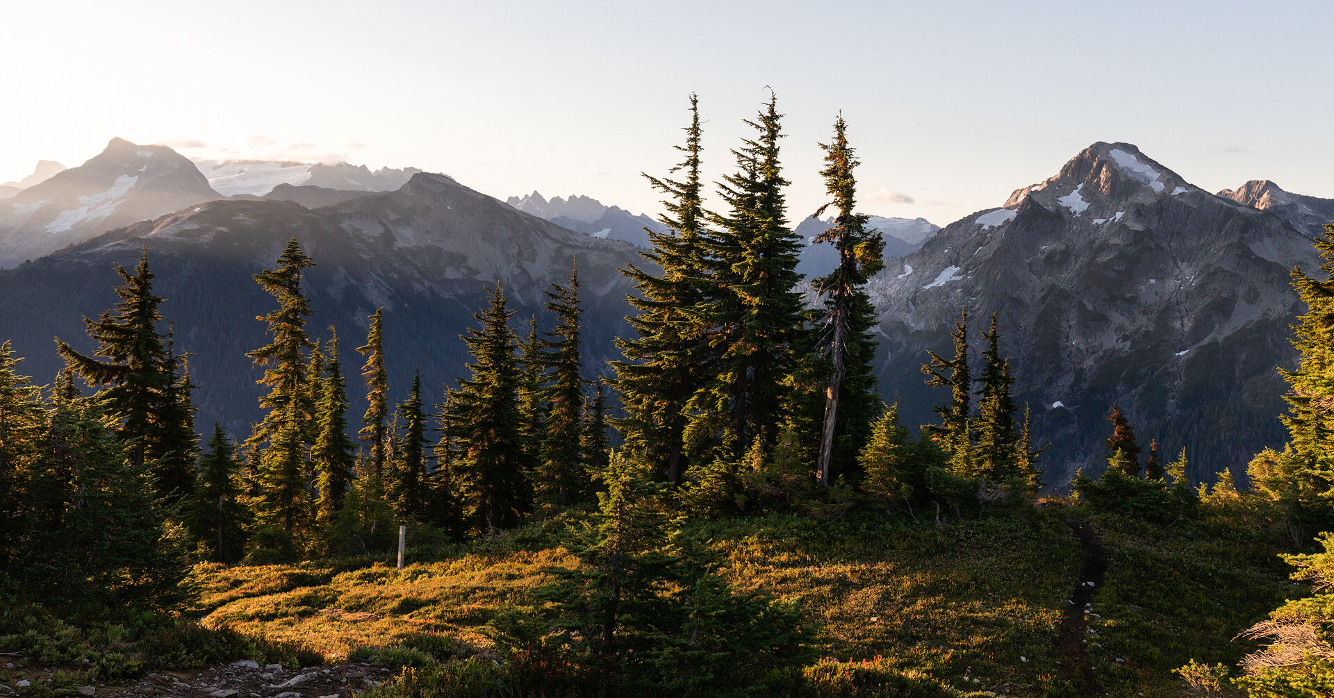
Icy Peak, Ruth Mountain, and Mount Shuksan seen on the trail from Silesia Camp to Hannegan Pass