
Over Ice and Tundra: 5 Days Backpacking with SEAG in Wrangell-St. Elias NP

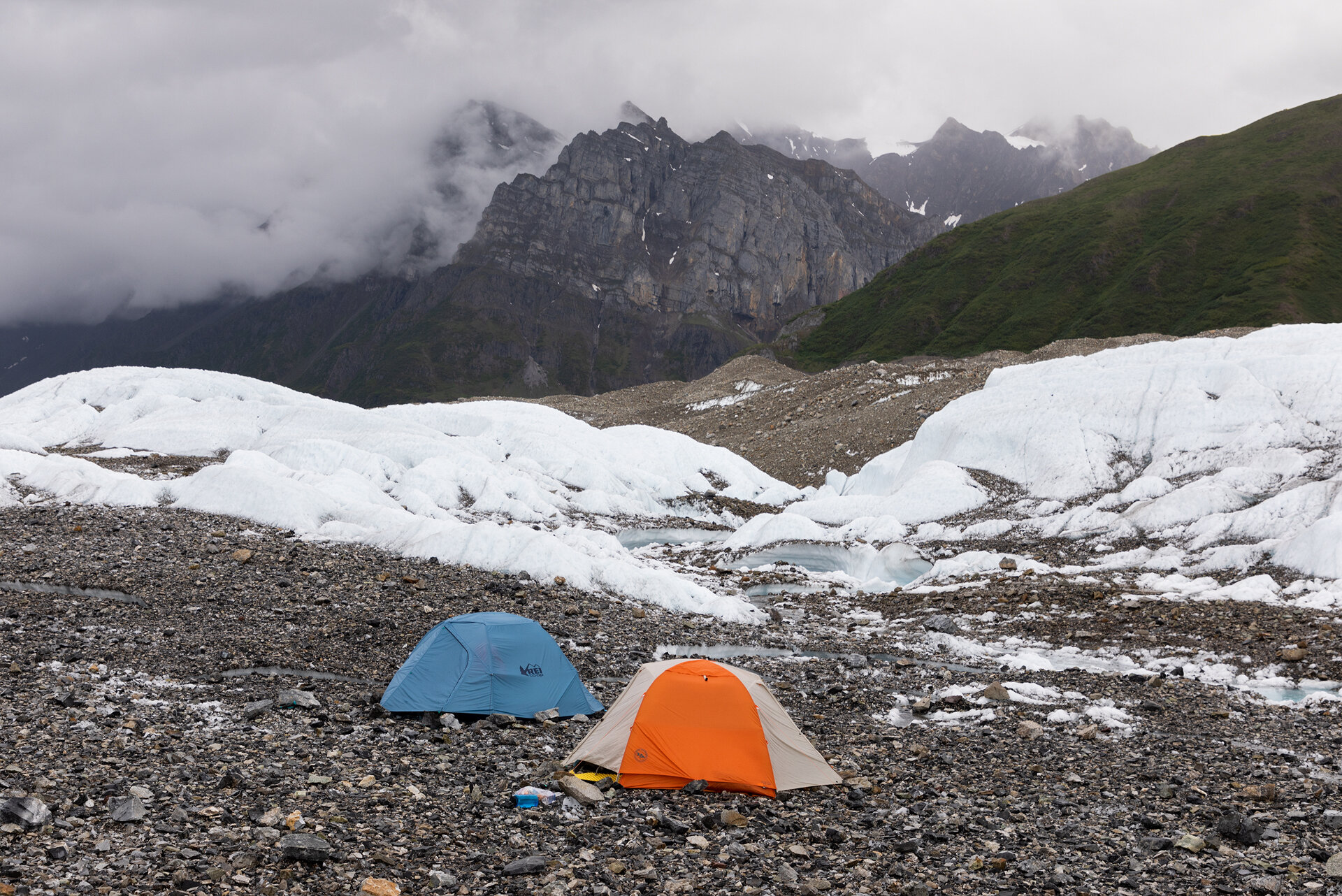
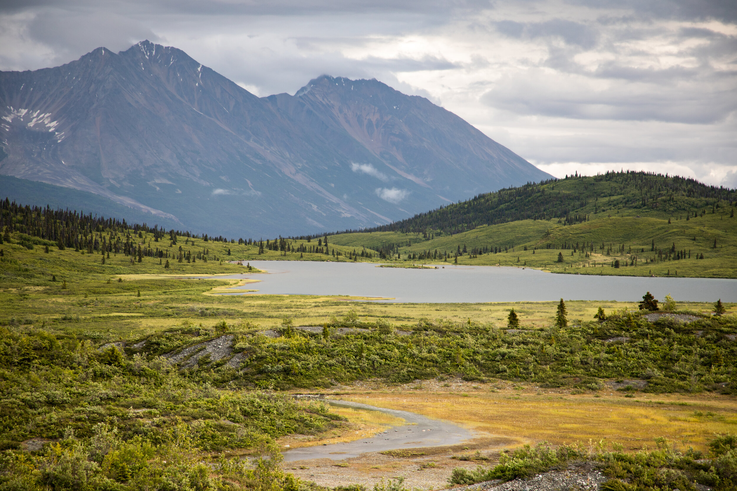
Emilie taking in the view from our camp spot on night one
Dates: 7/18/20-7/24/20
In 2017 I visited Wrangell-St. Elias for the first time and was blown away by the scenery. The snowy peaks, lush tundra, and stunning glaciers seemed to imprint on me during my time in the park and the trip was cemented as one of the best backcountry trips I have ever been on. I wanted others to have that same transformative experience, so in early 2020 I teamed up with St. Elias Alpine Guides (SEAG) to put together a five day women’s backpacking trip through the park’s backcountry. I announced the trip in January and within a week the trip sold out! I couldn’t wait for July!
However, as summer approached we were unsure if the guiding season would still be able to go ahead as planned due to COVID-19. SEAG consulted with a doctor to learn best practices for guiding during the pandemic, and Alaska enforced strict guidelines that travelers must follow. All travelers entering Alaska must present a negative test from the previous 72 hours upon arrival, and then get a second test 7-14 days after their arrival. SEAG and all of our group members complied with these regulations and the trip was able to go! (You can see all of Alaska’s current restrictions here).
Our group was comprised of ten inspiring women: two incredible guides (Anya and Anna), seven intrepid hikers (Emilie, Sam, Chelsea, Emily, Madison, Jeanelle, Maddie), and me. The route we had planned to tackle was a challenging one that would take us over the Kennicott, Gates, and, finally, the Root glaciers. This was the first backpacking trip for a couple of the group members and I was so inspired by their ambition in making their first backpacking trip one into the depths of the Alaskan backcountry! This would also be the first time traveling on glaciers and without trails for some group members, but everyone was eager and excited for the trip!

The view from the Fred Meyer parking lot in Palmer, AK where we stopped to pick up lunch on our way from Anchorage to McCarthy
Day 1: Journey from Anchorage to McCarthy
We met in Anchorage at a small airport hotel. It was still early and we exchanged greetings and introductions through sips of coffee. We had a long day ahead of us—a five hour drive to Chitina in a van and then a scenic flight with Wrangell Mountain Air that would take us into the town of McCarthy, the jumping off point for our trip to Wrangell-St. Elias National Park. Our van arrived precisely on time and we all piled ourselves and our gear into the van and we were officially underway!
As we made our way toward Chitina on AK-1, we got our first taste of Alaska. We looked out the windows in awe as massive mountains, boreal forests, and wide rivers rushed by. The day was overcast and clouds hung low on the horizon, but any rain remained at bay. Our van jostled along, every so often we were launched nearly airborne by a “freeze hump”; our driver, Paul, explained that these bumps were caused by water flowing under the roadway and then freezing during winter. Water expands when it freezes, which causes the road to bulge with humps and bumps that come with little warning.
We made it to Chitina by mid-afternoon and found our pilots from Wrangell Mountain Air already waiting for us, standing next to their vibrant yellow planes. I did a double take when I saw who one of our pilots was: it was none other than Kelly, the guide who led my trip to Wrangell-St. Elias trip in 2017! On the trip he had talked about wanting to become a pilot so it was a fun surprise to see him behind the controls.

An aerial view from our flight with Wrangell Mountain Air
Our group was too big to fit in one plane so we split up into a Beaver and a Cessna 172. Not long after arriving at the tiny airstrip, we were hurtling skyward. The trees and river shrank to the proportions of children’s toys far below. On the flight Kelly pointed out mountains and landmarks as we flew over them, naming the passes, and explaining the geology of the land. The flight was beautiful, offering a bird’s eye view of the park.

Mountains, valleys, and rivers seen during our flight to McCarthy

The Stairway Icefall and Root Glacier
As we approached McCarthy, Kelly asked if we wanted to fly over of the route we were about to embark upon. “Yes, of course!” we answered through our muffled headsets.
He banked left and headed towards sprawling glaciers. The blue ice stretched like a tongue into the green valleys far below the mountain peaks from which they originated. Kelly tried to point out a small airstrip where we would be landing in just one day. I strained to find the telltale sign of a runway, the unmistakable slash of dirt in the tundra, but I could not decipher anything man-made.
We then flew over the Kennicott Glacier and the Gates Glacier, while Kelly pointed out two lakes that twinkled like gems on the emerald tundra and informed us this was Donoho Basin, where we would spend a night. Finally, we flew over the Root Glacier and spied, for the very first time, the Stairway Icefall. The Stairway Icefall is a 7,000’ tall frozen waterfall of glacier ice. It is the tallest icefall in the world outside of the Himalaya, and just looking at it from our tiny bush plane was a humbling experience.
After 20 minutes of nothing but mountains, valleys, rivers, and glaciers, the town of Kennicott came into view. It was once a bustling mining town in the early twentieth century. Since then the National Park Service has take over and now offers tours of the old buildings. From the air Kennicott’s rust-red structures stood out starkly against the verdant backdrop. We landed shortly after, disembarked, and then scrambled into yet another van!
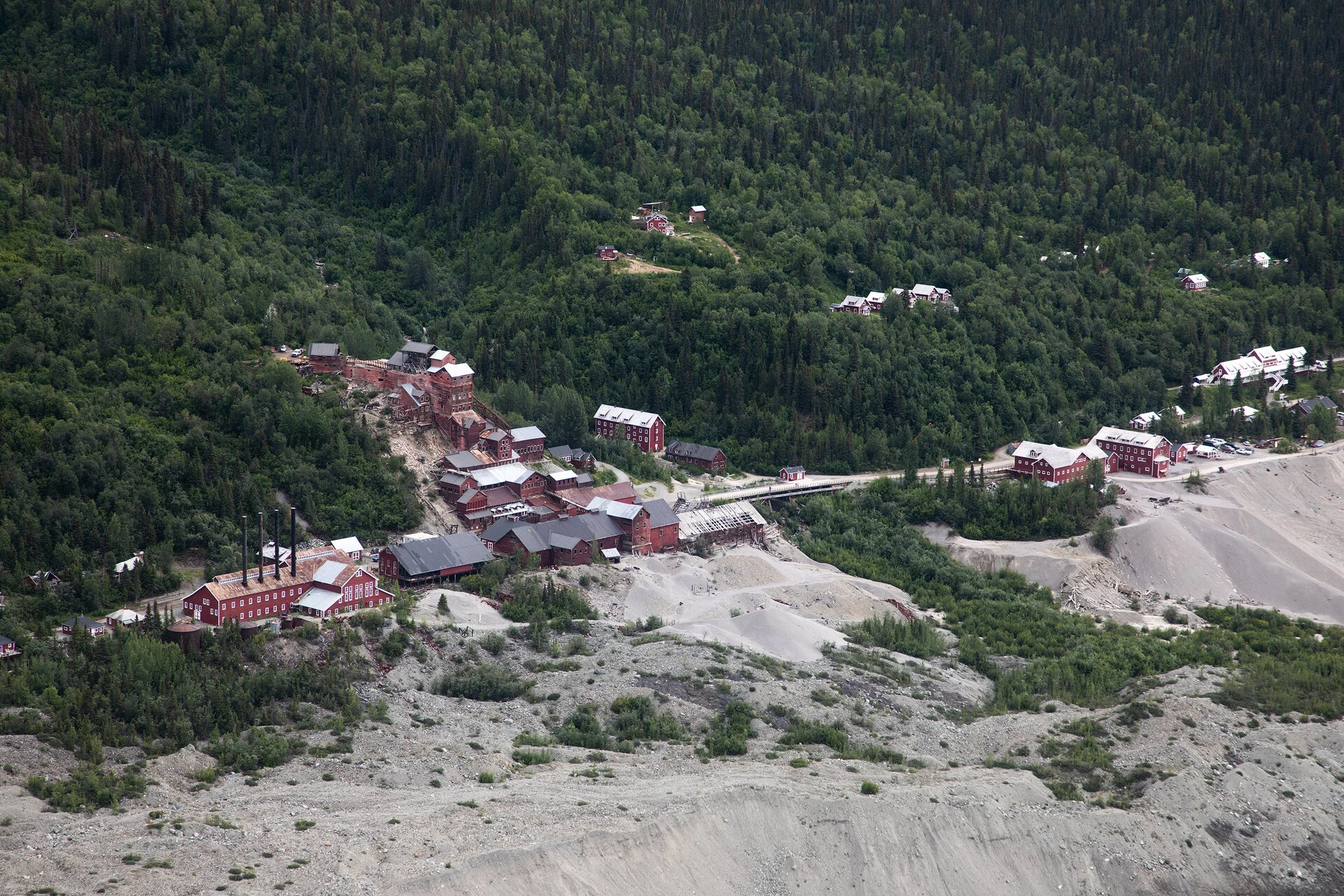
Our first view of Kennicott from the air
We had a few errands to take care of before we could rest for the evening. First, we headed to SEAG’s power house to put together our own personal snack packs. While SEAG took care of all the meal planning for breakfast, lunch, and dinner, we would be responsible for making sure we had enough snacks throughout the day. They provided us with gallon-size ziplock bags and let us have at their snack stash. They had every snack you could ever want—candy bars, pre-made trail mix, the ingredients to make your own trail mix, sweet snacks, salty snacks, fruity snacks, and an endless assortment of nuts and chocolate-covered morsels. We all filled our snack packs until they were bulging.

The SEAG headquarters
Then, we headed back to Kennicott to get fitted for our ice climbing gear and pick up our crampons. Our final day of the trip was going to be an exciting one—we were going to rope up and try ice climbing on the glacier, so we needed to make sure we were well-prepared and everything fit properly!

Our home for the evening, the Blackburn Cabins
Finally, after a long day, we made our way toward home for the night: the Blackburn Cabins. These are beautiful handmade log cabins tucked away in a stand of trees in McCarthy. Each cabin is one room with two full beds, a sink, dishes, and an assortment of games; in other words, the epitome of a cozy cabin in the woods. I’m not sure if it was due to my extreme exhaustion, but that bed was the most comfortable bed I had slept in in a long time. I felt as if I was being caressed by clouds!
The grounds also have two showers with a clear roof so you can enjoy the canopy of trees and clouds above you while you rinsed off, a very clean outhouse with a beautiful view of the forest, and a fire ring. After we unpacked and settled in, we all gathered around the fire. Anya and Anna had made us a delicious dutch-oven chili covered in cornbread. We all dug in, poured ourselves a glass of wine, and sat by the fire and talked until the fire fizzled out.

Day 2: The Fosse
Our second day of the trip was the day we had all been waiting for, the day we entered the backcountry and began our trek. We headed to the McCarthy airstrip bright and early where we met Austin, the pilot from Wrangell Mountain Air who would be flying us into the backcountry. It would require three round-trips to shuttle all of us and our gear to the backcountry airstrip known as The Fosse (this was the same airstrip I had failed to spot from the sky just one day earlier). Each round trip took over 40 minutes, so while our companions were in the air, the rest of us waited. We sat on our packs and watched the sky; the day was cloudy with a few patches of blue. The forecast for our trip looked quite wet, but we were holding onto hope that the forecast would be wrong. “The nearest weather station is over sixty miles away,” Anna informed us. The weather in mountains tends to be localized, so what was happening over sixty miles away might be entirely different from what we would experience, but only time would tell.
Finally, it was my turn to get in the Beaver and head for The Fosse. I got into the plane with Maddie, Sam, and Chelsea and Austin flew us toward the tiny airstrip on the edge of the Kennicott Glacier. As we approached I saw why it was so easy for me to miss—the airstrip was barely noticeable, just a faint dirt scar on the tundra.
Once we were all in the backcountry, Austin snapped a group photo for us before climbing back into the Beaver and taking off again. The drone of the propeller faded away and was replaced by a calm quiet. It was already early afternoon, but we were lucky due to the facts that our hike to camp would only take about an hour and the summer days in Alaska never seem to end.

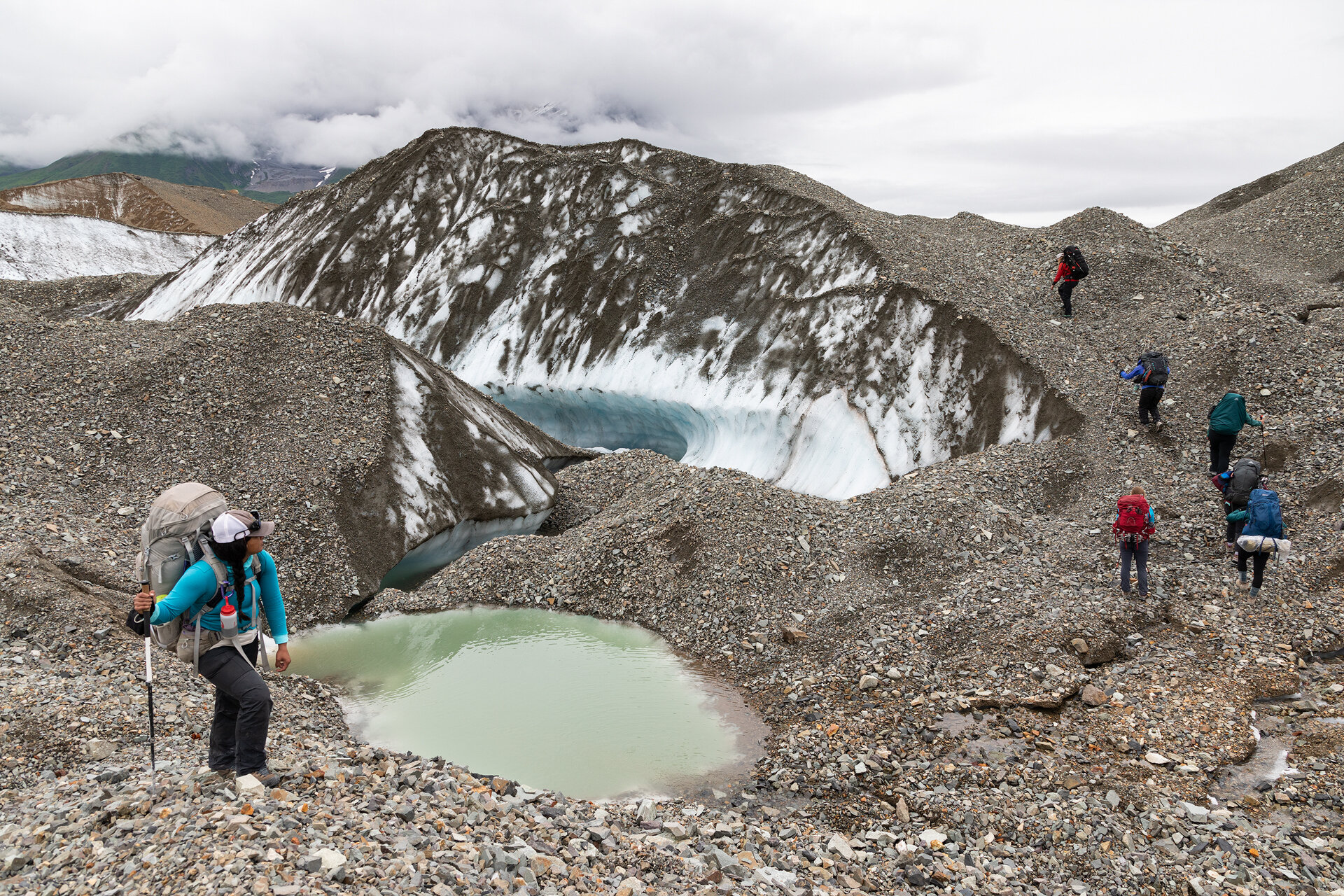
Our group hiking up a rocky gully toward camp
The hike to camp took us through a gully between the moraine and the mountains. After an hour of relatively level, albeit rocky, hiking we had one final push to camp up a couple hundred foot gain on steep, slippery tundra. We crested the final ridge and, as our camp spot came into view, it was very apparent that the steep hike was worth it. The flat terrace of tundra overlooked the Kennicott Glacier and had a beautiful perspective on the tooth-like Donoho Peak. After setting up our tents and eating lunch, Anya led us on a day hike to a place called Hidden Lake.

Madison and our tent at our campsite overlooking the Kennicott Glacier and Donoho Peak (the pointiest peak in frame)
We retraced our steps back down the steep embankment, back to the airstrip, and then continued onward over new terrain. We followed the rocky gully until it seemed to end and our only choice was to begin hiking up another steep hillside. It was tough hiking, there was a faint social trail but the brush was overgrown and fought us with each step.
Eventually, we broke out of the brush and were greeted by a scene unlike anything I had ever witnessed. Far in the valley below us was Hidden Lake, except it was no longer in its lake form. One week prior it was a lake, but since then a jökulhlaup occurred. Jökulhlaup is an Icelandic word that describes an event where water breaks through a glacier and drains, causing downstream river levels to rise, and leaves a jumbled collection of icebergs in its place. For the first part of summer Hidden Lake is very much a lake, with icebergs bobbing on the surface, but each year there is a time when the pressure of the lake eventually overwhelms the glacial dam. The resulting scene was incredible. The icebergs reminded me of a metropolitan city, with some as tall as skyscrapers.
Once we had snapped a few photos of the valley full of icebergs and ate snacks, we turned around. Unfortunately, as we began to make our way toward camp the skies opened and it began to pour. We threw on our rain jackets and pack covers and quickened our pace, but our speed was no use. By the time we got to camp we were all soaked.

Making our way to camp in the rain, half of the group took a ridge (which is where this photo was shot from) and the other half hiked in the valley below
Madison and I climbed into the tent we were sharing and listened to the wind and rain pelt the tent. The wind bore down on us in such strong gusts I had to hold the tent poles in place because I was nervous they would snap. I looked at Madison and said, “I don’t think I want to leave for dinner.” She looked back at me and nodded. We sat in the tent, holding it up, listening to the rain. Slowly, we noticed that there were longer lulls between gusts and the rain wasn’t hitting the tent with quite as much force. I looked out the tent and saw the clouds had lifted slightly. We pulled on our shoes and headed to the cook tent. Everyone else was already inside the tent, huddled in a circle, clutching cups and mugs that were steaming with tea, cocoa, or cider. Anya offered me some hot water which I eagerly accepted. I pulled out my apple cider packet and poured the spicy contents into my water. A hot drink had never tasted so good.

The Kennicott Glacier on the morning of Day 3
Day 3: The Kennicott Glacier
Our second day in the backcountry dawned overcast, but dry. We gathered in the cook tent again for breakfast. We started with hot drinks and talked about how grateful we were that the rain and wind had died down. We were all imagining worst case scenarios involving snapped poles and soaked sleeping bags, luckily those thoughts never became a reality.
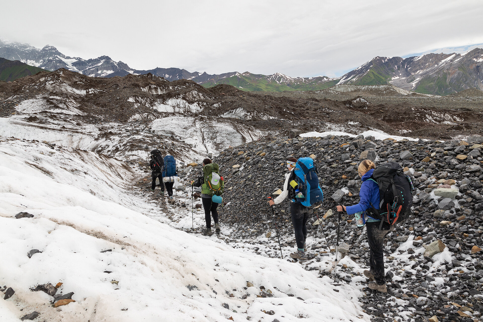
We had a strenuous day planned. We were going to have to find a way onto the Kennicott Glacier and then cross it, so we filled up with a hearty breakfast of couscous mixed with dates, fruits, and nuts. After we finished breakfast, we packed up camp and headed back down into the gully we had hiked through three times already. We were becoming very familiar with this area.
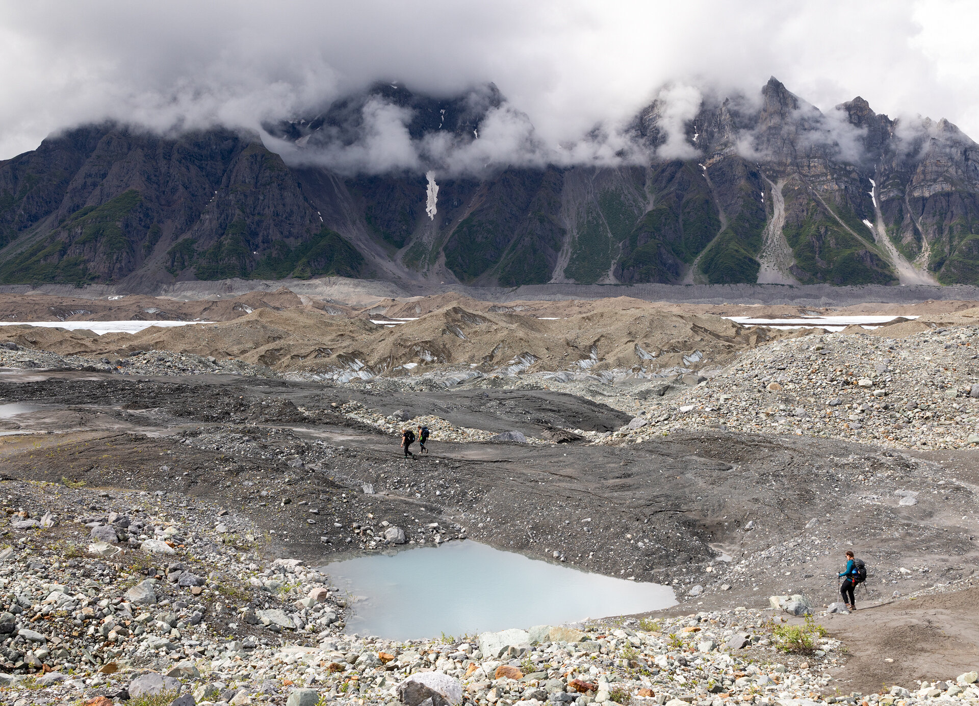
Heading toward the moraine (giant rock pile) in the distance. We would have to make it over this pile in order to get onto the Kennicott Glacier
Anya and Anna scouted the moraine, trying to find a good place to get onto the glacier, but it was proving to be a difficult task. The pile of rocks in front of us had a precipitous drop on the opposite side, we thought the hike would be as easy as walking up our side of the moraine and hiking down the opposite side. However, when we reached the ridge we found ourselves peering over the edge that made my knees weak. Back down we went, repeating this process a couple times, until finally Anna saw a promising depression in the moraine. She dropped her pack and ran ahead to check it out. She came back with a smile on her face and motioned us over. She had found a way onto the glacier!
The outermost edges of a glacier is one of the tougher surfaces to hike on. It appears to be a giant pile of rocks, but under one thin layer of rock is ice (seen in the photos below). It is easy to dislodge a few rocks only to find yourself slipping on the ice below them. The terrain requires careful, deliberate steps.
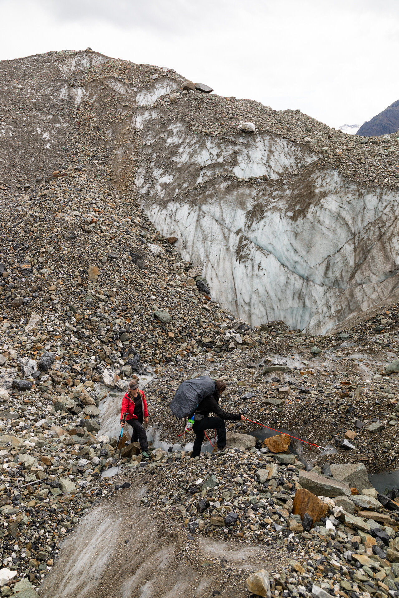
After some up and down on piles of lateral moraine we finally made it to the white ice, only there was one more obstacle. There was a deep and wide glacial stream separating us from the ice. Once again, we began searching for a route. We paced up the banks of the river looking for anywhere it was narrower or shallower. We continued to search until finally we found an area in the river where a giant boulder had wedged itself between the banks. Anya and Anna assessed it and determined it was just the spot we were looking for. We all put our crampons on and got ready for the crossing.

The glacial river we needed to cross
We were going to get across the stream by leaning onto the boulder—a trust fall, if you will—and then straddling it and scooting along to the opposite bank where Anya would lend a helping hand. We did this sans backpacks to make the crossing easier and planned to shuttle the packs across after we had all made it.
From afar the boulder didn’t look too tricky to cross, but up close, with the frigid glacial water flowing just below my feet, the crossing seemed much more daunting. I could hear everyone encouraging me on, but they seemed so far away. The only sound I could hear was my pounding heartbeat and the rushing water. I leaned forward, my hands braced in front of me, and let myself fall onto the boulder. I found a handhold and a foothold and hoisted myself on top. From there it was a quick scuttle across to the other side.

Emilie crossing the boulder with Anya ready to help
One of my favorite parts of this trip was seeing how encouraging and uplifting our group members were when they were supporting one another through a tough obstacle. Whenever we had a sketchy river crossing or a challenging hurdle in our way, everyone cheered each other on, “You got this!” “Woo! Way to go!”
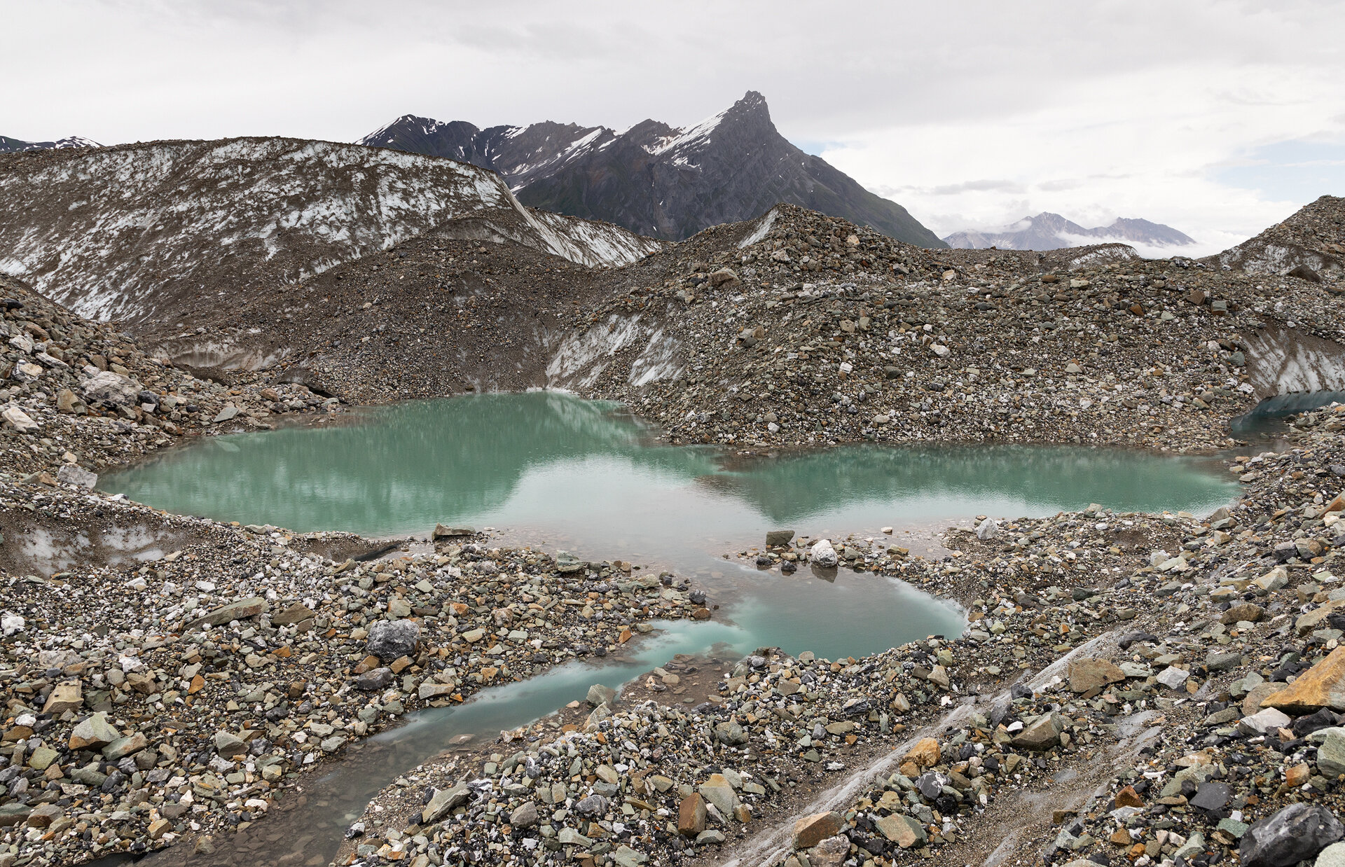
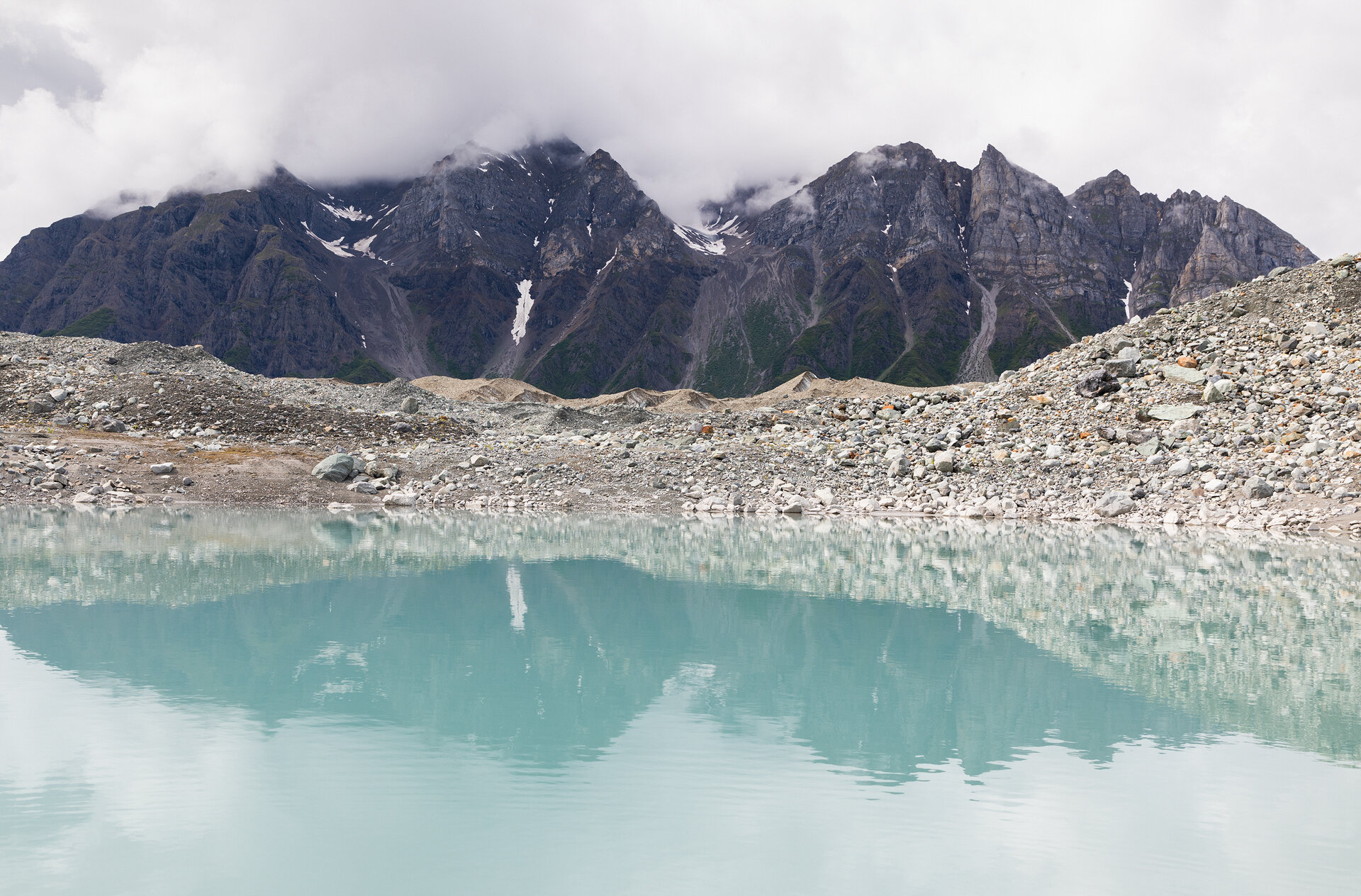
Once all of us and our gear were securely across the stream we continued on. This was our first time hiking on the ice and it was beautiful. It wasn’t long until we came across our first pool—an impossibly still, clear, and blue window into the depths of the glacier. We all gathered around it in awe exclaiming, “It’s just so pretty!”

The first blue pool we stumbled across
It was already early evening. Our river crossing and blue pool admiring had taken up quite a bit of time, so Anna and Anya suggested that we sleep on the rocky medial moraine near the pool. We were all tired and eager to set our packs down. Finding flat spots among the rocks and ice was tough, but eventually all of our tents had homes and we headed to the cook tent for hot drinks and dinner (this quickly became a morning and evening ritual we did not dare miss).
Our tents set up on the medial moraine. Inflatable sleeping pads are extremely helpful in these situations, mine made it so I couldn’t feel any rocks at all!
Day 4: Donoho Basin
I woke up groggy. It was a cold night of sleep and shortly after climbing into my sleeping bag I realized that our tent site was not nearly as flat as it initially looked, and I spent the night creeping down to the bottom of my sleeping bag. That said, it was still a unique experience to be able to camp in the middle of a glacier, listening to the creaking and groaning of the ever-shifting ice below and around us. We had another long day ahead of us so we filled up with a big breakfast.
The plan for the third day was to traverse across the Kennicott and Gates Glacier and spend the night in Donoho Basin, a green oasis that sits in a sea of ice.

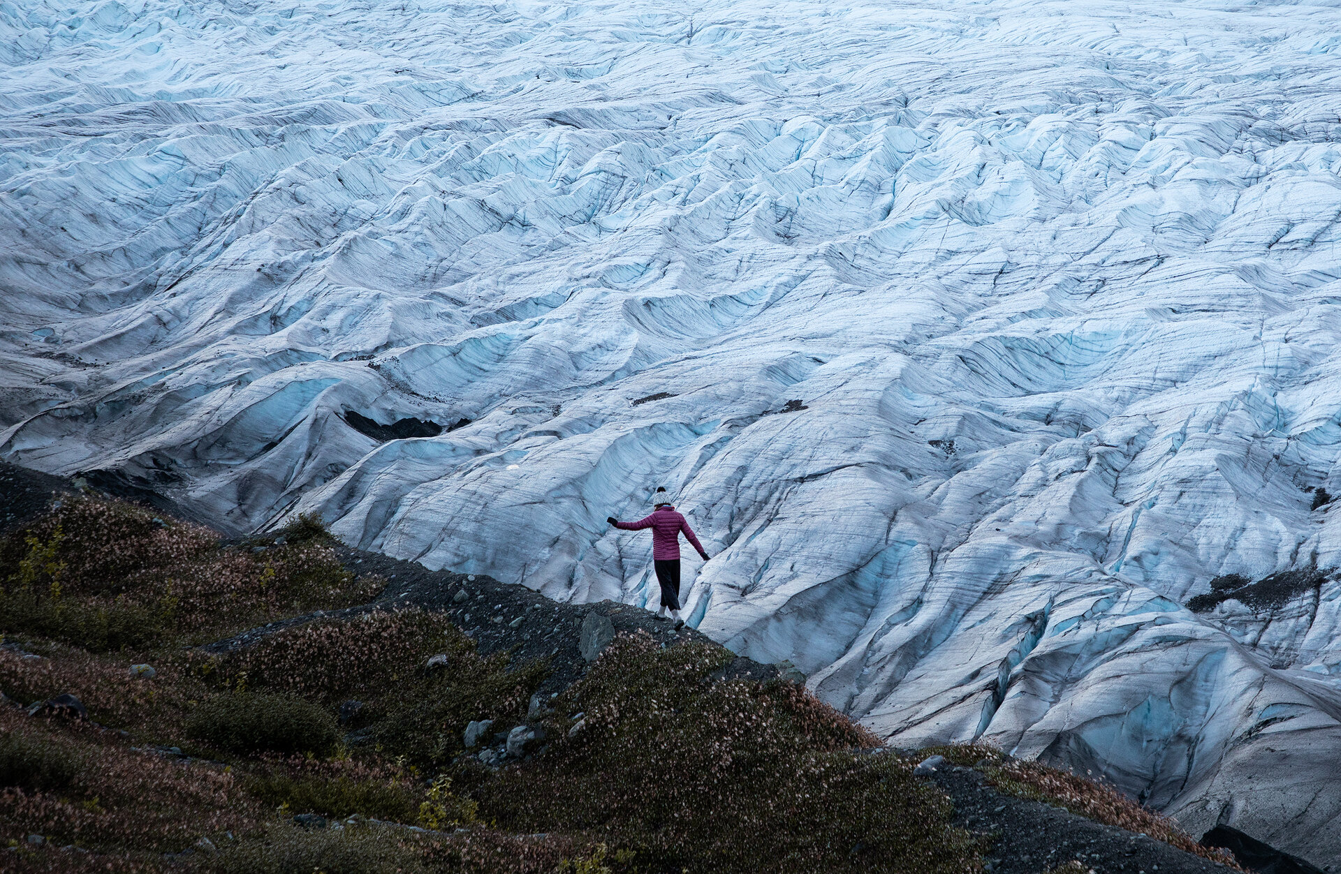
The views as we made our way across the Kennicott Glacier
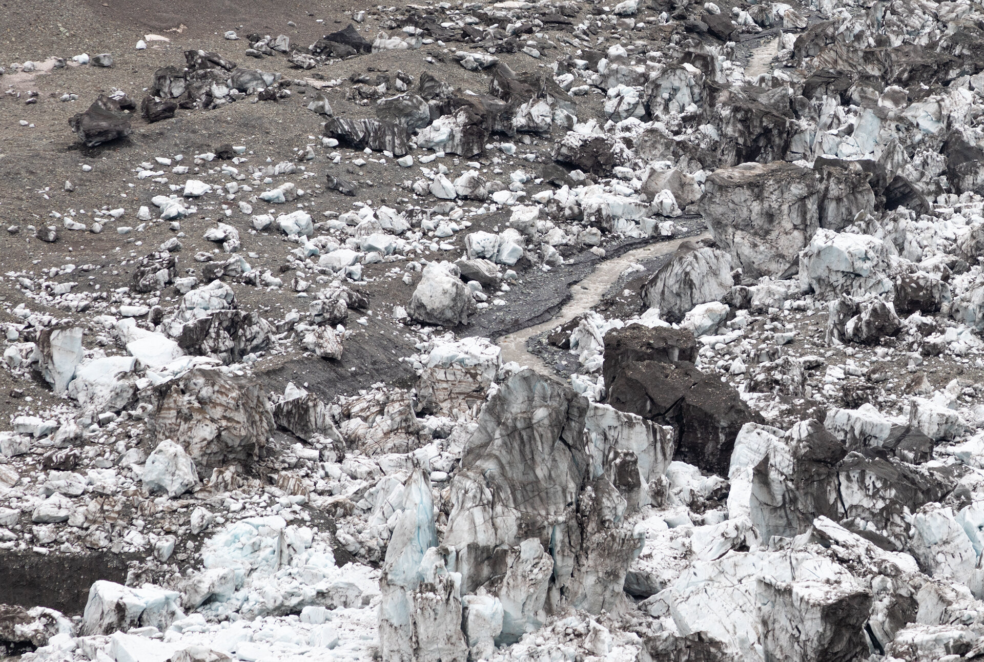
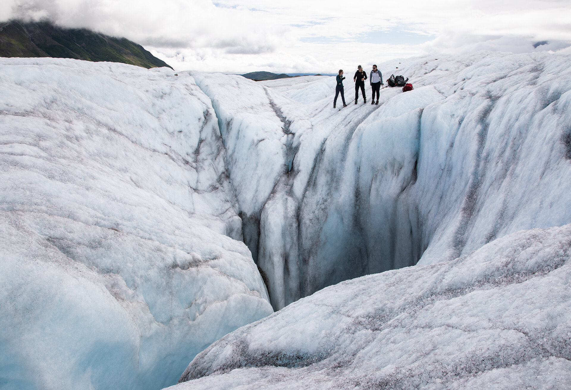
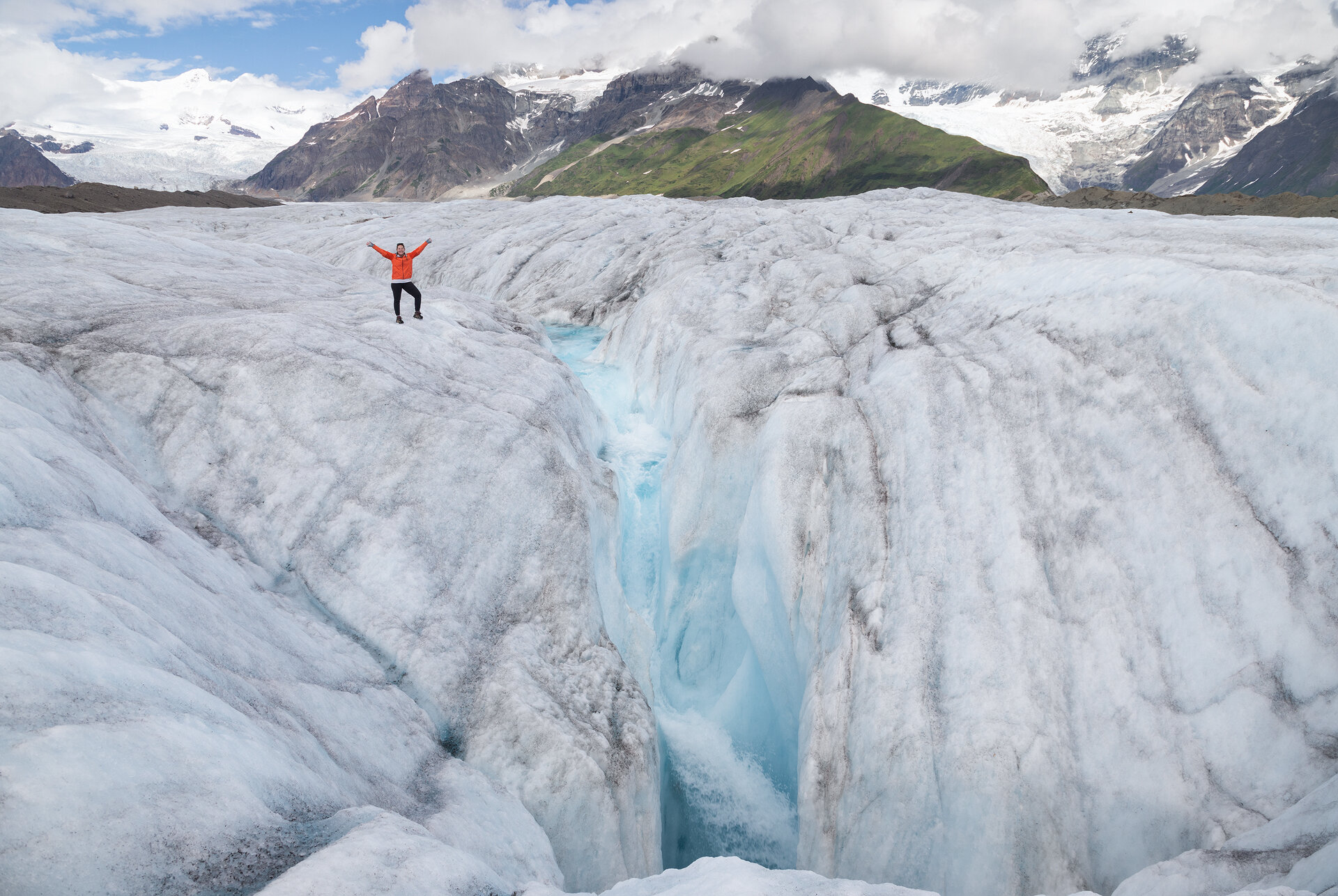
The morning required more clambering up and down rocky moraine, and a few more nerve-wracking stream crossings, but it was long until we were back on the ice. Hiking on the glaciers of Wrangell-St. Elias is always a treat. You never know what sort of glacial features you will find. We encountered blue pools, countless sinewy streams that resembled water park slides, crevasses, and moulins. A moulin, which is derived from the French word for mill, is a hole in the ice caused by water’s relentless boring down into the the depths of the glacier. At first the water forms a small depression in the ice, then it begins to grow as more water takes the path of least resistance and ends up in the same place. Some moulins grow so large they resemble cavernous jaws that could swallow a person whole.

Chelsea walking along a blue stream we encountered on the ice, this stream led us straight to a moulin
We were lucky enough to happen upon a five star moulin on the Kennicott Glacier. We encountered a large glacial stream after a couple hours of hiking. I looked down into the turquoise water rushing by below; I had never seen such a vibrant shade of blue before. We followed the river as it sidled across the glacier. I was lost in my thoughts and the water’s mesmerizing color when I became aware of a thunderous roar. Ahead of us was a massive moulin .
Anya lead us all to the edge and let us peer into its depths. It was a beautiful, yet terrifying, scene. I could see the water falling into the hole, but I could not see where it went. It simply disappeared into the darkness. If someone were to fall into a moulin they would be gone before anyone in their group could even react to throw down a rope. There is no telling how deep the moulin is or what sort of braided river system lies beneath the glacier’s surface.
As we crossed over to the Gates Glacier, the sky darkened. Once again we pulled out our rain gear. We hiked in silence as we made our way over the ice in the rain. This was the third day in a row it rained on us.

Anya hiking on the Gates Glacier as we made our way toward Donoho Basin
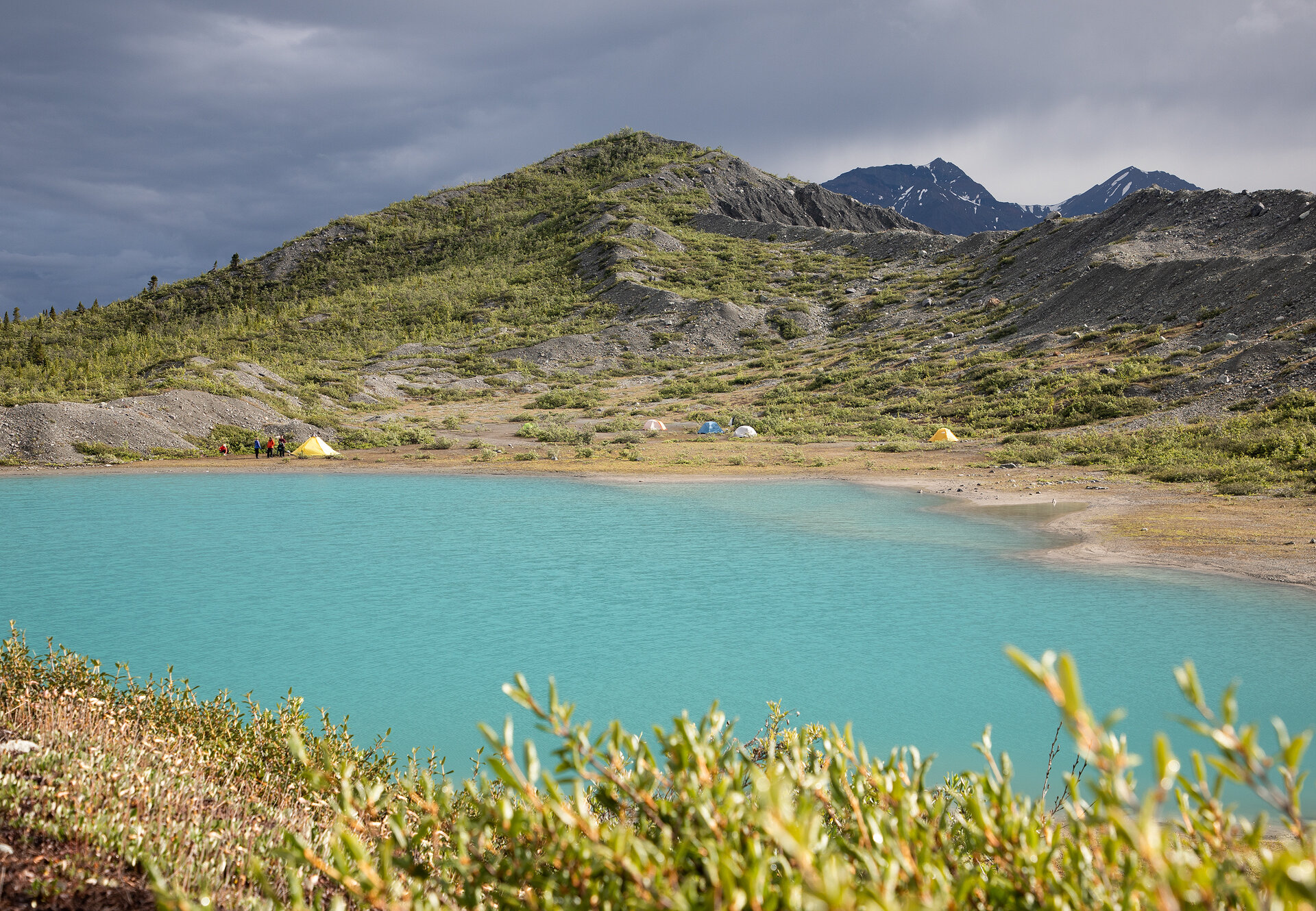
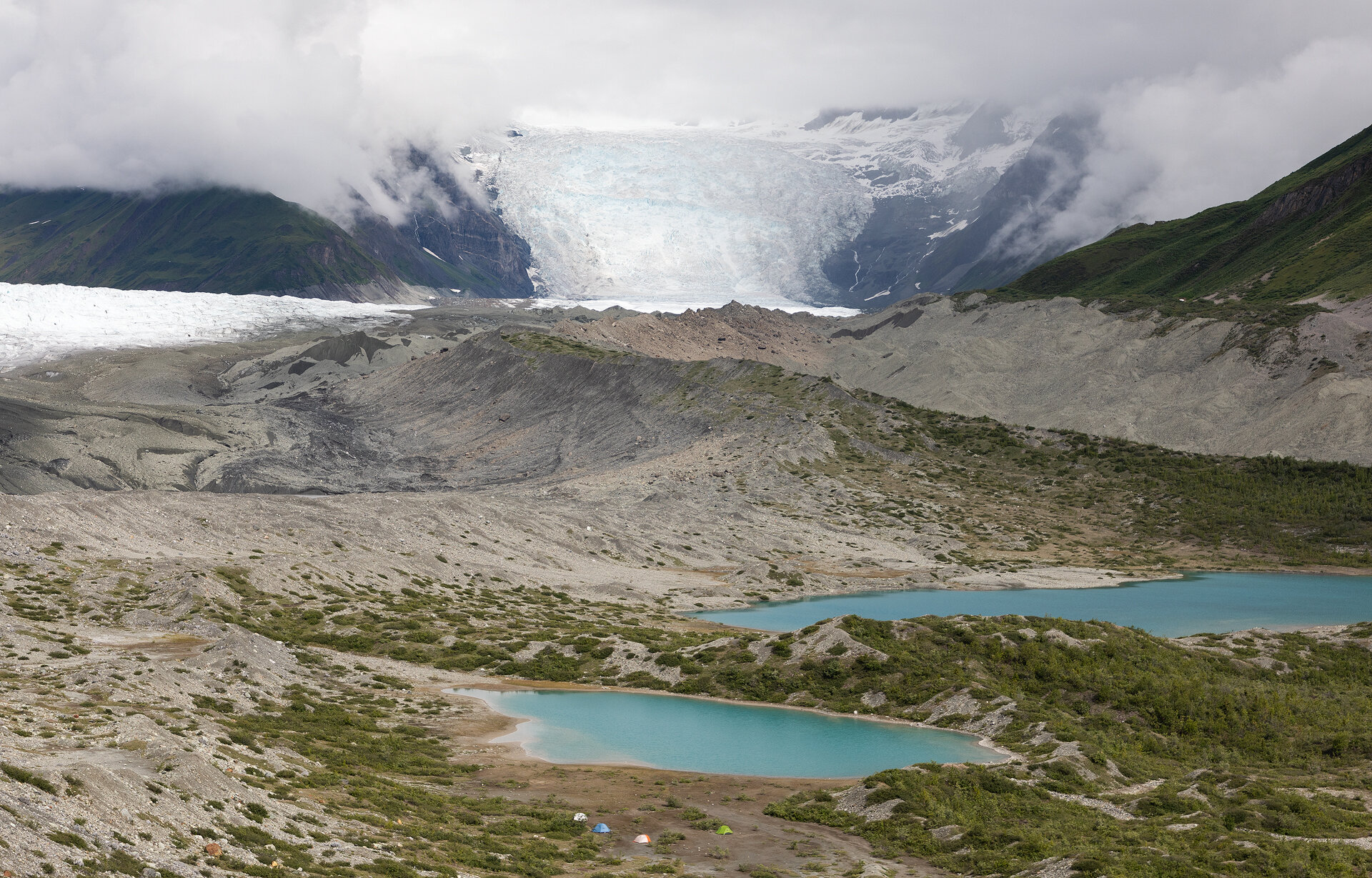
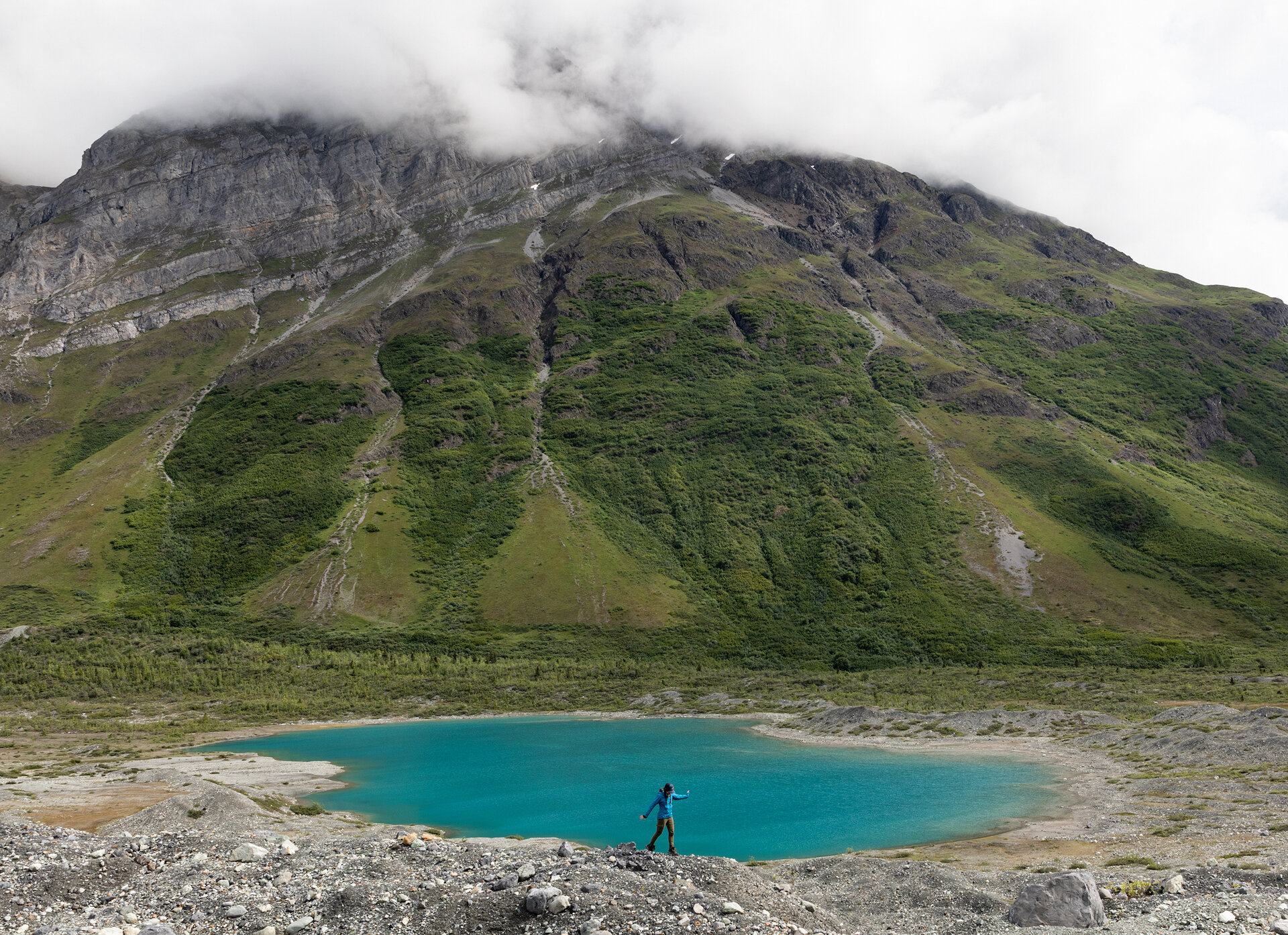
Finally, we crested a ridge and two shimmering lakes nestled beneath towering hillsides came into view. These were the same lakes we had seen from the plane just a few days prior. They were just as beautiful from the ground! Next to one of the lakes was a flat sandy bench that would be our camp for the night. We all scrambled down to its shores and took off our packs. It was still raining, but now there were rays of sun beaming through the clouds it seemed the rain might let up.

Maddie making her way down to the lakes in Donoho Basin
The rain cleared and I decided to scramble up a few ridges around camp for views. The landscape was breathtaking. Miles of ice, towering mountains, and a green basin with aqua lakes. All of the below photos were taken while standing in one place and simply pivoting my body. The diversity of the landscape was mind-boggling!
Day 5: The Soggy Traverse
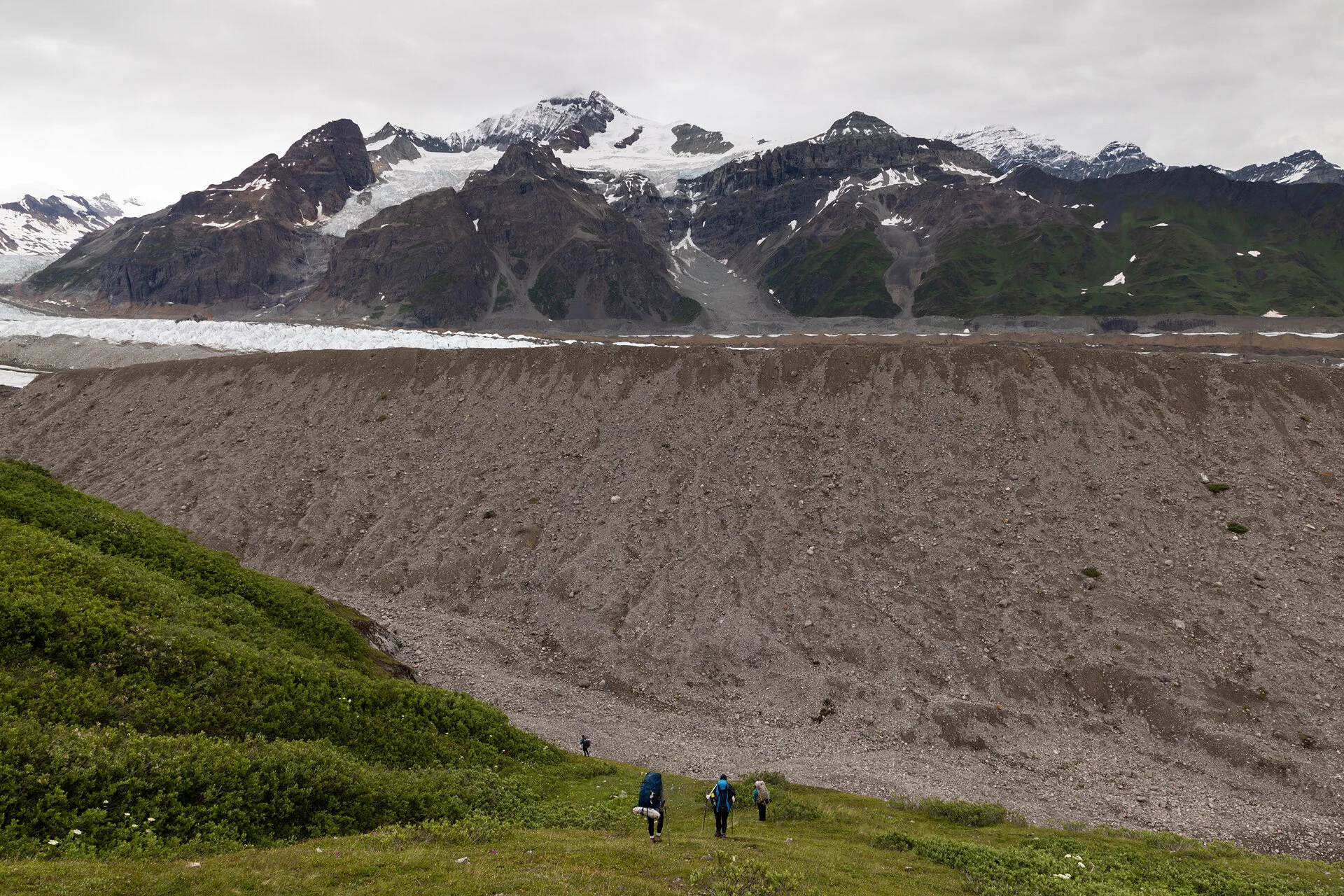
We had a relatively short hike to our fourth and final camp, so we slept in and had a leisurely breakfast in Donoho Basin. Anya and Anna had a fun, short loop planned for us to hike before packing up camp. First, we scrambled to the top of a ridge just behind camp and were treated to 360° views of the area. The Kennicott Glacier is 27 miles long and from our lofty vantage point we got a better view of just how expansive it was!
From the ridge we then headed down to the edge of the Gates Glacier to explore its fins. A giant silty pool had formed below the towering edge of the glacier. Icebergs floated around within it, from afar the icebergs looked small, but as we got closer to the lake’s shores they grew until we saw their true size. Some were as big as cars!

Jeanelle and Anya exploring the edge of the Gates Glacier
While the day had started sunny (Emily even hiked in a tank top for one brief moment!), it began to rain as we were packing up. Out came the rain gear again.
The hike to our planned camp wasn’t long, but it was brushy, which made for a very wet hike. We were getting rained on from above, and from below drenched leaves and branches whipped at our legs. I had my camera jammed into my jacket to keep it dry, so I attempted to take some photos and videos with my phone instead. I pulled it out to take a photo and realized that the lens had condensation under it. It looked like I was trying to take a photo through a milky film. Disappointed, I put my phone back into my pocket and hiked on through the mud.

Views from the hike as we made our way across Donoho Basin
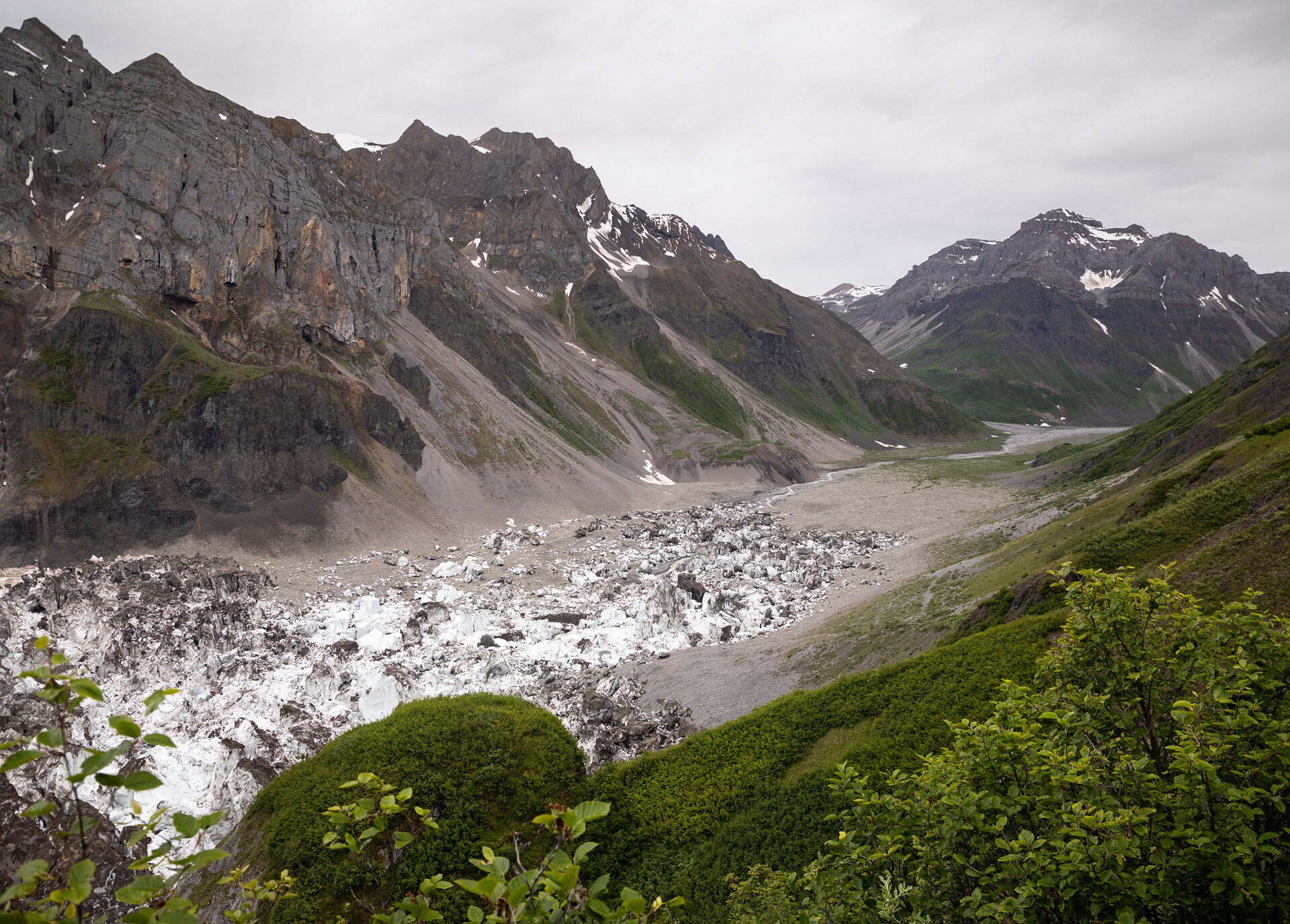
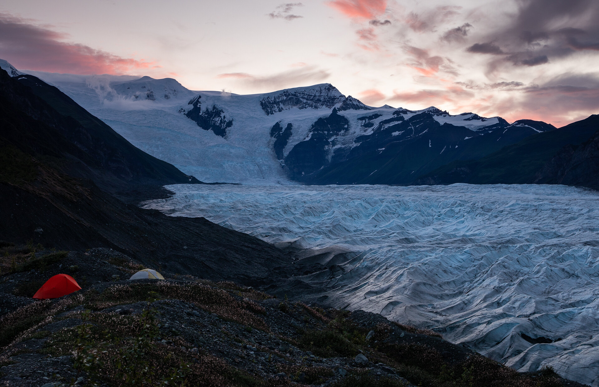
It felt as if we had been transported to an entirely new location as we hiked across Donoho Basin. Gone were the icy ridges and blue pools, and in their place were sitkas and marshy grasses. I had almost forgot we were still in the land of glaciers when we crested a hill and the Root Glacier came into view like a mirage; it looked like a frozen river in the valley. Our camp spot for the evening was a beautiful area that overlooked the entire Root Glacier, with commanding views of the Stairway Icefall. We could even see the town of Kennicott in the distance.
Fortuitously, the rain abated right before we made it to camp, so once again we could set up camp without worrying about the inside contents of our tent getting soaked.

Camp above the Root Glacier
After setting up camp, we once again congregated in the cook tent. We began reminiscing about our trip, already feeling the end nearing. As a surprise for the final night, Anya and Anna cooked up a backcountry Thanksgiving meal and, just when we thought the meal couldn’t get better, they pulled out a bag of wine! They had been secretly hauling the wine around for four days!! We talked, laughed, read aloud silly entries in a Naturalist book Emilie had brought along (an Olive-Sided Flycatcher’s call sounds like “whip three beers, whip three beers”). The night wore down and we all retired to our tents. I had hopes for a colorful sunrise on the final day, so I set an alarm for 3:45am, and kept my hopes high. Sam, Emily, and Chelsea also wanted to be awoken if the morning dawned clear so I promised to let them know.

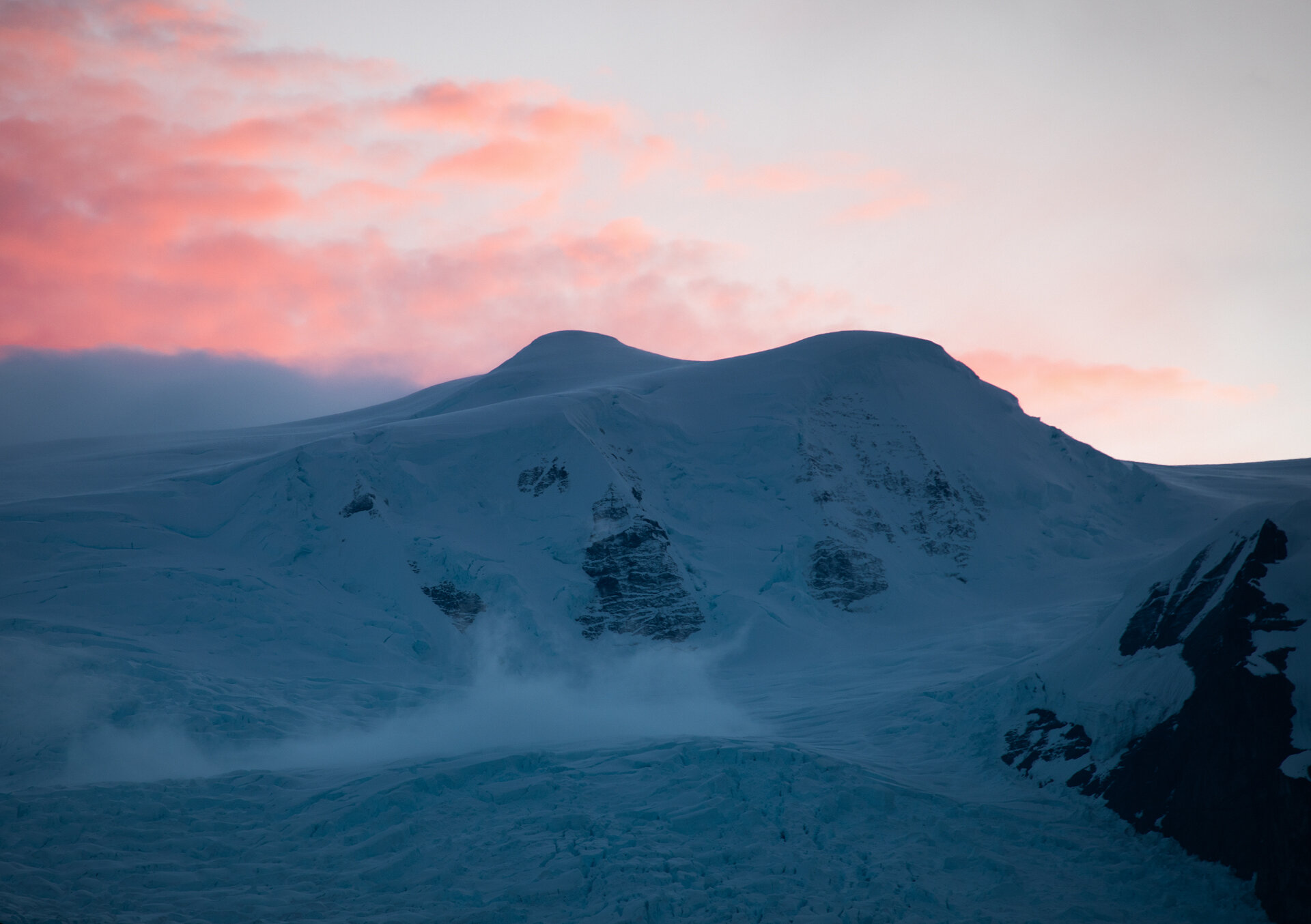
The Root Glacier during blue hour
Day 6: The Root Glacier
After what felt like minutes, my alarm sounded. Through a half-asleep daze I recalled hearing the gentle sound of rain pattering on the tent fly throughout the night and my hopes dropped. Still, I unzipped the tent and poked my head out of the fly. The sky was clear with a few faint wisps of clouds over Regal Mountain and the Stairway Icefall. If those clouds lingered for golden hour they would turn pink! I immediately hopped out of the tent and walked up to the ridge above camp, quietly waking the other tents along the way.
Sam, Chelsea, Emily, and I stood on the ridge, waiting for sunrise in the freezing cold. Chelsea thought ahead and had brought her sleeping bag up to the ridge! As we watched, the gray clouds slowly transitioned to pink and orange. It was such a change of luck after so many rainy days and colorless sunrises and sunsets. We stayed out there for nearly an hour watching the landscape change shades. After golden hour was over I curled back into my sleeping bag and smiled as I drifted back to sleep until breakfast.
Our final day of the trip was going to be the cherry on top because we had ice climbing planned! After breakfast we broke down camp and headed toward the Root Glacier. It was much easier getting onto this glacier than it had been getting onto the Kennicott. There was no boulder scooting or pack shuttling, just a couple easy steps and we were on the ice!

Two hikers on the Root Glacier
We crossed the glacier, headed up and over one final hunk of moraine, and then we saw the SEAG interns standing atop a towering wall of ice. They had kindly met us on the ice and brought all of the gear we would need for climbing. We settled in and waited as Anya and Anna set everything up for us.

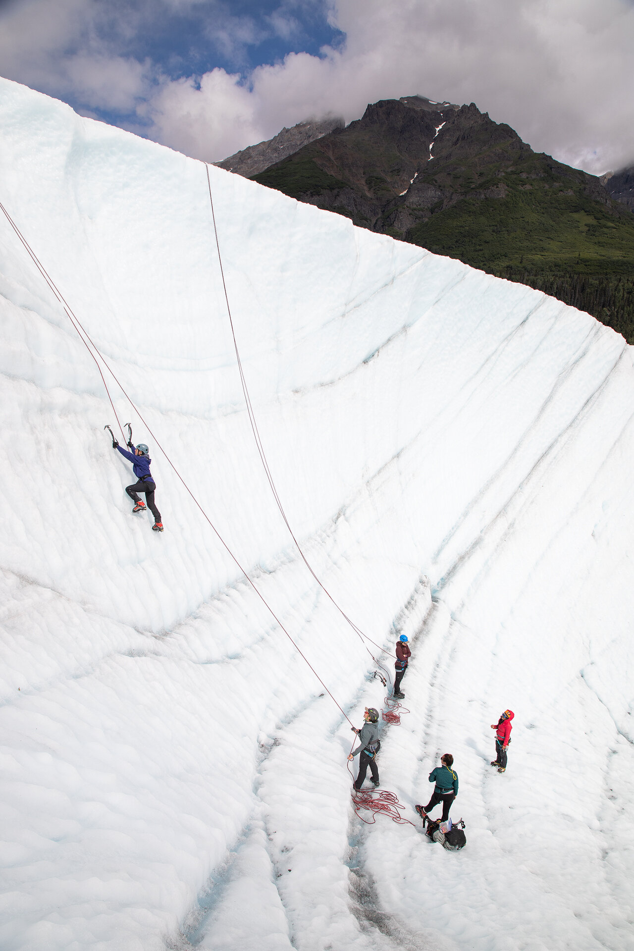
Madison and Emily climbing on the glacier
Emily and Madison were up first. Once again everyone cheered each other on, giving words of encouragement and support. We each climbed the wall once, except for Emily who climbed three times because she loved it so much!
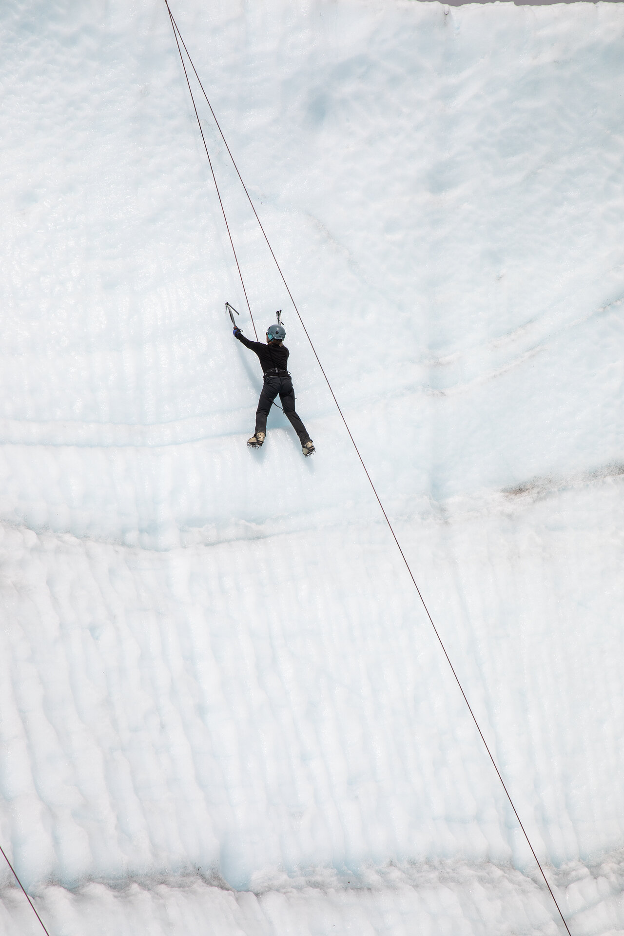
Being on the wall was exhilarating, every movement had to be thought out and calculated, but once I found my rhythm it was enjoyable! Hearing the satisfying thwack thwack of the ice tools finding purchase in the ice, then kicking in steps, and repeating the process over and over. At one point I looked down and realized how far I had come. I was so concentrated on the process I hadn’t even noticed my progress! I reached the top and then rappelled down.
Once we had all practiced, we graduated to the next level of ice climbing: a moulin! The moulin, called Big Blue, was only a couple minute walk away from the wall we practiced on. Anya set up the rope system and the intern, Anneke, set up a hand rope on the opposite side so we could clip in and take photos. Since I was going to be taking a lot of the photos and the hand rope wasn’t quite ready yet, I was lowered down first.
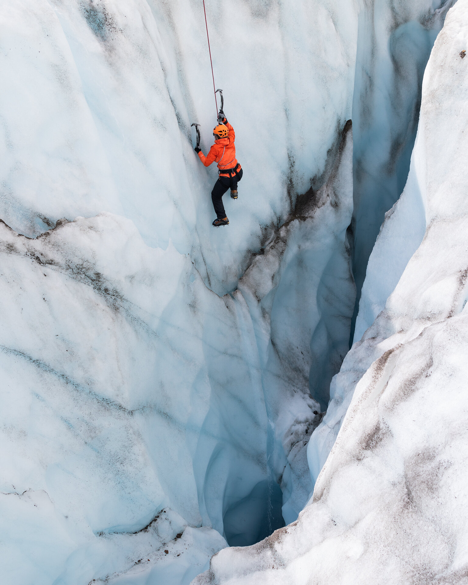
Sam climbing up the moulin

So happy to be back on solid ground
As someone who is terrified of heights, and deep, dark holes with seemingly no bottom, I was pretty anxious about this climb. Anya got me roped up, and then said I could walk down the side of the wall. She said to let her know when I was ready to climb back up.
Trying to quell my fears, I leaned back, my entire body horizontal over the moulin, tethered to the ice by a rope, and began to walk down the wall. After a few steps I called up, “Okay, this is my stopping point.” I couldn’t have been more than four feet down and Anya said, “Really?” I took a deep breath. I looked around noticed a ledge a little farther down and said that I would like to stand on that ledge.
Being in the moulin, hearing the water pouring off the edges and watching it fall into the darkness felt electrifying. After I took a few photos with my phone (with a death grip so as not to drop it into the bottomless well), I called up that I was ready to start climbing, for real this time. Climbing in the moulin was much different than the climbing we practiced on the glacier wall. Every time my foot failed to gain purchase on the slippery wall my stomach dropped. Logically, I knew I was safe on the rope, but the primal part of my brain was certain that missed step would be my last. Slowly, I climbed/crawled out from the depths, my arms were shaking noticeably by the time I made it to the top and collapsed onto the ice, grinning from ear and ear and pumped full of adrenaline.

Emily lowering into the moulin
The other women went after me and once again we all cheered each other on. It was such an inspiring experience. There were those of us who are absolutely terrified of heights that couldn’t imagine ever doing anything like this, yet here we were, pushing ourselves, overcoming fears, and learning we were so much more capable than we gave ourselves credit for!
After we all finished climbing we made our way toward Kennicott. We had a dinner reservation at the Kennicott Glacier Lodge for 7pm and we were quite behind schedule, so we had to push the pace on our way back.

We stumbled into the lodge a few minutes before 7pm, dirty and smelly, but feeling so fulfilled.
The Kennicott Lodge overlooks the Kennicott Glacier and felt like a warm hug after being in the cold and wet backcountry for the previous five days. They served us a family-style dinner of chicken, pasta, and warm veggies. We even had carrot cake for dessert (my personal favorite cake!). We sat at the table reminiscing on the previous few days, incredulous at how far we had come. I felt so, so happy.

Day 7: Home
On our final day as a group we were going to cover the same route we had on the first day, but in reverse—a flight to Chitina and then a van ride to Anchorage. We had all morning to spend before our departure so we slept in, enjoyed a delicious French toast breakfast at the Kennicott Lodge and then stopped at the Kennicott Trading Company to pick up souvenirs. I found a beautiful pair of malachite earrings with copper wire (to remind me of the copper mining town of Kennicott) and immediately put them on.
Finally, we were back at the air strip. Once again, our group split into two planes for our trip to Chitina. We passed over our route again, but this time was different. When we flew in, the landscapes all blended together, but on the way out I recognized those landscapes as if they were an old friend. I smiled down at the glaciers we had crossed, the moraine that had tripped us up, and the mountains that loomed on the horizon through the trip.

The Beaver passed our Cessna as we both made our way toward Chitina
I am so grateful for this trip. Not only did I get to explore and grow acquainted with new landscapes, but I also made new friends. We started as a group of strangers, but we turned into a group of friends as we were brought together by the backcountry. We tested our mettle, and learned and grew together. As the tiny plane flew over passes, mountains, and rivers I smiled the biggest smile.
Even in the rain, even during dreariest, most overcast days, Alaska will always be my favorite place and I am so glad I got to share this landscape with some of the most inspiring women I’ve ever met.

Chelsea stepping over a small stream on the Root Glacier