
Backpacking the Spider Gap - Buck Creek Loop in Glacier Peak Wilderness

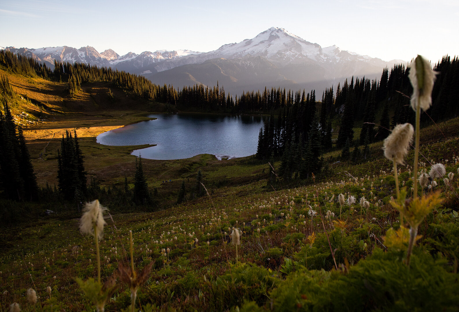
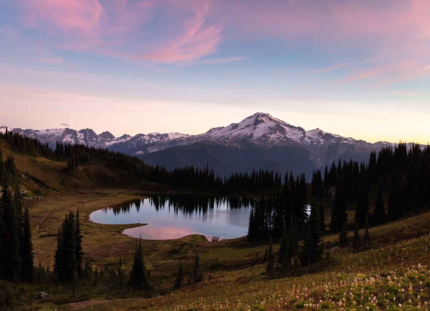
Glacier Peak and Image Lake at sunrise
Dates hiked: 9/4/20-9/7/20
Labor Day weekend is usually one of my favorite weekends to head out into the depths of the backcountry. The snow has long since melted, the days are still long and warm, and the bugs usually have declined to manageable levels. While 2020 may have put a damper on many trips, we were still going to make the most of our Labor Day.
We planned to complete a four day hike in the Glacier Peak Wilderness that we have been dreaming of doing for years—the Spider Gap - Buck Creek Loop. Alex and I first attempted this loop in 2017, but we vastly underestimated the road to the trailhead. Endless potholes and sand thwarted our first attempt, so we vowed to return with a sturdier car. This time we rented a Jeep Wranger and the road was, dare I say, fun this time around! We also invited our friends Alisha and Sean to join us. We met them while backpacking in the Sierra three years ago and have kept in touch ever since! They live in Idaho now, but made the trip out to Seattle to meet us. This would be their longest backpacking trip yet and we were excited to show them the beautiful mountains in our backyard!

An overview of our route on Gaia
Our planned route was 38.5 miles with ~8,300’ of elevation gain and 9,900’ of loss, split up evenly between four days. It also wasn’t quite a perfect loop—there are three miles between the starting trailhead (Phelps Creek) and ending trailhead (Trinity Campground)—so it required a short road walk back to the car.

Looking down on Upper Lyman Lakes
Day 1: Phelps Creek to Upper Lyman Lakes
9 miles, 3,500’ gain, 1,300’ loss

We knew this was a popular route—and would only be more popular over the long holiday weekend—so we got to the trailhead around 9am. Cars were already parked down the road. However, there are multiple trails and loops that begin from the trailhead, so we knew not every single person would be heading out on our exact route.
We signed into the hikers log at the trailhead (no permits are required for this area), and officially hit the trail. The first four miles are flat and sheltered. It was forecast to be a hot day, so we were grateful for the shady canopy of trees keeping us cool.
We made it nearly to Spider Meadows for lunch and took a break in the forest just before the trees gave way to a picturesque, but exposed, meadow. As we sat on the remnants of a giant, downed tree and enjoyed our lunch of pizza, we watched a few more groups pass by, headed toward the meadows.

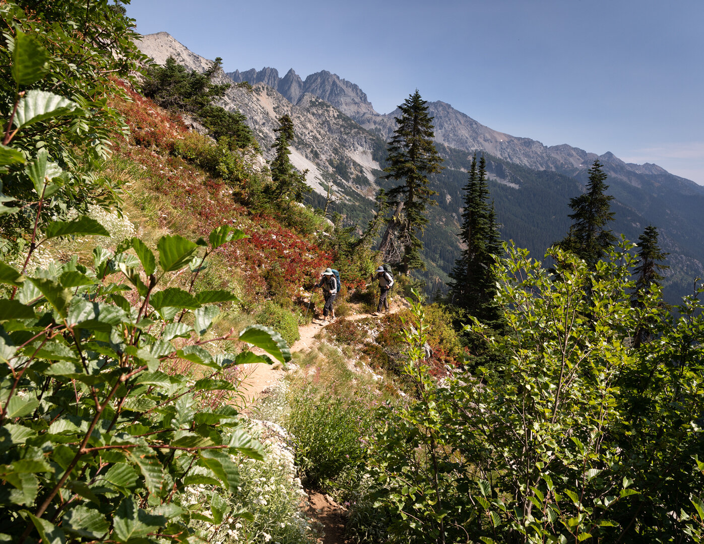
Alex hiking through Spider Meadows
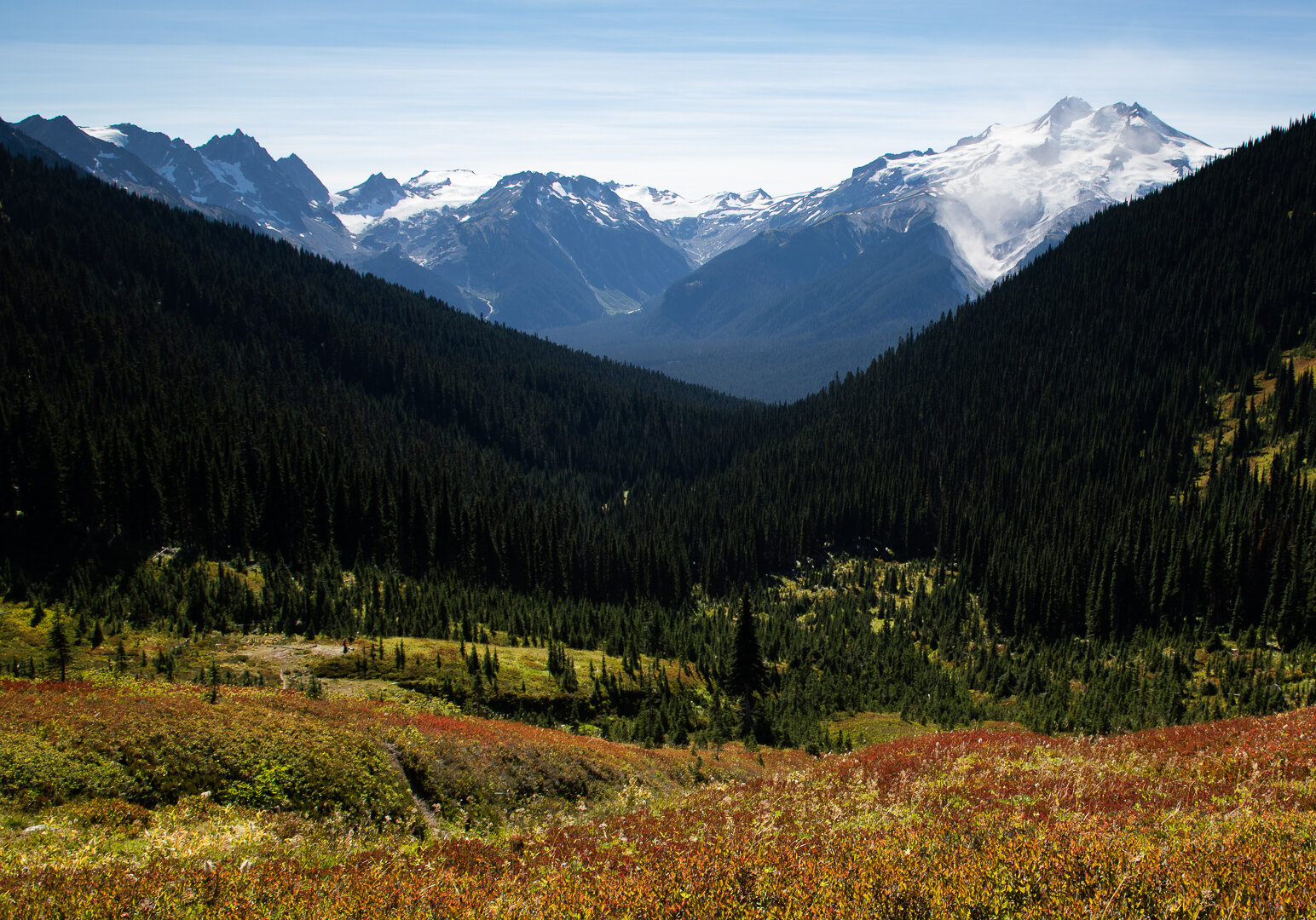
Past Spider Meadows the trail began to gain elevation in earnest as we made our way toward our high point for the day: Spider Gap. There was little shade along the way and we took breaks in the few spots we could find, relishing each shadow and the intermittent cool breeze that gave us respite from the unrelenting heat. As we gained elevation and got a higher vantage point of the valley below, I noticed there was a slight haze in the air. It was likely distant smoke from wildfires blowing in. Before we headed out we checked the wildfire radar and, while it didn’t look like there were any fires near us, there was a high fire warning out for the area we were in. That fact was always in the back of our minds as we hiked.
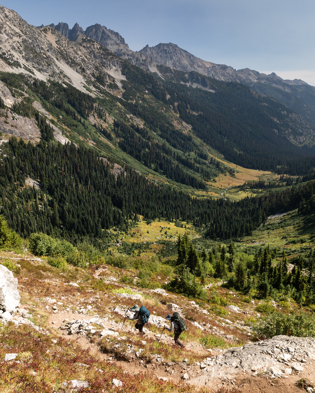
Finally, we made it to the base of the snowfield leading up to Spider Gap. We took another break there and filled up water at the stream rushing from the snowfield, the water tasted cold and fresh.

Alisha and Sean making their way up the snowfield toward Spider Gap
The ascent up to Spider Gap was steep, exposed, and seemingly endless. The hot sun reflected back on us, leaving us sweating and panting as we slowly made our way up the snowfield one foot at a time.

Upper Lyman Lakes from Spider Gap
While the ascent was a challenge, there is something that is so rewarding about making it to a mountain pass and suddenly seeing an entirely new panoramic view fall into place before you. We had spent the better part of a day hiking with a small (but beautiful) section of mountains to enjoy, but the second we crossed that gap, a brand new view with sprawling reaches came into focus. We were all giddy with excitement and took another break to snap some photos of the milky blue Upper Lyman Lakes.
The descent to Upper Lyman Lakes took longer than anticipated. We had to bring out our microspikes for another couple of snowfields, but they gave us little purchase in the slushy, late-afternoon snow so our progress was slow. Eventually, we were back on the rocky trail. We quickly began looking for a spot to set up camp for the night.

Alisha and Sean making their way toward camp on Night 1
Near Upper Lyman Lakes we found a large, flat slab of rock that made for a perfect campsite with a wide open view of the entire basin. We were all exhausted so we made a quick dinner and then retreated to our tents for the evening.
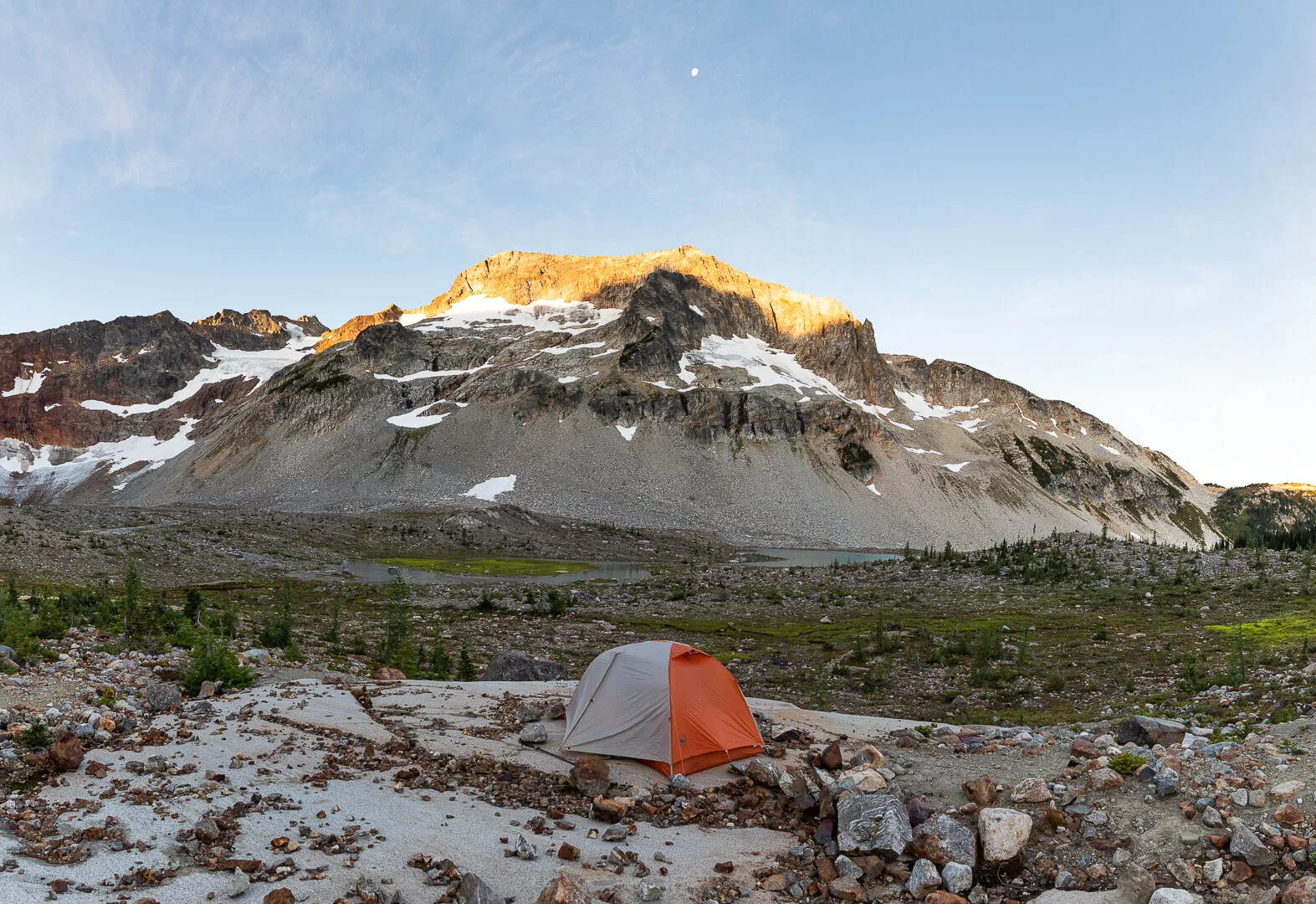
Camp on Night 1
Day 2: Upper Lyman Lakes to Image Lake
8.5 miles, 2,100’ gain, 2,000’ loss


Lower Lyman Lake viewed from the trail
The first half of this trip was the half I was looking forward to the most. The guidebook I used to plan our route spoke of these sections in enthusiastic superlatives, and I could not wait to see the views for myself. We woke up for sunrise and watched a spectacular show as the first rays of light painted the surrounding peaks in orange.
We ate a leisurely breakfast of coffee and granola and packed up camp. We didn’t have a long day ahead of us, however, our campsite for the evening (Image Lake) is one of the more popular sites along the loop and we wanted to get there relatively early to secure a spot.
The morning’s hike took us past the remaining Upper Lyman Lakes and then we descended to the shore of Lyman Lake. The blueberries and huckleberries were plentiful along this stretch of trail and we all plucked handfuls of them as we hiked. The guidebook said this route is known for its “camp raiding black bears” and it is easy to see why it’s such a heavily populated bear area—there are berries galore!
Once we passed lower Lyman Lake we began the first of two climbs for the day. This first one would require 800’ of climbing over 1.5 miles to get to Cloudy Pass at about 6,400’.
The views became increasingly more breathtaking as we got closer to the pass. We could see the entire route we had taken from Spider Gap toward the Upper and Lower Lyman Lakes and then up into a beautiful meadow. I can only imagine how colorful the meadow looks in the peak of wildflower season or the height of the fall colors!

The view of Upper and Lower Lyman Lakes from near Cloudy Pass
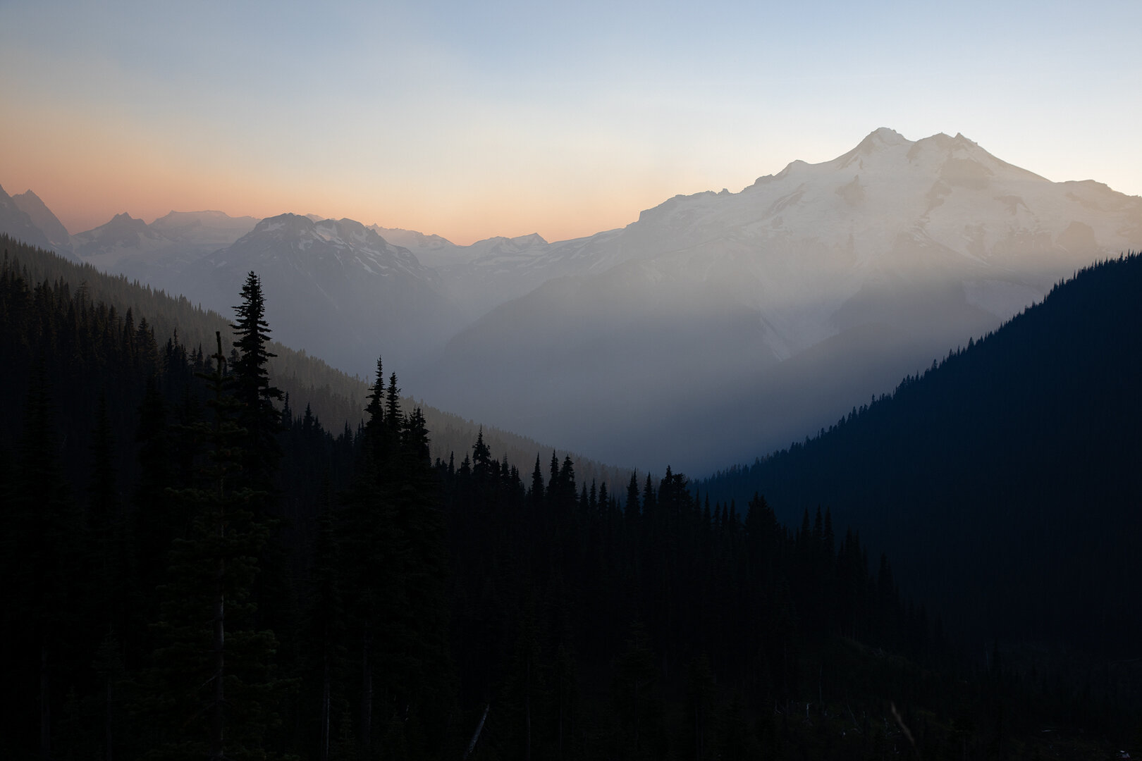
From Cloudy Pass we made quick progress to our second pass of the Day—Suiattle Pass. On our way to Suiattle Pass we saw our first views of Glacier Peak and it energized us. We had two days of stunning views of this peak to enjoy! Shortly past Suiattle Pass the trail breaks, with the main loop continuing south, however, we had a little side trip to Image Lake planned and headed west toward Miners Ridge.
I didn’t think the views we had seen from Spider Gap or Cloudy Pass could be topped, but this stretch of trail certainly gave the prettiest views we had seen thus far a run for their money. The trail traverses a lovely exposed ridge with an unobstructed view of Glacier Peak. We stopped often, not sure which direction to look because both in front of and behind us were stunning. Again, I couldn’t help but wonder how this part of the trail looks blanketed with wildflowers or fall colors. All the more reason to return someday!

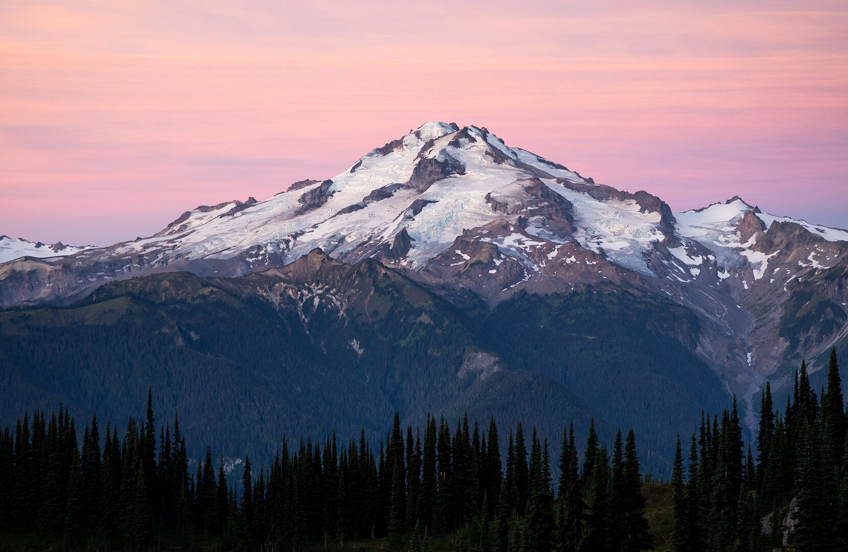
Glacier Peak seen from the trail

Alisha and Sean making their way toward Image Lake
Image Lake is nestled in a beautiful alpine basin with Glacier Peak looming dramatically over it. It’s a very popular and fragile area, so the national forest requests that visitors do not camp within a quarter mile of the lake and only camp in established campsites. We arrived around 2:30pm and already the number of sites were dwindling. We found a nice bare area with enough room for two tents and set up camp. By early evening there were tents set up on every bare stretch of ground available. A volunteer ranger stopped by to help everyone find a spot. She said she had done the same thing the night prior as well. Luckily, everyone was accommodating and friendly and didn’t mind getting close to their neighbors.

Our camps nestled in the trees under Glacier Peak
The view of Glacier Peak and Image Lake was well worth the side trip from the official loop. It’s an oft-photographed viewpoint and it’s easy to see why. The views are unbeatable. Alex, Alisha, Sean and I found a beautiful vantage point on a trail above the lake and set up to watch sunset. Another photographer joined us and we all talked about past trips and future plans. One of my favorite things about these places (besides their beauty), is the people we meet along the way and the stories they share.
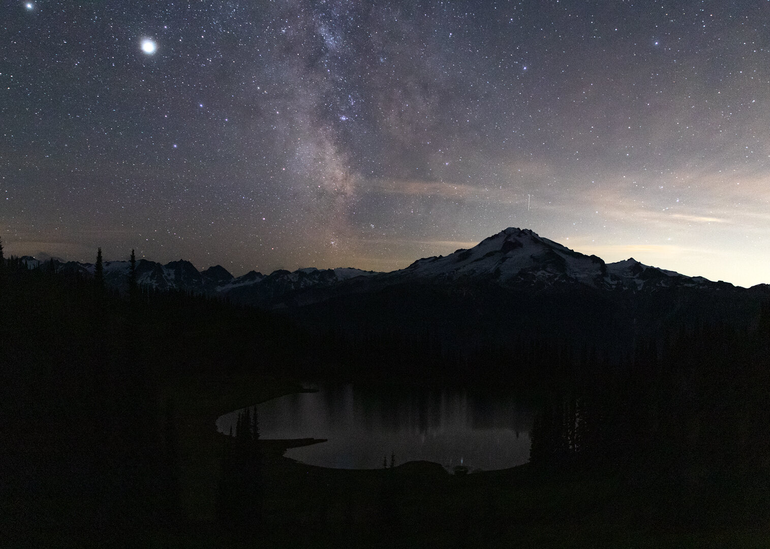
We stayed up there for a couple hours watching the landscape transition from a hazy golden hour to a beautiful sunset complete with wispy pink clouds and, finally, to a starry night sky. We returned to the tent at around 10pm.
Day 3: Image Lake to Buck Creek Pass
Planned: 11 miles, 2,700’ gain, 3,100’ loss
Actual: 15 miles, 2,700’ gain, 4,500’ loss

We awoke before dawn and returned to our lofty perch above Image Lake for sunrise. The sunset had been so beautiful we didn’t think it could be topped, but as the light began to paint the clouds behind Glacier Peak in pastels, we were proven wrong. As blue hour faded into golden hour, the entire sky was illuminated in shades of pink and lavender, and then, as the sun broke the horizon, Glacier Peak was drenched in orange.
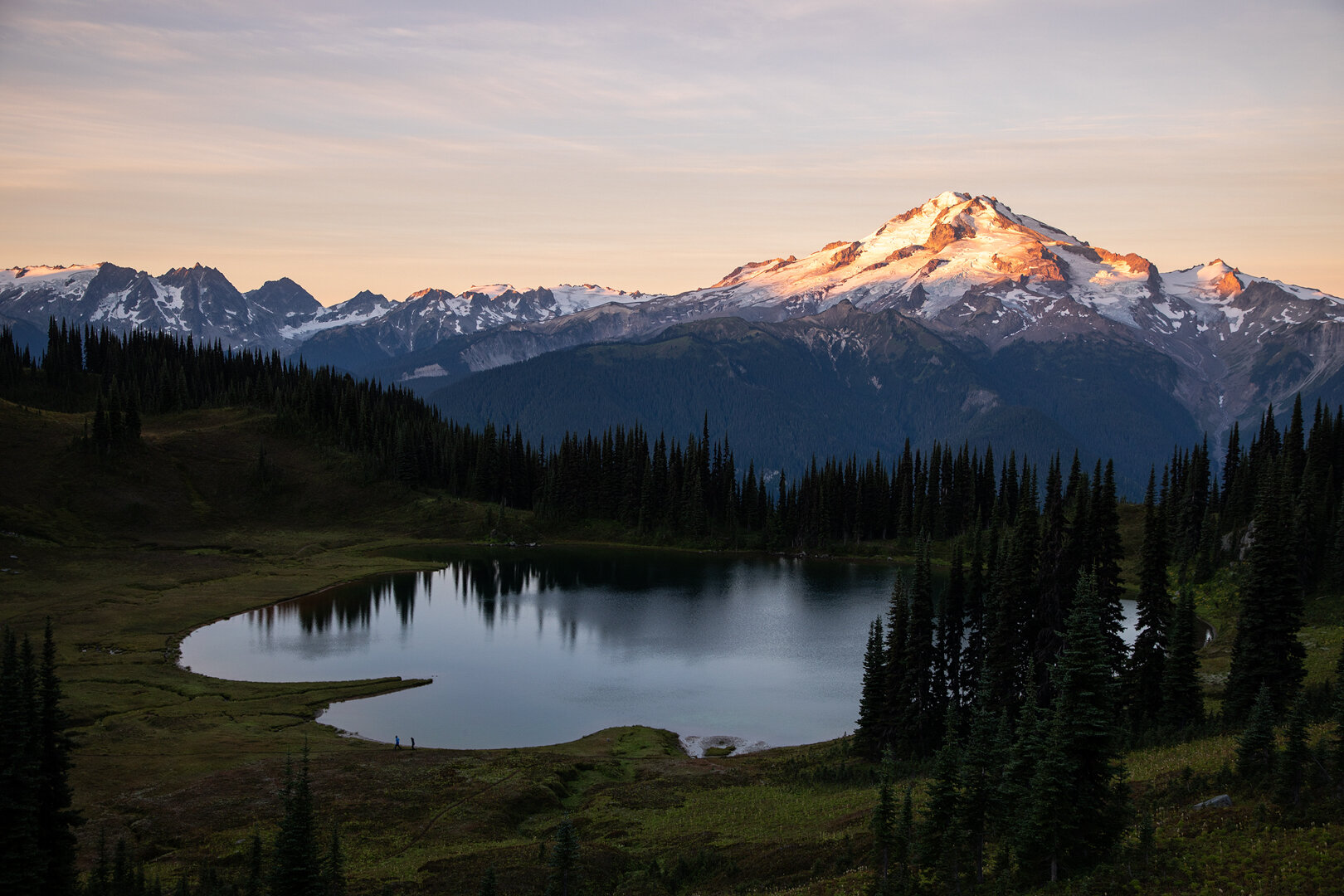
We had hoped to get an early start to our hike, but we couldn’t pull ourselves away from the scene until well after sun had risen.
We returned to camp and saw that our fellow hikers were already in the final stages of packing. Either they had long days ahead of them or they wanted to secure themselves the most sought after camp site at the next spot. After seeing how many people trickled into Image Lake, I was inclined to believe it was the latter. I was beginning to feel a little anxious about campsite availability at our next stop.
After a hearty breakfast we packed up and hit the trail. It still felt early (8:30am), but most of the other campers had long cleared out, but this meant that we were able to hike in solitude.
Our first portion of the day took us back over terrain we had hiked the day prior. Despite the fact we had already covered this ground, we still stopped often to take photos. The trail appeared so different in the early morning light compared to the harsh noon light we had experienced on the hike in.


Once we were back in the forest we began a long descent. We ran into quite a few PCTers (or section hikers) heading north along this stretch of trail. Finally, we left the PCT and headed up the Buck Creek Pass trail toward our final destination for the day.
The last portion of this trail was hot and exposed. I began to feel the exhaustion of the previous few days weighing on me and I hit a wall. Each step was an effort and I wanted nothing more than to put my pack down and rest.
Finally, we made it to Buck Creek Pass. There are a few extremely scenic campsites situated with a perfectly framed view of Glacier Peak, not surprisingly, those were already occupied. We meandered down the trail and were pleasantly surprised to find that there were ample sites tucked away in the trees. We found a spot for our two tents and set up.

The first signs of fall seen from Buck Creek Pass
My exhaustion had fully set in so I decided to nap before dinner. I fell asleep almost immediately after putting my head on the pillow. I slept deeply for about half an hour, at which time my alarm chimed: it was time to make dinner. I sleepily gathered all of our food and cooking supplies and headed to some comfortable looking logs.
Alisha, Sean, and Alex all gathered around and we made dinner together. It was hard to believe our trip was winding down, it felt as if it had only just begun!
I told the group that I was thinking about waking up early and heading toward Liberty Cap to try to get a better perspective on Glacier Peak for sunrise. I was tired, but didn’t know when I would be returning to this area so I wanted to make the most of my time there!
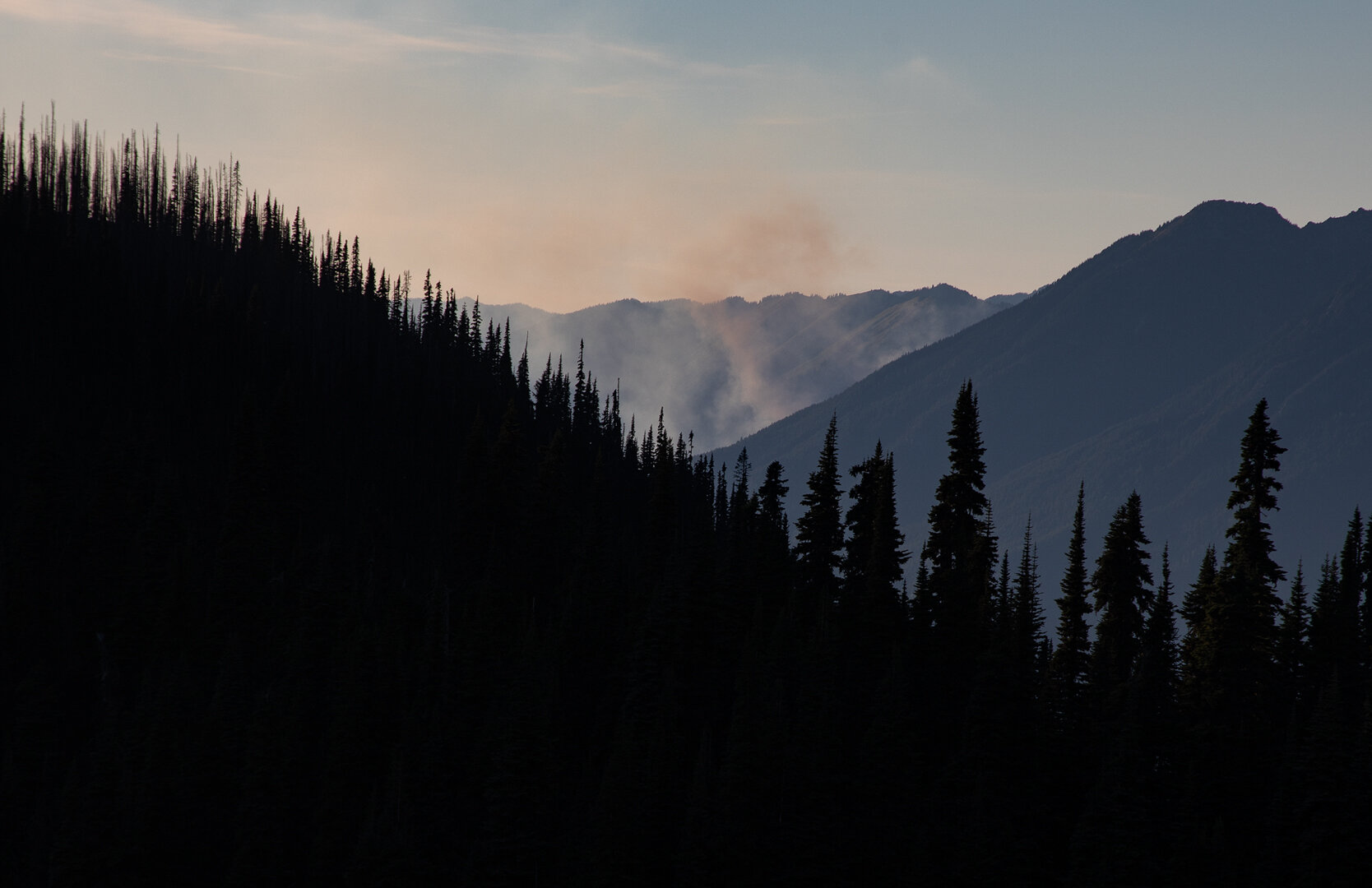
It was around that time that a camper came running into our camp. All four of us looked at him with obvious confusion, but he immediately informed us that he just saw a wildfire start. He said he didn’t want to alarm us, but his group was packing up and heading out. He quickly moved on to tell the next camping group and we sprung into action.
Alex and I ran back up to the ridge and saw the telltale plumes of smoke billowing up from a valley. A valley, that looked to be only ten or so miles away. We had arrived on a perfectly clear afternoon, but could see the smoke was blowing in our direction. Alisha joined us on the ridge and said she smelled smoke. Sure enough, the smell of smoke began to fill the air. As we stood on the ridge, debating what to do, Glacier Peak was enveloped in a haze and the smell became overwhelming. During this time a few other groups had packed up and left.
The hike to the trailhead would add another ten miles to our day, but we decided we didn’t feel comfortable staying at camp. It had been a long day, but as we packed up I felt adrenaline coursing through me.
We donned our headlamps and began the hike out just after sunset, hoping to make it to trailhead around midnight, if possible.
The first couple miles flew by in an adrenaline-fueled fog, but as darkness settled in I crashed. The headlamps we had seen bobbing along ahead of us faded into the darkness as other hikers pulled away from us. I ate a Snickers to try to buoy my energy but nothing helped. My feet were throbbing in pain and I wanted nothing more than to crawl into my fluffy sleeping bag.
As we descended into the valley the scent of smoke dissipated and a comforting coolness hung in the air. I desperately wanted to make it to the trailhead, but I was limping in pain. Finally, as we passed a large clearing in the forest with a few tents already set up I asked the group if we could find somewhere to camp. It was already 10:30 and we had made it about four miles. After a short discussion everyone agreed, we could spend the night in the forest.
I didn’t sleep well. I kept dreaming of encroaching wildfires and waking up. When I was awake I kept hearing sticks falling or breaking and my mind concocted visions of bears. I knew the thoughts were irrational, but I couldn’t push them out so I drifted in and out of sleep all night. Plagued by nightmares in both my waking and sleeping state.

Hiking out in a smoky haze on the final morning
Day 4: Hike to Trinity Campground
Planned: 10 miles, 500’ gain, 3,500’ loss
Actual: 6 miles, 2,000’ loss

Finally, the sun began to rise. Although I had gotten poor sleep, I was so grateful we could hike out in the light. We didn’t make breakfast or coffee, instead we ate bars which had turned rock-hard overnight, and started hiking as soon as possible.
The air still smelled of smoke, but it wasn’t nearly as bad as it had been up at Buck Creek Pass. The hike was all downhill so we kept a quick pace. We made it to Trinity Campground in about three hours. The hike was over for Alisha and I, but our car was still three miles up the road at the Phelps Creek Trailhead. Alex and Sean left their packs with Alisha and me at a picnic table and began their final ascent. About an hour later, the bright blue Jeep Wrangler pulled into the parking lot. We all changed our clothes, cleaned up and then left for Seattle!
This hike may have ended on a nerve-shaking note, but overall it was one of the most beautiful hikes I have done in all of Washington. The lakes, passes, meadows, and surrounding peaks are all stunning on their own, but together they make up one jaw-dropping mountain landscape. I have high hopes to return again in the future to see this area blanketed in wildflowers in summer and cloaked in brilliant reds and oranges in fall!

The view from Cloudy Pass