
A Fortress of Glaciers: The Mt. Baker Orbit
Dates hiked: 4/1/21-4/4/21
In late 2019 Alex and I signed up for a ski mountaineering course on Mt. Baker with Pro Guiding Service. After a few seasons of backcountry touring we were feeling limited by our lack of glacier travel and mountaineering skills. We had taken our AIARE 1 course and could travel and route find in the wintry backcountry, but we could not traverse onto the slopes of some of the more remote mountains in Washington because they were surrounded and covered by glaciers. Our goal for 2020 was to learn how to travel in glacier terrain, including learning crevasse rescue. Obviously, 2020 did not pan out the way we had planned and so our ski mountaineering dreams had to be put on hold until 2021. This year we signed up for the ski mountaineering course again but, wanting a little more experience working with guides in glaciated terrain, we also signed up for the Forbidden Traverse. This is a spectacular and remote traverse in North Cascades National Park. Unfortunately, a couple weeks before our trip date we got an email from the guiding service letting us know that our planned Forbidden Traverse would not be able to go ahead because of winter damage inflicted on on the Cascade River Road.
Martin, the founder and owner of Pro Guiding Service, sent us alternatives to our selected route, among those alternatives was the Mt. Baker Orbit. He also included a YouTube link in the email and after clicking the link and watching the short clip of the route I was sold. The route looked incredible and included summiting Mt. Baker and completing a high orbit around the peak, crossing ten glaciers along the way. I was bummed about not being able to do the Forbidden Traverse but my mind was already filled with the idea of blue glaciers and a volcano summit. Our trip was going to be very dependent on the weather though; our guides were deciding between the Mt. Baker Orbit and a mini Snoqualmie High Route. We didn’t know which trip we were going to do until the day prior, but I was excited for all of the options.

Roosevelt Glacier
Finally it was official. The day before our trip, our guides reached out to us and let us know that we would be attempting the Mt. Baker Orbit. The weather forecast looked decent (by Mt. Baker standards). The first few days of our four day tour were forecast to be partly cloudy, but on the third night Mt. Baker was forecast to receive over a foot of snow. We would have to be careful to make it back around the mountain before the storm moved in.
We arrived at the Glacier Public Service Center at 9AM to meet our guides and fellow adventurers. We had two guides (Trevor and Aaron) and three others joining us (Austin, Calvin, and Jesse). After a brief introduction and gear check we piled back into our respective cars and caravanned to the trailhead. We parked as close to the Heliotrope Trailhead as we could, but the snowline was still at mile marker 5. This meant we would have three miles to skin on the snowcovered road.
As we got out of the car and began to gather our gear I heard a hissing sound coming from the back passenger tire—never a good sound to hear. I bent down and saw that our tire had been punctured by something; I could even see air bubbling out of the wet tire. Alex came over and took a look at it, but there was nothing we could do. We decided that was an issue for our future selves to worry about and we put on our ski boots, shouldered our packs, and carried our skis to the snowline where we did a beacon check with the group before beginning to skin.
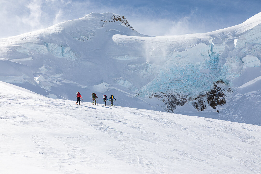
The three mile skin along the road felt leisurely as we made our way to the summer trailhead where we were able to get our first glimpse of our objective. Mt. Baker stood out prominently on the overcast morning. It was hard to believe that in just one day we hoped to be standing on top of it, from our vantage point it looked like it was surrounded by a fortress of glaciers and rock.

Out of the woods and into the valley
After a quick snack break spent admiring the volcano, we entered the forest and weaved our way through the trees, over a creek, and finally we broke out into an open valley. Our first day was going to be big—approximately 4,700’ of gain over 7 miles—so we kept moving for most of the time. Trevor and Aaron were excellent pacers, not too fast, not too slow, that perfect goldilocks pace that we could maintain for hours on end. We climbed up a gully and ran into a group of three skiers who were heading back down into the woods. We waited for them as they zipped by, looking like they were having a blast skiing. I envied them and couldn’t wait until I was finally skiing down those slopes, but that was still days away.

Camp on night 1, with a beautiful view of the Roosevelt Glacier and Mt. Baker
We made it to camp around 5PM, just as it was beginning to snow. We dug a deep pit to shelter ourselves from wind, set up the tent, and went to work melting snow. Winter camping requires many more daily chores than summer camping: pit digging, wall building, and melting snow all take up a surprising amount of time. We needed to melt about four liters of water each evening and morning for both me and Alex and the entire process took well over half an hour.
I went to bed exhausted after a long day of driving and climbing, and the next day was our planned summit day. I was excited but also anxious at the thought of carrying my fully loaded multi-day pack up and over the 10,781’ summit and skiing down the other side.

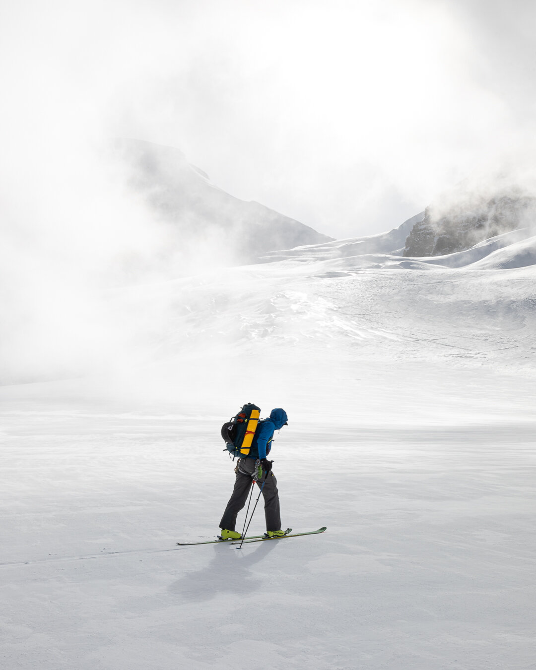
Roosevelt Glacier
The next morning we woke up at 6:30AM and I immediately began melting snow for water. It was a chilly night, but I had stayed cozy in my layers and new 20-degree Feathered Friends bag (somehow it feels warmer than my 0-degree Big Agnes bag ever felt!).
At about 9AM we loaded up our packs and convened for our daily beacon check. Trevor and Aaron informed us of our planned route for the day—up to the summit via the Coleman-Deming route and then down the Boulder Glacier to the east side of the mountain where we would set up camp near the convergence of the Park, Mazama, and Rainbow glaciers.
Once again, Trevor and Aaron paced us well as we made our way up the snowy slopes above camp. The climb from camp was stunning, low wispy clouds danced around the surrounding peaks and the light appeared soft and filtered creating for a magical scene. Along the way we passed a gigantic jumbled pile of glacier chunks that appeared small from a distance, but as we got closer grew to the size of buildings.
We were on the popular Coleman-Deming climbing route yet there were no other people around besides our group, which made the entire experience feel very remote.

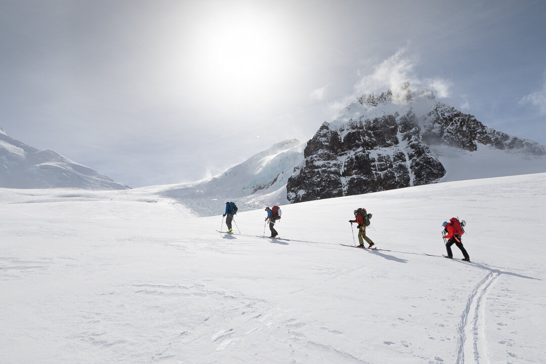
Leaving camp and heading toward the Coleman-Deming Col

The wind began to howl as we approached the col between the Coleman and Deming glaciers. I was wearing three layers already (my sun hoody, microgrid fleece, and softshell) and my fleece gloves but the wind was biting me through my layers. We approached the col and the wind grew even stronger. I stopped to put on my severe down jacket, severe hard shell, and thick skiing gloves. Still the wind tore through even my thickest layers and left me shivering. We didn’t take much of a break at the col (standing still just made us colder) and instead strapped our skis to our packs and began booting up Pumice Ridge. Trevor told us that if the wind didn’t die down we would be forced to turn around. I looked up at the ridges above us, obvious gusts of wind were whipping snow off the slopes, I was already resigned to having to turn around.
As we climbed the winds continued to rage, never abating, only increasing with gusts so strong I had to bend over and brace all of myself against the wind to prevent being blown backwards. The climb was miserable, even the beautiful clear views could not wrestle my morale from the depths. Yet we continued upward and somewhere around 1,000 vertical feet below the summit the ferocity of the wind lessened just slightly, but enough so I could take my hand out of my glove and take some photos and videos on my phone without worrying my hand would freeze.

Bootpacking our way to the summit platuea
It appeared we were going for the summit afterall.

By the time we reached the summit plateau the wind had increased again. Trevor and Aaron estimated that the winds were sustained 20mph with gusts over 40mph. I’ve never felt such strong or cold wind before; it was an entirely shocking experience that made me question if ski mountaineering was for me (am I strong enough for this kind of stuff?!). But, I kept going, willing one foot in front of the other until finally we were on the windswept summit. I was too cold to take out my phone for a photo so Alex took a quick selfie of us with his GoPro. Upon first glance it looks like we’re smiling in the photo, but in reality we were grimacing. I didn’t even have the energy to enjoy summiting—that fact would sink in later.

Summit selfie
We transitioned our skis and boots into ski mode just below the summit. Trevor informed us the skiing was going to be steep and variable and we were not going to be charging down the mountain. It was survival skiing as we made safe turns down the Boulder Glacier. A few hundred feet below the summit the wind had died down, and for the first time in hours I felt relief.

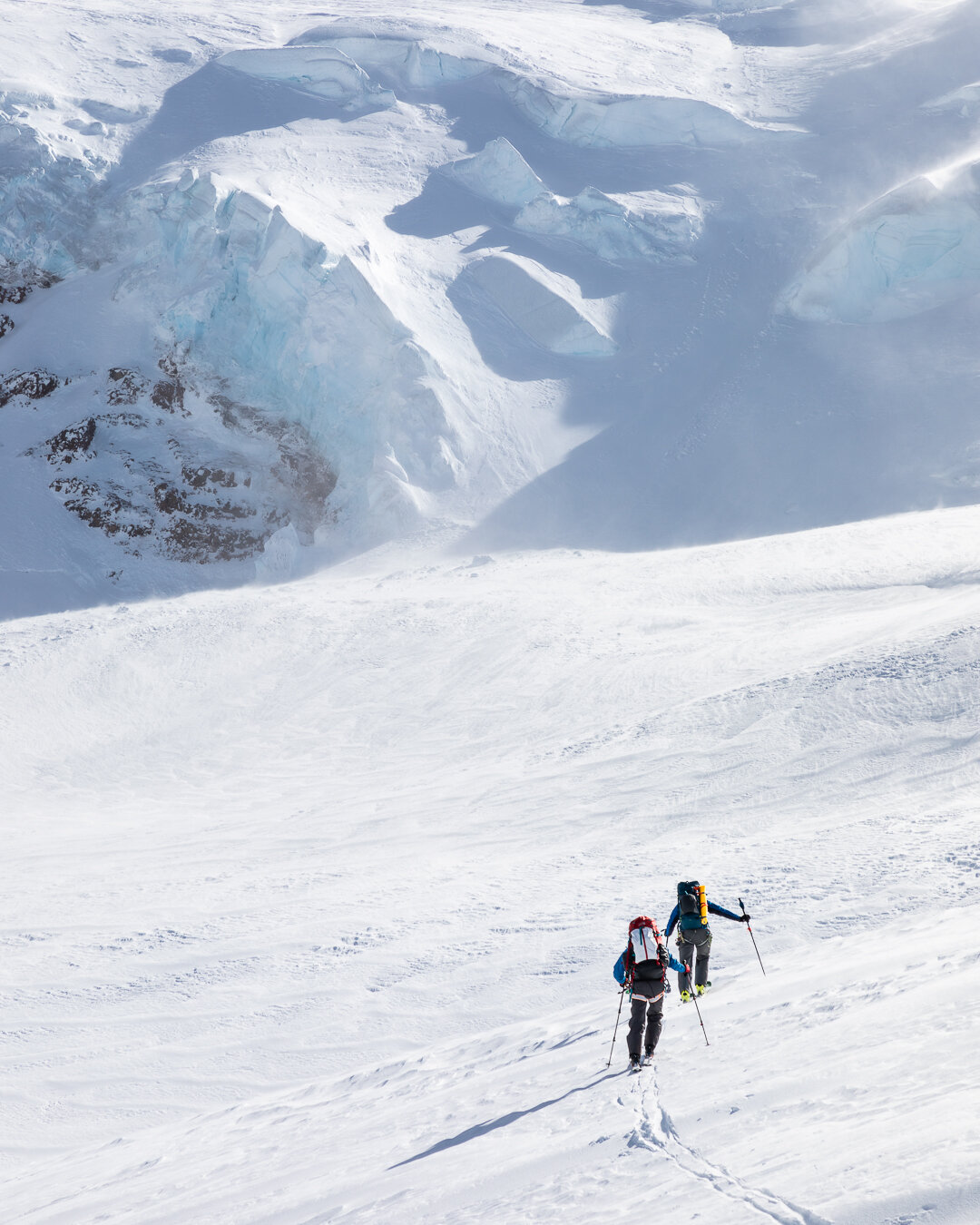
Views on the way to camp
We continued across the Park Glacier, transitioning back to skinning and then back to skiing once more before our final descent to camp. The final turns to camp were fun—true type 1 fun and I could not help but smile. Despite the fact that we had been moving for nine hours and I spent most of those hours fighting the cold and the wind, we did it. I did it. Maybe ski mountaineering is for me, I thought!

Skiing down to camp (the flat area in the center)

Camp on night 2
The sun was dropping on the horizon so we set up our tents as quickly as possible. The clouds were hanging low in the sky; we could feel the forecasted storm approaching.
In order to make it over Mazama Ridge and back onto the west side of the mountain before the impending storm we would need an early start so we were up at 5:15AM the next morning. I began melting snow and boiling water for coffee and oatmeal by the light of my headlamp. I wasn’t expecting sunrise to be anything spectacular given the thick clouds, but as the sky began to brighten the horizon the clouds surrounding Mt. Shuksan glowed orange. I hurried out of the tent to take a few photos before resuming my water melting duties.

Mt. Shuksan on the morning of day 3
We started our climb out of camp early. The sky was overcast, but the visibility was great and we had a stunning view of the northernmost Cascades up into Canada. I stopped often to take photos of the soft light on the snow and glaciers, but the sky to the north was growing increasingly darker. Soon, the peaks we had just been admiring were blanketed under a thick layer of clouds and snow began to fall. The storm was starting. We made our way up and over the col between the Mazama and Roosevelt glaciers in another bone-chilling wind.

Soft light before the storm

Looking north toward Mount Larrabee and Canada

Mazama Glacier
After quickly transitioning to ski mode on the col we descended down the Roosevelt Glacier. We had just enough visibility to appreciate the towering blue glacier walls as we skied past them. Once we all had descended we roped up to cross the glacier. The visibility continued to decline and the snow continued to fall. We passed beautiful glacier features that I could tell would be breathtakingly beautiful in the bright light of day. I longed to see those features more clearly, but I guess that’s just another reason to return again one day!

Making our way across the Roosevelt Glacier in low visibility
After we got off the glacier we transitioned back to ski mode. Trevor and Aaron decided that we would descend to the tree line to camp for the night. Tucked away in the trees, we would be more sheltered and protected from the expected storm.
We got to camp in mid-afternoon. The day felt so short compared to the two days we just had. Alex and I took our time to dig out a large flat platform for our tent. For the first time we had time to socialize with our group members and we sat outside our tents and chatted as we melted water and ate dinner.
The snow began to really come down at around 5PM, right on schedule. We all retreated to our tents. Alex and I went through all of our photos together, reminiscing on the trip thus far and marveling at the fact that just the previous day we had been on the summit of Mt. Baker.
I had thought that falling asleep early would be tough for me, but I easily fell asleep before dark and slept soundly the whole night. The snow continued to fall and Alex woke up intermittently to shake the snow from our tent. I had set an alarm for 6:30AM but turned it off the second it sounded. An hour later I heard Aaron outside our tent door, “Good morning!” I groggily got up. We had plenty of water from the night before so I was happy to not have to worry about spending time melting snow again.
Outside the tent the morning was bright and clear, and there were a few fresh inches of snow. Our plan for the final day was to skin back up approximately 1,500 vertical feet and ski down the Grouse Creek drainage before retracing our path through the forest and down the road to our cars.

Looking at the Roosevelt Glacier on the morning of day 4

Our path with the Roosevelt Glacier in the background
The skin up was spectacular. It was a bluebird day and we could see the entire route we had crossed the day earlier in the clouds. The Roosevelt Glacier was stunning!

This came out of our tire!
Finally, we made it to our high point and transitioned to ski mode. The final ski was so fun! The snow was perfect and we all enjoyed fresh tracks the whole way down. As Calvin skied down one extra-powdery slope he hollered out “this is immaculate” in pure joy. And it was! I didn’t want the descent to end, but eventually we found ourselves back in the trees and then on the road. The snowline had crept higher up the road since we had been out so we were forced to walk the last bit of road to our cars.
We rounded the last corner and our car came into view. Those future selves that we decided to burden with the tire issue came into existence. The back tire was completely flat! Austin offered to help us patch it and pump it back up so he went to work trying to wrench the piece of metal from the tire. The piece of metal was in the tire, after quite a bit of twisting, turning, and yanking, a massive piece of metal came out of the tire. Everyone was in awe. The patch ended up not working because the hole was too large, so we had to take out the tiny spare donut and change the tire.
It was quite the end to an already arduous trip, but it seemed to fit right in with the greater adventure.
As we were (very slowly) driving home I couldn’t help but reminisce on the trip. It was full of type-2 fun, the wintry conditions tested my mettle in a way no other trip has yet, but in the end I felt so accomplished. I second-guess and doubt myself often (especially during tough moments on the trail), but I’m learning that I’m capable of so much more than I give myself credit for and that is just one of the many incredible lessons the mountains have taught me.
Koma Kulshan, I can’t wait to visit you again soon!
