
Inspired in the North Cascades: Completing the Inspiration Traverse

DATE HIKED:9/5-9/9/22
TOTAL MILEAGE: 25 MILES
TOTAL ELEVATION GAIN: 12,300’
Over Labor Day weekend of 2022, Alex and I experienced the highlight of our summer. We went on a guided mountaineering expedition with Pro Guiding and completed the Inspiration Traverse in the North Cascades. The route connects the Eldorado Trailhead on Cascade River Road with the Thunder Creek Trailhead off Highway 20. It traverses six glaciers, presents opportunities to summit multiple peaks along the way, and offers an intimate look at some of the most rugged and beautiful terrain in Washington.
Despite this being the highlight of our summer, this was not our Plan A. Our Plan A was a traverse through the Northern Pickets (with a summit of Mt. Challenger and Luna Peak along the way), however, about a week before our departure date a wildfire broke out in the Chilliwack Range just a few miles from our planned route so we opted to pivot to the Inspiration Traverse. Luckily, the North Cascades are filled with bucket-list worthy traverses so it didn’t feel as if we were “missing out”, just that we got to experience an equally beautiful, yet slightly different, area of the park.
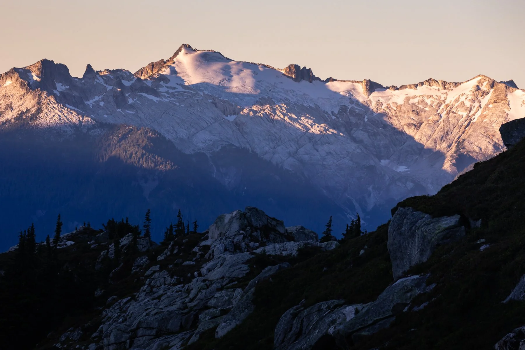
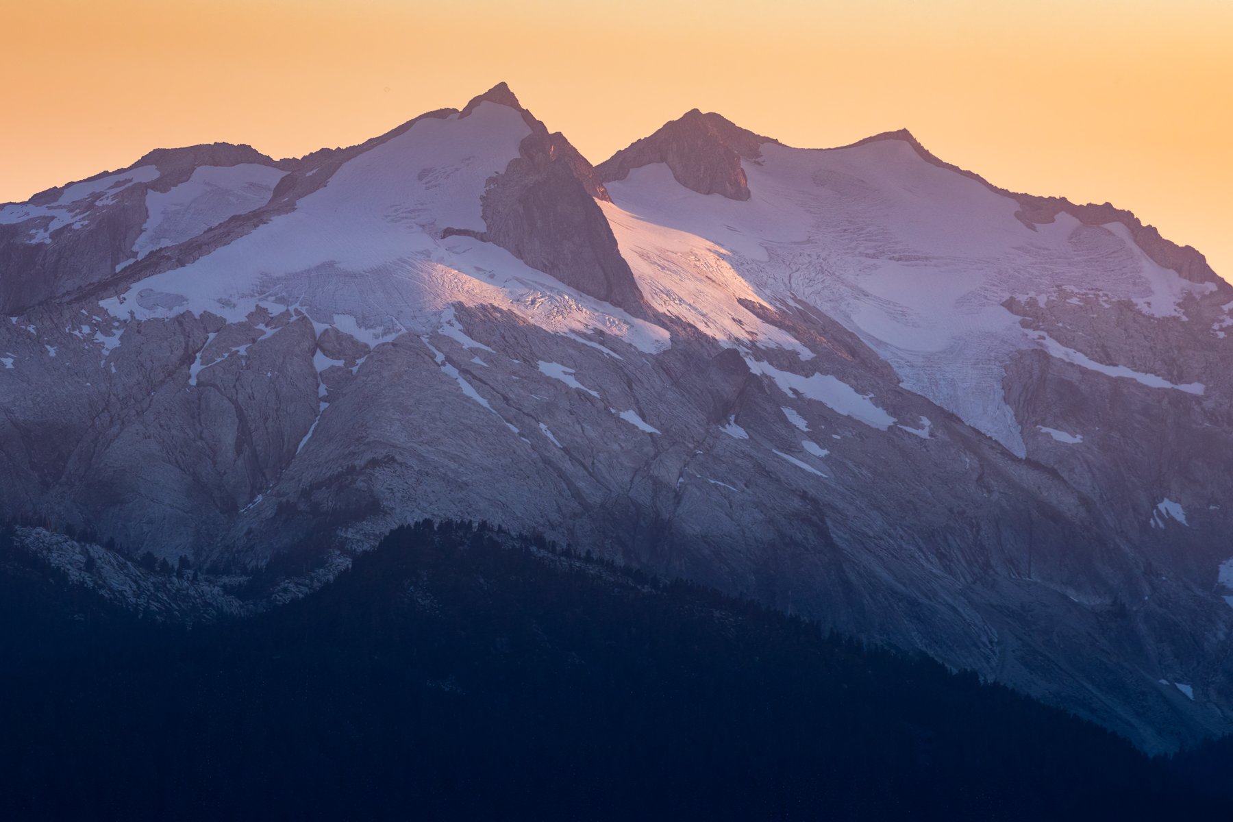
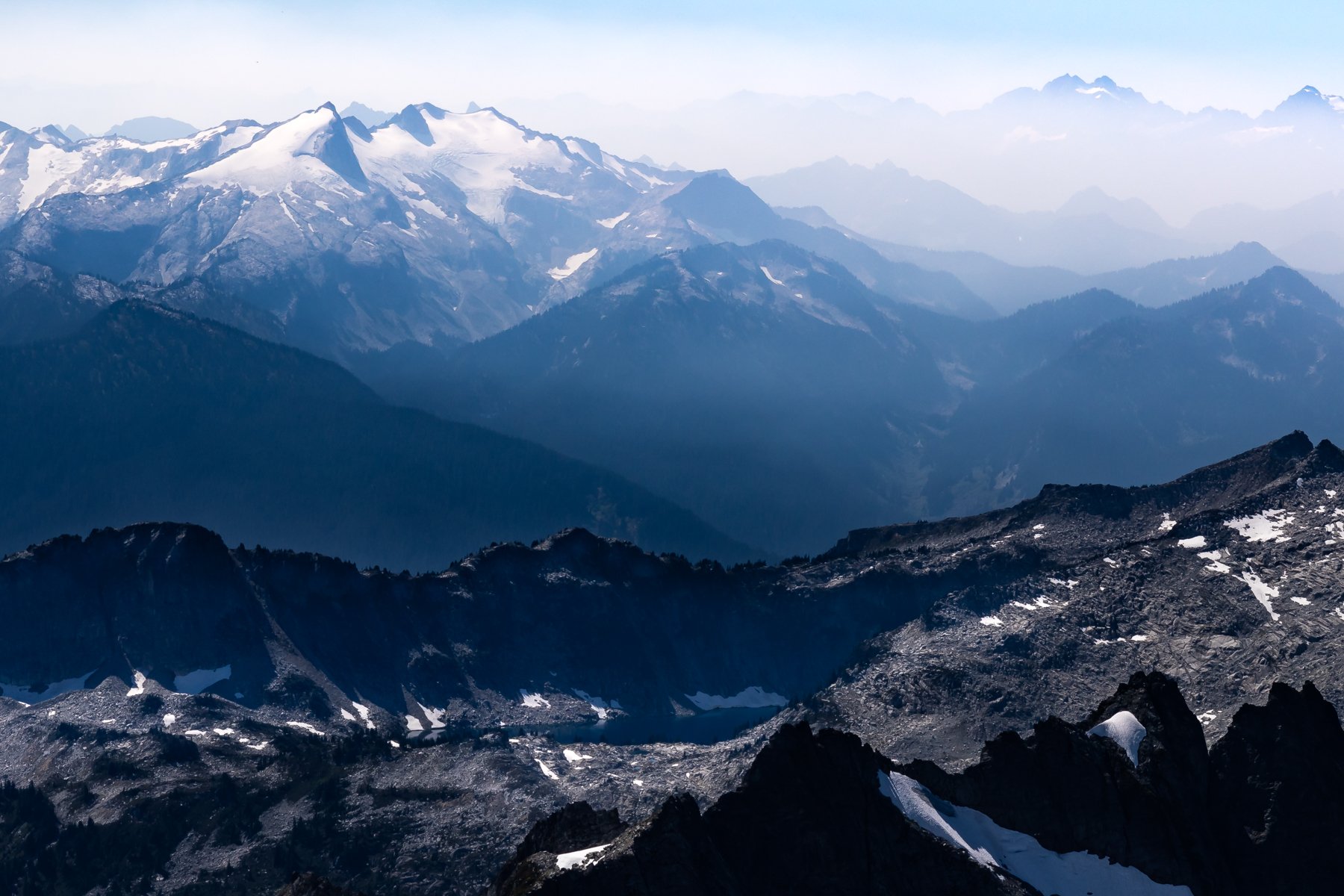
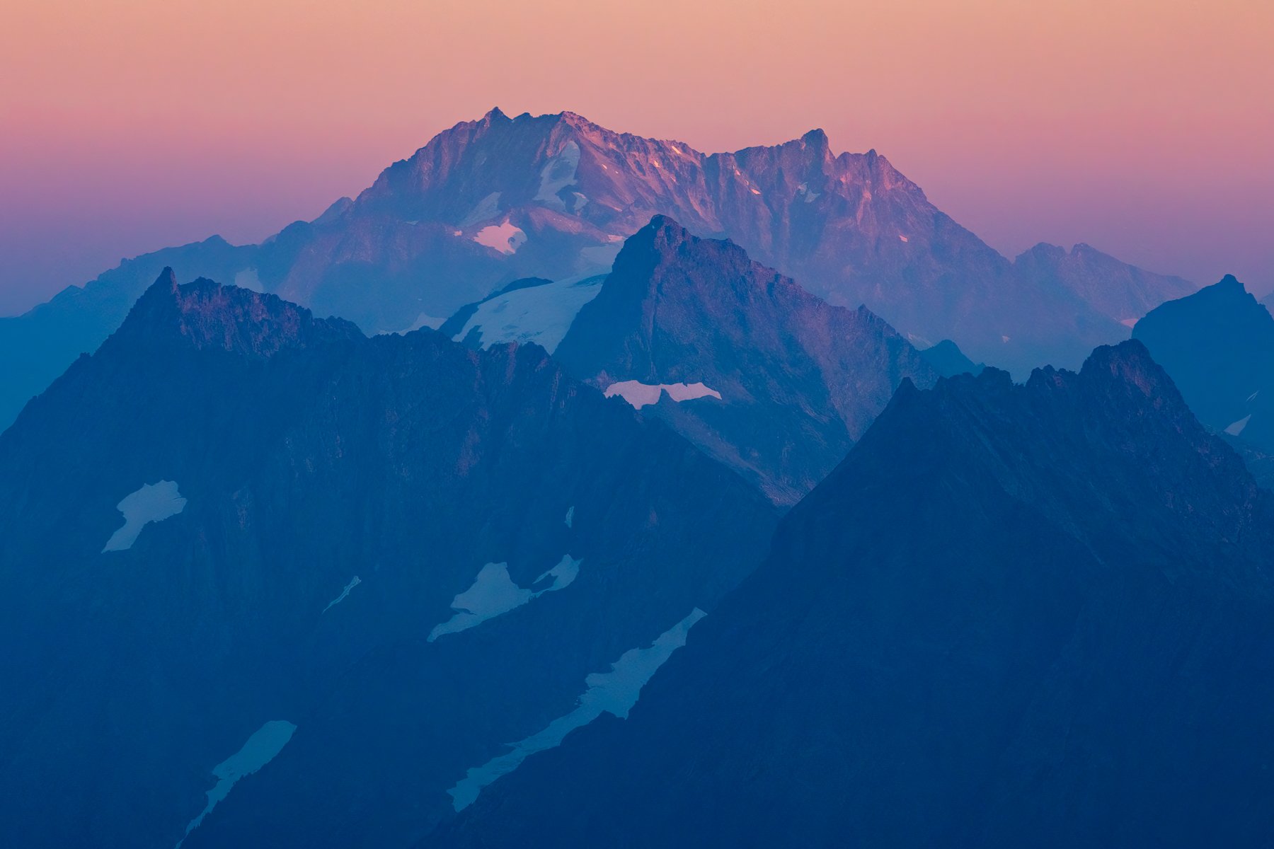
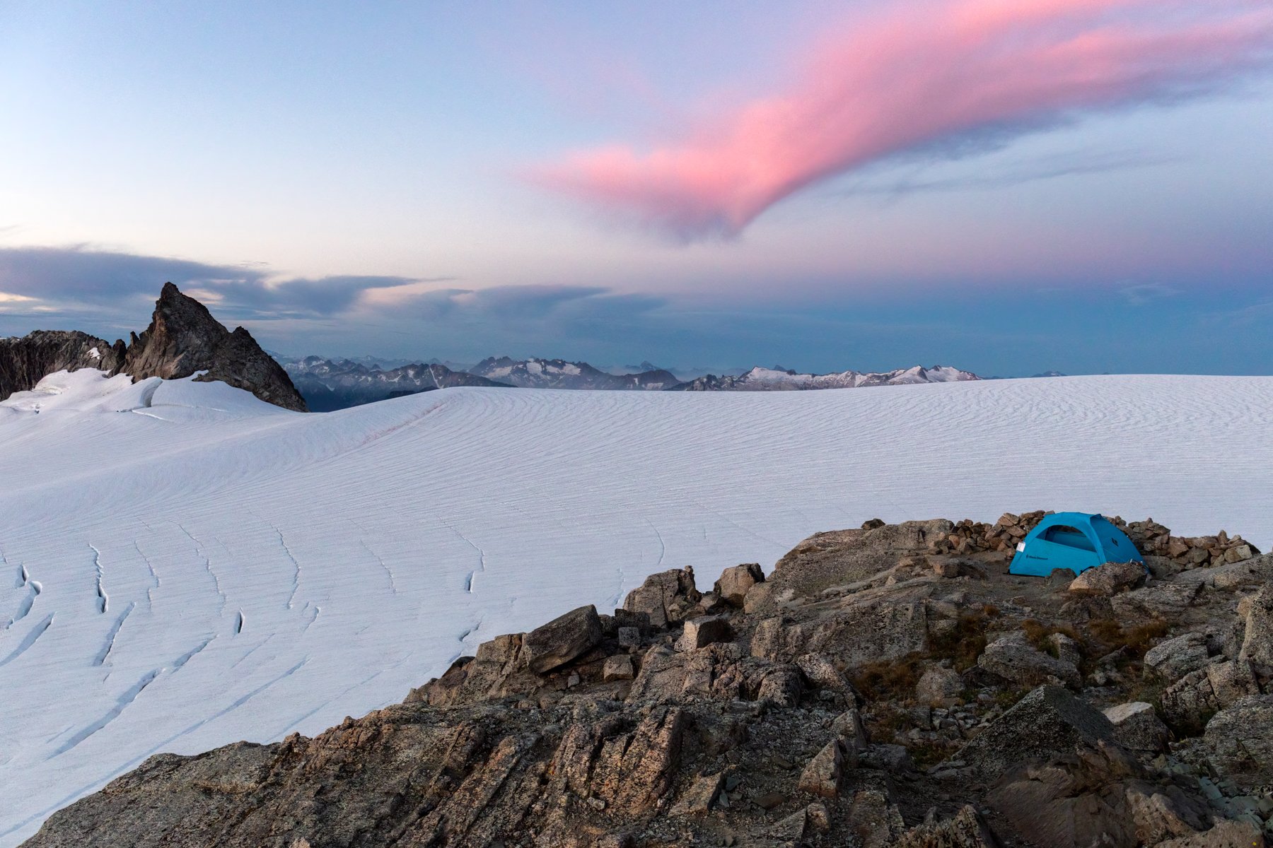
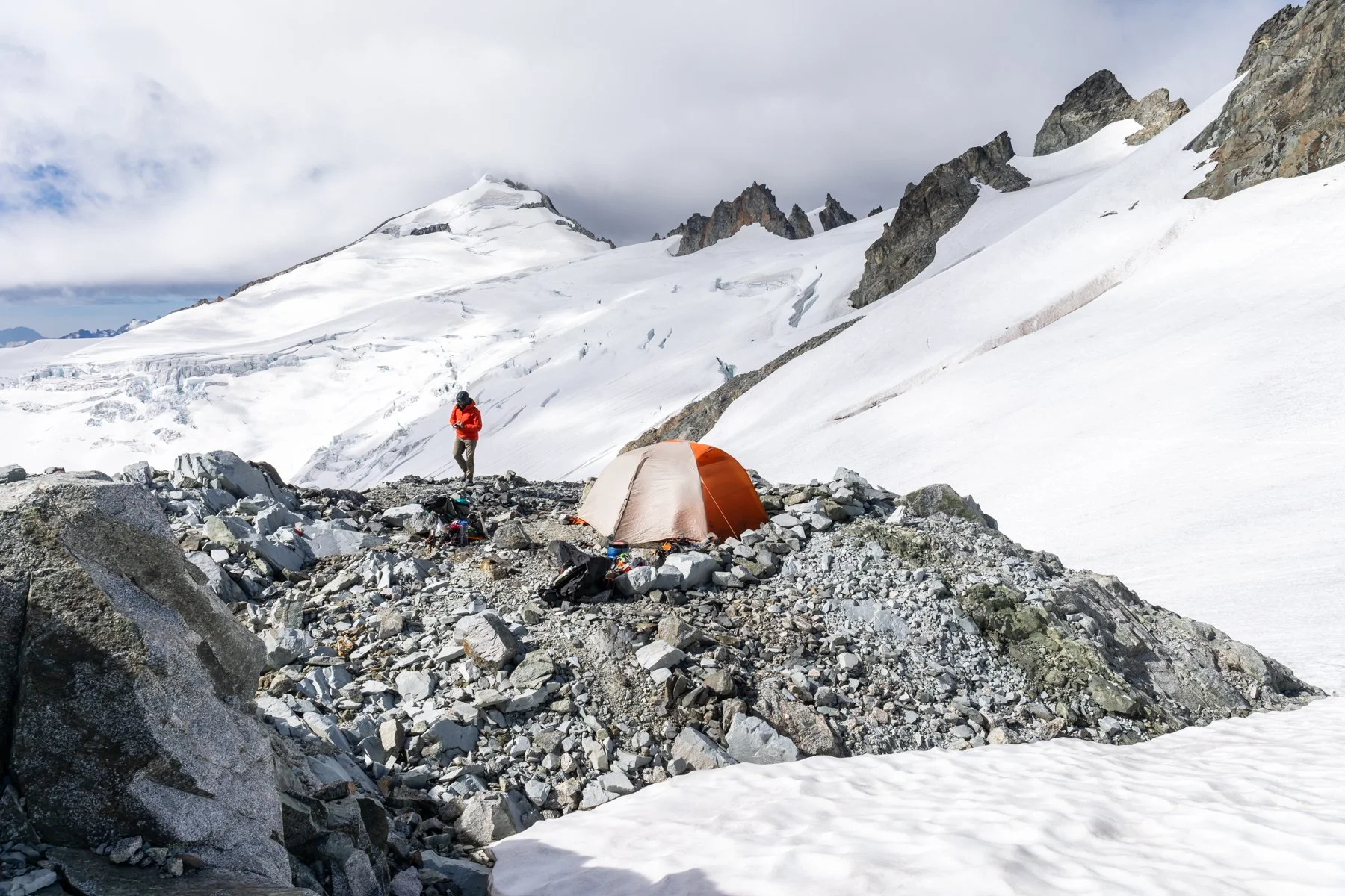
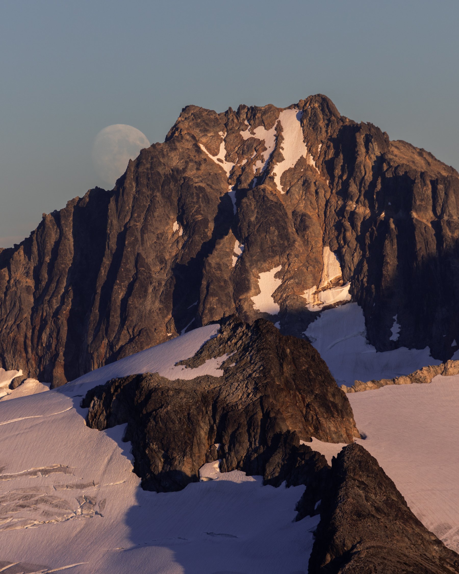
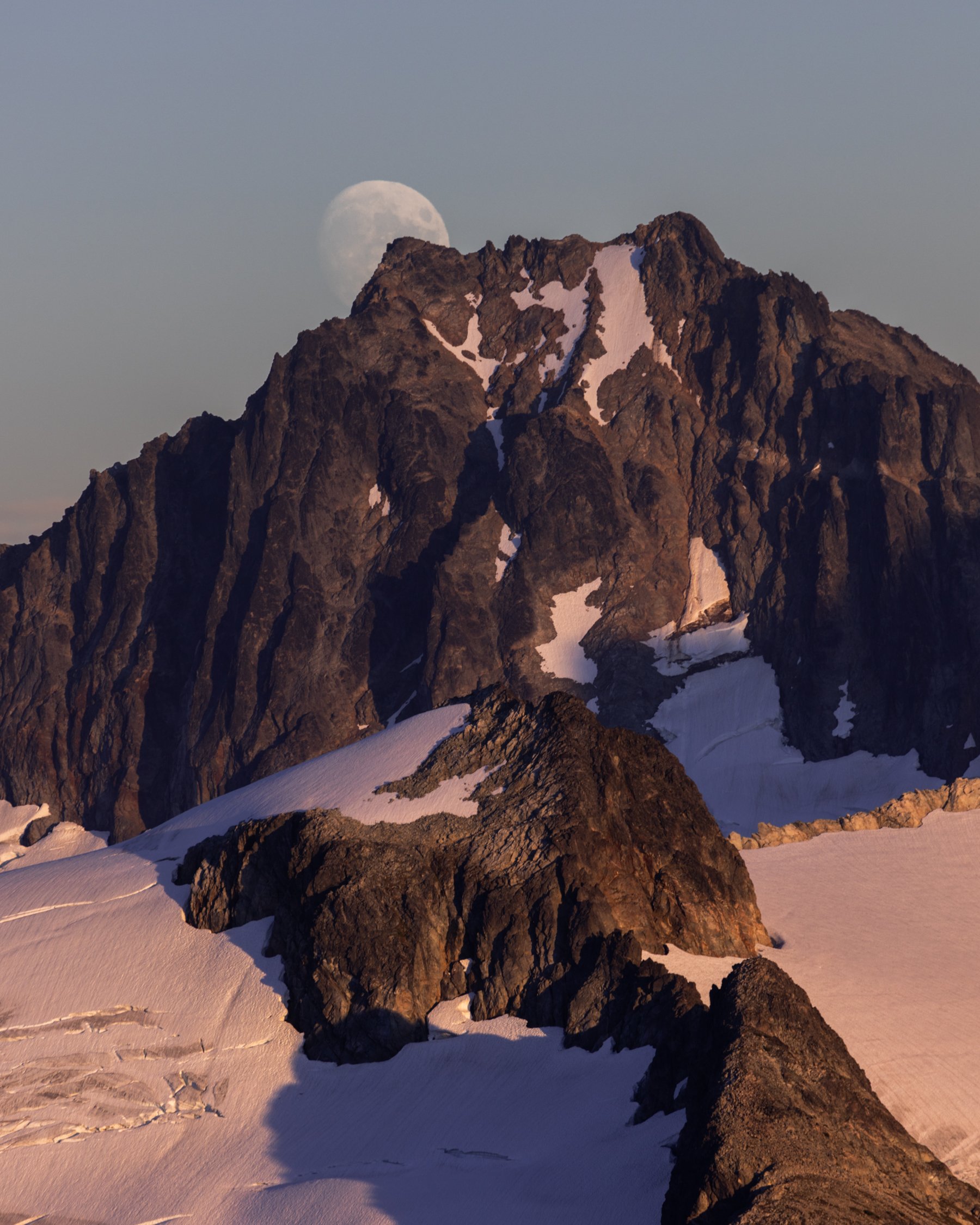
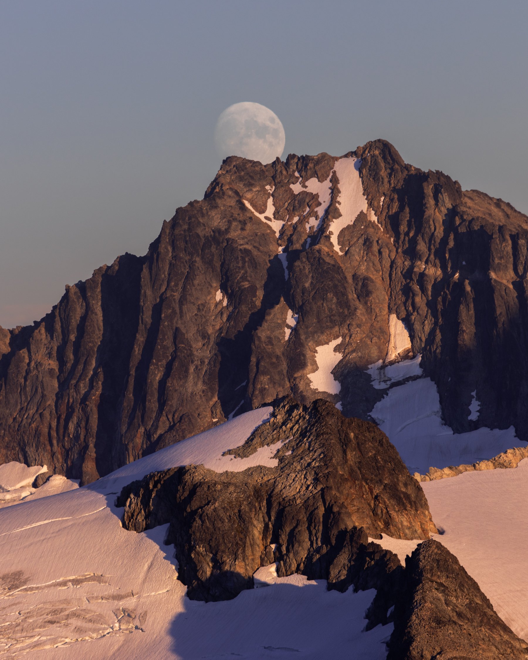
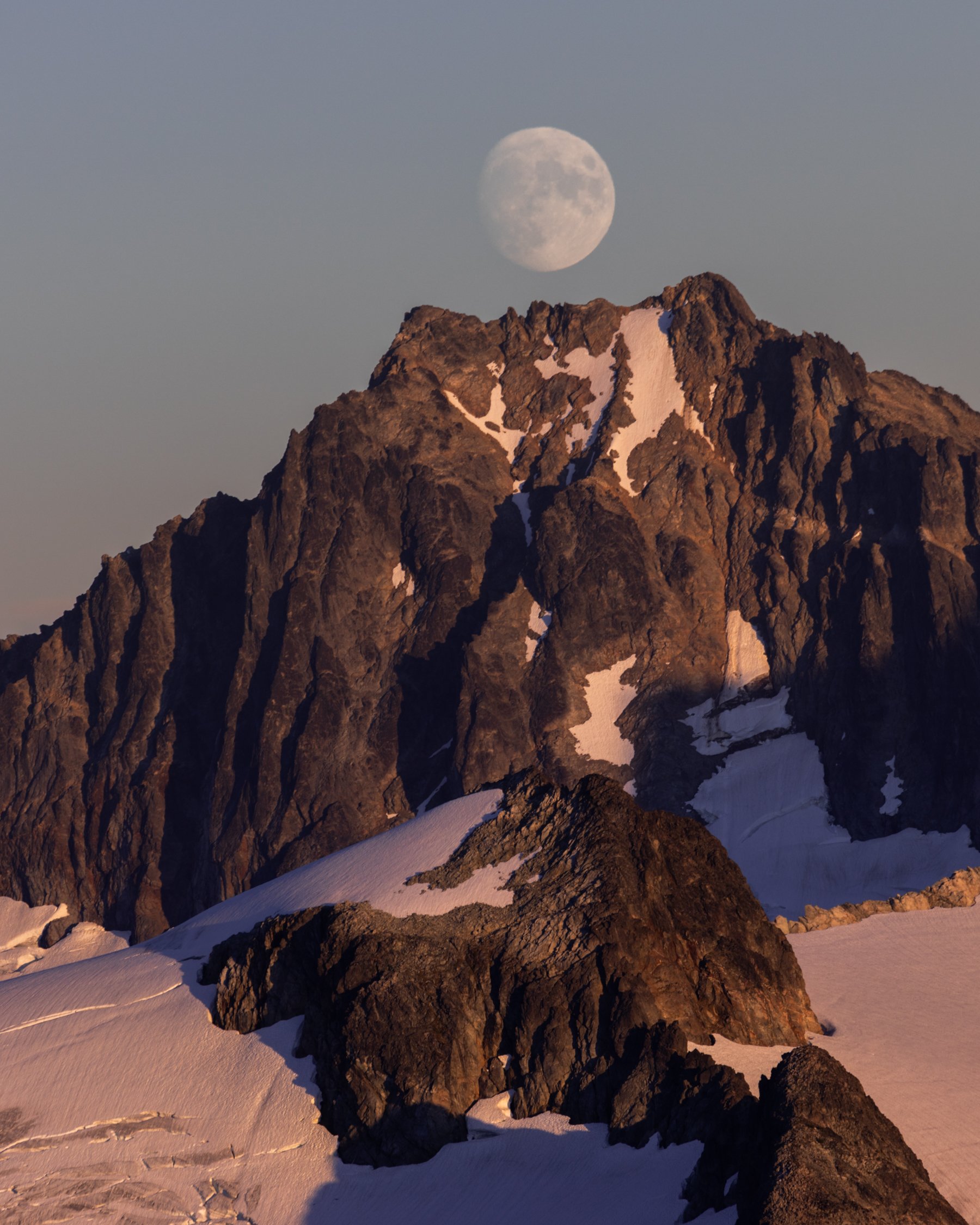
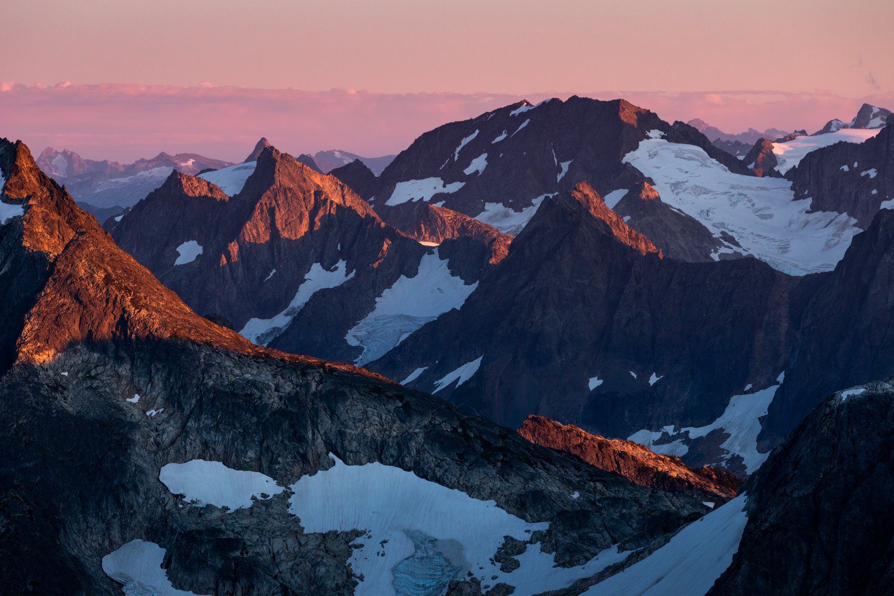
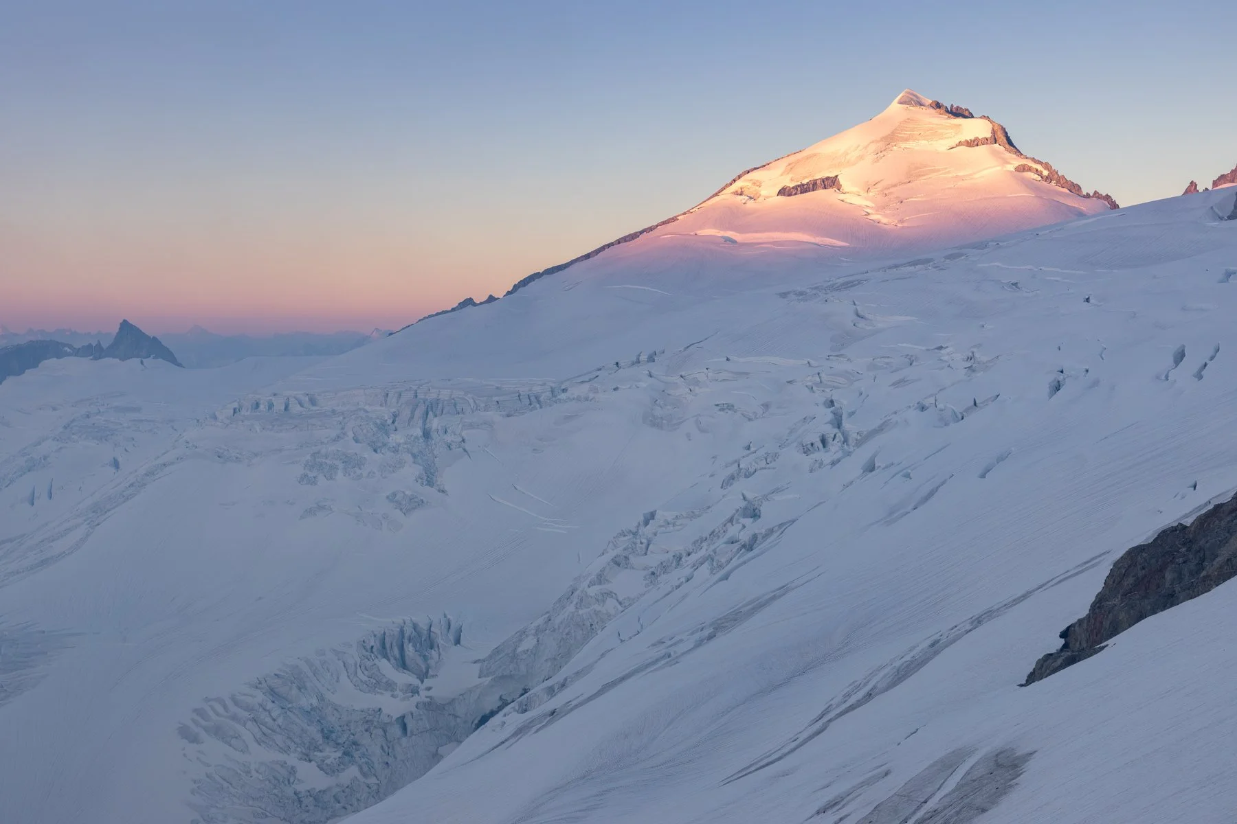
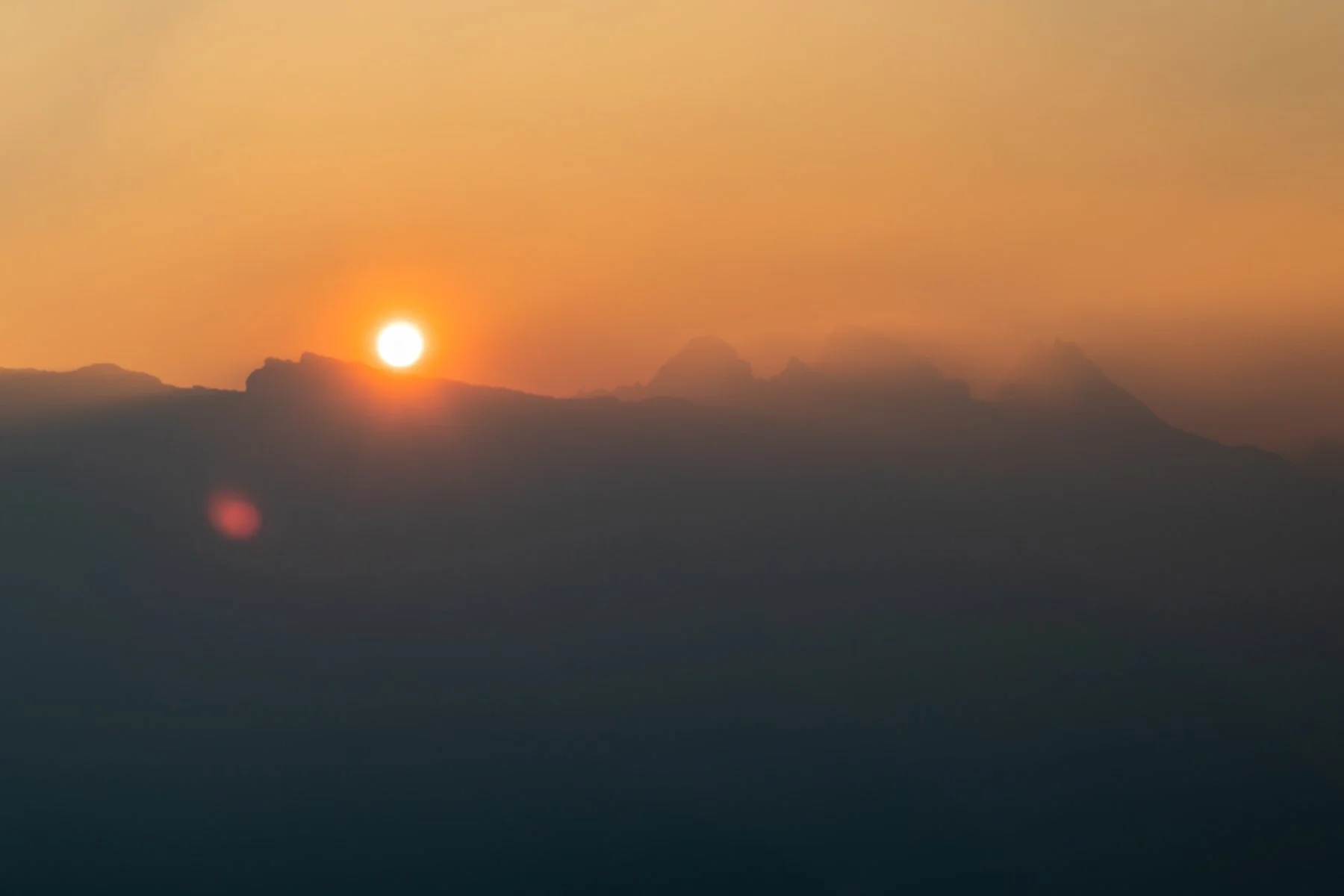
Sunset view from our first camp
Day 1
Permit Pickup, Car Shuttle, Eldorado TH to upper eldorado creek
Our first day of the trip was filled with logistics. First, we met our guide, Alex (henceforth known as A to not be confused with Alex my husband), for the trip at the ranger station in Marblemount and completed a quick gear rundown to make sure we had all the necessities. This trip was a high commitment. Once we entered the backcountry there would be no easy way out so we needed to make sure we didn’t forget something vital like crampons, a harness, or a water filter. After we ensured we had all our gear accounted for we picked up our backcountry camping permits. We needed to get a permit for two nights in the Eldorado XC Zone (one of the more popular zones in the park) and two nights in the Klawatti XC zone.
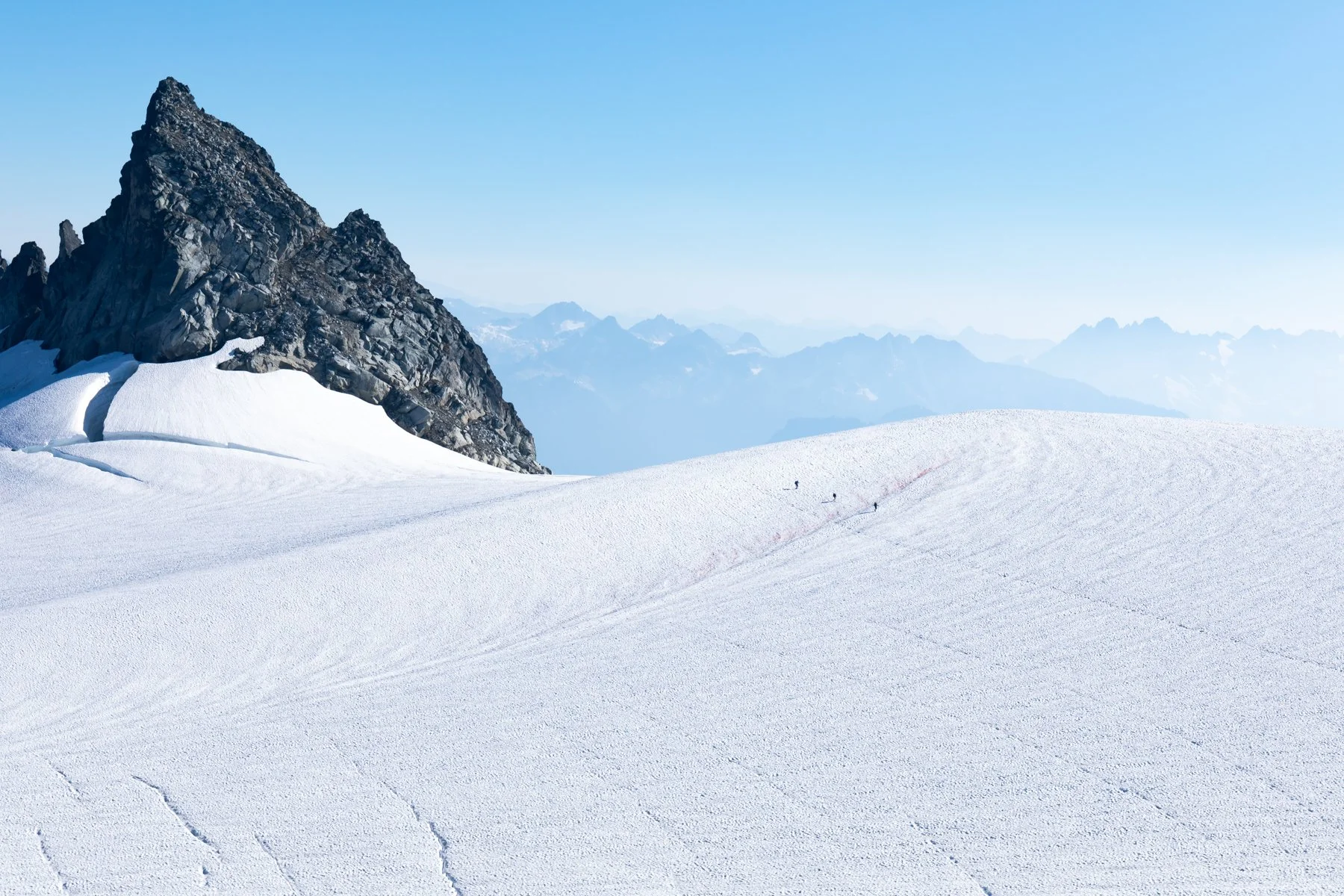
A group of 3 climbers crossing the Eldorado Glacier
Permits in hand, we moved onto our next logistical hurdle: shuttling the cars. Because the traverse was a point to point hike, we had to drop off one vehicle at the ending point, pile into another car and drive all the way to the trailhead where we would begin a long trek to the first car. The plan was to park A’s car at the ending point so we hit the road and followed his 1980s Jeep Comanche all the way to the Thunder Creek Trialhead. A parked his car in the overnight parking area, stuffed his backpack into our vehicle and then climbed into our backseat. We turned the car right back around and headed toward the Eldorado Trailhead on Cascade River Road.
The day was beautiful. It was sunny, warm, and, despite the fires burning in the northern reaches of the park, the skies were clear. I kept my fingers crossed that these favorable conditions would continue for the duration of the trip. The forecast looked promising but the smoke was what worried me the most—a sudden shift in wind could send smoke spiraling our way.
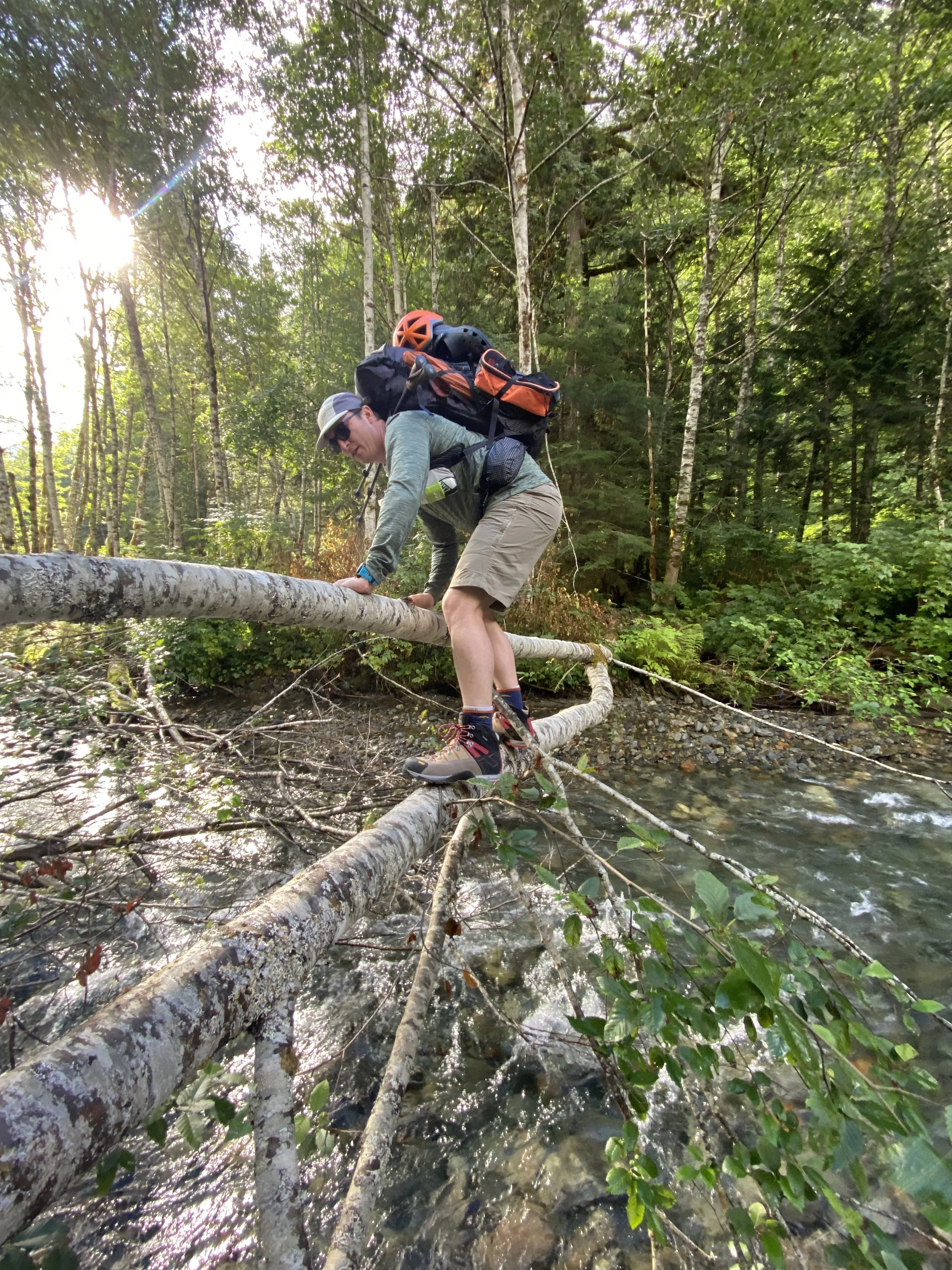
Alex crossing the creek
The North Cascades offer some of the most beautiful views in Washington, but those views can feel fortified. In order to break into the open alpine, climber’s must toil on steep, overgrown, unmaintained trails for half a day before being rewarded with any views. This route was no exception.
From the Eldorado Trailhead to our planned camp spot was a mere three miles, which doesn’t seem to bad on paper, until you learn those three miles come with 4,000’ of elevation gain along one of those aforementioned unmaintained climber’s trails.
Before the hike even began we were tasked with crossing Eldorado Creek, which is usually noted as one of the trickier aspects of climbing Eldorado (along with its infamous knife-edge, of course). We had already spotted a rickety downed tree that spanned the water that would allow us a sketchy way across, but we wanted to see if there was an easier way. We traversed up and down along the banks of the creek looking for a weakness in the river, some widening of the banks or slowing of the flow, but we couldn’t find anything that looked promising. We returned to the downed tree. A walked across it, but I didn’t feel that confident so I straddled the tree and scooched across inch by inch.
After we made it across the creek we began looking for the social trail. It was already turning out to be a hot day and in the canopy of the forest it was muggy. I could basically still see the car and already I had broken out into a sweat. It was not a promising start.
Eventually we found the social trail and we quickly fell into a steady pace as we climbed higher.
We continued up through the “green tunnel” for hours, breaking for snacks and water intermittently as the leaves gradually opened up and revealed glimpses of the mountains surrounding us.
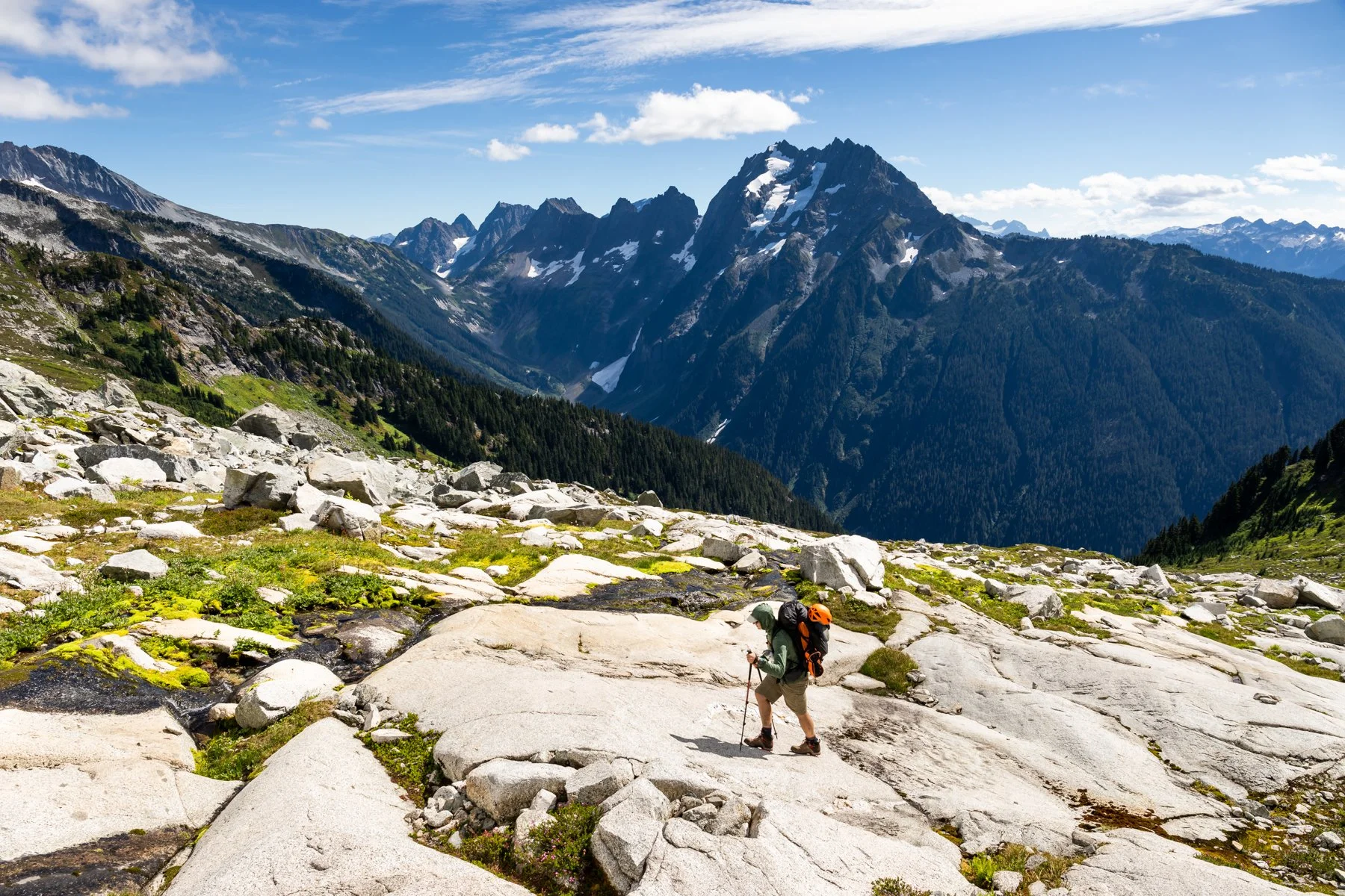
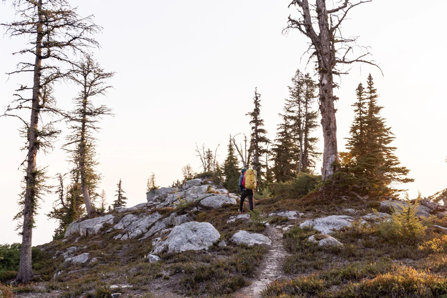
Alex hiking toward camp with Johannesburg Mountain in the background
We made it to camp at the upper basin near Eldorado Creek by mid-afternoon. There was a part of me that wanted to continue on to the Eldorado High Camp—it would have been another couple miles and 1,500’—but the day had already felt so long. So instead we set up camp, napped, and waited for sunset, which turned out to be a stunning welcome to the high alpine.
A leading us down from the summit of Eldorado
Day 2
Eldorado high camp and summit
Our second day was planned to be relatively short so we didn’t feel the need to get a super early start. We woke with the sun and made breakfast just as the surrounding peaks turned pink.
The plan for the day was to move camp to the Eldorado High Camp and then continue on to Eldorado Summit in the early afternoon. This was the part of the trip I was most nervous about. Eldorado has a notorious knife-edge summit ridge and I am terrified of heights. Just thinking about walking along that ridge made my stomach turn and my hands sweat. I was confident I could physically complete the climb, but knew in order to successfully summit I would need to keep my nerves in check.
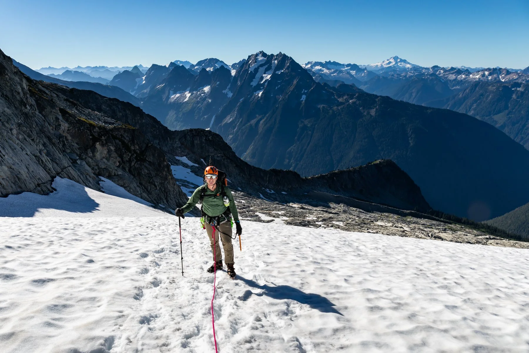
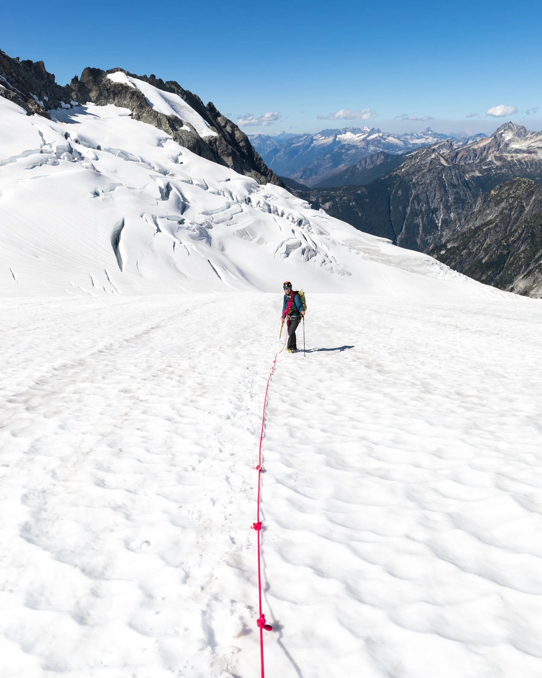
Alex hiking on the Eldorado Glacier
We made it to Eldorado High Camp in just under two hours and the view immediately blew me away. Forbidden Peak, Moraine Lake, and all the surrounding mountains were jaw-droppingly gorgeous on the bright bluebird day. I spent a few minutes soaking in the views, snacking, and psyching myself up for the imminent climb.
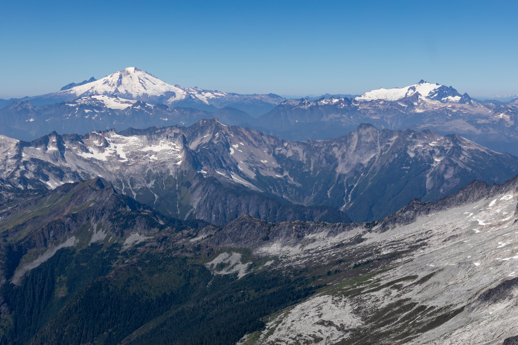
The climb up to Eldorado was straight forward—we could even see the summit from camp! We switched between the glacier and rocks as we made our way up. The late-season conditions had exposed quite a few crevasses on the route so it was easier to stick to the rocks for most of the climb. Finally, we made it to the base of the knife-edge. Looking up was intimidating—the snow was so steep and the ridge looked so narrow. I strengthened my resolve and we started up. I focused on only looking where I was placing my feet. I could sense airy exposure in my peripheral but didn’t dare look. As we made our way across the summit-ridge I’m pretty sure I repeated “oh God, on my God, ohhhh my God” over and over until finally finally we made it to the secure rocky summit. I threw down my gear and spun in a circle. The view was phenomenal and made even more sweet by (more or less) managing my fear on the way up. We could see Baker and Shuksan, Hidden Peak and Hidden Lake, and the view of Forbidden and Moraine Lake got even better with the elevation gain.

We could also see the Chilliwack fire raging to the north. The same fire that had prevented us from completing Plan A. Dark smoke clouds roiled in the distance and the wind swept it into a haze traveling east. I hoped the smoke didn’t head toward us.
View of the Chilliwack wildfire from the summit of Eldorado
Once we finished taking photos, enjoying the view, and having yet more snacks we roped back up and began the descent. Mentally, the descent was tougher for me than the ascent. Facing into the slope on the way up narrowed my view, but on the way down the slope seemed to unravel before me on a precipitous grade. Again, I focused all my attention of stepping with confidence, but I could feel my nerves start to fray with the pressure.
We made it back to camp by 2:30 and had the entire afternoon to relax.
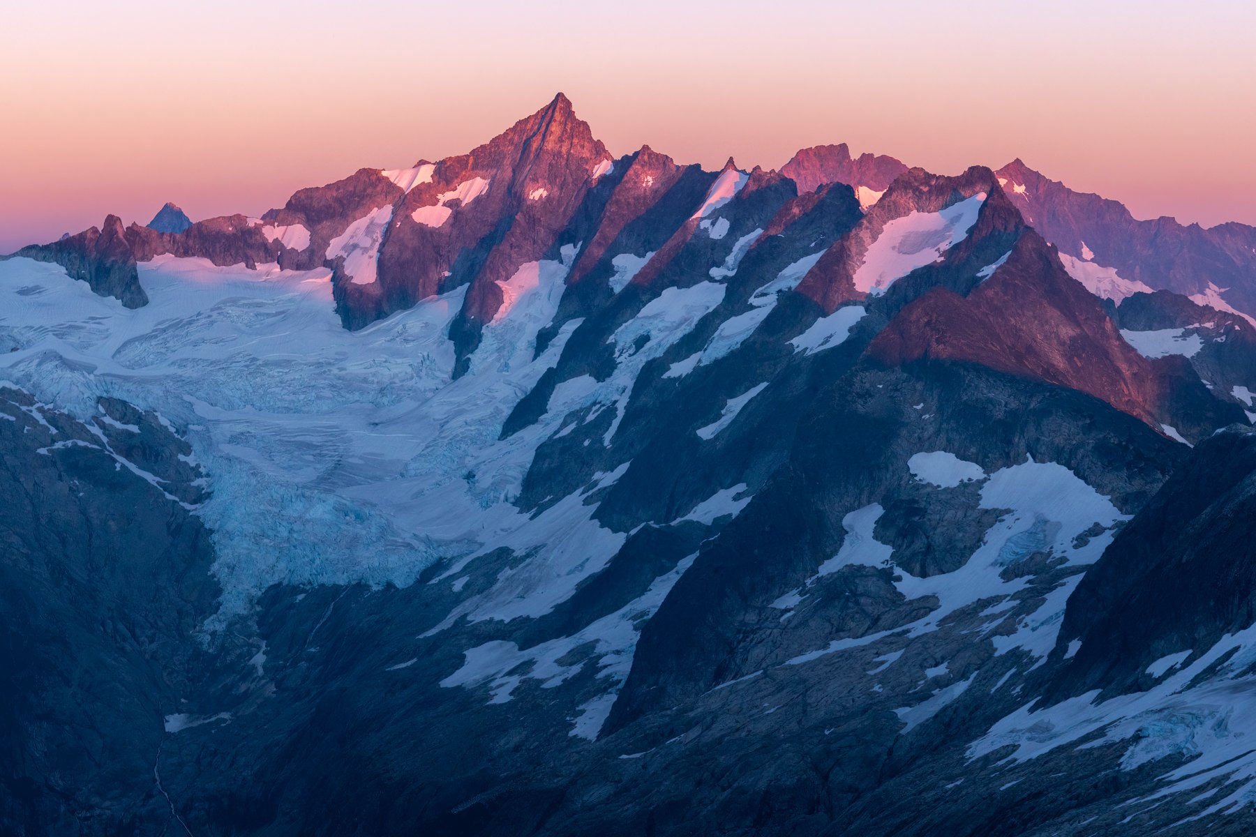
Eldorado High Camp
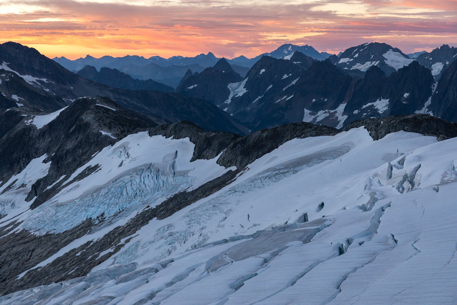
Sunset was once again stunning. The surrounding smoke hanging in the air transformed sunset into an extra vibrant show. That’s one thing about wildfire season—it can make for some spectacular sunrises and sunsets.

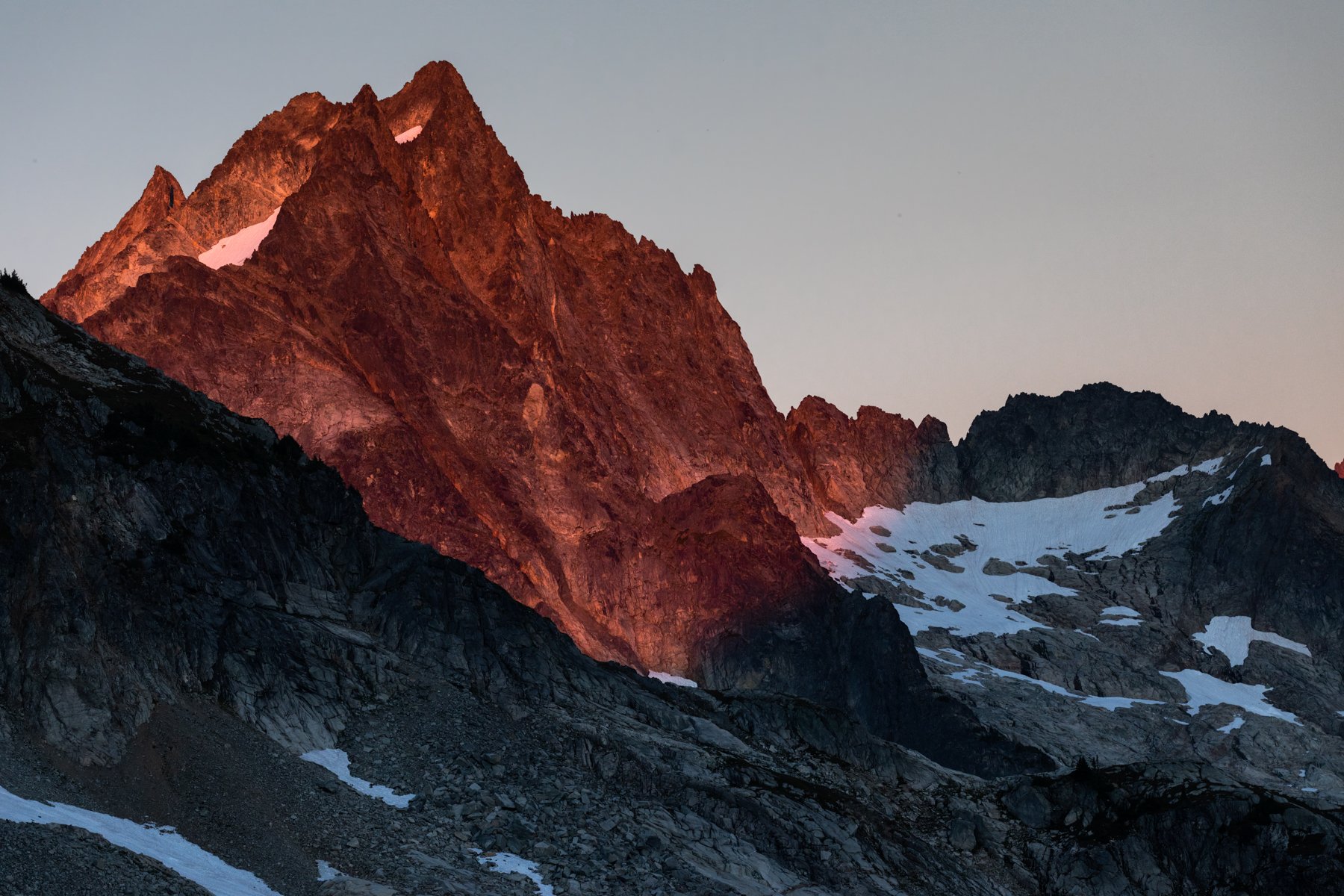
Sunrise from Eldorado High Camp
Day 3
Klawatti camp, the towers circumnavigation
Day 3 was planned to be another short day. That was one nice thing about our switch from the Pickets Traverse to the Inspiration Traverse—the Inspiration Traverse is relatively chill by mountaineering standards. The days, mileage, and elevation gain were all shorter and it also allowed for more of a choose-your-own-adventure mindset with plenty of peaks to choose (or not choose) to summit along the way.
Once again we woke with the sun and enjoyed a beautiful, albeit absolutely freezing, sunrise. It may have been early September but fall was already in the air. I hauled my sleeping bag outside of the tent so I could keep warm while enjoying sunrise and boiling water for coffee.
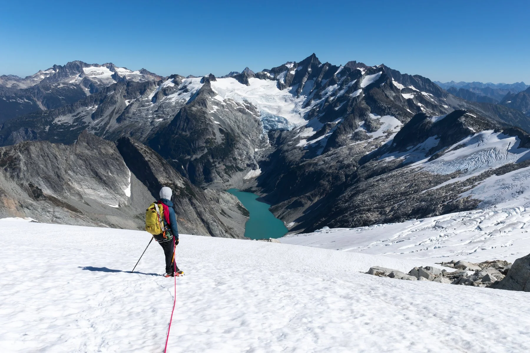
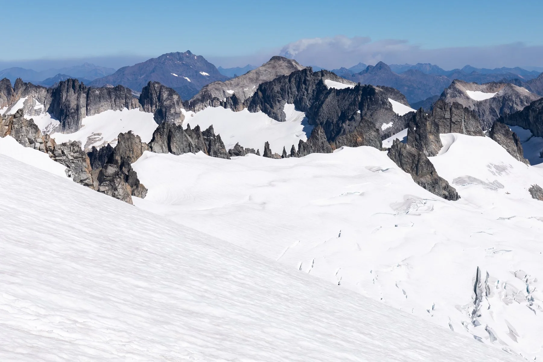
Our first goal of the day was to make it across the upper Inspiration Glacier and set up camp at the Klawatti Col. Crossing the Inspiration Glacier was such a good feeling. It was our divergence from the popular Eldorado route and we headed off into less-traveled terrain. Crossing above crevasses still made me uneasy, but I was getting more comfortable with glacier travel and better able to fully appreciate the terrain around me.
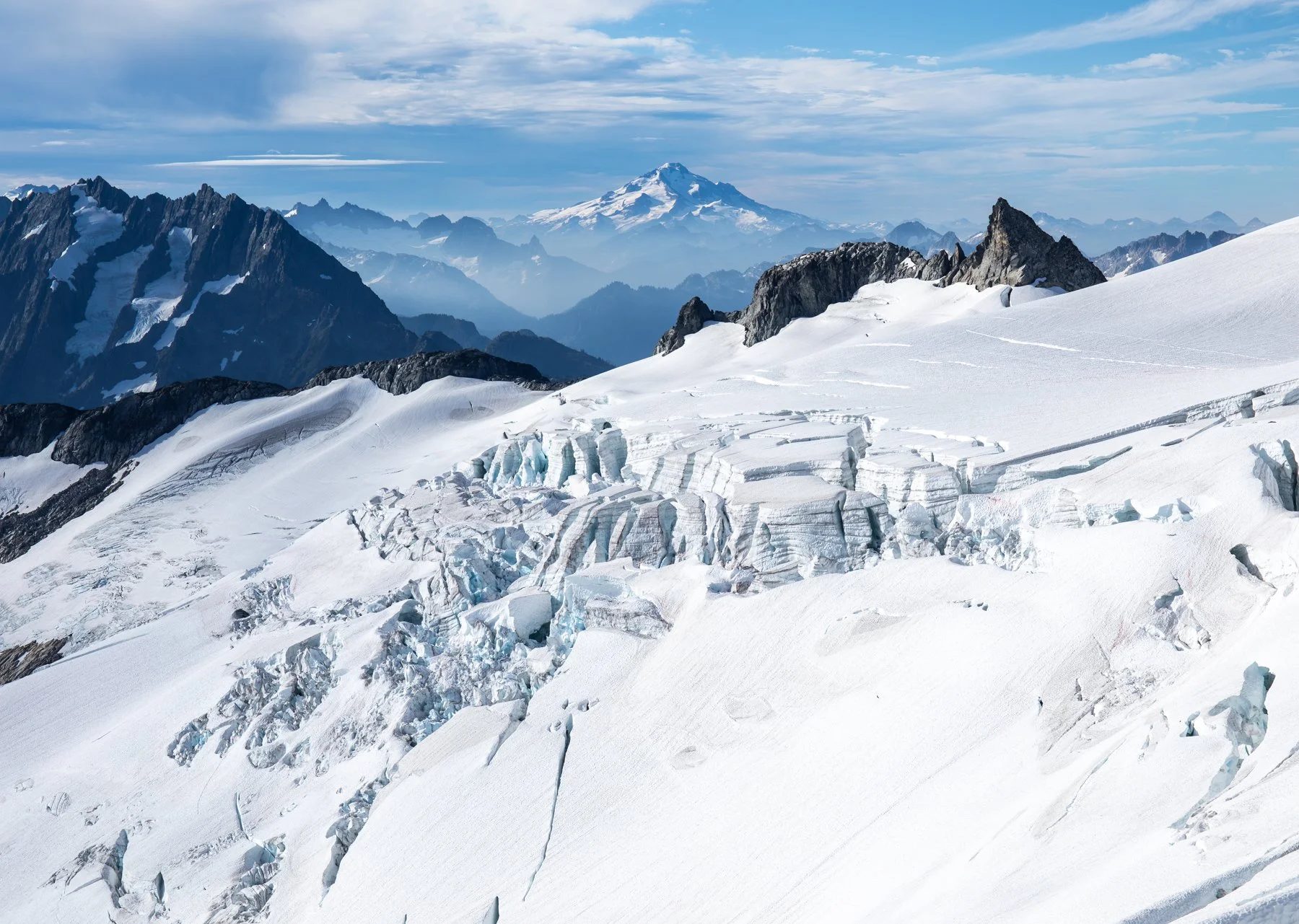
The Inspiration Glacier
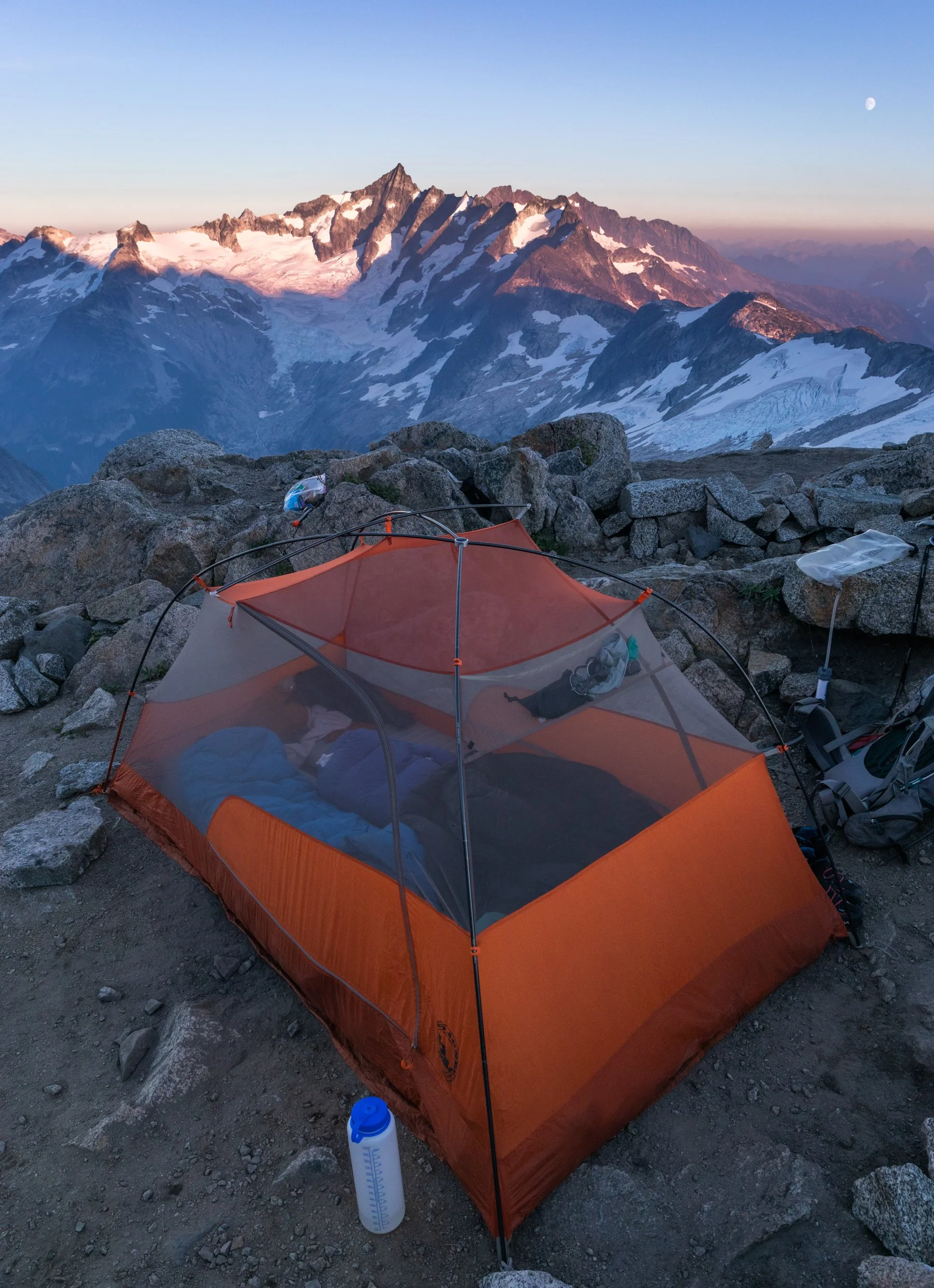
It didn’t take long for us to get to the col and we were happy to find that the snow had melted out enough that it revealed rocky platforms created by previous climbers. Alex and I chose a sheltered little spot and got to work setting up the tent.
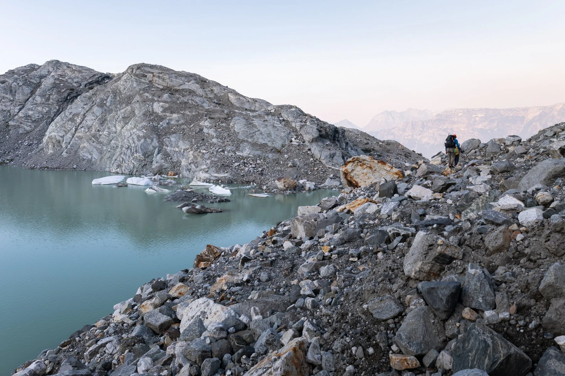
Camp at Klawatti Col
One of the options for extending the day was to go on a little walkabout from camp and circumnavigate some nearby towers. Alex decided that he wanted to spend the afternoon resting in the tent, but I was eager to get more glacier navigation under my belt so A and I set off as a rope team of two.
On the walkabout with A
This walkabout was one of my favorite portions of the trip. Our packs were light and we weren’t pressed for time so A let me lead and plan our route around the crevasses, which was excellent practice for me. Some of the crevasses were so massive we had to take huge detours to bypass them but others were narrow enough we could hop over them. Although I once made the mistake of looking down into the crevasse before hopping over one and my courage completely dissolved so we had to take a long detour to get around it. Lesson learned: hop then peer into the crevasse’s dark abyss.
The entire walkabout took only three hours, but I was exhausted. The trip hadn’t been physically tiring but it had been mentally taxing as I was hyper-vigilant with every single step I took. My focus was 110% dialed every minute we were on the glaciers and that is a tiring state to remain in for too long.
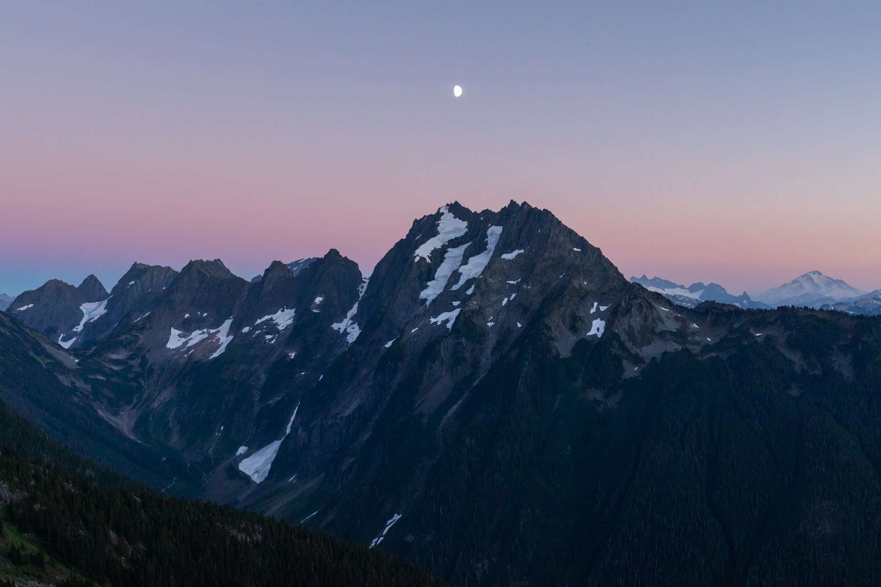
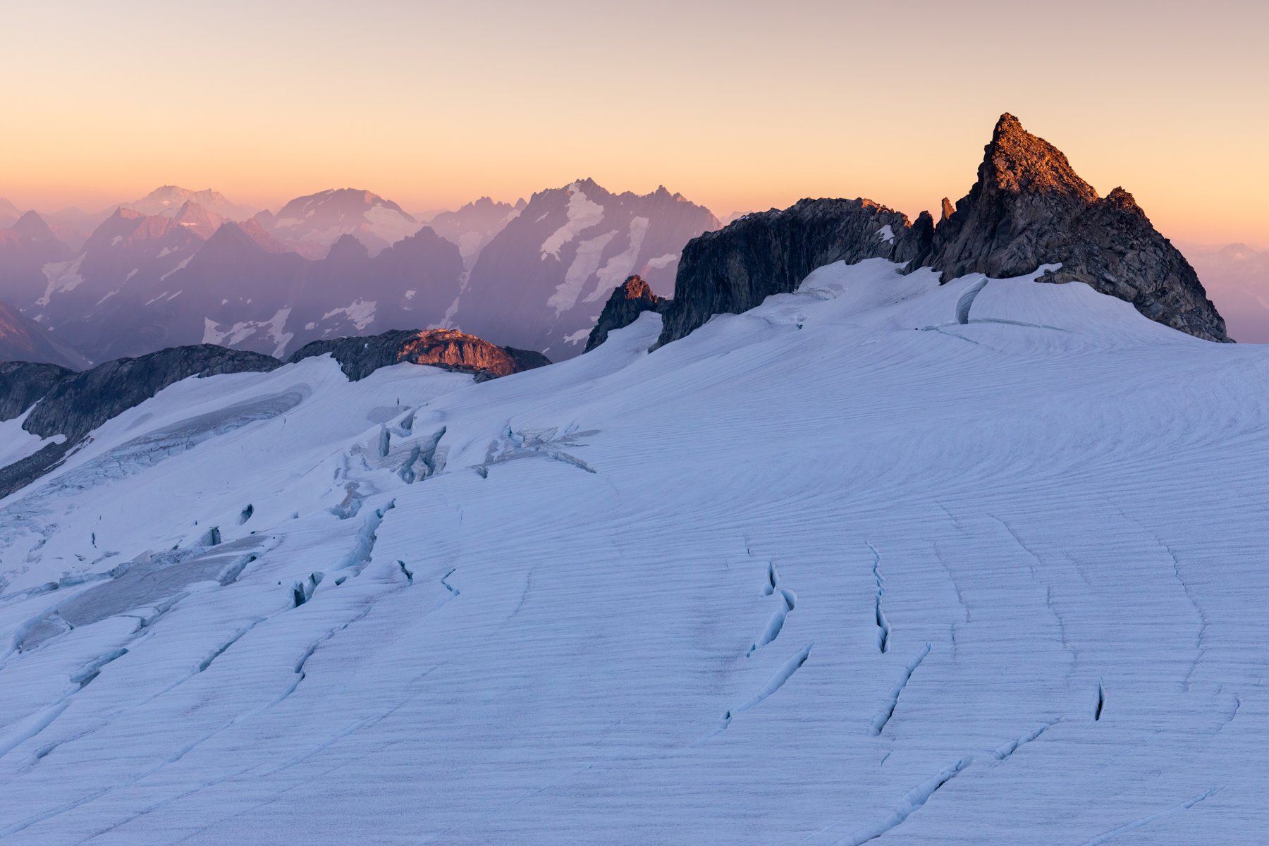
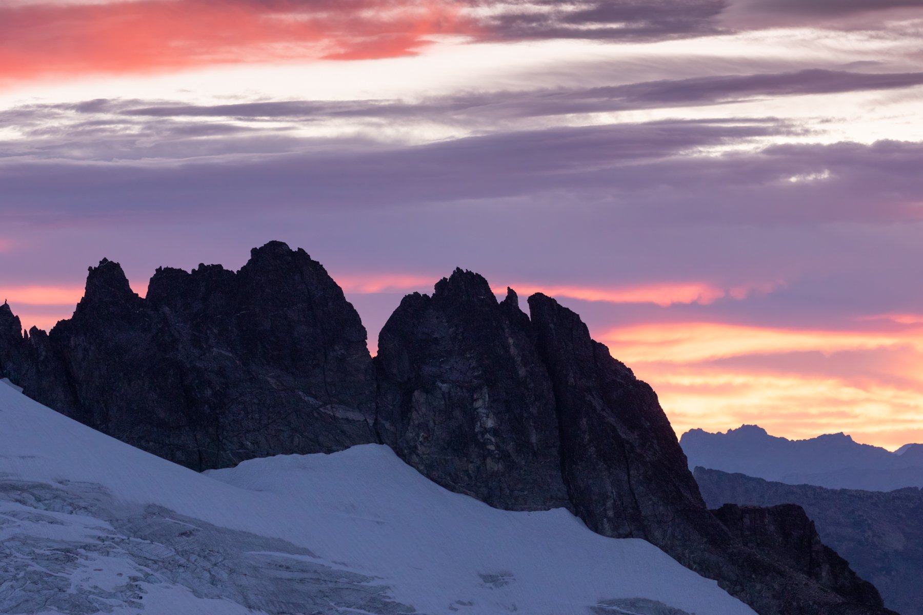
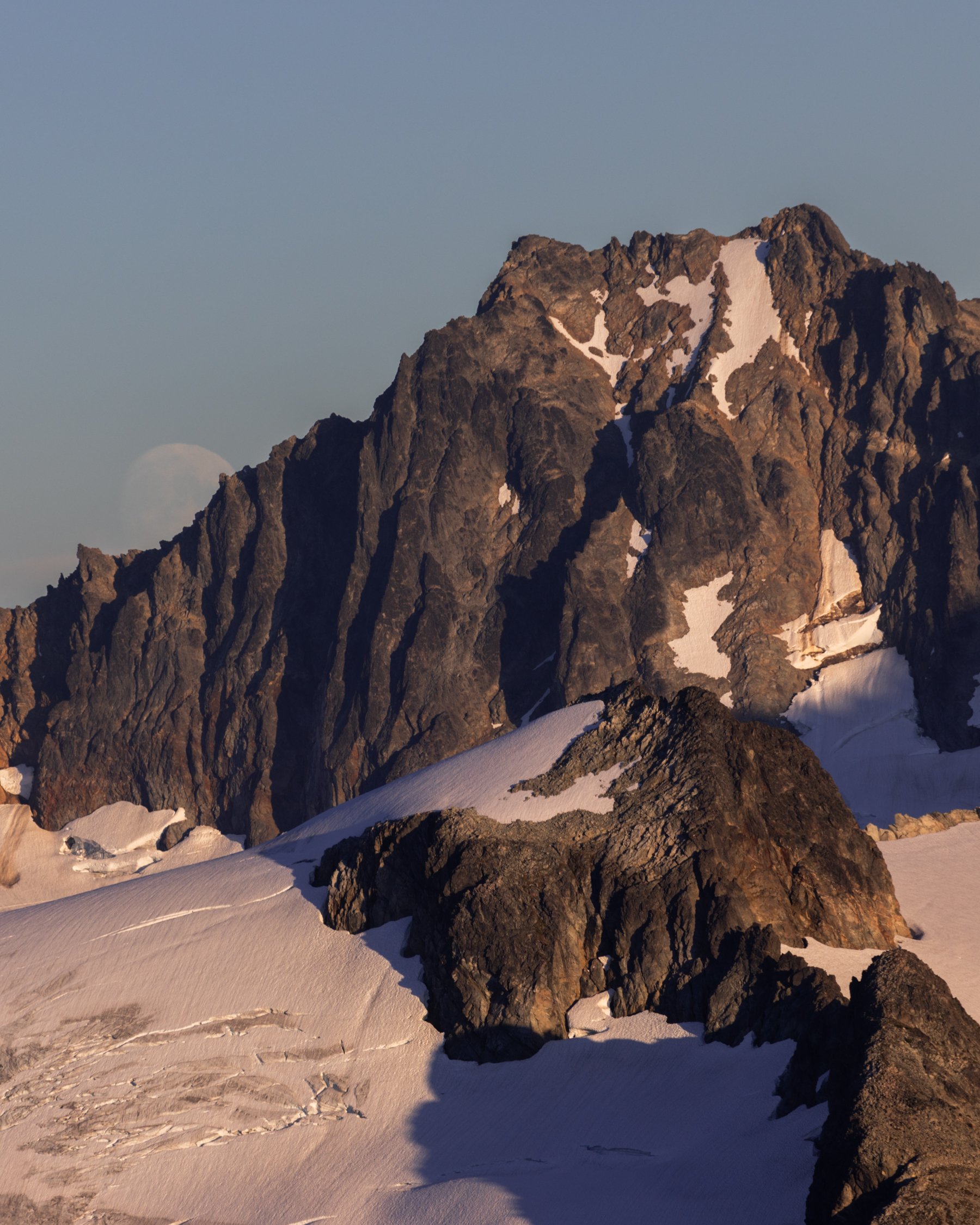
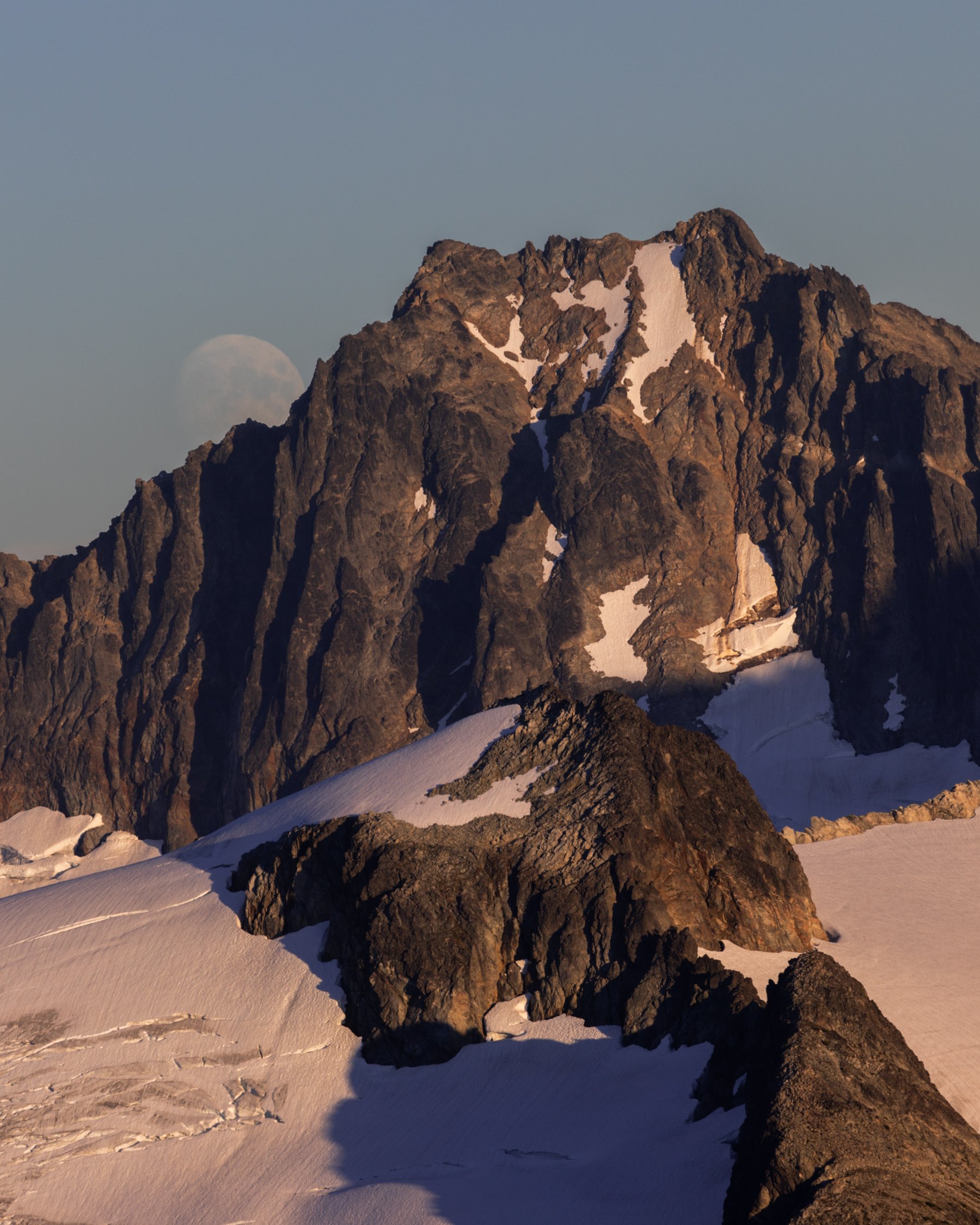
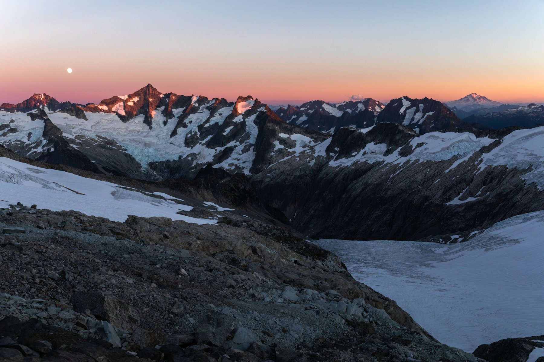
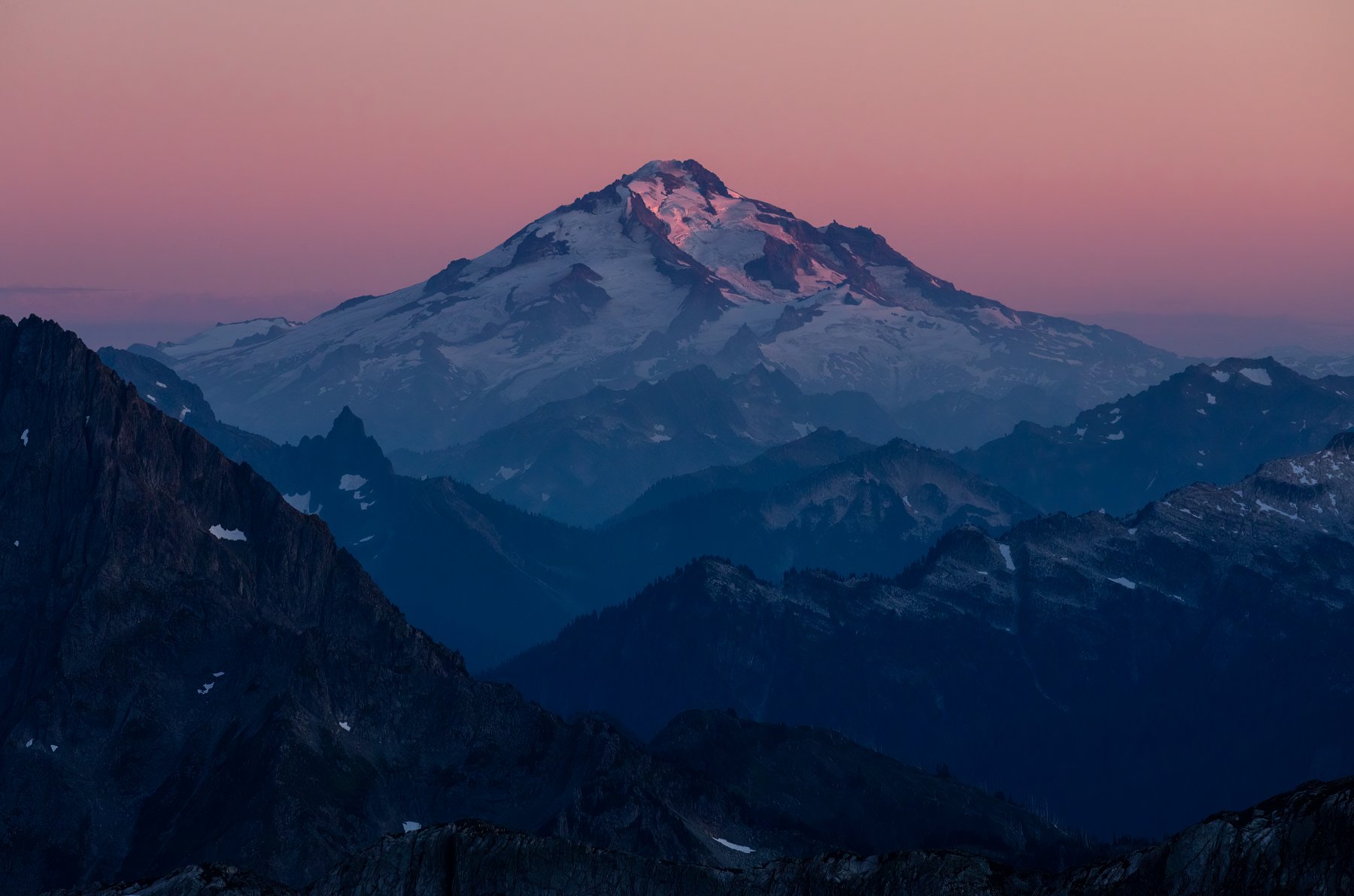
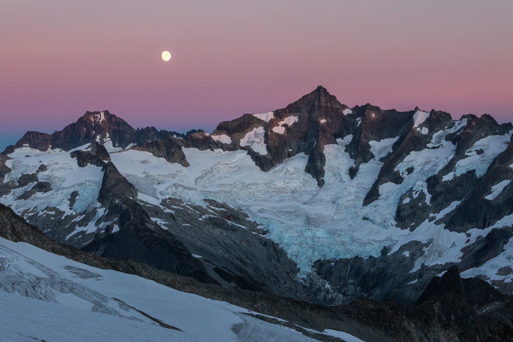
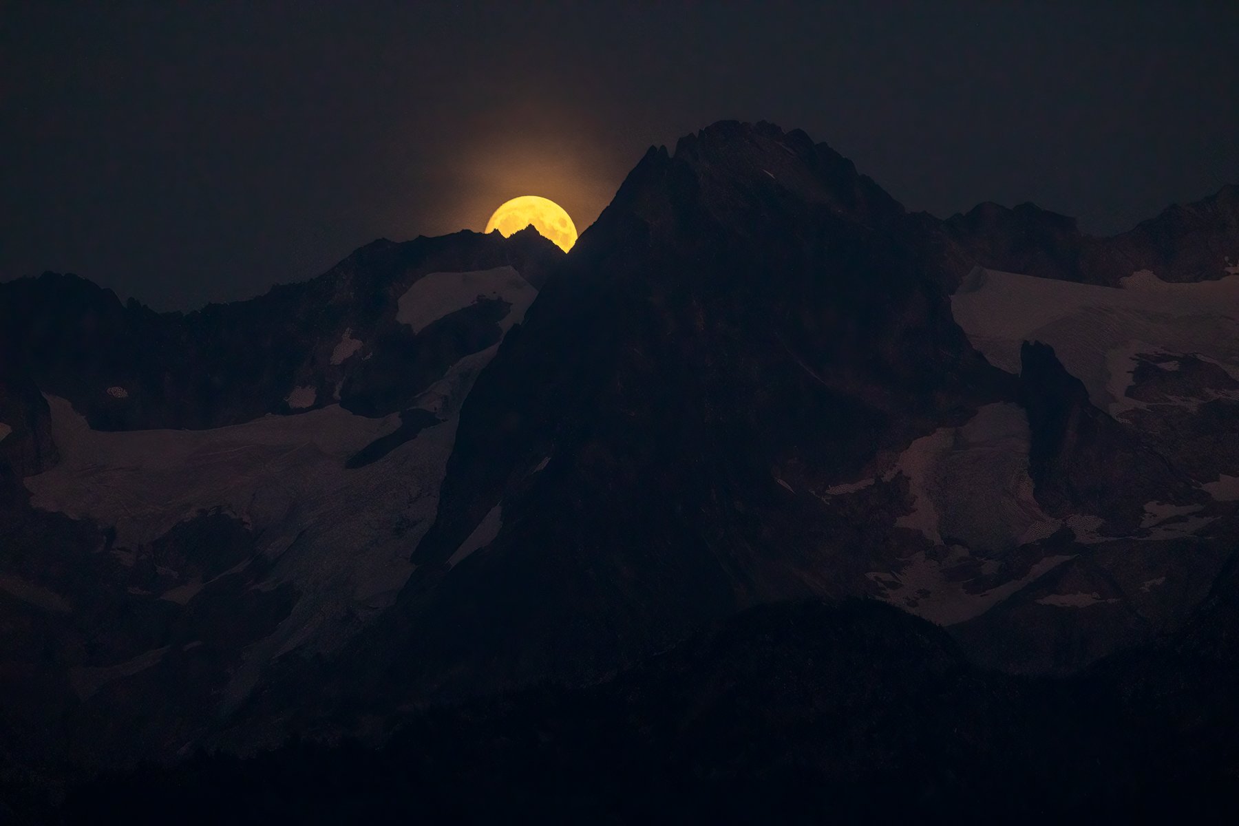
If there was one constant in the trip (besides my ever present nerves) it was beautiful sunsets. I thought that our sunset from Eldorado High Camp couldn’t be beat, but the sunset from Klawatti Col was even better. We had a wonderful view of Glacier Peak illuminated in pink. And, the moonrise coincided with sunset. Somehow, from where we were camped and where the moon was rising, and its trajectory, we got to see the moon “climb” Mt. Buckner. It was a moment that felt truly aligned. For a moment I forgot my nerves, I forgot the cold wind, and I just embraced the beauty of the scene surrounding me.
The moment the sun set, the temperature plummeted. Even in all my warmest jackets the cold wind found its way through the layers and chilled me to the core. I held out for as long as I could, trying to photograph the last glimpses of blue hour before finally retreating to the tent and snuggling into the depths of my sleeping bag for warmth.
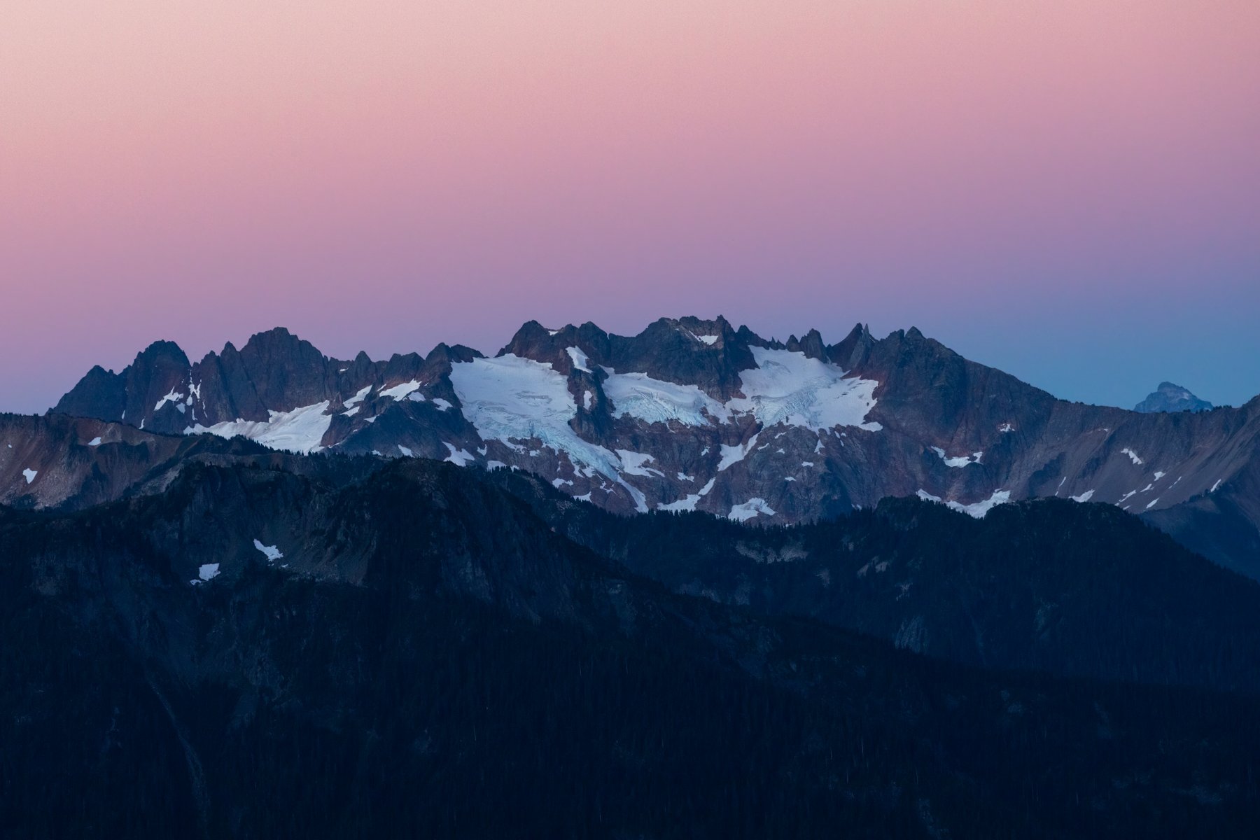
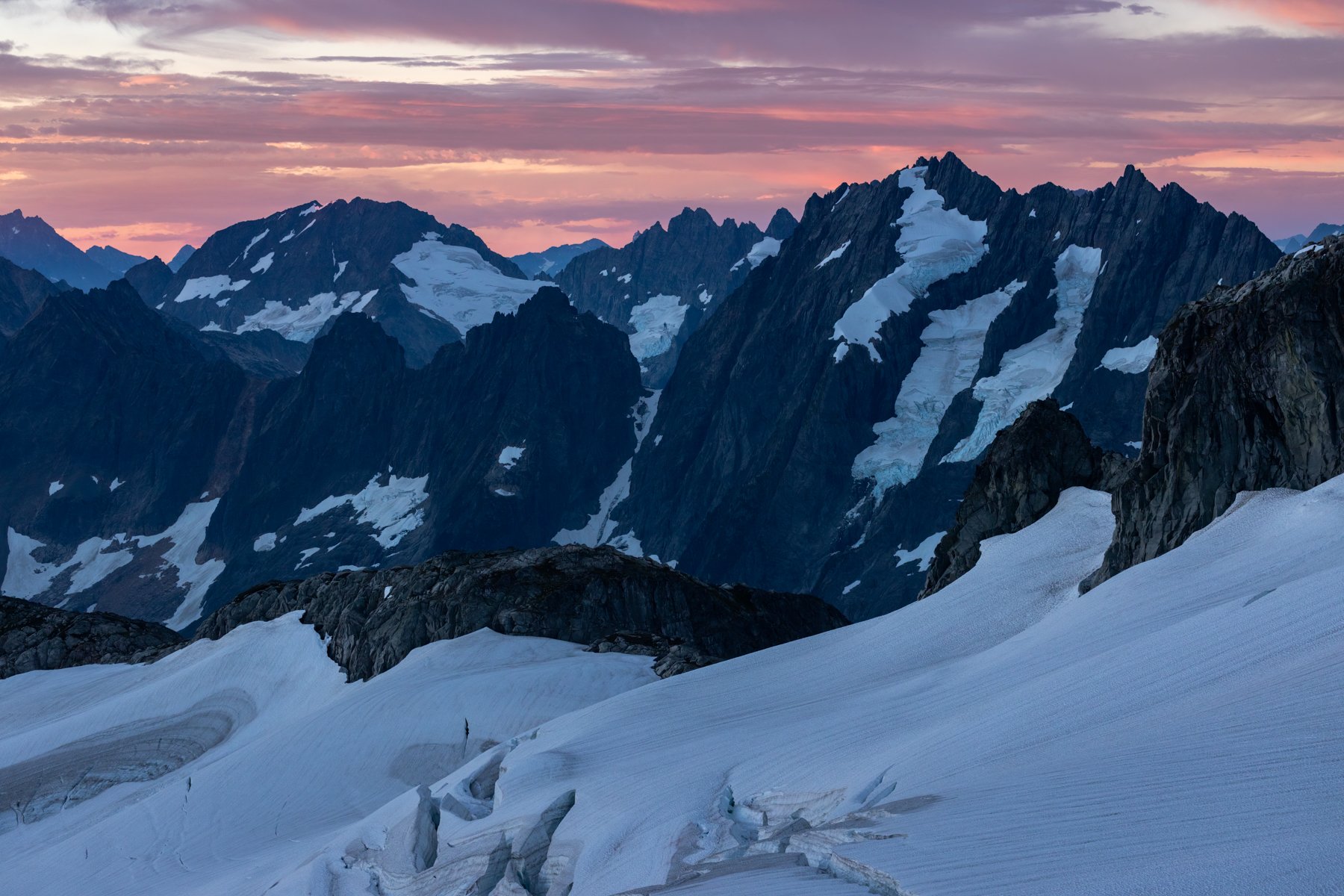
Smoky sunrise and first light on Eldorado seen from camp at Klawatti Col
day 4
klawatti col to primus peak to borealis lake
We woke on the fourth day completely oblivious to what the day had in store for us, but the smoke that settled into the valley below us while we made breakfast was the first bad omen. Over the previous days the wind swept the smoke in every direction but ours. We could always see it on the horizon but it never drifted our way and for that we were grateful, but it appeared our luck had run out. Overnight the wind had shifted and now the smoke was heading our way.
Unfortunately, the arrival of the smoke coincided with our planned biggest day. We planned to leave our camp at Klawatti Col, travel over the Klawatti Glacier, climb Austera Peak, navigate our way to the North Klawatti Glacier, climb Primus Peak, pick our way down the Borealis Glacier, and finally end the day at Borealis Lake for camp—a route we expected to take six to eight hours and plenty of route-finding.
Due to the length of the day ahead of us we began hiking at sunrise. Smoke continued to sweep in around us until the views we had been awing over the previous two days were gone and in their place was a white wall.

Smoke settling during our morning hike

Alex rappelling onto the Klawatti Glacier
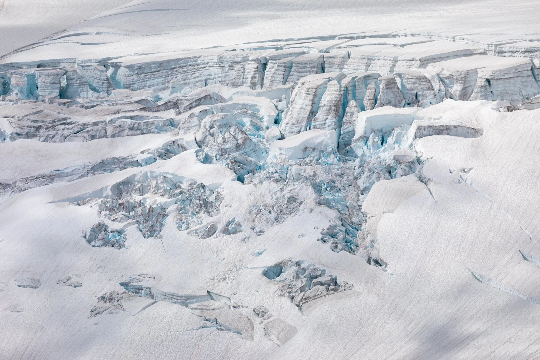
Our first obstacle of the day was getting onto the Klawatti Glacier. It required a rappel (a first for Alex and I in the backcountry) and it ended up taking quite a bit of time to set up and get us all safely down onto the glacier. Once we were all down we fell back into our rope team and made our way across the Klawatti. All around us smoke settled into the valley in a hazy inversion layer. We made it to the base of Austera Peak and began scrambling up, it was so hard to not feel disappointed. We climbed but were bitterly rewarded with smoke-choked views. Atop the false summit of Austera Alex and I decided to turn around. My mental strength had been waning already and I didn’t want to waste it on an unessential summit along our route.

Back at the base of Austera we had a serious conversation as a team. Should we continue on the route or should we head back the way we came? Both options had their pros and cons. Continuing on meant we could complete our planned route, but it was also going to require heading into unknown territory. We could return to the Eldorado Trailhead, where we knew the route, but that would be an immensely long day. No matter which direction we chose, we were going to be forced to contend with thick smoke.
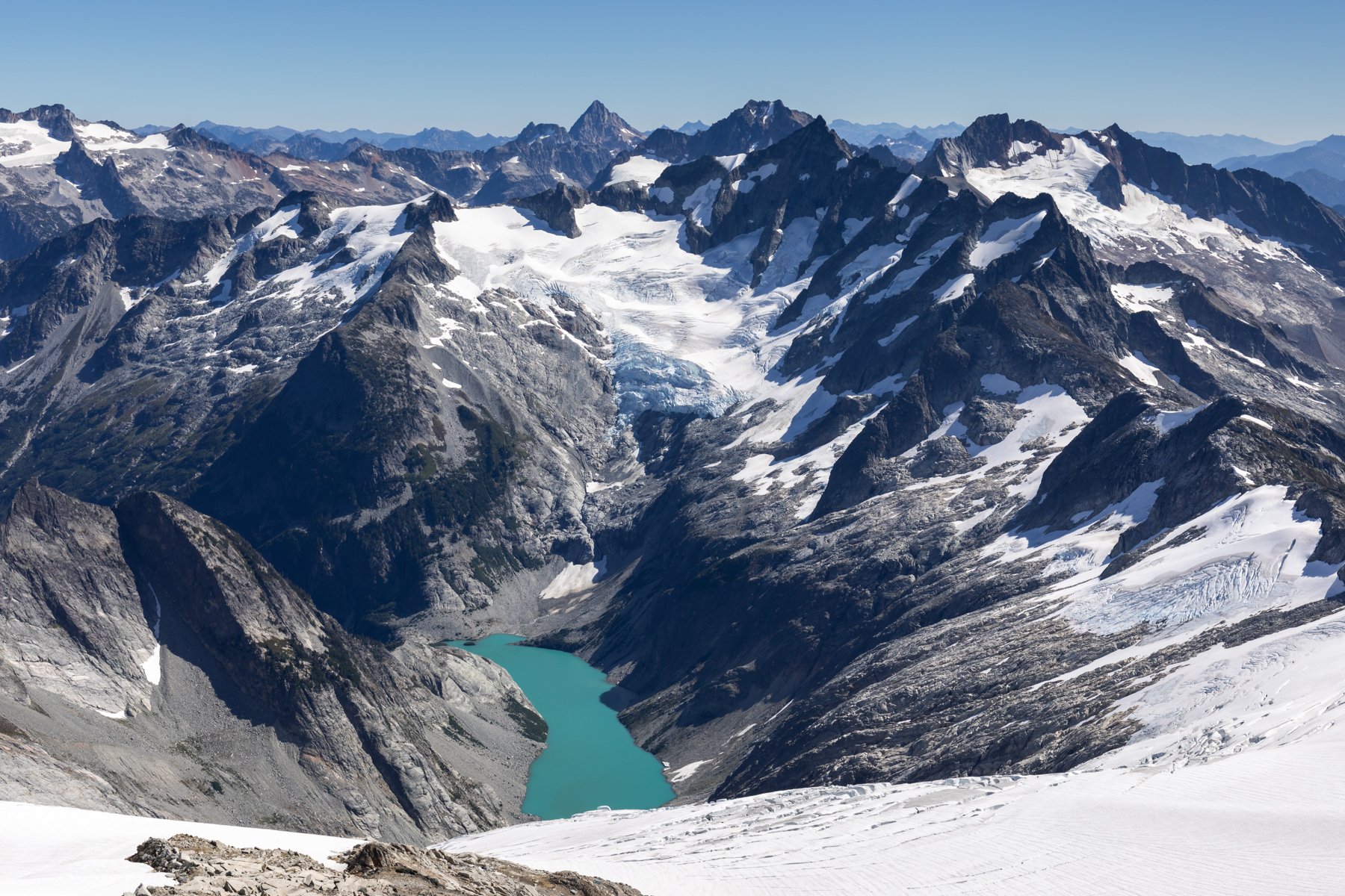
Ultimately, we chose to continue on and began our descent along the ridge of Austera Peak. This was an extra demoralizing stretch for me. Barely perceptible through the haze was Klawatti Lake far below us. From researching our route I knew that on clear days this beautiful turquoise lake twinkled like a jewel in the basin below. But today, it appeared more as a mirage. Everything was a fuzzy shade of gray.


We spent an hour or so navigating the slabs and boulders of lower Austera Peak as we made our way toward the North Klawatti Glacier. I was happy to be making progress on our route but we still had so much ahead of us and we were clearly far behind our planned six to eight hour day. As we crossed the glacier, the sun bore down on us. There was no wind to offer reprieve, no views to distract us, just an intense heat and thick smoke to accompany us.
From a distance Primus Peak looked foreboding. It appeared steep and rugged and I had doubt that I would be able to make it to the top, which was something I really had no choice about since there was no way else around it on our route. But, like many peaks it revealed itself to be more manageable up close. It was a giant, crumbly pile of rocks, but getting to the top was easy enough with just a few scrambly bits on the way up.

Borealis Lake seen from the summit of Primus Peak
Making it to the summit of Primus felt like rounding the final corner of a race. We could see our destination for the evening. It was at least a couple thousand feet below us, but all we had to do was descend Primus Peak, find our way onto the Borealis Glacier, navigate its crevasses and cliffs, and boulder hop our way along the shoreline. That was “all”. I looked at my watch. We were eight hours into our day and it appeared we had at least a couple hours left.

Our very approximate route from Primus Peak to the lake
Despite my assumption that summiting Eldorado would be the toughest part of the trip for me, the toughest moments of the trip were the prolonged moments I spent on the Borealis Glacier. Three days of glacier travel and an eight hour (and counting) hike in the smoke left me mentally depleted. The snow was wet and slick and my crampons weren’t able to bite into the glacier well, so every few steps I would place my foot down and it would slide. I would feel that falling sensation and adrenaline would course through me. This carried on for the stretch of the Borealis Glacier.
When we finally stepped off the glacier I looked back at what we had crossed and my jaw dropped in shock. Had I known that below our route was a no-fall zone and hundreds of feet of glacier-smoothed cliffs I never would have been able to manage the crossing. But I did, and a sense of accomplishment swelled through me—or maybe that was more adrenaline—but I didn’t have time to enjoy the moment because the minutes were ticking on and we still had to descend to the lakeshore.
We made it to camp and threw down our packs. It had taken us twelve hours. I barely had the energy to boil water, let alone set up camp.

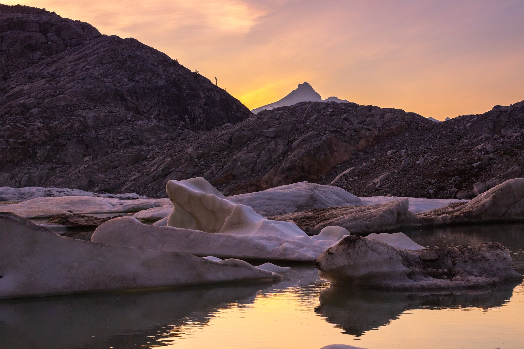
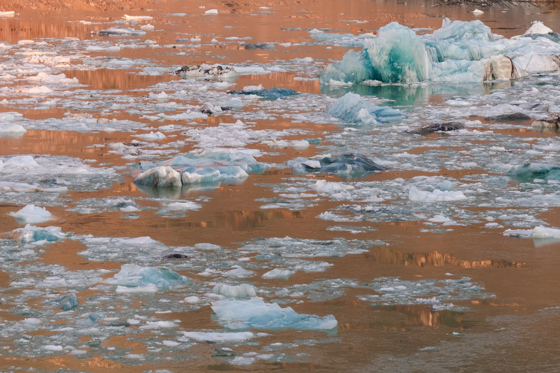
View of Borealis Lake and Primus Peak from near camp
The smoke had slightly dissipated since we stood on the summit of Primus Peak and it appeared the lingering smoke particles would create another stunning sunset—and they did. The lake stilled and reflected vibrant fuchsia clouds like a mirror. The day had been so long, so exhausting, but in that moment I had completely forgot about the hardship. The sunset, the moonrise, the colors, the ice bobbing in the lake—it all made everything feel so worth it.
We slept with the rainfly off and spent the night listening to the glacier creak and crack and calve.
A smoky sunrise on our final morning
Day 5
to the thunder creek trailhead
Another smoke-filled sky greeted us on the morning of the our final day. By this point I was ready for the hike to be over. To escape from the smoke, to not carry our heavy packs, to not worry about falling into a crevasse.
Sunrise light on Borealis Lake
But between us and the trailhead was another ten miles, and the first two mile stretch came with about 4,000’ of descent. I wanted nothing more than to not have to worry about every single step I took, but this section had some more harrowing moments—scrambles, down climbs, and veggie belays as we descended precipitously toward the valley floor.
Finally, we made it to the last obstacle of the trip: crossing Thunder Creek. Previously there was a bridge spanning the creek, but that had long since fallen into the river during a raging swell so we were left to pace the shore of the creek looking for the easiest spot to cross. In a way it was a fitting bookend to the trip, since a swollen creek was also our first obstacle of the trip.
It didn’t take long to find a wide, but relatively calm, bend in the river. We plunged forward into the icy water. I immediately lost feeling in my legs as the water rushed up to my waist and threatened to knock me off my feet. Using my poles and all the strength I could muster I inched forward one step at a time, gritting my teeth against the cold. The crossing probably didn’t take more than a couple minutes but by the time I made it across I collapsed. We took a quick break to recover before making our way into the forest and onto the Thunder Creek Trail. For the first time during the entire traverse we hiked on a maintained trail, and what a difference it made!
We spent the next six miles cruising through the forest at a pace of 3.5 miles per hour. After days of toiling in terrain that allowed for a mile an hour at most it felt like we were flying. I finally let my mind wander instead of hyper-focusing on my surroundings. I enjoyed the greenery, the diffused light filtering through the treetops. I thought back to everything we had done in the past few days. Climbing Eldorado (a peak I never thought I’d be capable of climbing), crossing glaciers, witnessing beautiful sunsets and sunrises, pushing myself physically and mentally, and expanding the edges of my comfort zone, and learning more about the mountains and myself.

Sunrise on Borealis Lake