
A Larch Loop through Glacier Peak Wilderness

DATEs HIKED: 10/4-10/6/24
TOTAL MILEAGE: 20 MILES
TOTAL ELEVATION GAIN: 8,300’
Every fall, Washingtonians flood to the mountains for two to three weeks each October to embark on an annual “larch march”. During this brief window of time, the needles of larch trees in the high alpine turn from green to a vibrant shade of yellow before dropping entirely for the winter. They are among a few species of conifers that drop their needles annually and they do it in such a vivid display of color that people from all over come to see the spectacle. It’s tough to nail the timing of the larch trees turning. It’s a narrow window and can shift depending on seasonal weather patterns, but when you are able to get the timing right the scenes are jaw-dropping. I try to go on a larch march once a year, but I don’t think I’ve ever got the timing quite right. I would either be too early and the trees would still be slightly green, or I’d go too late and entire stands of larches would be brown or naked. Those hikes were still undoubtedly beautiful, but I felt as if I wasn’t getting that experience that so many other larch-lovers get. Until this year.

I had been wanting to backpack Ice Lakes since before Alex and I even moved to Washington. The hike was included in a guide book that I bought and pored over before moving to the state, and from just the written description the hike sounded stunning. A sapphire lake situated beneath a sprawl of peaks, and as an added bonus that lake happened to be surrounded by larches.
However, the Phelps Creek Road that leads to the trailhead is notoriously rugged, absolutely necessitating a high-clearance 4WD vehicle, and unfortunately for a majority of the years we’ve lived in Washington we’ve owned a sedan. But now that we have a Santa Fe more hikes are becoming accessible to us and Ice Lakes was among them.
While the trip to Ice Lakes can certainly be done as an overnight backpacking trip (or even a day for the heartiest of hikers) I wanted to spend more time exploring the area, including climbing Mt. Maude, the easiest 9,000’ peak in Washington. The first weekend of October is usually prime time for larches so Alex and I requested off work for Friday the 4th, and planned for a three day trip.
As our trip dates approached the forecast was looking iffy for Friday (I swear I write something similar in every blog post), but Saturday and Sunday looked clear and sunny. We could have shortened the trip to avoid the weather on Friday, but in the end we decided to go for it. There wasn’t supposed to be much snow or rain accumulation and we had plenty of warm layers and winter gear so we headed to the trailhead on Thursday night.
While the Phelps Creek road may have once been a beast to contend with, a recent grading has tamed it so completely that a sedan can now easily make the drive. Alex and I had been nervous the entire ride up Chiwawa River Road, remembering the last time we drove to this trailhead in 2020 to hike the Spider Gap Loop. We had rented a Jeep Wrangler then and even with a vehicle as rugged as a Wrangler, we still were white-knuckle driving the final three miles. This time around it was so easy and painless that when the trailhead came into view we thought we had somehow gone the wrong way. We arrived at 11PM. Four or five cars were already there. We quickly assembled the sleeping platform in our car and settled in for the night.

DAY 1
8 miles, 4,500’ of elevation gain
We planned to start hiking at 7AM, but when our alarms sounded we chose to hit the snooze button (again and again and again) until it was suddenly 8AM. The weather outside our car looked bleak. Heavy clouds hung in the sky and threatened rain, but for the time being they held. Eventually we pulled ourselves out from the under the cozy blankets and began gearing up for the hike.
There are a few routes that lead to Ice Lakes. They can be accessed via the Phelps Creek/Leroy Basin Trail and they can be accessed via the Carne Trail and the Carne High Route with many people choosing to connect these trails to create a lovely loop. This is what we decided to do. We planned to hike up the Leroy Basin Trail on the first day, climb over Freezer Pass, set up camp in the basin for both nights, and then head out the Carne High Route trail on Sunday. The Carne trail is famously larch-y and we wanted to save that for a guaranteed sunny day and I’m glad we did.

Just past 8:30AM we hit the trail. The surrounding landscape was moody, the clouds hung low in the valley, shrouding the nearby mountains in a misty veil. After only a few minutes of hiking that rain that had been threatening to fall all morning was finally released. Alex and I dug our rain jackets out of our packs and layered up.
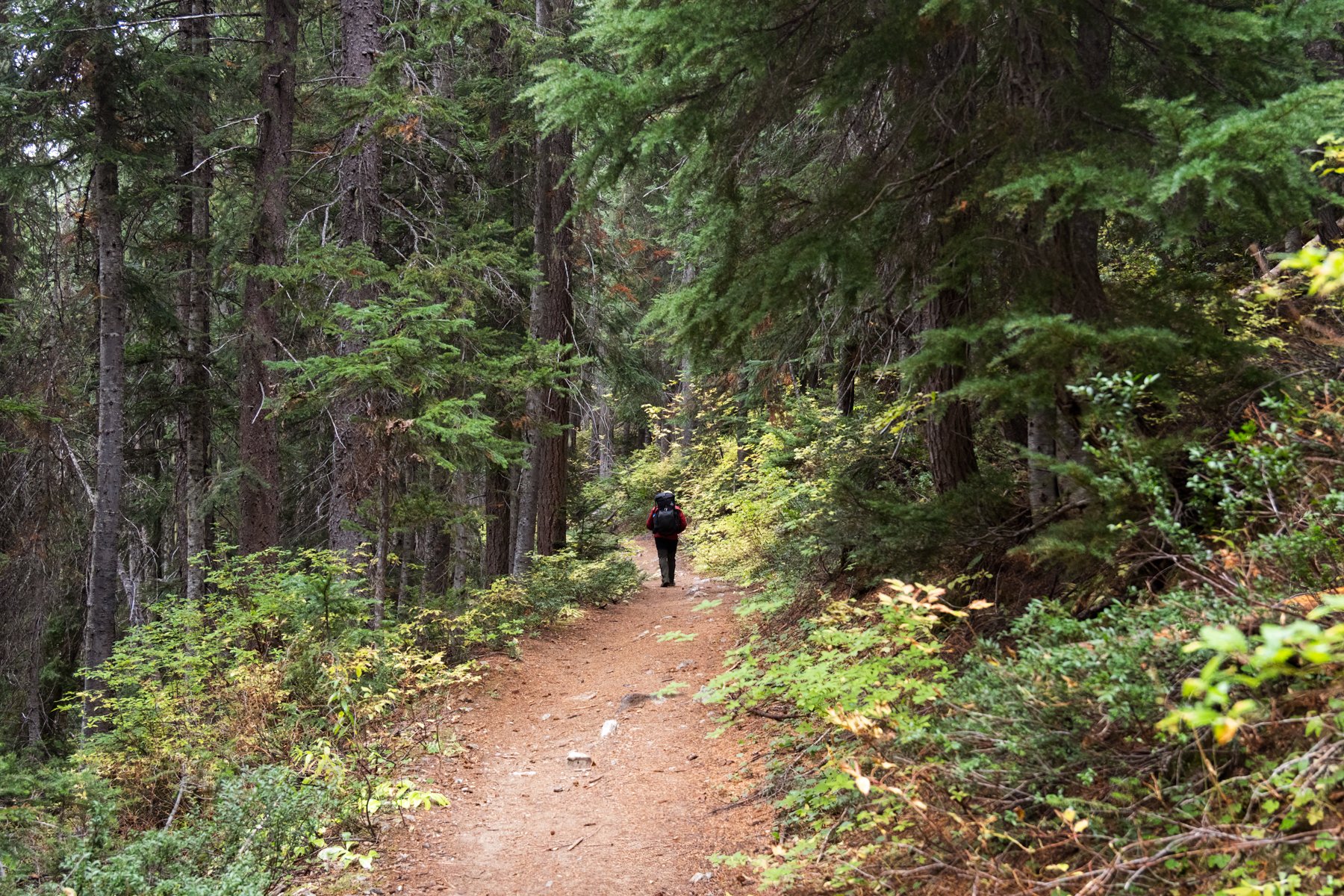
Cruising on the well-maintained Phelps Creek Trail
The first four miles of the trail flew by in a little over an hour. The miles were relatively flat, gaining just 600’ until the junction with the LeRoy Trail, where the route splits from the well-maintained Phelps Creek Trail and begins to climb a relentlessly steep climber’s trail to Leroy Basin. I quickly grew hot hiking up such a precipitous grade while while wearing my Gore-tex rain shell. Even though it was still lightly drizzling, under the cover of the trees it felt like we were staying more or less dry so Alex and I took our rain jackets off. It was noticeably more comfortable hiking without the hard shells on.
As we approached Leroy Basin it started to precipitate a little more heavily, but this time it was a wintry mix with snow and sleet falling. Once again we stopped and put our hard shells back on.

The trail at the start of Leroy Basin
By the time we reached Leroy Basin we were in the midst of a full on snow storm. The visibility was severely limited and snow was beginning to accumulate all around us. The forecast had called for snow, but not as low as Leroy Basin. If anything, we had expected to experience rain at that elevation, but as the saying goes “the mountains make their own weather”.
We decided to take an extended break at Leroy Basin and talk through our options. We knew it would be even stormier and snowier up at Freezer Pass and we were growing concerned about the trail conditions. We had packed microspikes so we felt comfortable in snow but if there was sheer ice up there it could get sketchy. A few hikers who were heading down from the pass told us that they experienced gale-force winds and blizzard-like conditions, but also said that conditions seemed to be changing quickly up at the pass.
As we deliberated, the snow eased up and the cloud ceiling started to rise. We took that as a good sign and made the decision to keep hiking. If anything it would at least give us something to do. We had been at Leroy Basin for an hour and yet it still wasn’t noon. If we set up camp we’d have 18 hours to fill before sunrise!

Climbing through larches above Leroy Basin
The trail above Leroy Basin, despite being covered in snow, was easy to follow, but the snow started to fall harder as we gained elevation.
As we approached Freezer Pass, we were hit with gale-force gusts. The wind whipped with such a fury that there were moments I had to stand still, my body pitched forward into the wind just to keep myself from blowing over. There was a silver lining though, the wind seemed to be so strong that snow couldn’t fall all the way to the ground, it was getting whipped around in the air instead of accumulating, so we only had one tough weather condition to deal with.

Camp just below Freezer Pass
The closer we got to the pass, the more ferocious the wind grew and just when I thought the wind couldn’t possibly get worse, we reached the pass. The wind had to have been gusting at over 45mph, I tried to take my phone out for a video and it was nearly blown out of my hand. Alex and I couldn’t help but laugh, this is what we used a vacation day for.
We didn’t linger at the pass and were happy to discover that just a few steps into the basin, the wind dropped off significantly. The lake basin still looked so far away—at least a few hundred vertical feet below us on a steep trail that was now completely covered in snow. We looked around and saw an established site about 50’ below us, tucked under a larch tree with a large windbreak (the wind here must be a regular issue). We headed over to the campsite and set our packs down. I quickly scanned our surroundings and saw what looked like a stream bed a bit further to the north—a water source. And with the nearby water source found and the sheltered campsite secured, we got to work setting up our tent.

South Spectacle Butte peppered in larches, as seen from camp
Not one minute after we started setting up the tent did it start to snow again. It had been calm all the while we were scouting the campsite and water source, but then, just as we were clicking the tentpoles into place and blowing up our sleeping bags, the snow started accumulating again. This start and stop snow continued on all afternoon. There were moments when the clouds broke and we enjoyed the sun shining on the lake and larches below, only for the clouds to swallow the light mere minutes later and once again dump snow. It was the most sporadic weather I’ve experienced in awhile. Finally, it appeared the snow had won the battle for control and we retreated to the tent.


The wind raged through the night. As we laid in the tent we had warning the wind was coming. It sounded like a freight train barreling over the pass, then a few seconds later the full force of the gust hit us and shook the tent so violently that I’m still surprised none of the poles snapped. The shaking continued for another five to ten seconds and then dropped off as quickly as it came on, an eerie and complete silence replacing the howl. And on and on this went until 5AM, when the worst of the storm seemed to have passed and I finally slept for more than thirty minutes increments.

Day 2
4 miles, 2,300’ of elevation gain
After the storm-filled night, I was not expecting much in terms of a sunrise. In fact, I had thought it might still be snowing when we woke up, but at 7AM I awoke to Alex exclaiming, “Sonja, get out of the tent now!” I hurriedly looked for some layers, my glasses, and my camera and stumbled out of the tent as quickly as I could. I think I let out an audible squeal at the sight. The fieriest sunrise I had seen in months, perhaps even all year, was unfolding before us. I couldn’t stop grinning as I took photos of the scene. It was the perfect way to start the day. Suddenly, all the hiking in rain, snow, and wind felt completely worth it. And the freshly fallen snow just made the Ice Lakes basin look even more spectacular. It appeared that the forecast would be right after all. It looked like it was going to be a beautiful fall day.


Our plan for the second day was the climb Mt. Maude if conditions were right. It seemed that despite a few inches of fresh snow on the ground, the conditions were going to be great.
We enjoyed a leisurely breakfast while we basked in the warmth of the sun and relished the complete solitude (only one other group had braved the elements and camped in the basin and they were all the way down by the lake). Not long after I finished my coffee, we saw the first hiker pop over Freezer Pass. It was a trail runner on his way to Mt. Maude. We briefly exchanged pleasantries from afar before he began to zoom up the slope. I was actually happy that he was going ahead of us because it meant we wouldn’t have to route-find through the snow, we could just follow his footsteps.
We set off for Maude at around 10AM, the sun already high in the sky, illuminating the entire basin and turning Ice Lakes a deep shade of blue.


Mt. Maude is 9,040’, and while many 9k peaks in Washington are arduous climbs, Mt. Maude is a relatively easy walkup. It’s not much more than a gigantic pile of rocks to clamber up. From our camp it was about 1,600’ to the top and we expected it to take us a couple hours to make the climb.

Wolverine tracks on Maude
The trail runner ahead of us did a great job of finding the route up Maude so we made good time. Just prior to the shoulder at 8,200’, we saw animal tracks also winding their way up to the ridge. Upon closer inspection we could hardly believe what we were looking at. The prints had five triangular toes with claws, and they were large. They had to be wolverine tracks! Wolverines are repopulating Washington, but they are so rare and elusive that seeing even a trace of them is incredibly unlikely. Thanks to the fresh fallen snow we got a little hint that one was in the area. (I submitted these photos the Cascades Wolverine Project, a non-profit dedicated to wolverine research and recovery in Washington.)
Up on the ridge, the wind that had since abated in the basin once again blasted us. It was frigid! We quickly layered back up and kept climbing to keep warm.


About an hour and a half after leaving camp, we were on the summit of Maude. The views from the summit are truly spectacular. It felt like we were in the heart of the Cascades with sweeping views of prominent peaks in all directions and a particularly stunning view of Glacier Peak, which was made even more beautiful by the recent snow fall. The wind felt even stronger at the summit, so we didn’t stay long. We signed the register, took a few photos, and began the hike back down to camp.


As we descended we could see more and more people arriving at Freezer Pass. It appeared that our solitude in the basin was over. Given that it was a nice Saturday during the prime of fall, we knew it would be. It just made the morning all the more special.

After we got back to camp we decided to go explore the lake. We still hadn’t descended any lower than our camp and the lakeshore looked inviting.
We headed down to the basin and picked out way to the shore, which was a little trickier given the new snow covering everything. We had hoped to check out lower Ice Lake too, but with all the snow we were having a difficult time finding the correct route. We kept getting cliffed out and had to backtrack. The tricky route-finding combined with being tired from the previous days’ hike and the morning jaunt up Maude, plus the sun’s lowering position in the sky, led us to abandoning our plans to see the lower lake. We decided to return to the upper lake and sit on the shoreline for a bit. I was (and still am) bummed we didn’t make it to the lower lake (in addition to being slightly embarrassed I couldn’t figure out how to get there) but the day had already been so fun that I couldn’t dwell on that shortcoming for too long.


I had kept my fingers crossed for another fiery show at sunset, but instead the afternoon grew cloudy and overcast and it appeared that the sun would go down with a fizzle instead of a bang.


As I sat near our camp and looked out at the basin I was struck by how much snow had melted over the course of the day. In the morning, nearly all of the basin was coated in snow, but at sunset it was clear most of it had melted, only the north facing nooks and crannies seemed to be snowy holdouts. While the scene was still captivating, I think I preferred the snowy version and I was even more happy that we had arrived the prior day.


Day 3
8 miles, 1,700’ of elevation gain
We were greeted by yet another beautiful sunrise on the morning of the third day. The trip just kept delivering! Our plan for the day was to hike out via the Carne High Route and loop back around to the Phelps Creek Trailhead. This was a section of trail that I had been highly anticipating, having only heard great things about the larchiness of the high route.


Despite being eager to hike the high route, it was difficult to pull ourselves away from Ice Lakes. The basin was such a beautiful place to call home for two days, I couldn’t help but be overcome by gratitude for the entire experience. Wind and all!


Eventually, we did pull ourselves away and start hiking at 9AM. We knew the trail would likely take us a little longer than normal because we were expecting quite a few photo stops. And we were right, the first few miles of the trail were so slow because we were surrounded by a kaleidoscope of fall colors that kept demanding our attention.


Larch yellows and maple reds were everywhere, and when they were backlit by the sun they actually appeared to be glowing. We stopped often to take photos of sprawling stands of larches and lone illuminated larches alike. And, to our surprise, the trail was not busy. From Freezer Pass to Carne Mountain we ran into only a handful of other backpackers and a few trail runners heading in the opposite direction.


Once we reached Carne Mountain it was clear our solitude was over. We decided to do the quick walk up to the proper summit of Carne Mountain and I was surprised to see at least 15 people sitting atop Carne Mountain when it came into view. After hiking alone for the previous few hours, running into a large crowd felt like an abrupt change of pace. We quickly snapped a photo of Maude towering to the north and then hurried back down.

Mt. Maude (center) and the Carne High Route and larches below
From Carne Mountain we decided to beeline it to the trailhead. We had gotten our fill of larches and were ready to drop our packs, change our clothes, chug some Gatorade, and just sit for awhile. We clocked 15-17 minute miles on the way back to the trailhead, it was like we were being pulled in by a magnet.
And just like that, a couple hours after leaving Carne Mountain, we were back at the car. The calendar may have read October, but it felt like summer. It was pleasantly warm, the sun beamed down and not a cloud was in the sky. We could not have asked for a better hike out.
The first day of the trip may not have been ideal, but this trip was easily one of the highlights of my summer. After years of dreaming about seeing Ice Lakes with my own eyes, surrounded by larches in the peak of fall, to finally make that a reality was so rewarding.

*****