
Sloan Peak via the Corkscrew Route

DATE HIKED:7/20/24
TOTAL MILEAGE: 10 MILES
TOTAL ELEVATION GAIN: 5,000’
I had the third weekend of July set aside for a climbing trip with my friend Kara and her friend, Sam, since the beginning of the year. Initially we had planned to climb Snowfield Peak over the weekend but between the oppressive heat and wildfires near Highway 20 we decide to change our plans. Kara suggested Sloan Peak since it was a climb that had been on her radar for years and it would still give us a Snowfield-esque experience, though in a much smaller package—Sloan has the steep, forested approach, it crosses a glacier, and it has a fun scramble to top it all off. The main difference is that Sloan can be done in a day and we wanted to avoid hiking with overnight packs in the heat so it seemed to fit our bill perfectly.
There are two trailheads that access Sloan Peak. For years the standard option was the Cougar Creek route which starts at the Sloan Peak trailhead northeast of Sloan, but it requires multiple river/stream crossings that can be quite dicey so climbers have increasingly started to use the Bedal Creek trailhead instead and this is the route we preferred to use as well. However, the road to the Bedal Creek trailhead is incredibly rough and everywhere we looked we saw that only high clearance vehicles should attempt the drive so Kara offered to drive us in her Tacoma. We felt well-equipped to take on the rough road.

On Friday evening we drove the Mountain Loop Highway to try and find a nice spot off the road to set up camp and snag a few hours of sleep before our early start. We were surprised to find nearly every pull off already occupied by the time we arrived around 8pm. We were nervous we weren’t going to find any open spots, but about a mile before the turnoff to Forest Road 4096 we found a large spot near Bedal Creek. It even had some flat campsites tucked away so both Sam and I had space to set up our tents while Kara slept in her truck bed. I set my alarm for 3AM.
The drive up Forest Road 4096 cannot be overstated, I do not know if my Hyundai Santa Fe could have made it and I was so glad that we had Kara’s trusty Tacoma. It was incredibly rough, overgrown, and narrow with very few areas to pull over should you meet a driver coming in the opposite direction. Another surprise to us was just how few parking spots there are at the trailhead. When we arrived there were already four cars parked and the only spot left was too small for the truck. We couldn’t even turn around in the limited space at the trailhead so we found ourselves in a bit of a predicament. We had passed a parked Jeep about a tenth of a mile back and it looked like there was enough room for another vehicle so we started the process of backing up. This was a huge feat on the forest road in the pitch dark, but Kara managed to get the long truck down to the pull off, turned around, and parked next to the Jeep. I would say there is only room for 8 vehicles between the main parking area and this little pull off, any extra vehicles would need to park quite far down the road and turning around is a huge hassle.

Since parking took a little longer than expected we didn’t hit the trail until 4:20AM. For the first 1.5 miles we followed the Bedal Creek trail, it was overgrown in places and the leaves were covered in dew, but I was already starting to warm up so I welcomed the cooling dew. After 1.5 miles we started to look for the climber’s trail, luckily the sky had started to lighten and Kara easily picked out a bright pink flag tied to a branch just off the trail. We took a short break before beginning the ~1,500’ climb through the forest. I had been worried that the forested trail would be overgrown and difficult to navigate but it was anything but. Between the bright pink flags and the well-trodden trail we made great time up this section and covered the 1,500’ climb in about an hour.


By the time we popped out of the forest, the sun had risen and we got our first views of Sloan Peak. From our vantage point it looked so steep and unclimbable, but the route we were to take was still out of view on the other side of the peak.
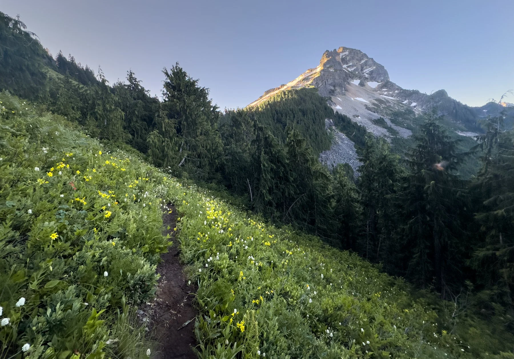
The open meadows along this stretch of trail were full of beautiful wildflowers but every time we stopped we’d get swarmed by mosquitos so we kept hiking and admired the view while moving.
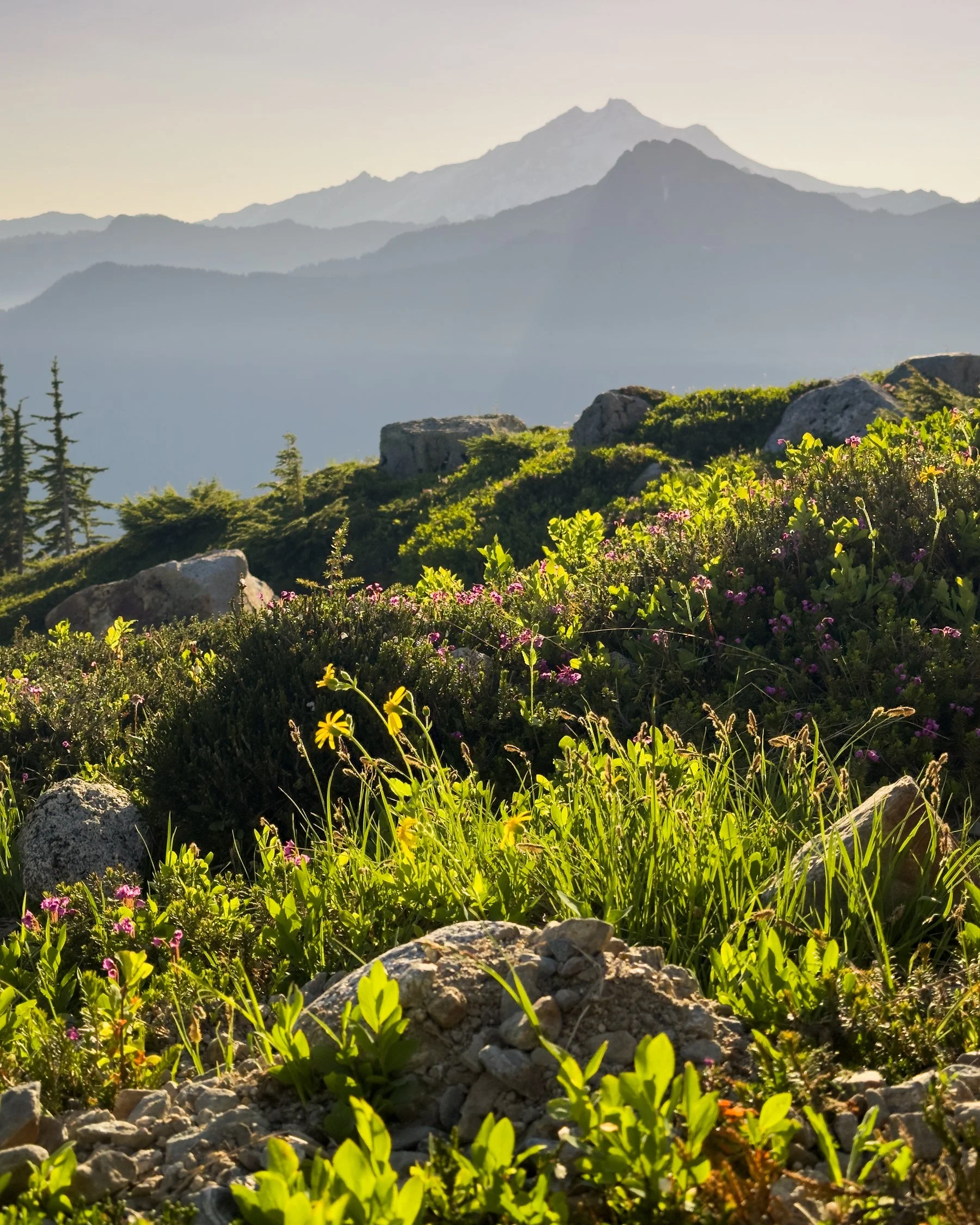

After the meadows we entered a beautiful slabby basin, striped with endless creeks of snowmelt and yet more wildflowers. One of the aspects I loved most about the Sloan Peak climb was how varied it was. I’ve never encountered so many different types of terrains in such a small package before. No segment of trail went on for more than one or two hours so I never felt as if the day were dragging on. I remained fresh and the novelty of every turn was exciting.

We meandered our way up the slabs, making our way toward a notch in the distance. We ended up going a little too high a little too quickly and had a few harrowing route-finding moments scrambling back down to the correct route, but at 9AM we made it to the glacier and began roping up. There were two other groups of three who were also roping up at this point and we would be leap-frogging and climbing alongside these groups for the rest of the day.


The glacier was still in very good shape and made for quick travel. There were a few crevasses opening up but they were easily navigable. The views as we worked our way up the glacier were incredible. Glacier Peak, Mt. Baker, and Mt. Shuksan were all visible, as was a growing fire that appeared nearby Glacier Peak. In the early morning we hadn’t noticed the smoke at all, but as the day carried on the smoke plumes transformed into massive clouds. It’s always a little unnerving to hike with an active wildfire just a few ridges over.

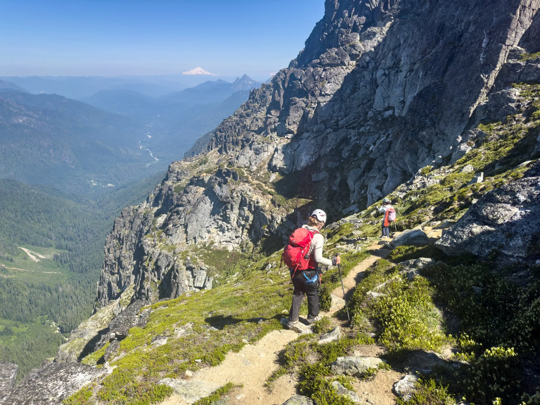
A little over an hour after stepping foot onto the glacier, we hopped off the glacier and onto the rocky ridge. For the first time all morning we got a view to the south and wow, was it stunning! The Monte Cristo group was immediately before us and it was beautiful. I’ve never seen this group of peaks so close before and I immediately imagined potential future trips into the area. I’m always so blown away by just how much there is to explore in the mountains of Washington!

You can see the trail go up through the grass to the left
We took a quick break on the ridge; we reorganized our gear and ate a few snacks while assessing the route ahead of us: the Corkscrew route. The route is so named for how it winds its way around the mountain in a corkscrew-like manner. This was the portion of the climb I was most nervous for. The term “scramble” still makes my hands sweaty and all of the trip reports we read for Sloan Peak noted this scramble had a crux “bear hug” move near the top which both Sam and I were apprehensive about. Kara offered to bring the rope and a few cams up just in case we wanted to protect the move.


Kara completing the “bear hug” move
The beginning of the “scramble” was more accurately just another stretch of trail. It wound its way up and around the south face of Sloan to the west. This trail was still a place you cannot fall but it felt secure and easy to hike on. We made quick work of it and made our way up the short, but loose and rocky, gulley. From there we followed cairns and made our way up, up, and up. The “bear hug” move didn’t come until just below the summit and I definitely breathed a sign of relief when I saw it. It looked so much more manageable in person! In my head I thought the move would leave hundreds of airy feet beneath me, but in actuality it was not a sheer drop. It’s definitely still a no-fall zone with at least a 30’-4'0’ fall below it, but the rocks were secure for both handholds and footholds and we did not feel the need to use the rope.
One hour after we started the scramble, and 7.5 hours after we left the car, we made it to the top. One of the other groups of three was already on the summit so we waited for them to sign the register and take a few selfies before switching places with them. The view from the summit was so pretty, 360 mountain views in every direction. I will never tire of summit views.
We didn’t linger long at the summit because we still had a long descent ahead of us.

The scramble back down took an hour and then we were back on the glacier for another hour long leg. It ended up taking us five hours to get from the summit back to the car, which meant the full day took 12.5 hours and I genuinely enjoyed most of those hours (maybe there was a combined hour of steep snow that I didn’t enjoy, but then again I never enjoy steep snow!) This route was just so fun. I would certainly do it again!

*****
