
Journey to Olympus

Hiked: 7/3/21-7/5/21
Total Mileage: 43 Miles
Total Elevation Gain/Loss: 9,400’
Red Tape: Wilderness Permits needed from Olympic National Park
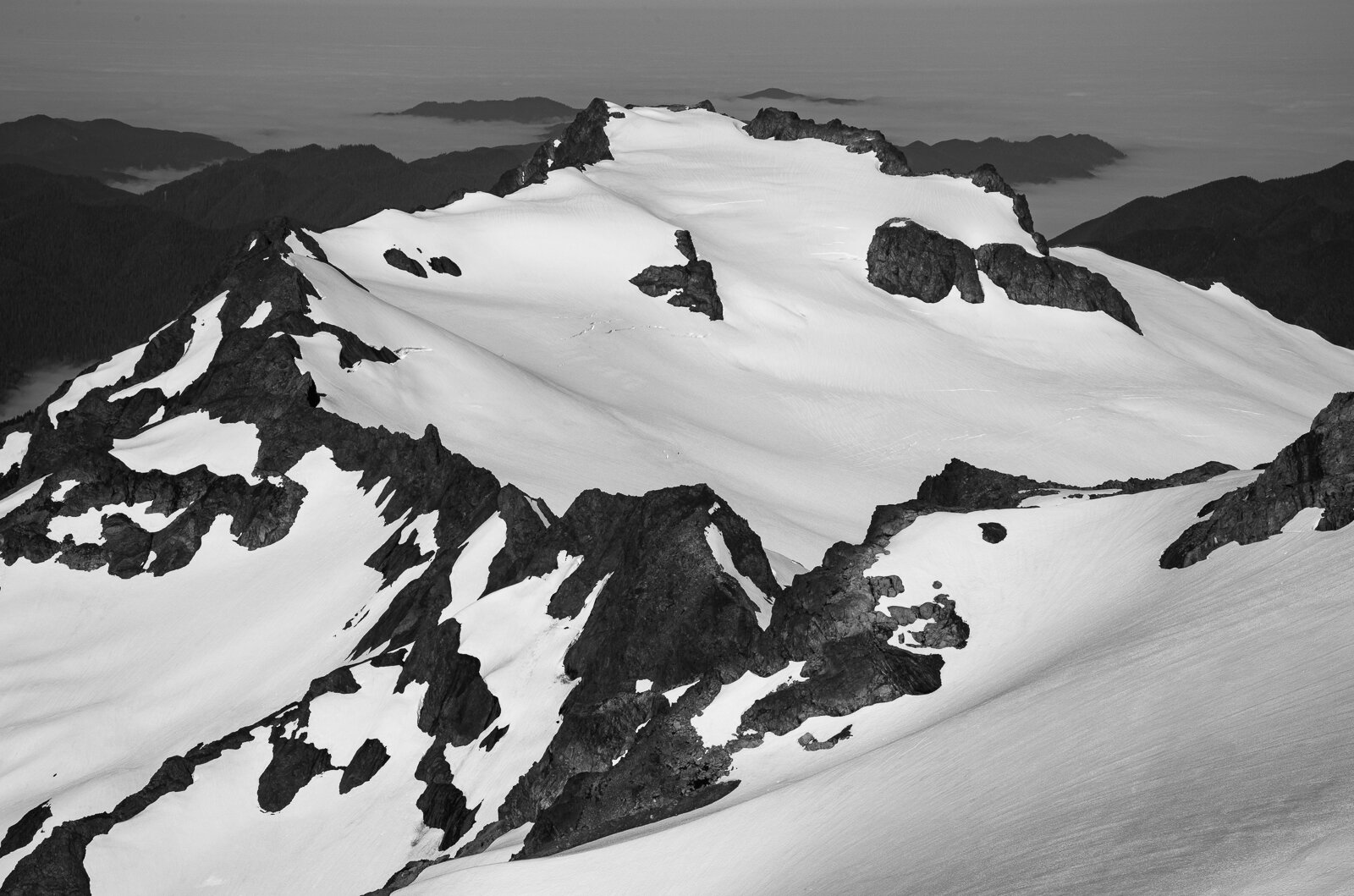
Deep within Olympic National Park, surrounded by the verdant Hoh Rainforest and a winding network of rivers, lies the park’s crown jewel: Mount Olympus. At 7,980’, this peak is the tallest on the Olympic Peninsula and offers a birdseye view of the park. However, getting to the summit is no walk in the park, the trek requires 19 miles of hiking before visitors even glance a view of their lofty objective. The peak is also flanked by glaciers—the Blue, Hoh, Humes, Jeffers, Hubert, Black, and White—their blue tongues reaching into the valleys below, and crossing them requires carrying extra ropes and gear for potential crevasse rescues. Finally, if the hike in and the glacier travel weren’t enough of a challenge already, the final 100’ summit block requires a pitch of trad climbing or a stomach-turning scramble.
Over the long Fourth of July weekend my friend Nate and a few of his climbing friends were attempting to summit Mount Olympus for Nate’s Olympic Project. He invited me along and since I have a penchant for challenging hikes with high payoffs, of course I said yes. The planned trip would be three days/two nights and include a total of 43 miles and approximately 9,400’ of elevation gain. It was a lot to try to cram into a long holiday weekend, but after a spring full of tough treks, I felt ready.

Day 1: Hoh River Trailhead to Glacier Meadows Camp
17.5 miles, 4,100’ gain/600’ loss
The first day was planned to be a slog of a hike that would take us all the way from the Hoh River Trailhead to the Glacier Meadows camp, which acts as a jumping off point for Olympus climbs. We knew we had a long day ahead of us so we got to the park early and were able to easily find a parking spot near the trailhead. We loaded up our packs and we were off. Bound for Olympus.
The first 12 miles of trail were relatively flat, which meant we were able to cruise along at 3mph for the first few hours. The trail was breathtaking—the Hoh Rainforest is one of the most popular areas of Olympic National Park and it is easy to see why. Massive spruces and hemlocks line the trails, standing like centuries old sentinels, cloaked in coats of vibrant moss and lichen. The gray-blue Hoh River cuts a sinuous path down the valley and every so often the trail would open and we would get a view of one of the bends of the river. Usually hikes with long stretches of forest miles seem unending, but the Hoh Rainforest isn’t like other forests and instead of feeling bogged down, I felt enchanted.

Our break at the Olympic Guard Station
The miles whizzed by quickly and before noon we were already at the halfway point of our day—the Olympic Guard Station. Everyone eagerly took off their packs and dug out snacks. The day was as perfect as a summer day could be. Warm, clear skies overhead, and a cool, light breeze to keep it from being too warm. I was feeling good, but I was also feeling apprehensive of the three strenuous back to back to back days. The first day alone was going to match my previous longest day with a fully loaded pack. And then I was going to climb a mountain, and then I would once again match that longest day stat. Not to mention, I was towing along with some of the strongest hikers I’ve ever hiked with!

Mount Tom and the White Glacier viewed from an opening on the trail
After an extended break we hit the trail again, knowing that the toughest portion of the day still lay ahead of us. Our 17.5 miles also came with ~4,100’ of elevation gain, but the kicker was nearly all that gain occurred in the final five miles. Those miles were tough. My feet ached, my leg muscles strained, and my exhaustion began to take a toll. Our pace slowed to a crawl and I had to take mini breaks often. But incrementally, the mileage and elevation gain continued to tick up as we put more trail behind us. Eventually we made it to the crux of the day: the infamous ladder descent.
I had known that the ladder was coming, but my stomach still dropped when I saw it in person. This area of the trail has eroded away into a steep, dusty cliff. In order to aide hikers in the precipitous descent, someone installed a giant ladder and rope system.
None of the photos I had seen of this ladder prior to the trip seemed to accurately capture just how long and steep it is. I’m afraid of heights so this was a challenge for me. All the dudes in the group, very comfortable with exposure, whizzed down the ladder with the ease of a mountain goat. I stood at the top with two other hikers I had just met, Jake and Emily. I watched nervously as others descended, trying to memorize their technique and handholds and foodholds.
Finally, it was my turn. I hesitantly walked over to the rope and ladder and began picking my way down the slope. I tried to focus only on looking where I was placing my feet, blurring out my peripherals and their dizzying effect.

Calvin, Nate, and Marko descend the ladder
Rung by rung I lowered myself. There were a few sections where the wooden rungs had broken free on one side and dangled haphazardly and utterly useless. In those areas I took extra care, tightening my grip on the rope and double checking each foothold before placing weight on it. This went on for what felt like an hour, but was only a few minutes in reality, until I hit level ground again. I dropped the rope by my side and continued along the trail, my stomach still in knots and my legs still tense.
Thankfully, after the ladder it was only a couple minute stroll to our camp at Glacier Meadows. We found a site that would accommodate our tents and got to work on dinner. We were planning to wake up at 2am the following morning so we didn’t stay up late. I crawled into my sleeping bag when it was still light, set an alarm, and quickly fell to sleep.

Another group on the Blue Glacier during blue hour
Day 2: Mount Olympus
8 miles, 4,700’ gain/loss
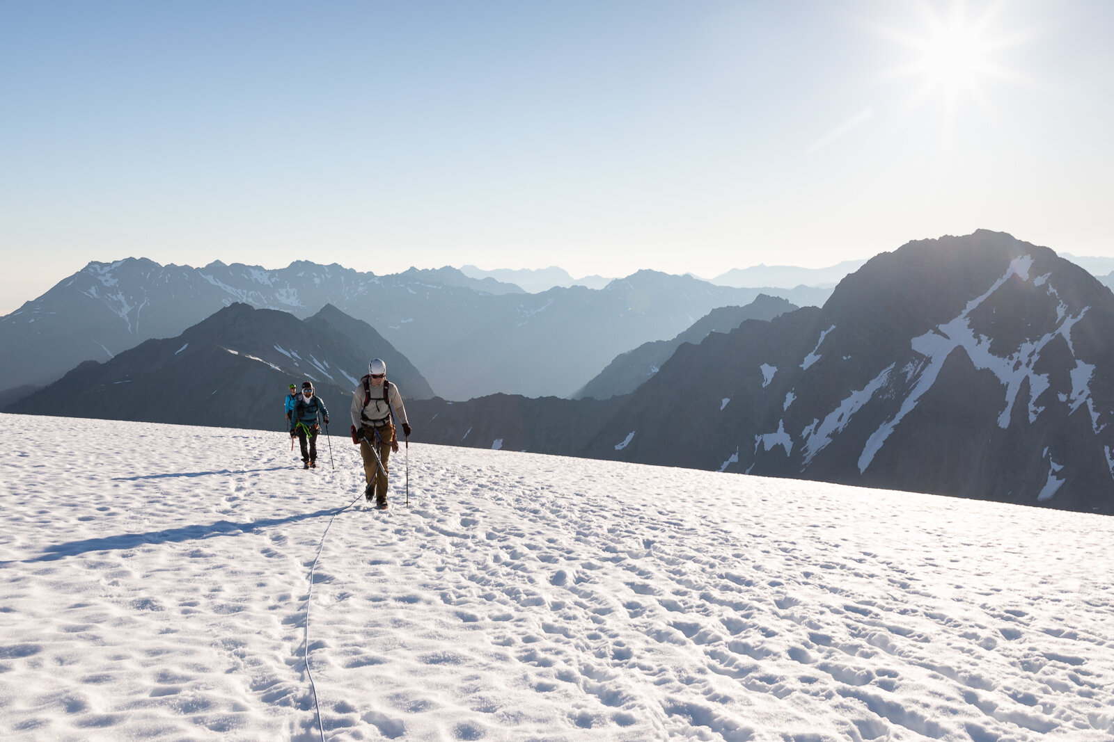
From Glacier Meadows Camp to the summit of Mount Olympus is ‘only’ about four miles and just under 5,000’ of gain, but the glacier travel, moraine navigation, and summit block take up quite a bit of time. In order to minimize the amount of time we would spend on the glacier during the hottest part of the day (which elevates the potential for icefall hazards), we were on the trail by 3am, traveling by the halos of our headlamps.
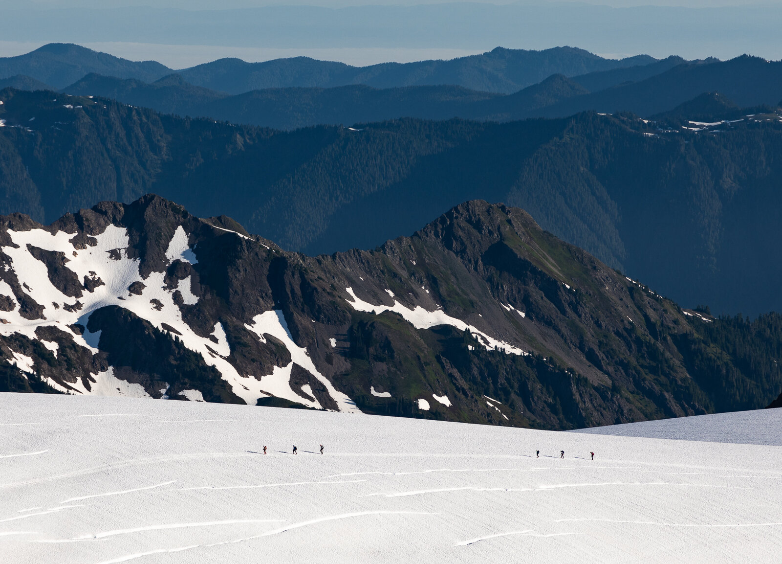
The hike up to the moraine was steep for tired legs, but after half an hour we broke out of the forest and gained the ridge of the moraine. The snowy slopes of the Olympus Massif vaguely glowed during the morning twilight. I could see the tongue of the Blue Glacier far below us and knew that’s where we were heading. We still had so far to descend. It was tough to navigate down the crumbling moraine in the dark, but after I saw the moraine in the light of day, I was relieved that I was blissfully unaware of just how steep some of the drop offs were as we quickly descended a couple hundred feet on unsettled rock. We kept setting off slides, yelling “rock” every time a dislodged piece went catapulting downward.
Once on the snow, we put on our harnesses, helmets, and assembled into two rope teams.


Sunrise colors
As we made our way up the Blue Glacier the sun began to rise, drenching the landscape in vivid oranges and pinks. There is nothing quite like starting a hike in the depths of night and being rewarded with a beautiful sunrise from a high vantage point.


Views from the top of Snow Dome
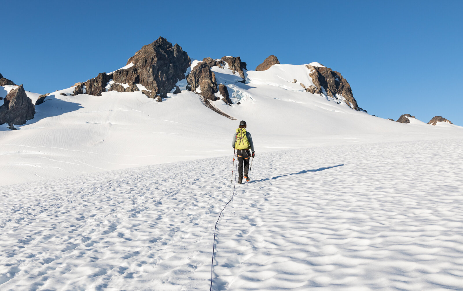
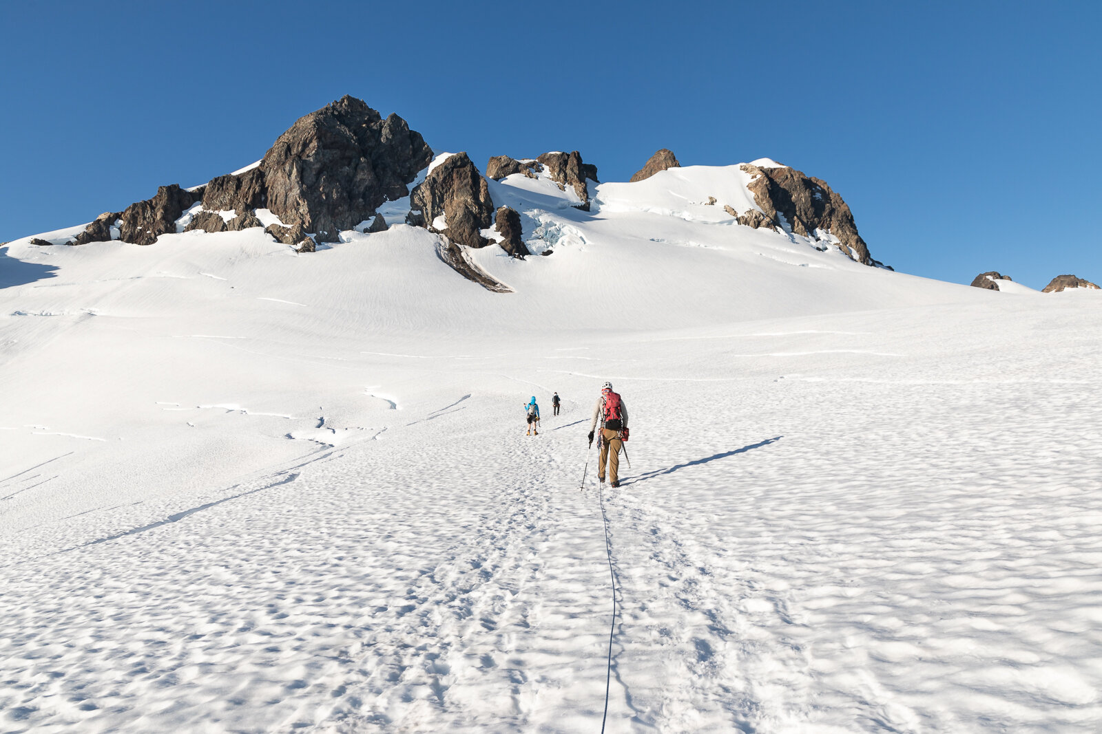
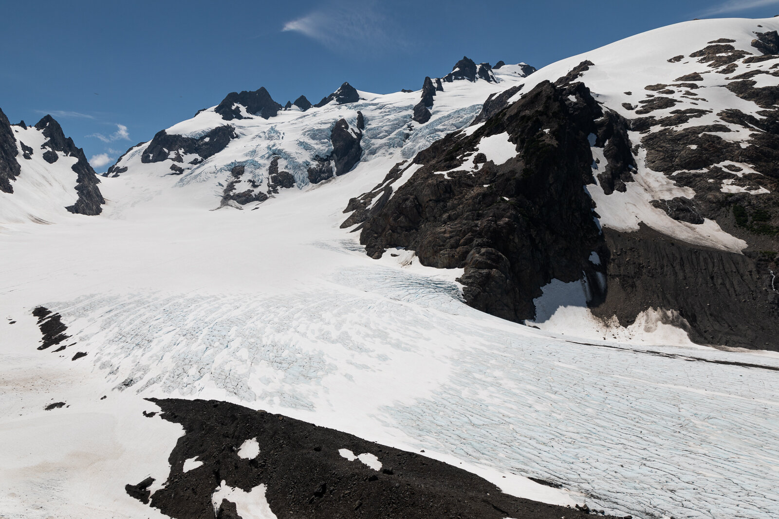
After we crossed the Blue Glacier, our next challenge was ascending Snow Dome, a steep section of snow that leads climbers up to a flat, cruise-y expanse of the glacier. Being on top of Snow Dome and looking down onto the lower glacier, icefalls, and crevasses felt magical. It’s views like this that keep me coming back to these places.
We made our way toward Crystal Pass, enjoying the burgeoning bluebird day every step of the way. We were happy to find that there was no gaping bergschrund to contend with at Crystal Pass, an issue it has later in the season when more snow melts.
From the pass we had another ~700’ climb that brought us to the last hurdle before the summit block: a short, albeit very exposed scramble. When I saw this scramble, my heart dropped. In that moment I knew my chances of summiting plummeted to near zero. The glacier travel had already taken a big mental toll on me. I could feel my mind fraying under the heightened state I was in as we navigated the glacier, knowing that at any moment I might fall into a crevasse, or slip and fall down a steep snowy slope. Additionally, I was well aware that the summit was only the halfway point. I still had to do everything I already did again. Doug, Calvin, and Marko easily made their way over the scrambly bits while Nate waited for me to slowly attempt the scramble. Every rock I touched moved. Everywhere I placed my feet shifted. I couldn’t do it. I told Nate to go on without me and turned around, tears welling up in my eyes. I backtracked and found a bare and flat expanse of rocks to sit on while I watched the rest of my group make their way up to the top.

The Mount Olympus summit block, the scramble to the summit block is in the shadows of this photo. To the left is a drop of hundreds of feet, definitely a no fall zone!
I had a good cry and was able to get my frustrations out. Frustrations about my fear of heights, fear of falling. Frustrations with not being stronger or faster or more competent. After I got that out of my system, gratitude began to replace my disappointment. I looked around and took in some of the most stunning mountainous landscapes I’ve ever seen. No one else was around, it was just me in this postcard scene. Sure, I didn’t make it the final 200’ to the summit, but I did make it this far. I did get to enjoy spectacular mountain views. I pushed myself on glacial terrain and further expanded the edges of my comfort zone. After a few minutes, I wasn’t even upset that I didn’t summit. I was just happy I made it as far as I did.
Mount Tom from my stopping point

The rest of the group coming down from a successful summit
After their successful summit, the rest of the group rappelled down, descended a snow ramp, and scrambled back over to where I was. I congratulated them and then we roped back up and began our long descent. The snow had softened up quite a bit, which was conducive to plunge stepping. Descending down Snow Dome was a little harrowing for me, but Doug and Marko (who were on my rope) were patient and helpful as I led our rope team slowly back down to the Blue Glacier and finally across to the heaping moraine pile. The moraine ended up being much easier to ascend than it had been to descend, and it wasn’t long before we were back at camp.

Doug and Marko and the Blue Glacier
At camp we celebrated with “Maker’s Marko”, fresh smoked Steelhead that Doug recently caught, and soaked our feet in the ice-cold stream near camp.
It was another early dinner and I called it a day at 5:30pm and slept the deep, dreamless sleep of the exhausted.
Blue Glacier from the moraine
Day 3: Back to the Trailhead
17.5 miles, 600’ gain/4,100’ loss
Our third day was going to be another whopper of a day mileage wise—luckily almost all downhill this time—so we got an early start. It was nice to get the ladder out of the way early. As with most terrain, this was easier on the way up. Once again, I made sure to keep my eyes focused on where I was stepping and it wasn’t long before I was at the top of the ladder. I scurried along the dusty ledge and we headed back into the forest as a group.

While on the approach we all hiked together, on our way out we each fell into our own hiking pace. The miles flew by in a green blur and after a few hours we were at the Guard Station again. This time there was a Ranger there who checked our permits and chatted with us while we snacked and refilled our water bottles with freshly filtered water.
The final few miles of trail were tough. We knew we were getting so close to the trailhead and yet it seemed elusive, always out of reach. After just over 6.5 hours we made it to the trailhead.
We cheersed the end of a successful trip with ciders and beers. The nearly-empty parking lot we had left was now overflowing with vehicles and hikers. The whole scene was a far cry from the countless hours we had spent hiking and climbing in solitude, but all good things must come to a close.
Despite the lack of a summit, I’m grateful for this experience. It is a bummer to hike over 20 miles and gain nearly 8,000’ of elevation only to stop 200’ short of your goal, but in the scheme of things the summit is really a brief moment during a trip like this. Merely minutes of a multiday trek. The miles and hours of hiking and climbing are not negated by turning around. Yes, it’s always nice to wrap a trip up with a pretty bow in the form of a summit, but it’s also nice to just be in the mountains. Plus, there’s always next time!
