
Skiing Ruth Mountain

Dates: 5/22/21-5/23/21
I first saw Ruth Mountain in the summer of 2019 while Alex and I were hiking the Copper Ridge Loop. We were on the early stretches of the trail, making our way toward Hannegan Pass when a beautiful mountain face, its upper slopes still draped in snow in late summer, came into view. In my planning process for that hike I had been so fixated on the camp spots and other high points that I had entirely overlooked Ruth Mountain, but it was impossible to overlook on the trail, it dominated our views. As we got closer I said to Alex, “I’m pretty sure you can ski off that. We should do that!” 1.5 years later and we did just that!
However, we didn’t just want to ski Ruth Mountain, we also wanted to camp on its summit to fully appreciate the views of Shuksan and the North Cascades during the golden glows of sunset and sunrise. So we loaded our packs with overnight gear, our skis, and our boots and we hit the trail at approximately 9AM. The trail is 6 miles to the summit with 4,400’ of gain, which isn’t too daunting on paper, but it was still the middle of May when conditions are at their most volatile. We weren’t sure how far the snow line had crept up so to be safe we started the hike in our trail-runners.

Alex crossing one of the many avalanche paths along the trail
It turns out that the snow line hadn’t crept that much at all! After only a few minutes of hiking we encountered our first patch of snow. A few minutes later we encountered another. The trail crossed avalanche path after avalanche path and the thick debris piles had not yet melted so we were forced to cross each and every sketchy pile of snow. To make the hike even more precarious, many of the avalanche debris piles also happened to have snow bridges that we had to navigate. Some bridges were still solid, others appeared to be as flimsy as a potato chip. We carefully made our way around the snow bridges that were flimsy and hurried across the ones that appeared they would hold our weight in a gut-wrenching game of backcountry roulette.
In the summer this portion of the trail was a breeze to hike and we clocked 20 minute miles. However, in the winter our pace slowed to a crawl. After two hours we still hadn’t even started the ascent up to Hannegan Pass, instead we were buried in the snowy depths of the forest. But, despite the snow surrounding us, we were hot. The sun bore down on us and reflected off the snow in a double whammy blow to our morale and energy reserves. Eventually, after over four hours we made it to Hannegan Pass where we threw our packs down, guzzled water, and ate handfuls of snacks. We sat in the shade and enjoyed the heavy silence that I’ve grown to love in snowy landscapes.

Making our way toward Hannegan Pass

After half an hour we decided it was time to resume our efforts with a cool 500’ bootpack up a steep and slushy slope.
When we finally rounded the knoll marked as point 5830 on topo maps, we got a stunning, panoramic view of Ruth Mountain. It was 4:15PM and the summit still loomed far overhead and our energy levels were deteriorating. The wind also had picked up quite a bit, despite the forecast which called for 0mph winds with 0mph gusts. Without even saying the words out loud, both Alex and I knew we weren’t going to make it to the summit in time to set up camp and relax before sunset. From our vantage point we saw an inviting cluster of trees huddled on a flat expanse of the Ruth Arm that looked like it was only another ten minutes away. We decided we would camp there for the night.

The panoramic view of Ruth Mountain that we saw when we rounded the knoll

Camp for the evening
The spot ended up being perfect; it was sheltered from the wind, flat, and had views into the sprawling valley below and a peek-a-boo view of Mt. Baker. We went to work setting up the tent and melting snow for water.
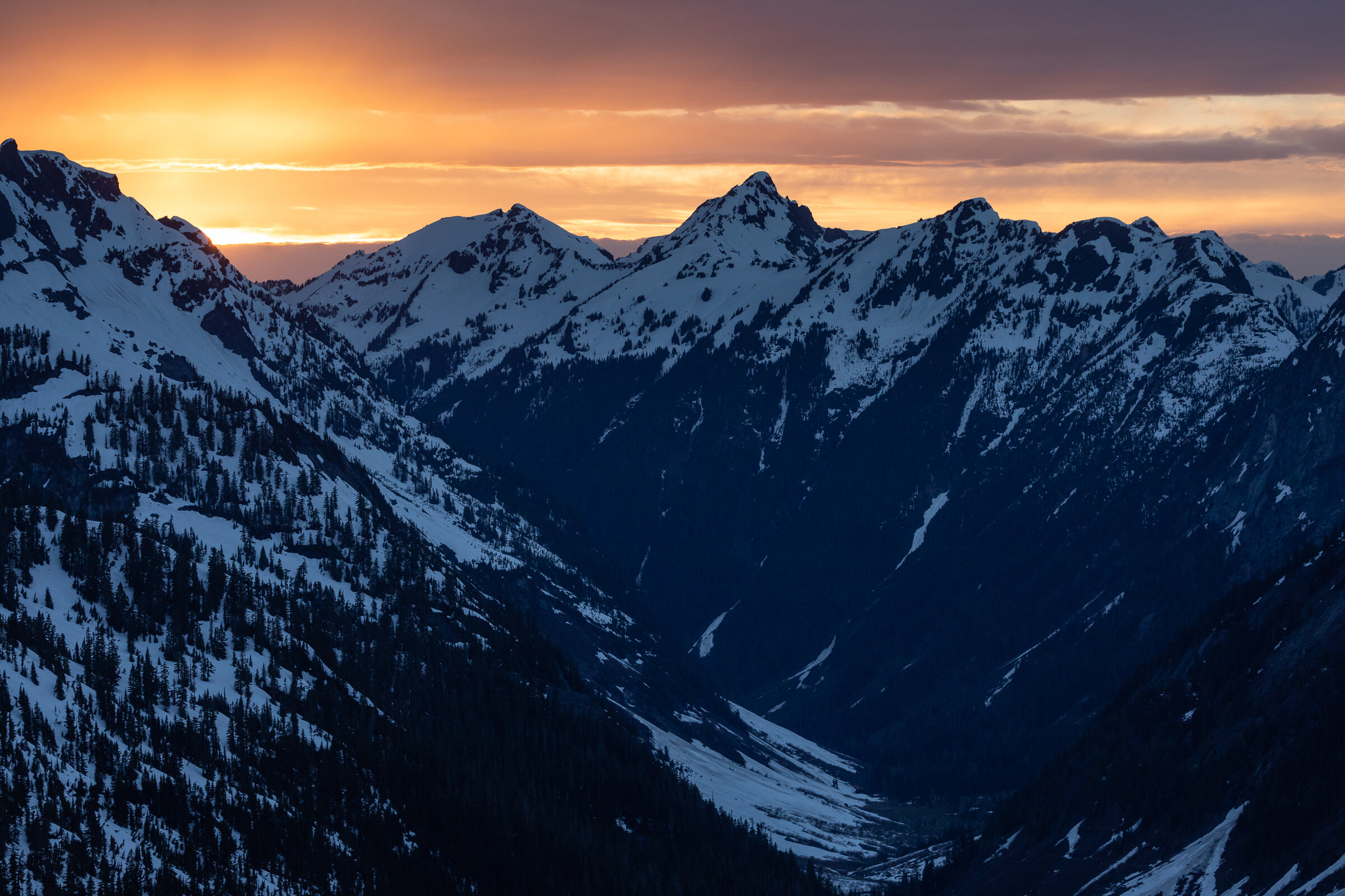
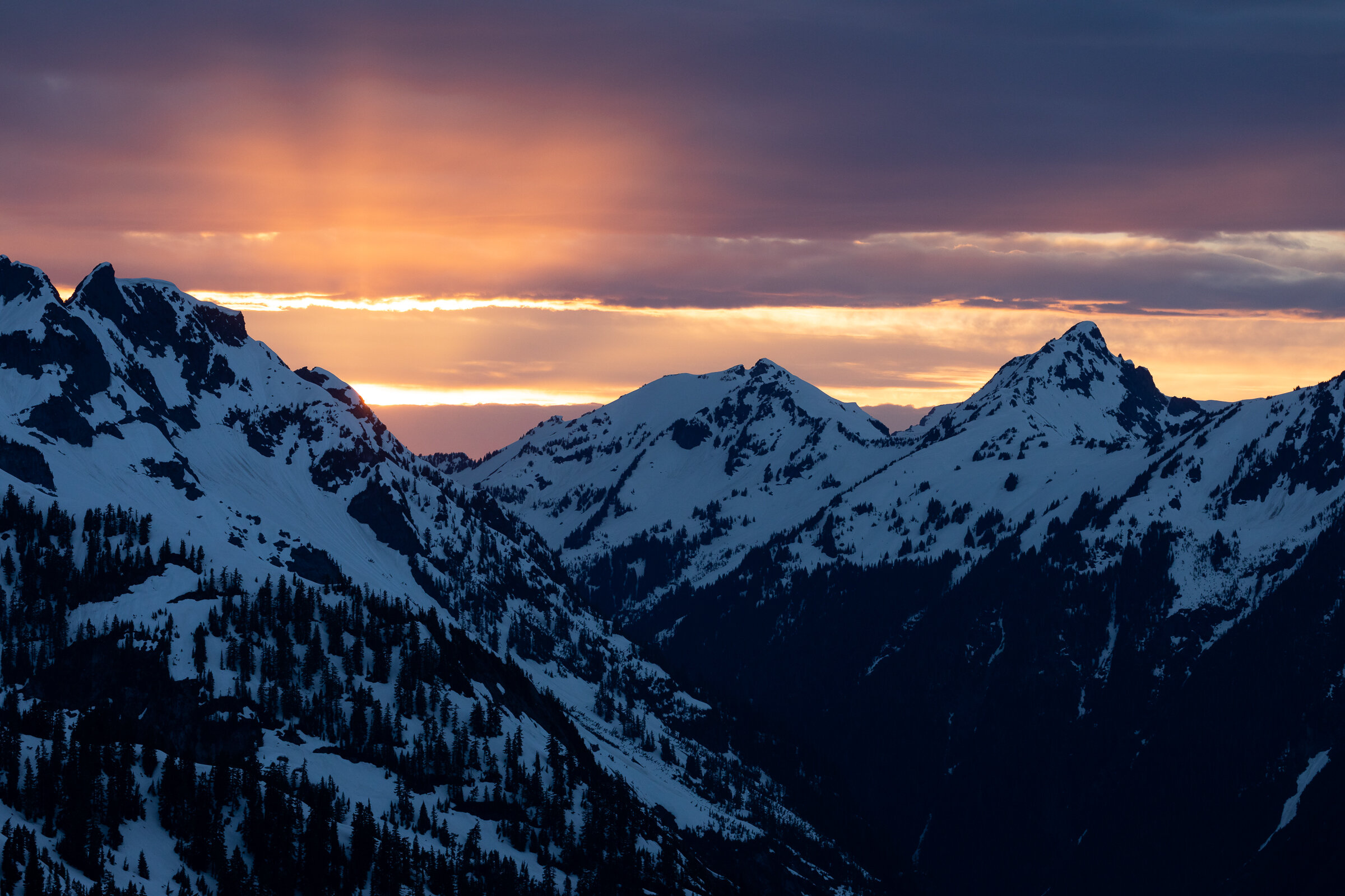
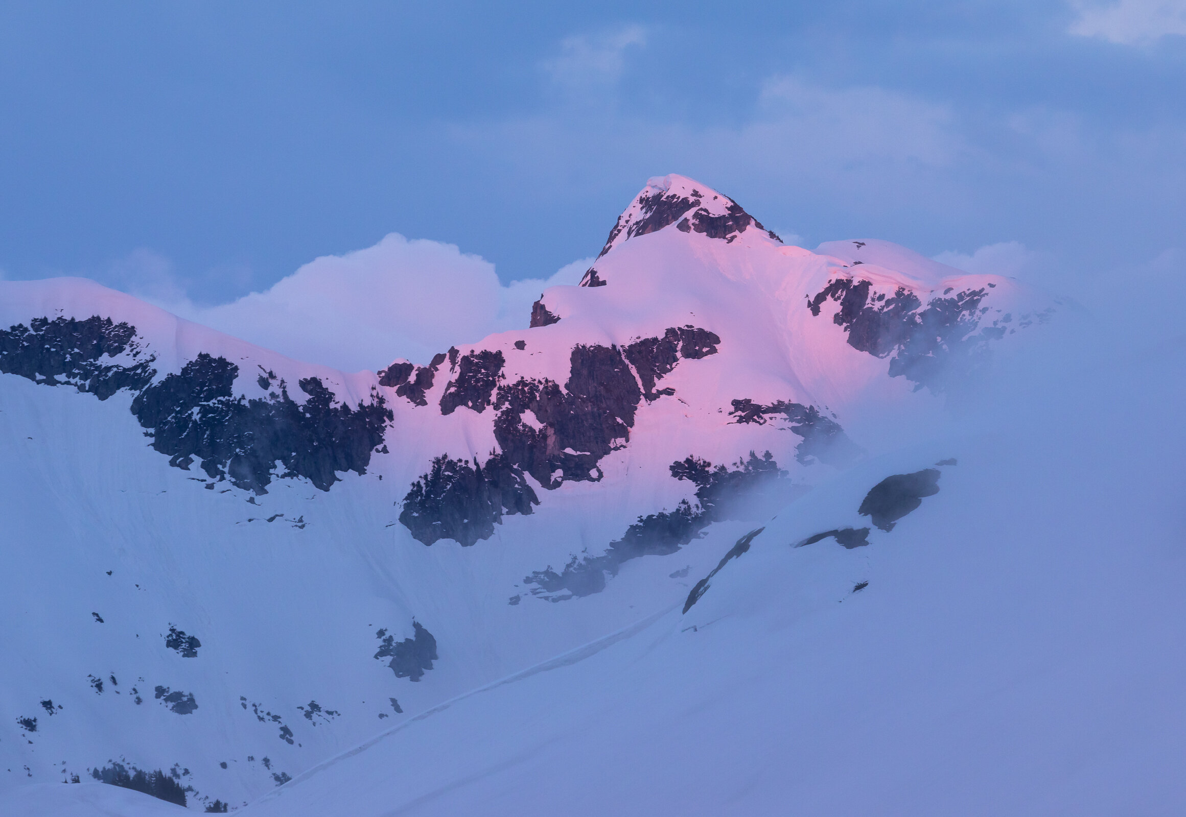
The clear sky that we had hiked under all day was now being filled with thick, grey clouds. It appeared that there might not be a beautiful sunset after all. The forecast had been disappointingly inaccurate so far. What was predicted as an evening with no winds and perfectly clear skies ended up cold and windy. We ate dinner and watched the scene before us. Shadows danced across the mountain faces and, disconcertingly, we noticed an incoming cloud bank rolling over one of the ridges to the east. It resembled a wave breaching a wall; the clouds poured into the valley below just as a waterfall would pool in a river.

A wave of clouds pouring over Whatcom Peak
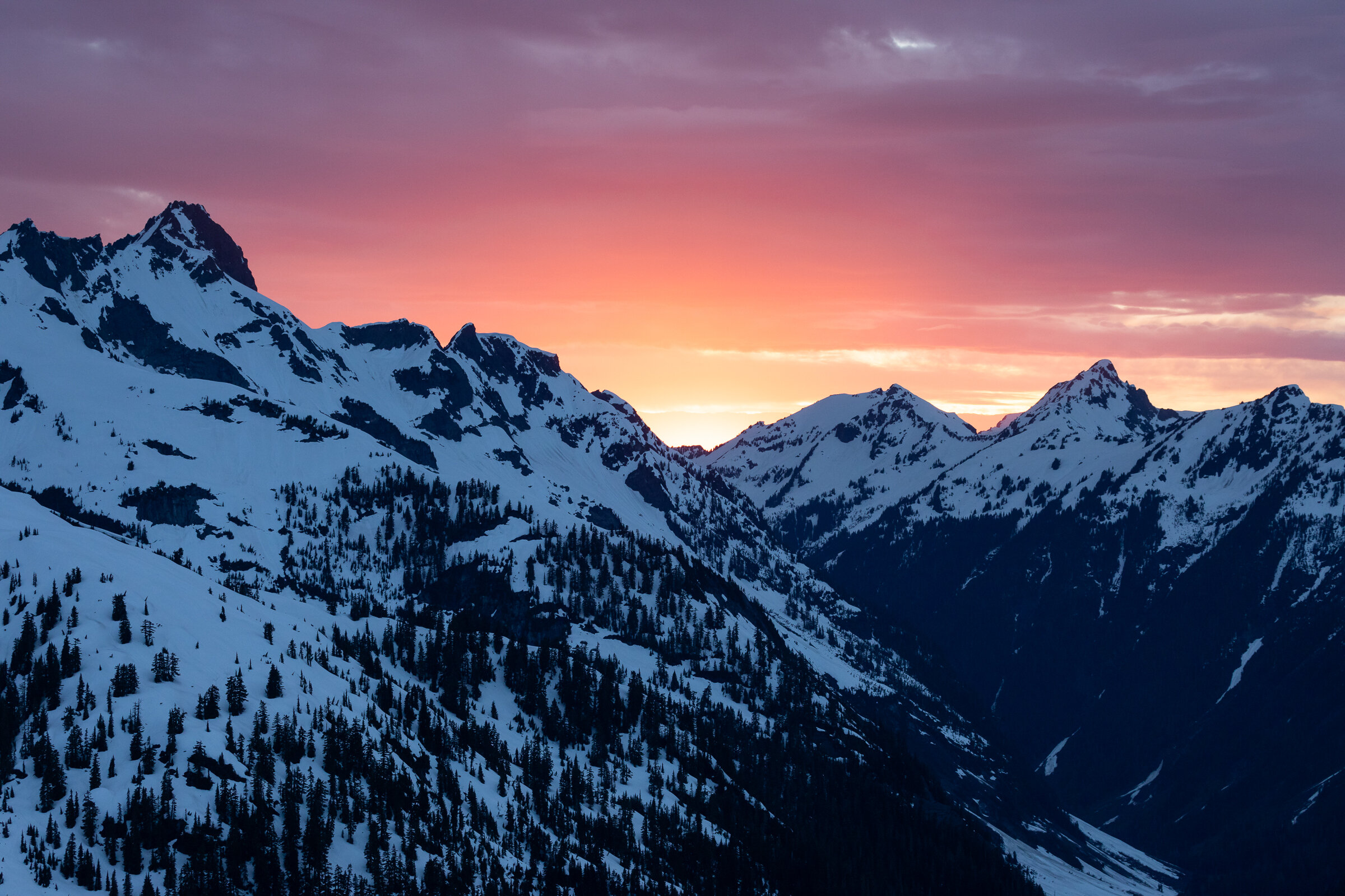
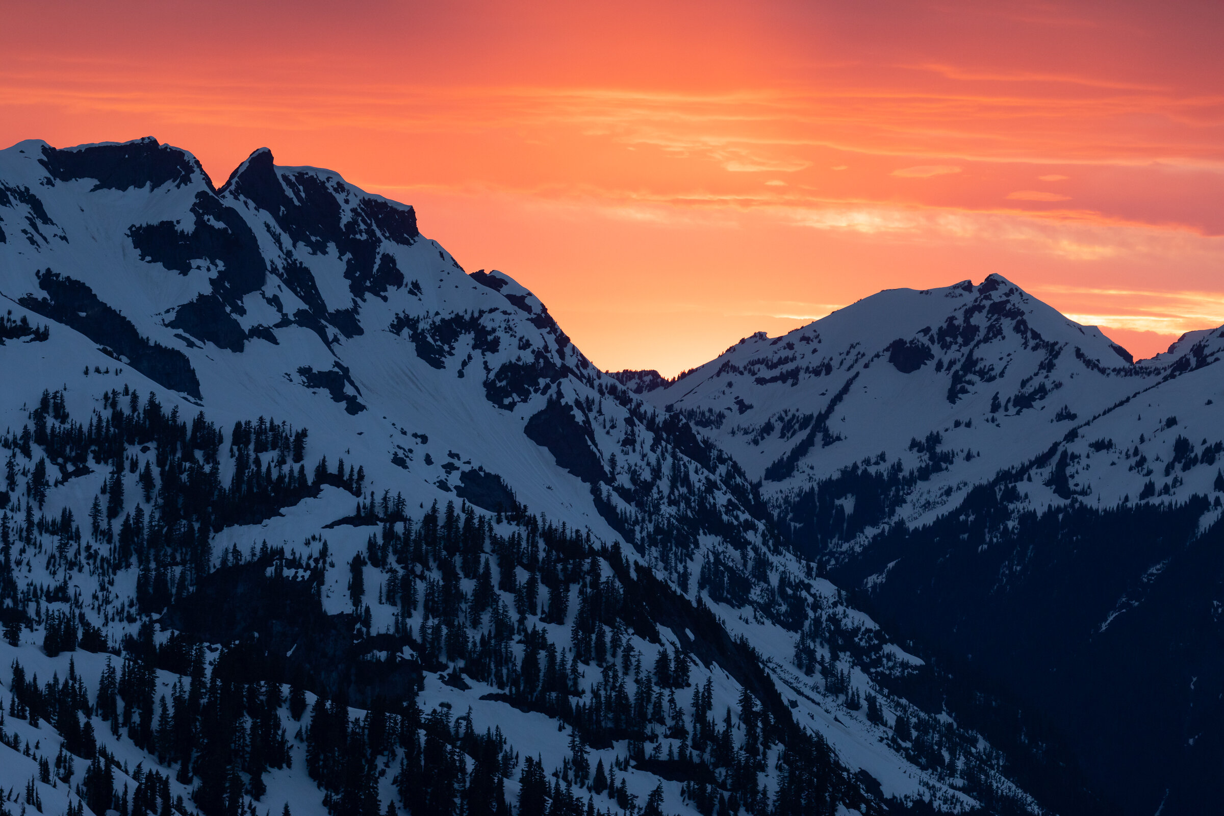
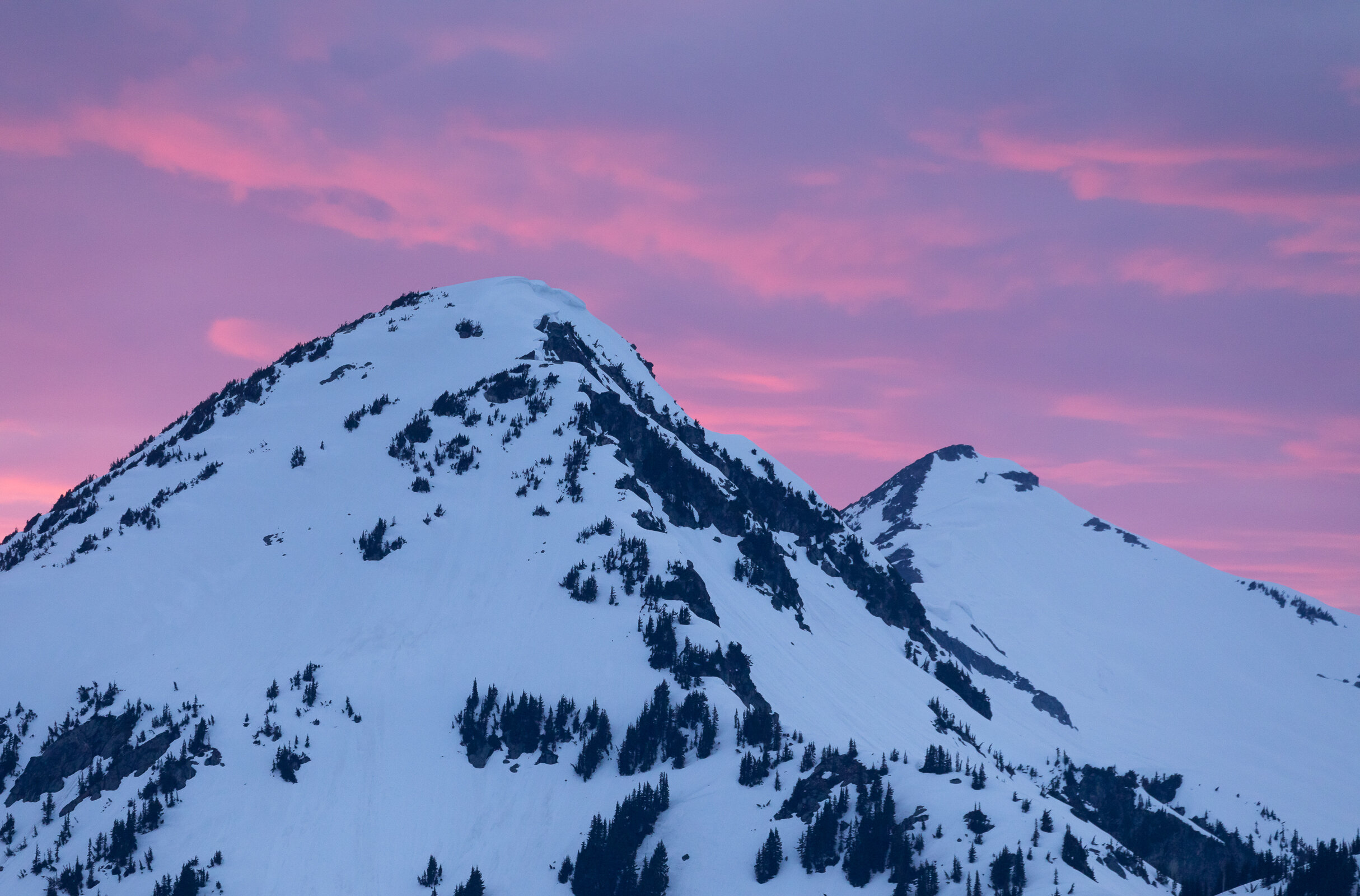
Golden light began to illuminate the sky and clouds. It wasn’t the fiery sunset that we had been hoping for but it was better than nothing! I enjoyed the scene and took a few photos before crawling into my sleeping bag for the evening while Alex stayed out to melt more snow. I was about to drift off to sleep when suddenly Alex’s voice sounded from right outside the tent door, “it’s turning pink!” I quickly grabbed my camera and hopped out of the tent still in my down booties. The scene that unfolded next was something that dreams are made of. There was a break in clouds at the horizon that allowed the sun to shine through and illuminate all of the other clouds in the sky. They turned orange, then pink, and finally a fiery red. Every time I thought that the light had to start fading soon it would morph into another brighter color. Finally, true alpenglow drenched the peaks in fuchsia as an encore.

Mt. Baker during the final moments of light
We went to bed completely giddy after witnessing that sunset. Suddenly, all our exhaustion from the day faded along with the last light.

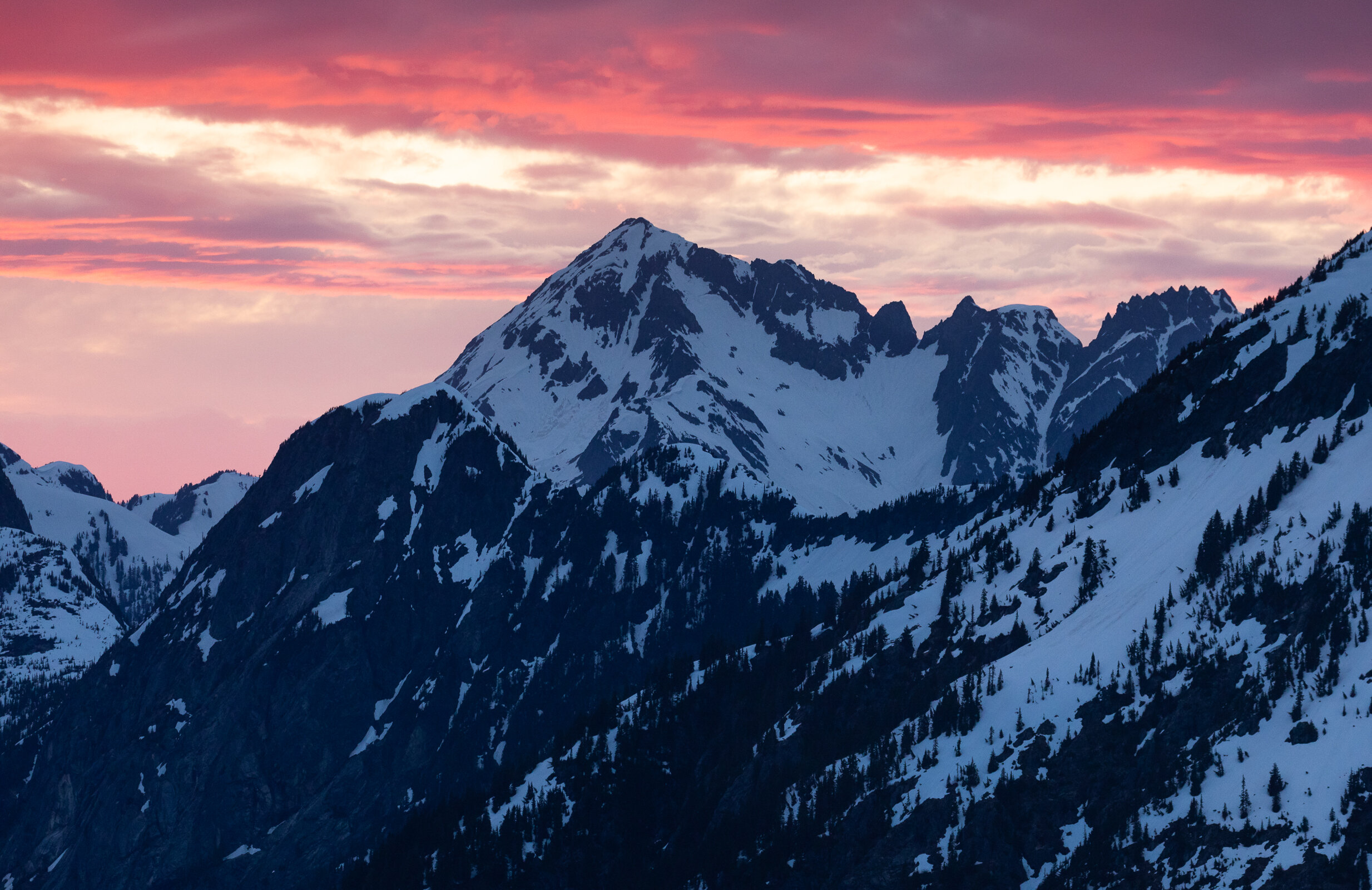
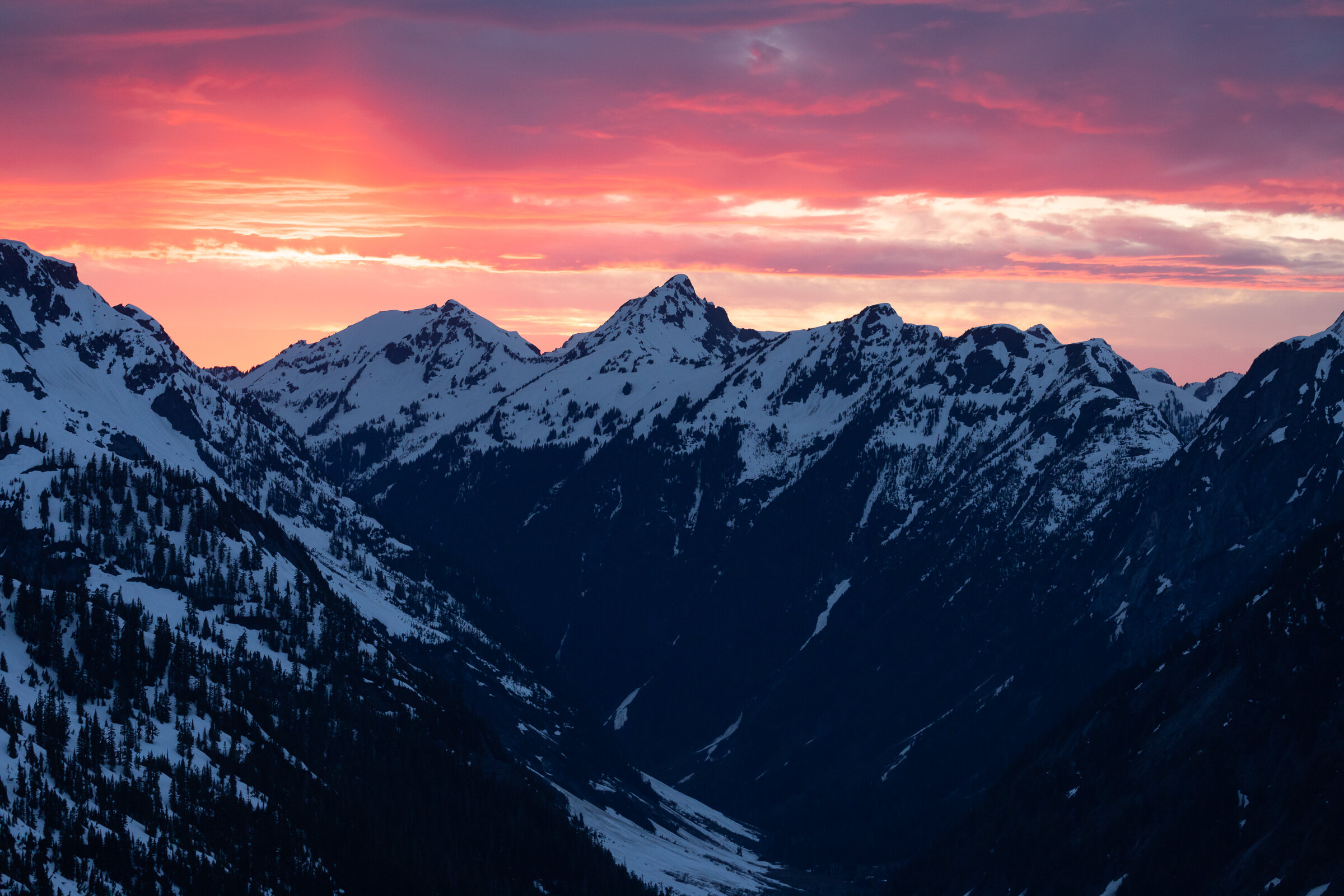
Sunrise light

The next morning I woke up at 4:30 to see how the sunrise was progressing. While it wasn’t nearly as spectacular as the previous night, it was still a pretty dawn. I went to work making breakfast as the first light of day graced the summit of Ruth Mountain. It looked like it would be another beautiful day in the North Cascades.
After breakfast, we packed up all our gear in our tent to minimize the amount of time we would have to spend at camp after we skied down from the summit. Finally, we got our packs loaded, put on our helmets and harnesses, and started heading up the slopes. Two groups had already set out ahead of us and were making quick progress.

Roping up to cross the glacier near the summit
The cloud banks that we had first noticed the night prior were back. While we were making our way up the slope they continued to grow until they engulfed us and we were hiking inside a cloud. Frustrated, we stopped in our tracks unsure of whether it was a passing wisp of a cloud or something more stubborn. After a few minutes the cloud began to filter past us and we continued our climb. We climbed and enjoyed the views around us until we were about 200 vertical feet below the summit and another cloud bank crept in. This one seemed like it was going to stay. Still, we continued toward the summit and about fifteen minutes later we found ourselves on the true summit surrounded by a wall of white. The wind had picked up and there were no breaks in the clouds, no small window from which we could see any views (or our descent line, for that matter). After a quick snack and a selfie, we put away our rope and got ready to ski.

The summit marker
We had spent the previous afternoon and evening watching groups of skiers jubilantly ski down the face of Ruth Mountain in beautiful S-curves. As we watched them I imagined our own descent and felt that it would make the strenuous hike in well worth the effort. Unfortunately, it appeared our ski would be much less jubilant and much more like survival skiing as we picked our way down the mountain with awful visibility.

Skiing down in the white out
The ski was disorienting. It’s easy to lose your sense of direction when everything around you is one uniform shade of white. It was also easy to lose sight of Alex, we could only make a few turns before we would have to stop and regroup or we would lose each other in the clouds. Luckily, the cloud seemed to be parked right on the summit of Ruth Mountain and after descending a few hundred feet we found ourselves below the cloud with great visibility. We zoomed toward camp to pack everything up.

We decided that instead of retracing the path we had taken into camp, we would ski straight down into the valley from the west side of the ridge we camped on. It appeared to be a much more straightforward exit and all of the chutes below still held snow. This route was definitely faster, but it also had its fair share of obstacles—a common theme on our ski mountaineering trips! The first obstacle presented itself as a steep gully that held soupy, slippery snow. We sideslipped most of our way down that before finally breaking out and making a beeline for the valley floor. From there we picked up a skin track and began to head down the valley. Since we descended so quickly along this route, we had a couple miles of bushwhacking as we made our way down the valley, through the forest, and back towards the trail. We battled the trees (the trees won) and plunge stepped through more avalanche debris piles. I checked my Gaia route intermittently and eventually, our yellow marker was right on top of the trail. Finally, it was smoother sailing.

Alex refusing to take off his skis as we made our way back toward the trail
We made it back to the trailhead just after 3PM. Another full day of adventuring in the books! Ruth Mountain was a challenge. I’ve discovered that ski mountaineering objectives are always much more difficult than they appear on paper. The route-finding is difficult. The bootpacking is difficult. The variable snow conditions are difficult. But, the rewards can be well-worth the efforts. And when I’m standing on a mountain, watching a beautiful sunset, all of the exhaustion and soreness seem to melt away. We’ll be back to enjoy the views from Ruth’s summit someday!
