
The Elusive Snowfield Peak
DATES HIKED: 7/4-7/5/25
TOTAL MILEAGE: 19 MILES
TOTAL ELEVATION GAIN: 9,500’
Over the Fourth of July weekend, my friend Kara and I climbed Snowfield Peak, a mountain that we have been wanting to climb since 2023. Each year, some weather-related event prevented us from even stepping foot on the trail. In 2023, just days before our planned trip, the Pyramid Area wildfire sparked and the entire area was closed. We decided to find a different objective since we already had time set aside and climbed Chiwawa Mountain in the Glacier Peak Wilderness instead. In 2024, the weekend we scheduled our Snowfield climb coincided with an oppressive heat wave that swept into the region and, not wanting to haul our overnight gear and glacier gear up in the heat, we pivoted to doing Sloan car to car instead. This year, we decided to plan the trip at the beginning of the season to try to avoid the wildfires and heat waves that can afflict the North Cascades later in the season. The strategy paid off. Finally we got our Snowfield summit!
Trips in North Cascades National Park always stress me out a bit because of the hassle of needing to secure limited and highly sought-after permits. To be extra sure we would get a permit over the long holiday weekend, I took off work the day before our trip and made the trek to the ranger station in Marblemount. It was a lot of driving, but I didn’t want to risk the climb due to red tape. Once again, the strategy paid off because I waltzed right into the ranger station, up to the front desk, and a few minutes later I walked out with our permit for the Colonial XC Zone for 7/4. We planned to camp at the Neve Col and apparently the park recently redrew their XC zone boundaries. Climbers were getting confused about the Neve Col camp, not knowing if they needed a Snowfield XC Zone permit or Colonial XC Zone permit, so the park decided to make it easy and extend the Colonial boundary. Now anyone camping in the Colonial Basin or at high camp on the col will need a Colonial permit.
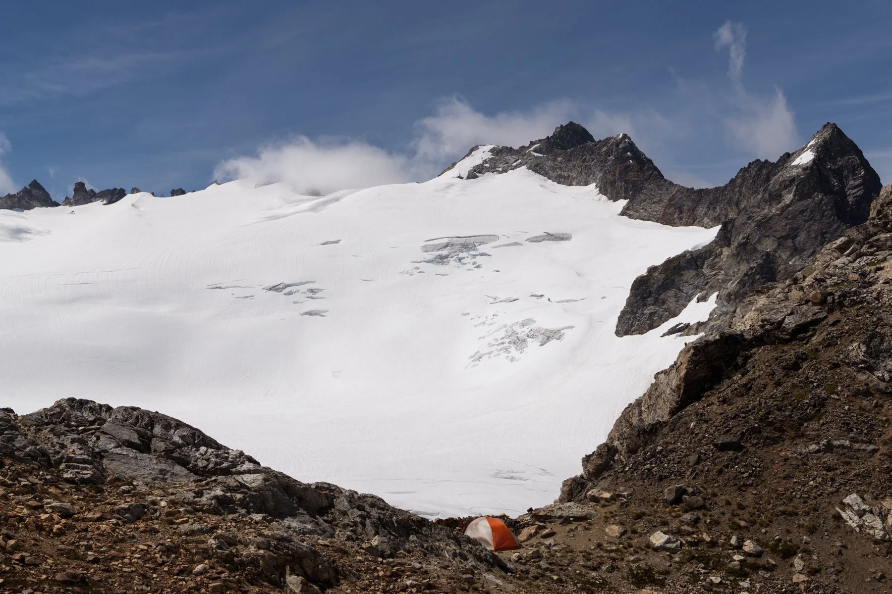
Our tent at high camp
DAY 1: TRAILHEAD TO HIGH CAMP AT NEVE COL | 7 MILES | 6,550’ OF GAIN, 800’ OF LOSS
Kara and I met at the Pyramid Lake trailhead at 8AM for a reasonably early (but not brutally early) start to the day. Kara opted to stay at the Colonial Campground nearby, but I chose to drive up from Seattle since the third was Alex’s birthday and I wanted to spend time with him.
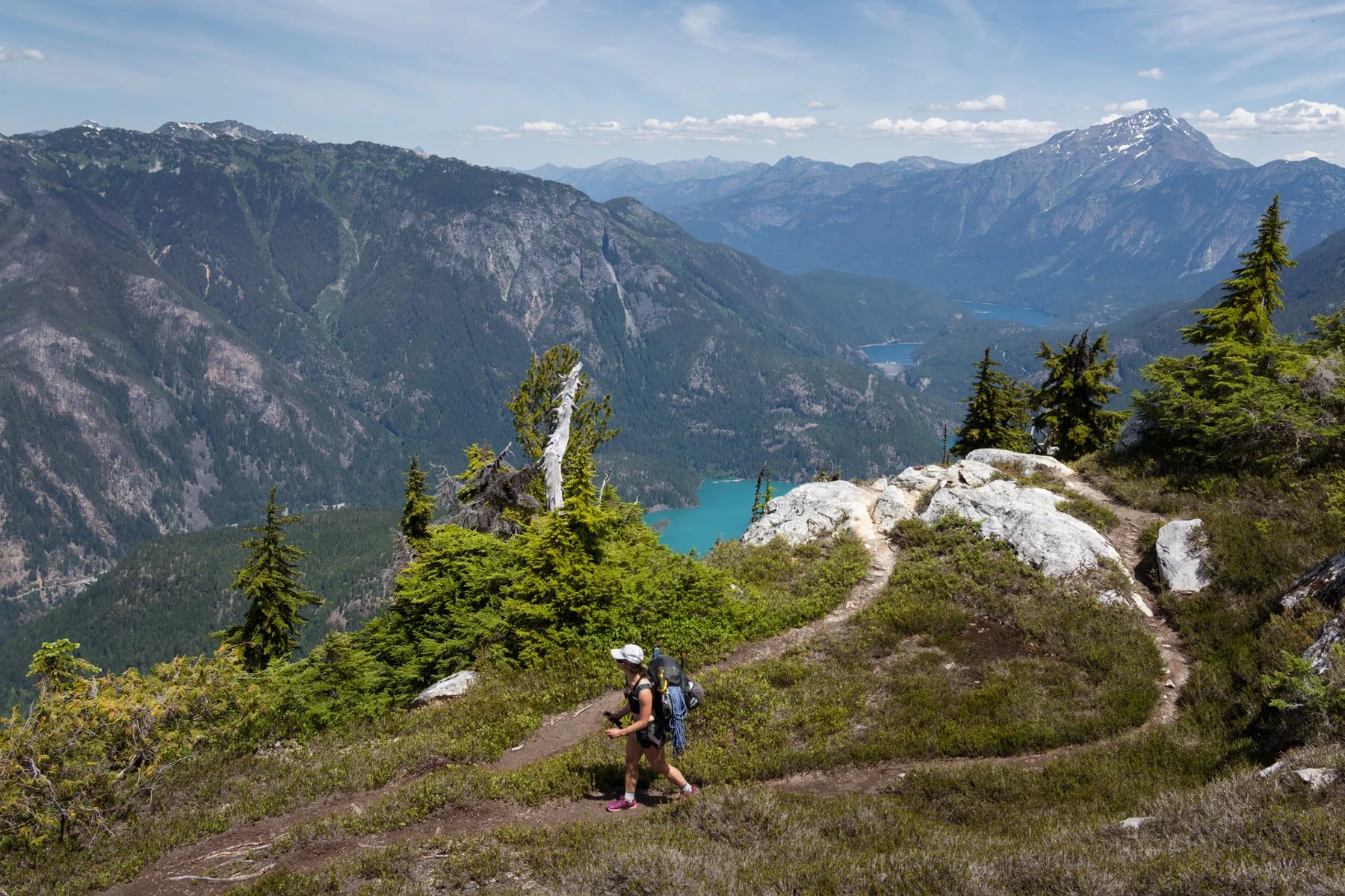
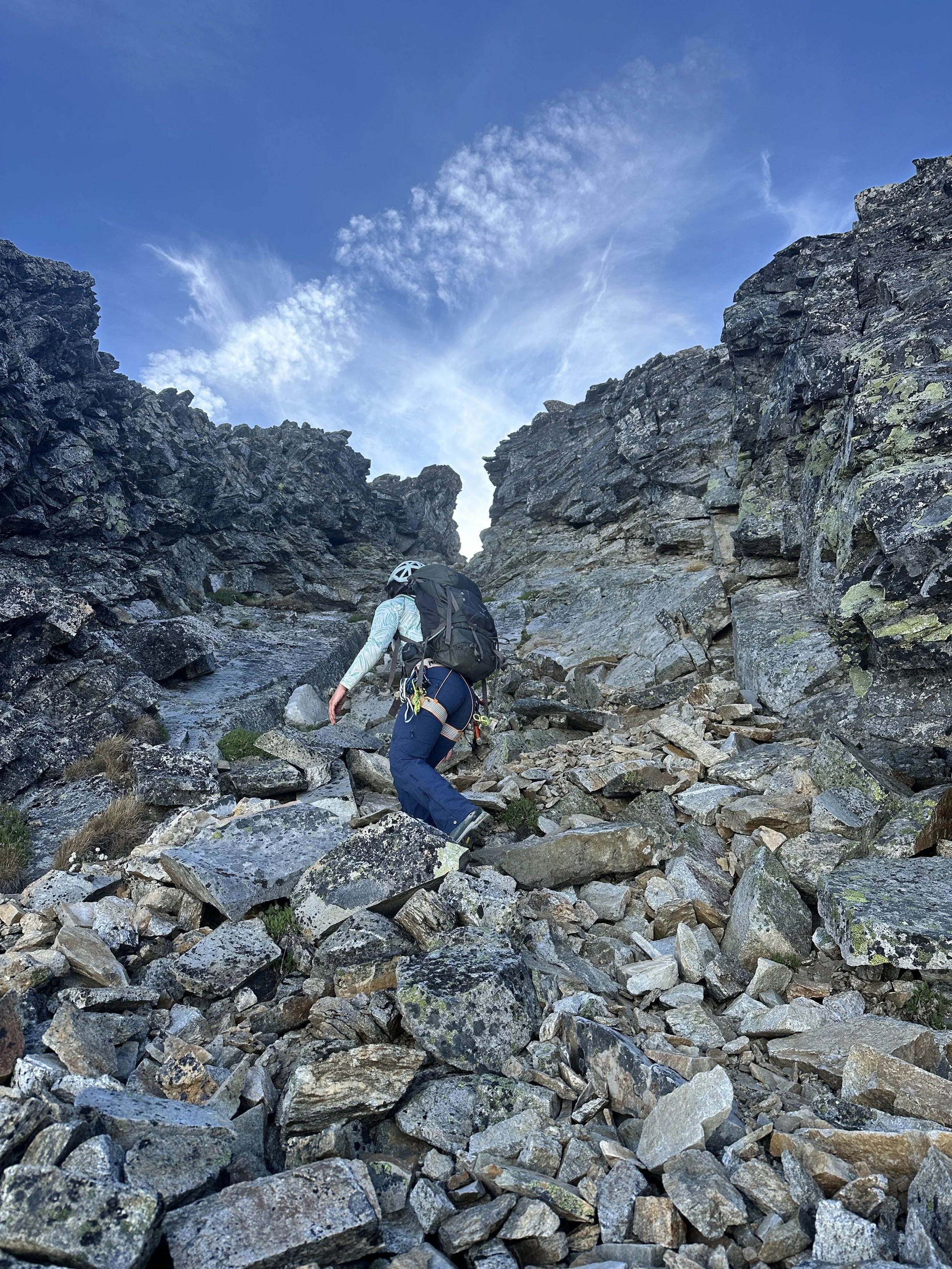
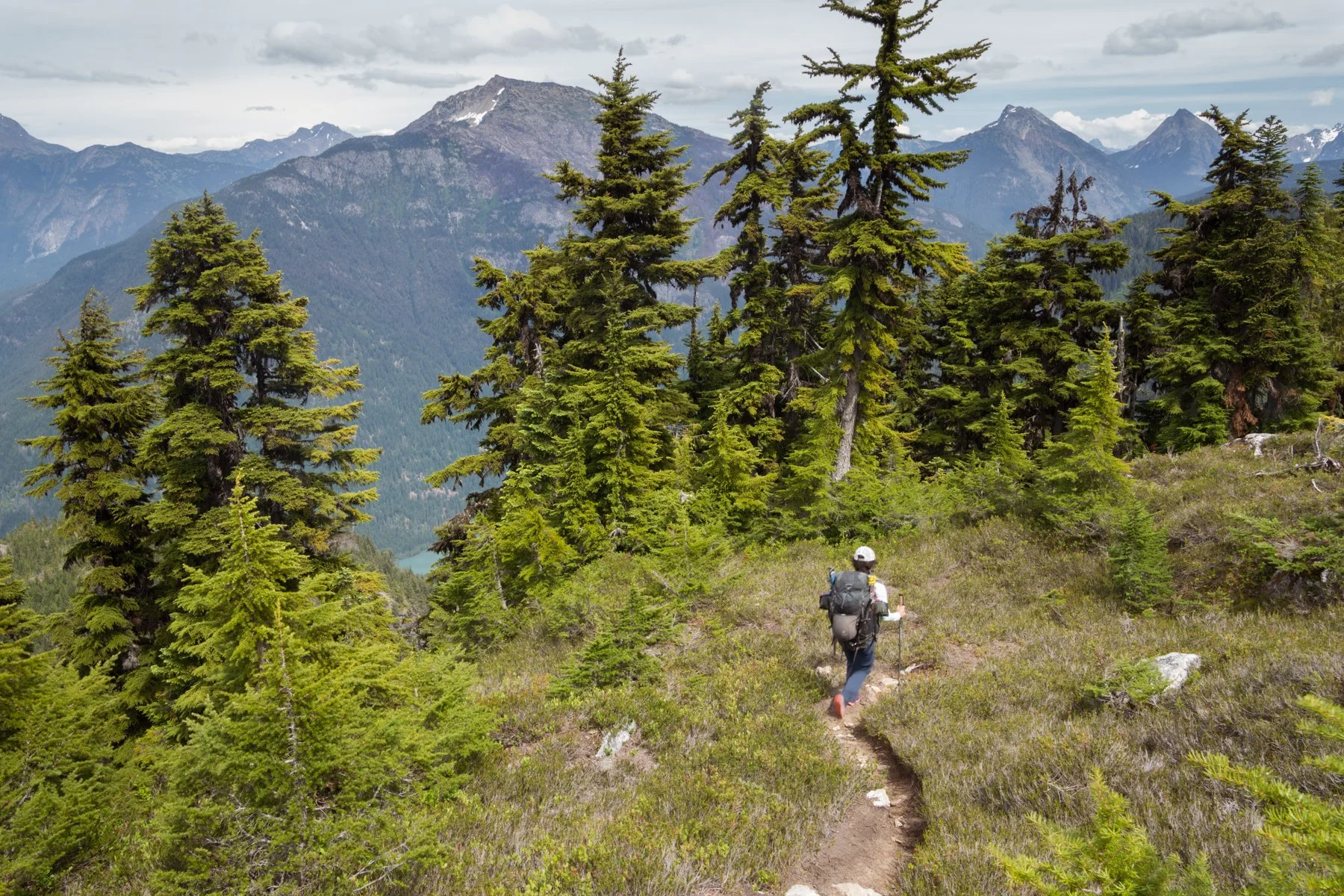
We both pulled into the parking lot at the same time and quickly geared up. At 8:20AM, we crossed Highway 20 and started up toward Pyramid Lake. For the first two miles we relished the maintained trail. This was actually my second time in the area. In 2020, Alex and I tagged along on our friends’ climbing trip to the Colonial Basin, and while nearly five years had passed since that trip, I still vividly remembered how steep and relentless the climber’s trail was. We mistakenly veered off-route on the ascent from Pyramid Lake on that trip and wallowed in the forest trying to get back on track. This time I made sure to not make that mistake again. We took the correct path and made our way endlessly up. The climber’s trail gains about 3,000’ feet in 1.5 miles in the trees. I was grateful for the cooler weather, but the forest still held in moisture and humidity that left me dripping in sweat in no time.
Out of the woods with Diablo and Ross lakes in the background
With no real views to offer a distraction, this section of the climb was the toughest. After four hours we finally broke out of the trees and into the subalpine, where shrubs and wildflowers abounded amid a backdrop of snowy peaks and gushing waterfalls. I was immediately reminded of the reason I toil in the trees. Once you make it to the subalpine and alpine, the North Cascades sure know how to put on a show.


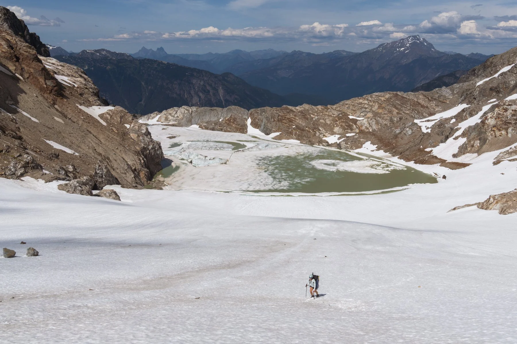
Out of the woods, we still needed to gain about 400 more feet before we could begin the traverse toward Colonial Basin. On my previous trip, this stretch was almost completely devoid of snow and in its place was a tedious boulder field that we cautiously wound our way through. Thankfully, going earlier in the season meant Kara and I could cruise through most of the traverse on snow, with only a few small boulder fields to easily navigate.
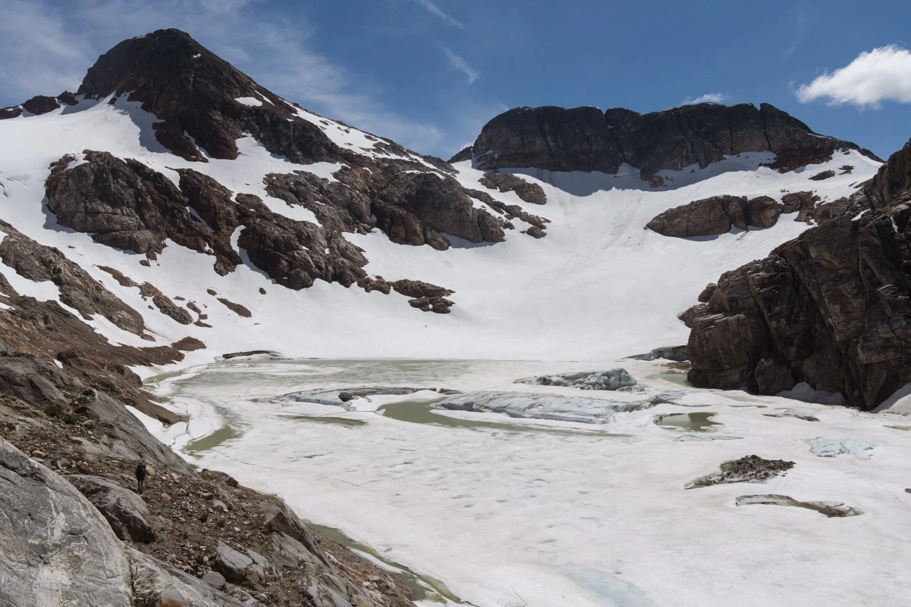
The mostly frozen lake in the basin
After six hours, we arrived at the glacial lake and were immediately buffeted by wind. The basin must have formed in a perfect topographic configuration that transforms the landscape into a wind funnel because everywhere else on the route was pretty calm, but this spot threatened to blow me off my feet. A group of hikers coming down from the summit told us they highly recommended camping at the col instead of the lake because of the near constant wind the lake experiences. We thanked them for the beta and took a break huddled under an unused campsite’s windbreak. We had briefly considered camping at the lake, already we had logged 5,300’ of gain and the col was still another 1,200’ away, but getting to the col would put us in a better position for summit day. Plus, it’s supposed to be one of the prettiest camp sites in the North Cascades. We continued on.
The snowfield leading up to the col was ideal. It was soft enough to kick solid steps, but not so soft we post-holed. Two other climbers had ascended the slope about 30 minutes ahead of us, so we easily followed along in their well-trodden footsteps.

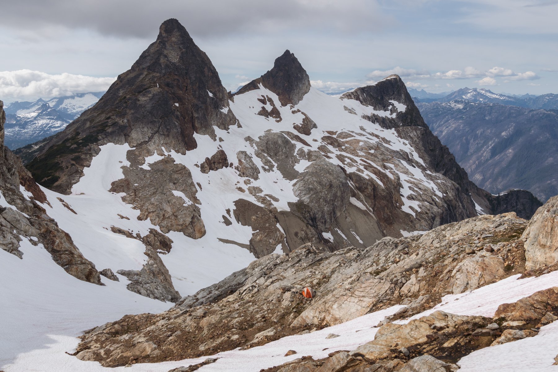
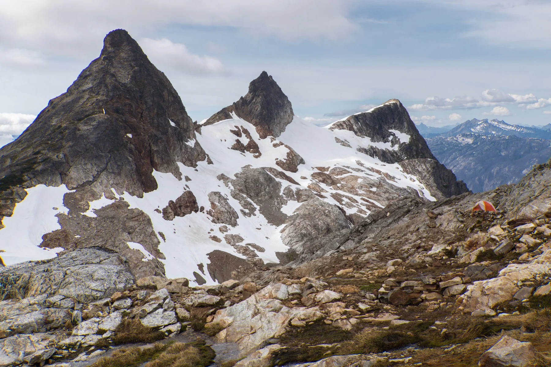
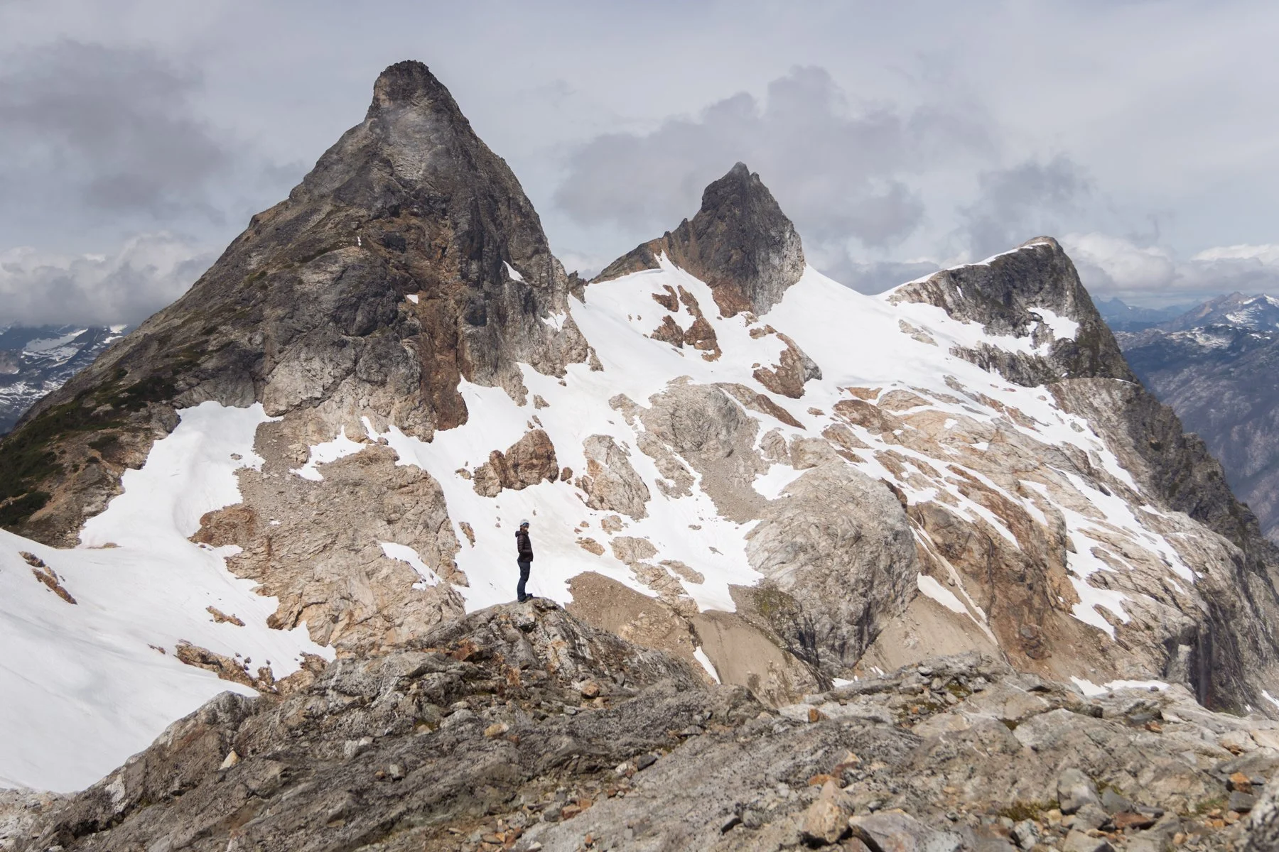
As we climbed above the lake, the surrounding views got better and better. Paul Bunyans Stump, Pinnacle Peak, and Pyramid Peak jutted up like three fingers over the cracked green glacial lake nestled below. The ascent was hard on already-tired legs, but unlike the forest slog, this time I had views to take my mind off the climb.

Our first views of Snowfield Peak (prominent peak on the left)
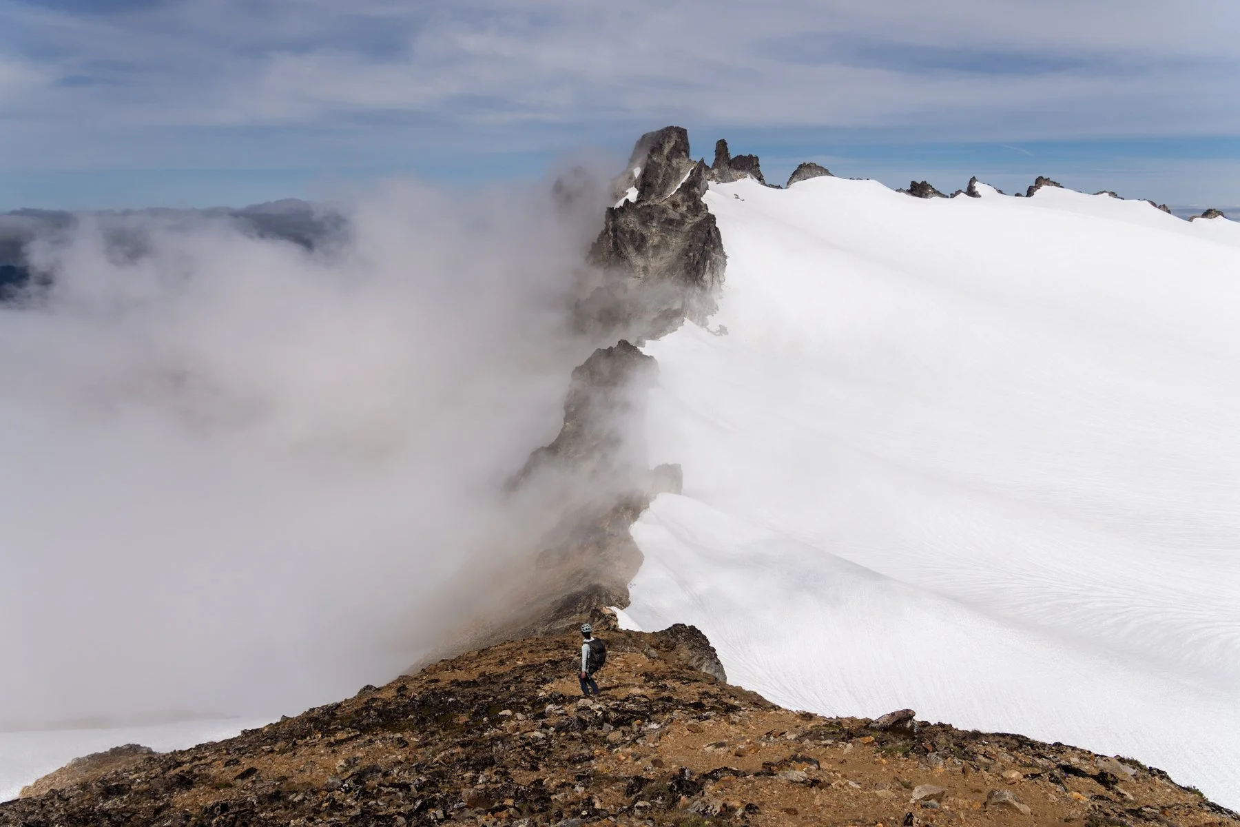
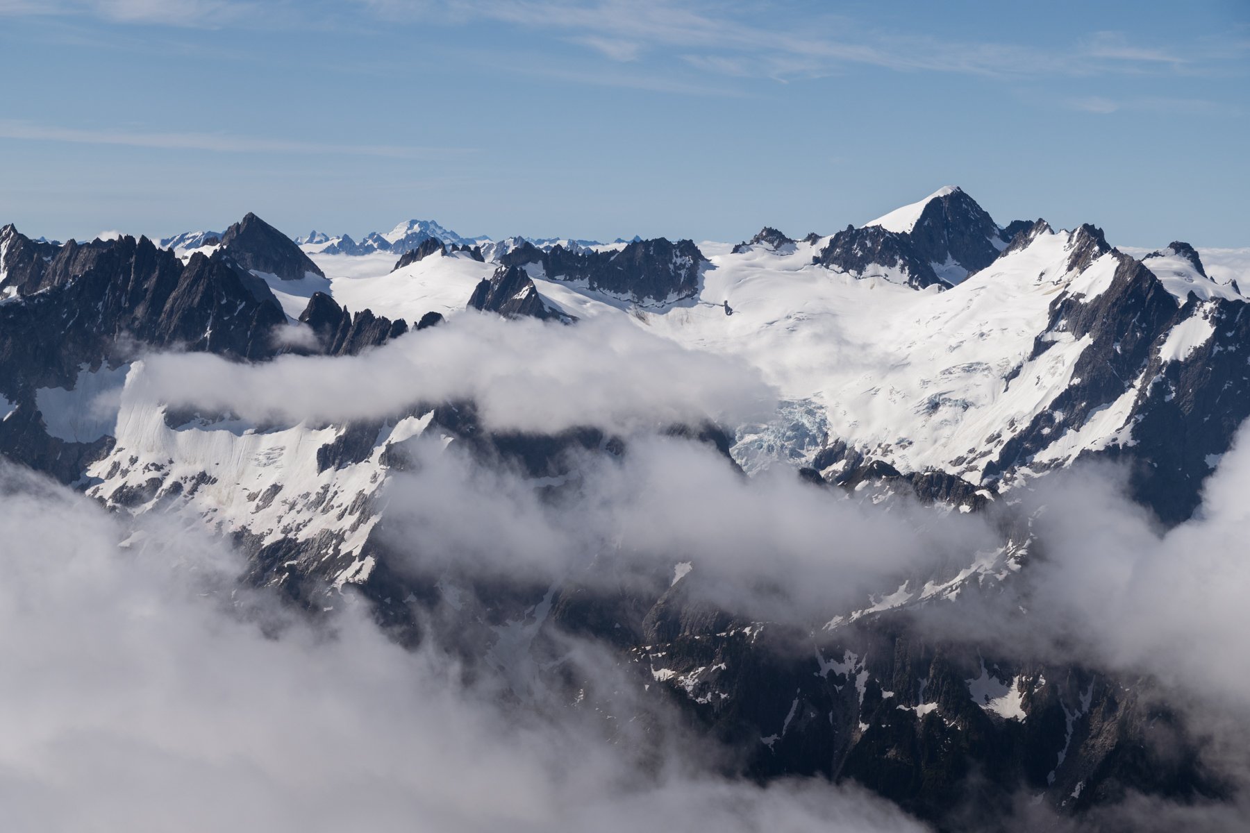
After 7 hours and 45 minutes of hiking, we arrived at the col and my jaw dropped as Snowfield came into view for the first time. From the northeast, the view is of lush green valleys and the blue snake-like Ross and Diablo lakes, but the view to the south is a glacial wonderland. The Neve Glacier pours from the flanks of Snowfield and the Needle, a sprawling white blanket draped over the landscape, softening all the hard angles of the peaks and rocks.
The other campers’ picture perfect camp spot
The two climbers who set the bootpack up the snowfield ahead of us had already snagged the campsite, the one that’s situated on the col so that one side of the tent looks out directly at Snowfield while the other side looks at the trio of Paul Bunyans Stump, and Pinnacle and Pyramid Peaks. All the camps in the area are stunning, however, and not too far away we found another campsite, tucked away in the rocks and sheltered by a solid rock wall. We called it home for the night.
Our camp for the night
As we set up camp, clouds began to roll in, slowly at first and then suddenly all at once. The trio of peaks to the north were quickly engulfed in a thick layer of clouds. Snowfield disappeared. Accompanying the clouds were the wind and the cold. This was a far cry from the heat wave of 2024! It was so chilly we resorted to sitting in our sleeping bags as we cooked and ate dinner outside the tent. This weather had not been in the forecast. I started to worry. I messaged Alex on the InReach and asked if he could kindly check the weather for us. He did. He informed us the next morning should be clear from 5AM to 8AM and then clouds were expected to roll in again around 2PM. This reassured us and we set our alarms for 3AM, hoping that we could leave early and get to the summit for sunrise.

I was also hoping the clouds surrounding us would fall as the temperature dropped at sunset, but they were just too thick. They did break slightly and offered a few peekaboo views of the glowing Snowfield summit, but otherwise they stubbornly clung to their position in front of all the peaks. I retreated to the tent just as it started to drizzle (also not in the forecast).
DAY 2: SUMMIT AND EXIT | 12 MILES | 2,900’ OF GAIN, 8,650’ OF LOSS
Our alarms sounded at 3AM. I peeked out the tent door and saw a wall of clouds. We were still in the thick of it. Tired from the previous day, and not wanting to navigate the glacier in a whiteout, we decided to snooze and check outside at 30 minute increments. At 3:30AM, it was still cloudy, as was it at 4AM and 4:30AM, but at 5AM I looked out and saw the tips of peaks poking just above the clouds. It appeared the clouds were thinning. It was go time. We started to get ready for the day.
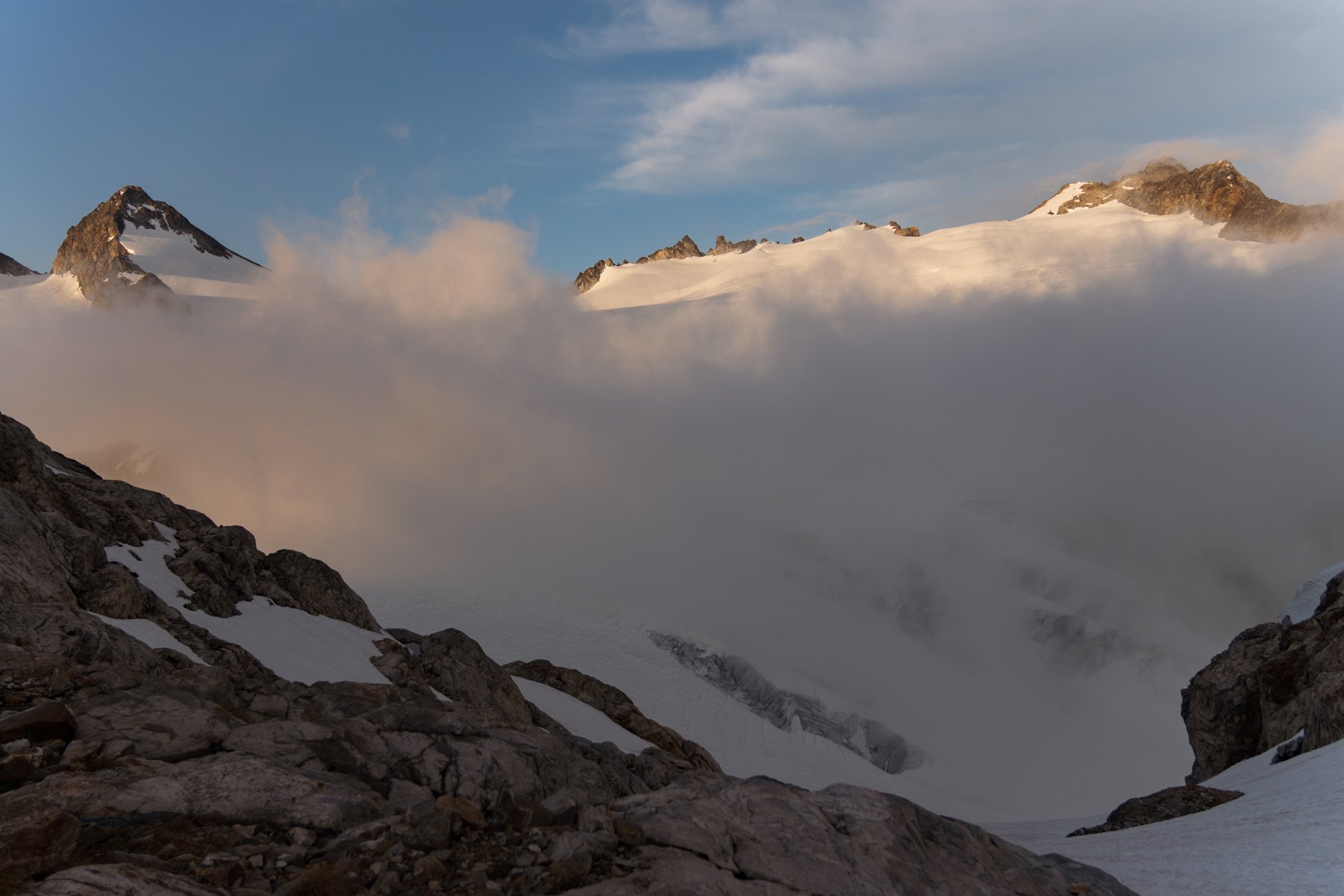
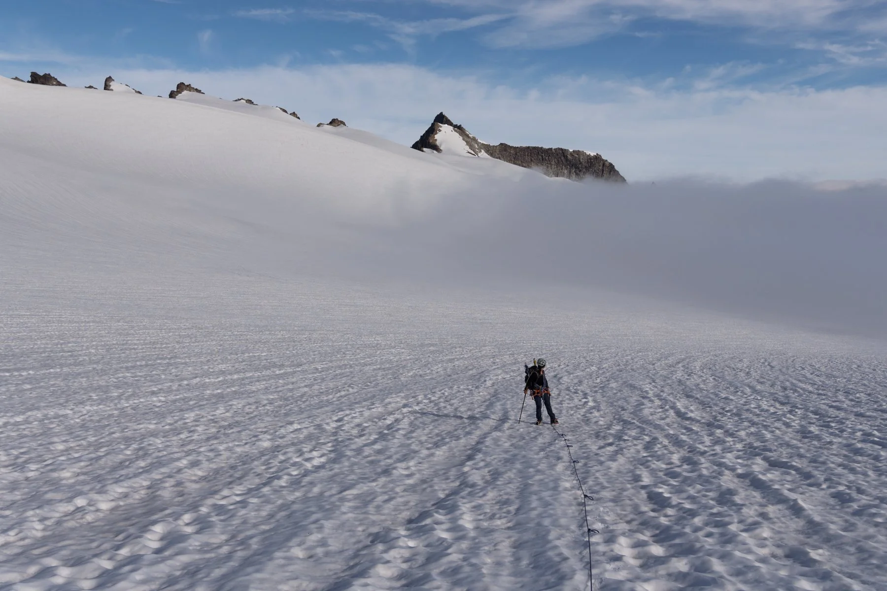
From camp, we descended 300’ from the col to the Neve Glacier and roped up as the clouds danced around us, swallowing the peaks whole one moment and then spitting them out completely the next. The Neve Glacier was pretty mellow, so even as visibility waxed and waned we found our way without much issue. As we climbed higher, the clouds dropped lower, settling in and forming a low lying undercast in the valleys.
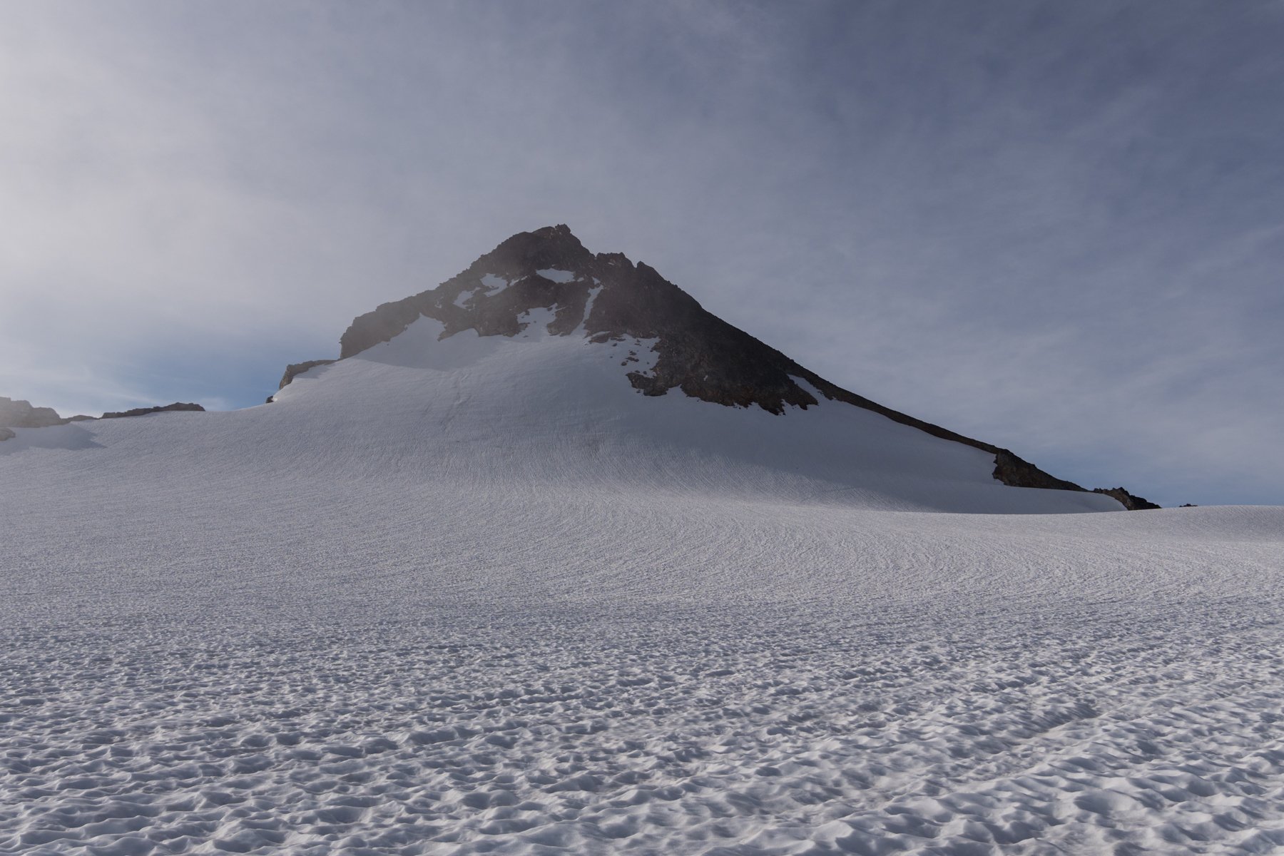
Snowfield looking closer, the route follows the ridge up the right side
Clouds settling into the valleys below
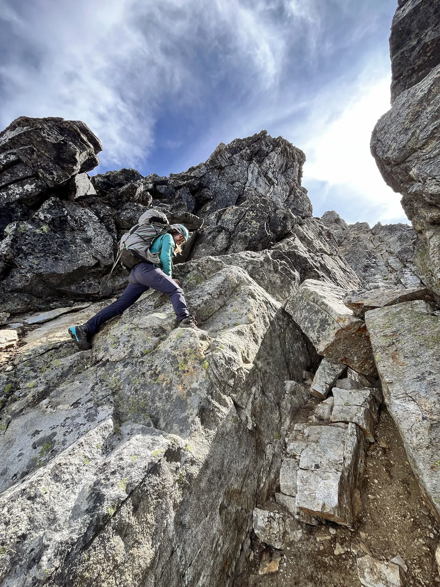
At 8AM, we made it onto the rocky west ridge of Snowfield where the scramble begins. The ridge also offered us another stunning view to the south. It seems every ridge or summit in the North Cascades just unveils new and inspiring views. We admired Backbone Ridge and Eldorado as we took off our glacier gear and started the 600’ scramble to the top.
The first few hundred feet were easy and flew by as we followed a distinct path up the ridge. Just as I found myself thinking wow, this isn’t bad at all! did it all start going sideways. First, we took a wrong turn and ascended about 100’ up the wrong path. Not a problem, it was a short detour and we quickly descended and found the correct path, straight up the gut of a gully. We made quick work of the gully, but then we found ourselves at the top of the gully with no apparent route in front of us. A cairn up and to the left told us that was the way, so we checked it out but it seemed like it was perched right on top of a ridge with a precarious down climb above an exposed slope. We thought that couldn’t possibly be right, so we headed back down to try to find a different route, only to quickly realize that was the correct path and re-ascend the gully.
Kara ascending the gully
The scramble ended up being a little more scrambly than I had bargained for. There were some exposed, steep, sketchy sections that kicked my fear of heights into high gear, but Kara was right there to talk me through the toughest moves. I kept getting lost in the big picture—the rest of the scramble, the thought of the eventual downclimb—and she helped bring my focus back to the simple task at hand: taking it one step at a time.
Eventually, the slope ran out in front of us and we reached the top. The view from the summit, like the view from many of the North Cascade peaks, was sprawling and jaw-dropping. The clouds, which had been so annoying the previous night, now added a certain dynamic element to the scene that made it feel even more magical. The clouds sloshed around below the tallest and most jagged peaks, like a sea punctuated by islands. It was tough to pull myself away from the view, but we did have an 8,500’ descent ahead of us.


The scramble down, much to my relief, was much easier than the ascent. We knew the exact route and made quick work of it. Before I knew it, we were back on the glacier, plunge stepping down the slope, still captivated by the views surrounding us.


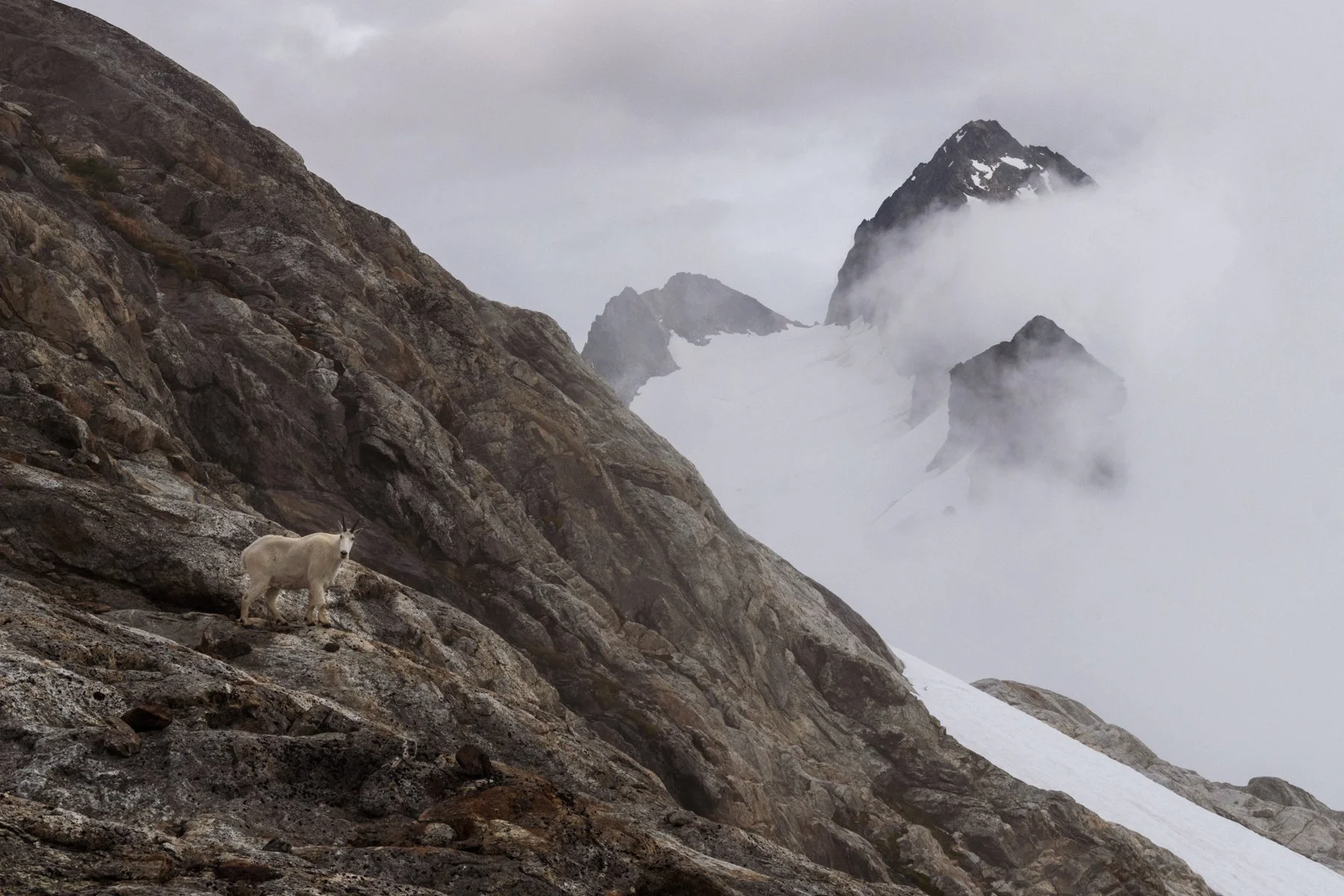
We made it back to camp at noon, and while we would have loved to take a nap or at least enjoy an extended break, it was already getting late and we still had a long ways to go to the car, so we immediately started packing up. The resident goat kept a watchful eye on us from above as we deflated our air mattresses and stuffed sleeping bags into our packs.


Just after 1PM, we gave the campsite one final look over, snapped a few last photos, and started the long journey back.
Descending to the lake was a breeze as we glissaded nearly the entire snowfield, stretches of slope that we spent so long ascending the day prior whizzed by in seconds. Back at the lake we found ourselves once again in the wind funnel. More than once I was nearly blown off my feet by a gust, so we hurried along.
The descent through the forest was one of the most frustrating stretches of trail I’ve hiked. There were so many micro-uphills I didn’t even register on the ascent, and so many steep, rooted, and rocky walls to down climb. After already moving for so long, and carrying a heavy pack, I was so ready to be done.
Somehow, someway we made it back to the trailhead by 6PM. 12 hours had passed since we set out from camp in the morning. Everything hurt. I felt delirious, but also I felt so fulfilled. Sometimes building a trip up for years can make it feel anticlimactic, but with Snowfield it was the opposite. Finally putting the trip together, putting in the hard work, and watching that work pay off with a great friend felt like the biggest reward.
****